First looks: initial reading and analysis of Vero Beach downtown master plan held Thursday
VERO BEACH — The first draft of the master plan for downtown was unveiled Thursday.
Coming two months after the downtown fact-finding week, the draft was presented before the Planning and Zoning Board by project manager Xavier Iglesias of DPZ CoDESIGN — the firm tasked with designing the plan founded by urban planner Andres Duany.
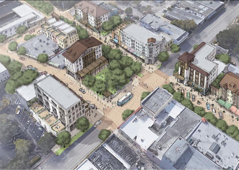
The plan detailed, outlined and fleshed out Duany's vision for downtown's future, while also seeking feedback from the Planning and Zoning Board.
"This is clearly a downtown that is on the rise," said Iglesias. "There is faith and potential in downtown."
Very good bones
The common theme of the plan is prioritizing a walkable downtown and making downtown safe, comfortable and interesting.
"We are documenting ideas and creating a comprehensive plan that is implementable," said Planning and Development Director Jason Jeffries.
"We've organized our ideas into eight different geographic areas of downtown" said Iglesias. "Each area zooms in on the major issues and solutions."
The geographic areas were:
A Downtown Business District situated along 14th Avenue
Downtown-West, the area west of 14th Avenue, around First Methodist Church
The Citrus Bowl, defined as south of downtown
Old Dixie/Commerce Avenue, along the FEC Railroad
South U.S. Route 1, the older commercial area east of Old Dixie Highway
Commerce Avenue east of Old Dixie Highway
North U.S. Route 1, south of Vero Beach Regional Airport but north of Twin Pairs
The major issues identified were parking, storm water management and restrictive building codes.
Following Iglesias' presentation, planning and zoning officials were given the opportunity to respond.
"People are going to be concerned with the cost," said board member Jason Ground. "However, the revenue and benefits that this would generate should not be understated."
"This is all about taking away the fear of change," responded board member Neli Santamarina. "Vero Beach is a gem that has gotten cloudy, all we have to do is shine it."
More: To many, Vero Beach, Sebastian traffic seems worse; or is it just a matter of perspective?
More: As season winds down, Breeze rolls back number of flights into, out of Vero Beach
Iglesias will take the responses of the board and continue to fine-tune the plan.
The City Council will have the opportunity to discuss the plan at the May 14 meeting.
Nick Slater is TCPalm's Indian River County Watchdog reporter. You can reach him at Nick.Slater@tcpalm.com and 224-830-2875.
This article originally appeared on Treasure Coast Newspapers: Vero Beach downtown master plan unveiled, what are the key issues

