Fire weather warnings today, chance for severe storms Wednesday

LANSING, Mich. (WLNS) — In true springtime in Michigan fashion, the forecasts can be drastically different for any two days.
Fire Weather Warnings
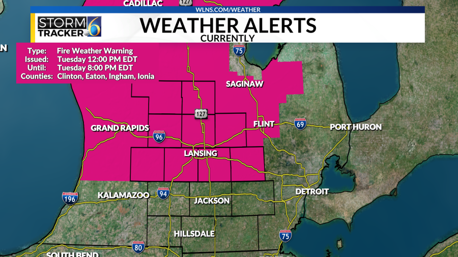
The sunny and warm conditions we have experienced over the past several days have dried out the atmosphere over Mid-Michigan. In addition, we have winds gusting between 25-30 miles per hour and relative humidity dropping between 20-25% this afternoon, increasing the risk for fires across portions of the area.
The National Weather Service has issued a Fire Weather Warning for counties along and north of I-96 that will expire at 8 p.m.
When under a Fire Weather warning, you should use caution with any activity that could lead to a wildfire, as fires could spread quickly in these conditions.
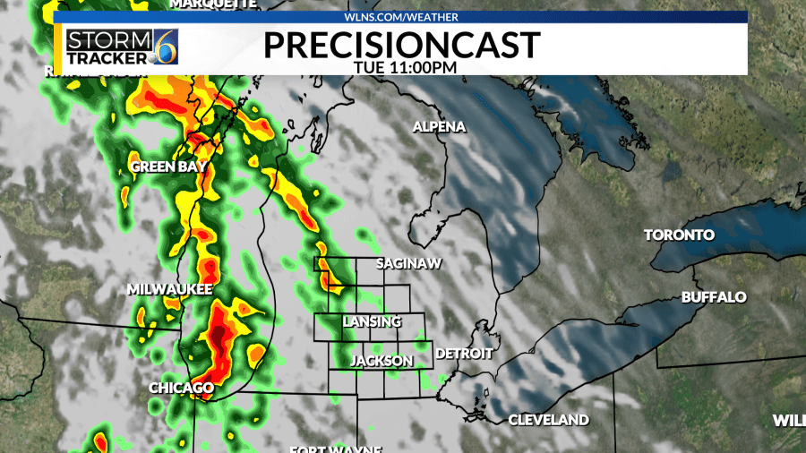
The impacts of this dry air will be extremely short-lived, as we have showers moving into the area tonight, with the chance for severe weather tomorrow.
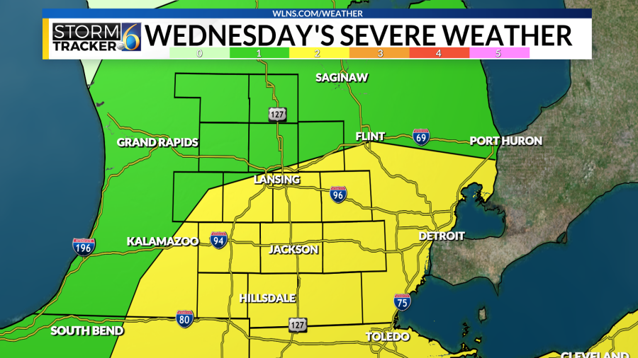
Strong to Severe Storms are Possible on Wednesday
The Storm Prediction Center has placed portions of Mid-Michigan in a slight risk (Level 2/5) for severe weather on Wednesday.

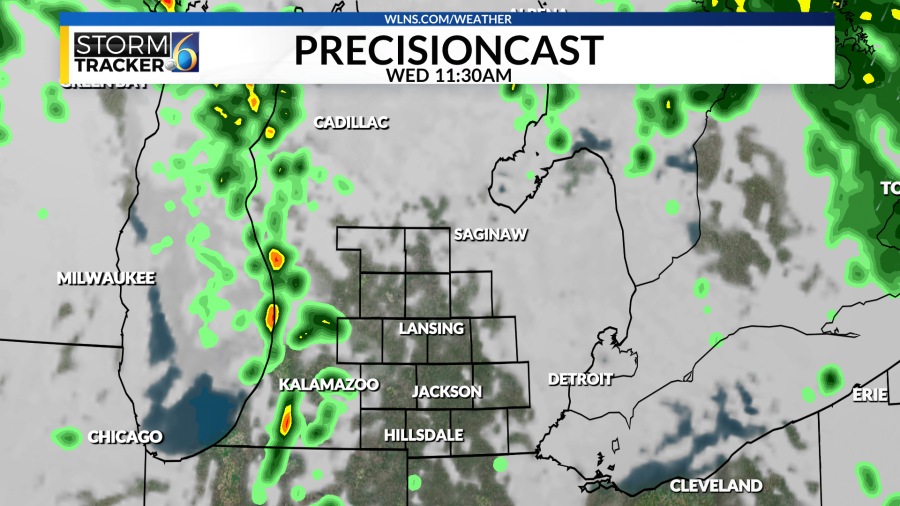
A low-pressure system will move towards the area this evening, with showers and isolated non-severe thunderstorms moving in tonight as a warm front lifts through the area. This first round of rain will begin shortly after midnight and end in time for Wednesday’s morning commute.
(WLNS) (WLNS) (WLNS) (WLNS)
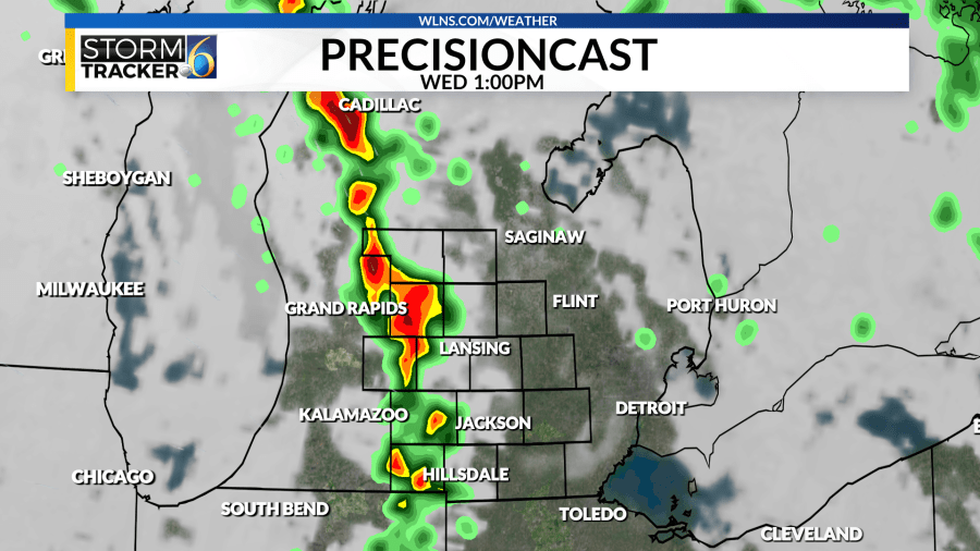
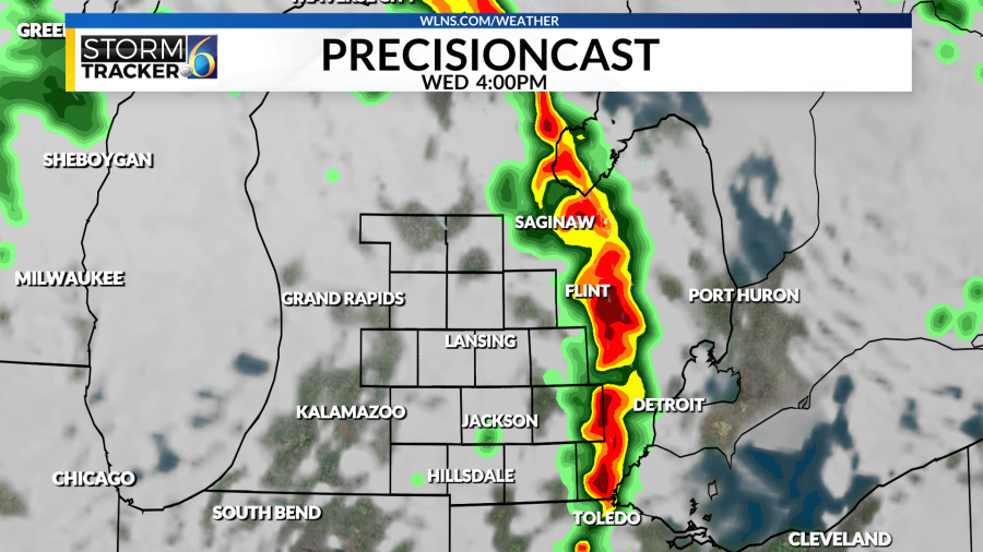
The main focus will be on a second line of showers and storms that will arrive on Wednesday afternoon, between 1 and 4 pm, as a cold front moves through the area. All kinds of severe weather are in play with this second line of storms, including quarter-size hail and strong winds (up to 60+mph). There is also a chance for an isolated tornado in the area.
However, there are still questions about how much the atmosphere will recover from the morning showers. But the latest computer models are showing the chance for some clearing to occur late Wednesday morning. If we see any clearing across the area, that would help to destabilize the atmosphere and increase the potential for severe weather.
For additional updates on the potential for severe weather tomorrow, stay with 6 News on-air, online, and through the StormTracker 6 App.
For the latest news, weather, sports, and streaming video, head to WLNS 6 News.

