FEMA wants input on its new Morris County flood insurance maps. Is your home on the list?
- Oops!Something went wrong.Please try again later.
After three years of study, public meetings and community engagement, the Federal Emergency Management Agency is introducing updated Flood Insurance Rate Maps for public view in eight flood-prone Morris County towns.
The maps were scheduled to go online Friday at the launch of a 90-day appeal and comment period. They are expected to go into effect, along with associated flood insurance requirements, in the summer of 2025. The maps can be found on FEMA's Flood Maps Changes View webpage.
The communities covered by the updated maps include Butler, East Hanover, Kinnelon, Lincoln Park, Montville,Parsippany-Troy Hills, Pequannock and Riverdale. All are impacted by periodic flooding along the Passaic River and its many North Jersey tributaries, including the Rockaway, Whippany, Pompton and Pequannock rivers.
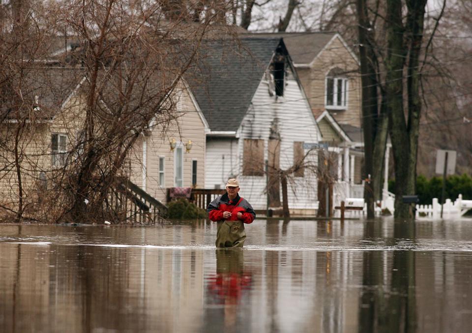
Story continues after gallery.
The maps were produced by a scientific review panel working in coordination with local, state and FEMA officials, the federal agency said in a news release last week.
"Significant community review of the maps has already taken place, but before the maps become final, community partners can identify any corrections or questions about the information provided and submit appeals or comments," the statement reads.
Why flood insurance maps matter
FEMA administers the National Flood Insurance Program, a federal program enabling property owners in participating communities to purchase protection against flood losses. In exchange, the communities agree to adopt and enforce ordinances that meet or exceed FEMA requirements to reduce the risk of flooding.
Most homeowner’s insurance policies do not cover such damage, but flood insurance is generally required for mortgaged properties in high-risk zones. The average annual cost of a NFIP policy in New Jersey is $933, FEMA estimates.
In New Jersey, a Standard Flood Insurance Policy compensates homeowners, renters, and business owners for all covered losses, and unlike a federal disaster loan, it does not have to be repaid.
Pequannock fought flood zones
Disputes over flood maps aren't uncommon.
In 2021, U.S. Sen. Cory Booker and Rep. Mikie Sherrill pushed FEMA to resolve a long-running dispute with Pequannock officials, who said hundreds of residents were paying the price for improper placement of their properties in designated flood zones.
That came after Pequannock appealed a 2016 map revision, which FEMA altered again in August 2017. Even on the revised map, township officials said they found areas that never flooded − even during major events like Tropical Storm Irene in 2011 − but were included in flood plains.
The classification also can decrease property values by as much as 25%, Pequannock officials said at the time.
"Residents have experienced difficulty selling their homes, obtaining mortgages or home equity loans, or obtaining permits for home improvements," Booker and Sherrill wrote.
Hanover Mayor Thomas "Ace" Gallagher is familiar with flooding issues along the Whippany River. He's ready for studies to end and "action" to begin.
"I would like to see some remediation on some of the findings that they've had there to date," Gallagher said. "There was an incredible, comprehensive study that was released in 1987. Even if they used some of that as a blueprint, we'd be in a much better place."
Gallagher added "Where rivers were 4- to 6-feet deep years ago, now they are nine inches deep. Of course they are going to overflow. We have to start to put together remediation in addition to the studies. We have to de-snag. We have to do bank re-establishment. We have to dredge."
More: Denville still waiting for federal report 13 years after Tropical Storm Irene devastation
How to appeal FEMA flood maps
For the latest updates, FEMA is encouraging "residents, business owners and other community partners" to review the updated maps to learn about local flood risks and potential future insurance requirements. Appeals can be filed by anyone who feels the modeling or data used to create the map is technically or scientifically incorrect.
The next step in the mapping process is the resolution of all comments and appeals, FEMA said. Once they are resolved, the agency will notify communities of the effective date of the final maps.
For more information, contact a FEMA map specialist by phone at 877-FEMA-MAP (877-336-2627) or by email atFEMA-FMIX@fema.dhs.gov.
Timeline of Morris County process
2021-2023 — Regular coordination meetings with local officials on mapping progress.
Sept. 28, 2023 — Preliminary Flood Insurance Rate Map released.
Dec. 8, 2023 — Community Coordination and Outreach Meeting to review Preliminary Flood Insurance Rate Map and discuss updates to local floodplain management ordinance and flood insurance.
May 10, 2024 — Appeal Period starts.
Summer 2025 — New Flood Insurance Rate Map becomes effective and flood insurance requirements take effect. (Timeline subject to change pending completion of the appeal review process.)
William Westhoven is a local reporter for DailyRecord.com. For unlimited access to the most important news from your local community, please subscribe or activate your digital account today.
Email: wwesthoven@dailyrecord.com
Twitter: @wwesthoven
This article originally appeared on Morristown Daily Record: FEMA flood maps of Morris County are now updated. How to view, appeal

