FEMA will unveil proposed new county floodplain maps Thursday
BRANCH COUNTY — Officials from the Federal Emergency Management Agency will unveil the latest flood maps for the county at a presentation at the Coldwater Brown Municipal Building at 5 p.m. Thursday.
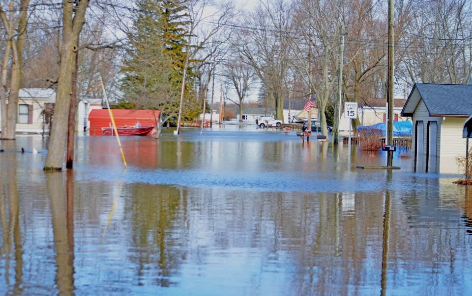
"If you've got a house in the floodplain, it's very important because you're going to be required to get flood insurance, and that's not cheap," Branch County Drain Commissioner Mike Hard said.
The process will ultimately determine what homes need flood insurance, which most mortgage companies require.
The meeting will allow residents to review preliminary versions of the recently completed Flood Insurance Study and its accompanying preliminary Branch County Flood Insurance Rate Maps. The new maps update the April 2010 maps.
Flood Insurance Rate Maps show designated flood zones of high, moderate, and low flood risk. FEMA and mortgage lenders use these flood maps to help determine flood insurance rates.
There are only a few floodplain areas in Branch County, and Hard is unsure of the numbers. "Most of the lakes have an area, a few spots here and there," Hard said. "Let's be realistic. Some homes were built where they should not have been built in a floodplain."
Other flood plains occur along the river and streams in the county.
Hard said local officials, especially township officials, will be expected to adopt these floodplain maps. "In a county disaster, if something comes through and we have a flood," adoption of the maps may be required to receive FEMA disaster aid, he said.

The FIS and the FIRMs provide base flood information on designated areas within the county that are subject to significant flood hazards, areas expected to be inundated by a flood event that has a 1% chance of being equaled or exceeded in any given year.
Local officials will learn more about FEMA requirements when they meet with them.
Hard expects the new maps to increase floodplains in Branch County. "Rain events are increasing, so there is more coverage," he said.
The drain commissioner also said with more disasters and flooding, "FEMA tends to increase the area's trying to get more money into the insurance fund."
In its release announcing the open house, FEMA said, "Experts at the open house will help residents understand flood risk and flood insurance, flood plain development regulations, and the mapping process."
FEMA said the meeting was also a good educational opportunity for realtors, lenders, and insurance agents to learn about the flood insurance program and maps.
Subscribe Follow this story. Subscribe to the Daily Reporter.
Residents can meet with experts one-on-one to view their addresses on the new maps. FEMA will discuss their specific risk and ways to help prevent flood loss.
FEMA will offer information to public officials that they may use to guide or limit development in the floodplain.
— Contact Don Reid: dReid@Gannett.com
This article originally appeared on Coldwater Daily Reporter: FEMA presents new county floodplain maps at Thursday meeting

