Rain, thunder threat returns to Ontario, and the snow chances aren't over either
You'd never know it was the middle of March with double-digit temperatures, and abundant sunshine splashing through much of southern Ontario this week. Some areas even reached or exceeded the 20-degree mark on Wednesday, thanks to the influence of the upper-level ridge, combined with some southerly help.
It's just one of those "too good to be true" feelings, though, as shorts and t-shirt weather is certainly unusual at this time of year (though welcomed to those on March Break).
Winter is always known to fight back in Ontario, and that will be the case in the coming days across the region.
DON'T MISS: Everything you need to know for April's spectacular and rare solar eclipse
There is trouble brewing for Thursday and Friday, and again by St. Patrick's Day on Sunday. Multiple systems will move in with some unsettled weather, including rain and the chance of thunderstorms, before colder temperatures return once again, bringing southern Ontario back to reality with a shot of snow for some areas.
Thursday into Friday: Rain, thunderstorms and flurries dampen the mid-March heat
The day will start off nice enough in southern Ontario, but a system traversing the central U.S. with many types of weather, including rain, severe thunderstorms and the risk of tornadoes, will nudge into the region later in the day.
Cloud cover will thicken in southern Ontario by Thursday afternoon, allowing for rain to creep into extreme southern Ontario first before hitting the Greater Toronto Area (GTA) a bit later in the day.
A widespread 10-20 mm of rainfall is expected for most areas.
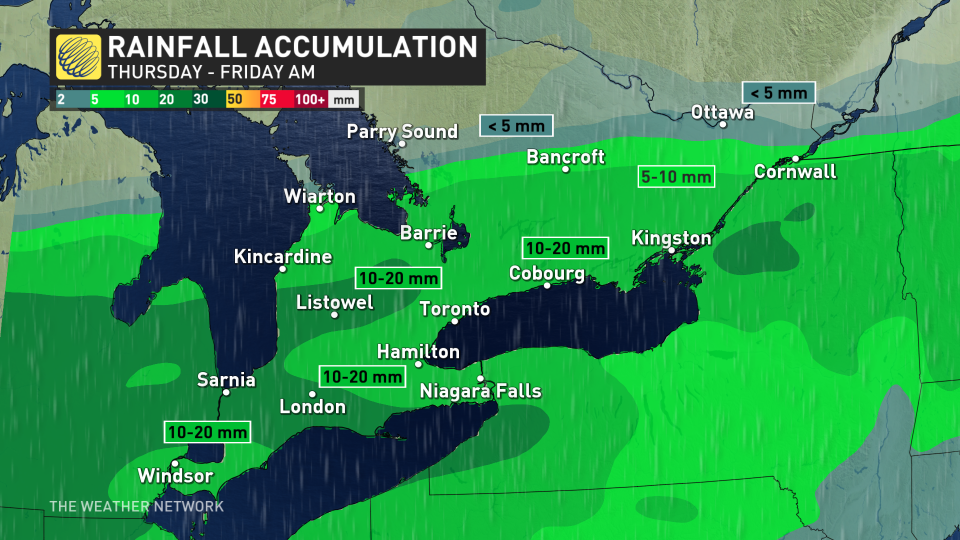
As a result of some instability, there is even a chance of weak thunderstorms throughout Thursday afternoon and evening, with the risk greatest in the extreme southwestern corner of the province.
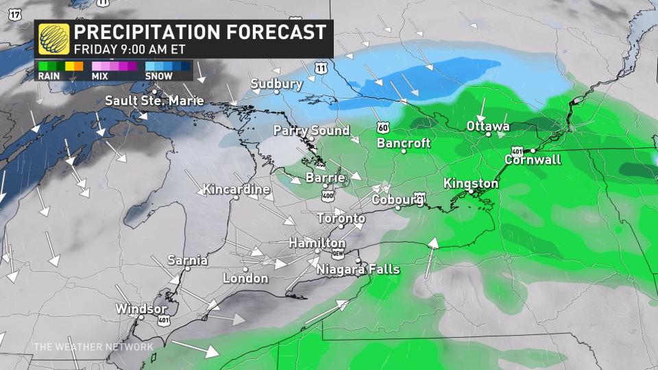
While storms aren't expected to become severe, there is a slight possibility of stronger winds, and small hail in thunderstorms that develop. The rain will continue Thursday overnight and into Friday morning.
Also on Friday, precipitation may change over into a period of flurries in parts of cottage country, as the first round of colder air moves into the province.
Expect cooler, more seasonal temperatures in behind this system for the weekend.
Sunday to Monday: Temperatures cool, and snow chances creep in
For those with St. Patrick's Day plans on Sunday, you'll want to monitor the hourly forecast closely over the next couple of days to determine the proper attire and if an umbrella is warranted.
Another system is expected to develop at the end of the weekend, featuring stronger dynamics and ingredients for more impactful weather. Precipitation begins with snow in northern Ontario, followed by rain in the southern and eastern sections.
The long-range pattern supports a deep trough in Eastern Canada while ridging occurs in the West. This will mean a pattern flip for Ontario, with much more seasonal air for mid-March funnelling into the province.
RELATED: St. Patrick's Day green traditions linked to these weather patterns
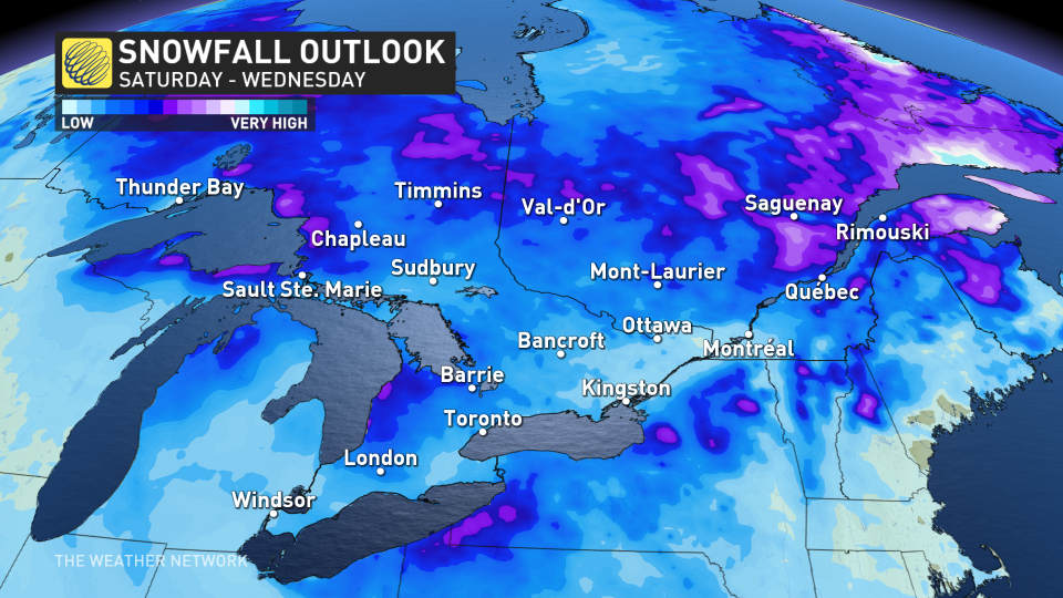
This colder blast of air could also mean a changeover to snow across southern and eastern Ontario by Monday, along with a further cooldown throughout next week.
While confidence currently remains low for exact snow totals and placement in the Great Lakes, there's higher certainty for a late-weekend system cooling down temperatures and bringing unsettled weather. That means drivers should at least be prepared for the return of winter driving conditions, as snowfall chances are not over in southern Ontario just yet.
Changeable temperatures are anticipated by mid- and late-next week and into the final week of March. That will also be an active pattern with a few significant systems and potentially wintry weather for parts of the region, though with a higher likelihood for rain in southern areas.
Stay with The Weather Network on all platforms for the latest details on your forecast across Ontario.

