Baton Rouge severe weather: A cold front may bring strong to severe storms

2:30 AM UPDATE: The complex of showers and storms has moved off to the east and we will be drying out through the morning. The severe thunderstorm watch for the entire viewing area has been cancelled.
Overview:
At the surface, a cold front will be moving southward toward the Gulf Coast from Thursday night into Friday morning. In the upper levels, a disturbance will cross over the Lower Mississippi Valley during the same time frame. This will help spark shower and storm development over Northeastern Texas and the Arklatex area.
Storms will eventually congeal into a mesoscale convective complex (MCS), or an organized cluster of storms and move along the I-20 corridor over Louisiana into Mississippi heading toward the Alabama and Florida coastlines.
The Storm Prediction Center (SPC) has placed areas near and north of the I-10/I-12 corridors including Baton Rouge under an Enhanced Risk (3/5). Northern areas have the best chance to see any strong to severe storms (and overall rain or storm chance).
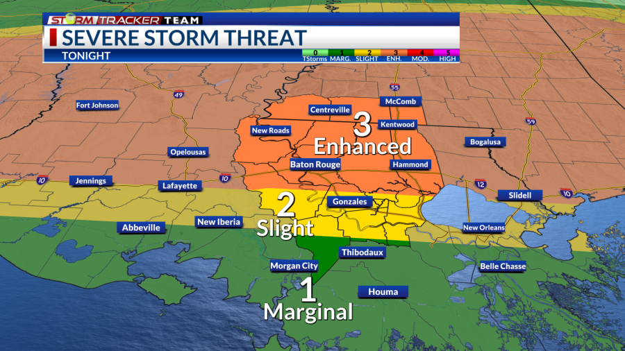
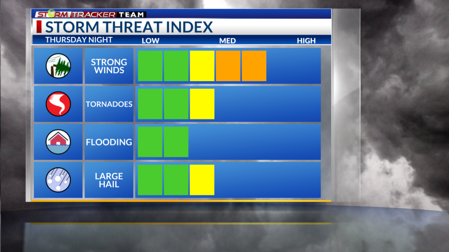
Threats
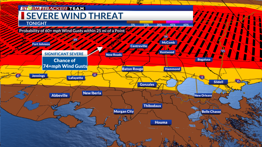
The main threat will be that of damaging wind gusts (60-85mph) with any squall or bowing segments with the main line of storms. Large hail will be a possibility as well with any storm.
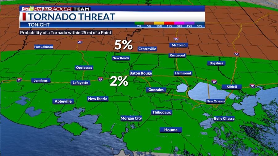
The tornado threat is lower, but non-zero. A few isolated tornadoes could spin up quickly as the main line moves through.
The flooding rain threat is also lower, as this system should be fairly fast-moving. However, some quick downpours could lead to ponding and localized issues.
Threat levels Damaging wind threat Tornado threat
Timing
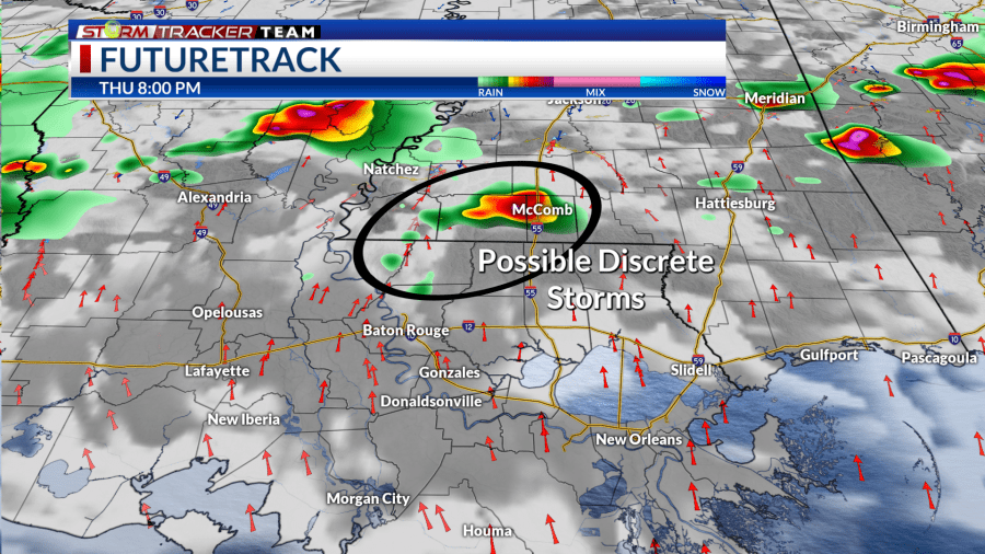
Storms are already firing over Northern Texas Thursday evening and will eventually spread eastward into the night as a cluster. There is the potential for a few discrete storms to develop ahead of the main line over northern areas in the early night around 8-10 p.m.
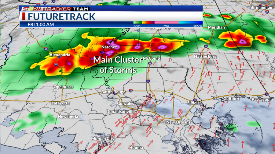
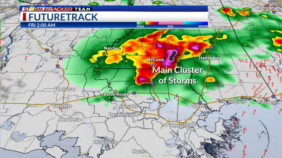
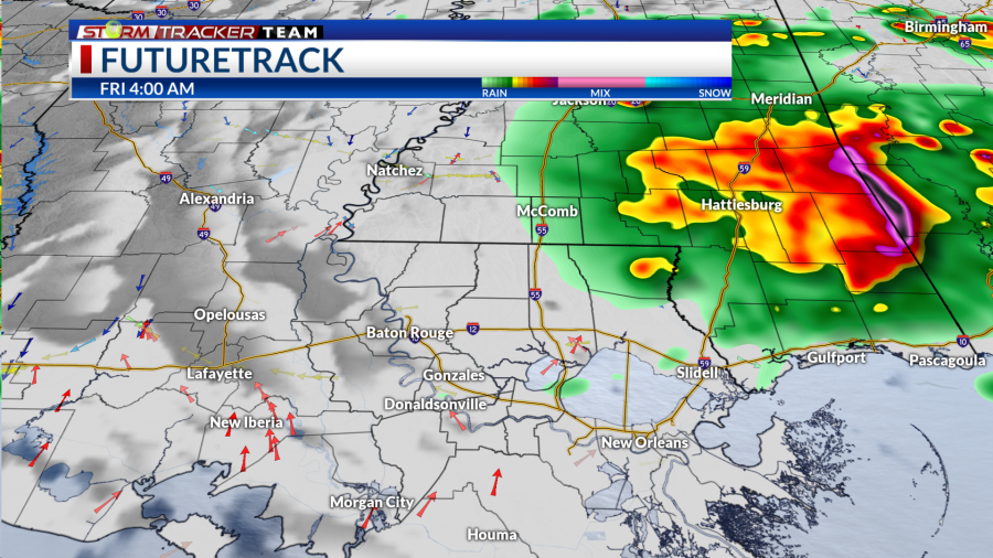
The main line will likely arrive over northwestern areas as early as 11 p.m. Thursday night and move eastward through around 4 a.m. Friday morning.
A few strong storms possible in the later evening Main cluster of storms Main line moves towards I-55 Drying out closer to sunrise
How to prepare
Be sure to have multiple ways to receive weather alerts and stay tuned to updated forecasts during the day. Make sure your phone is unmuted, charged and turned on for notifications. Turn off your do-not-disturb and take your phone off of silent mode so those alerts can reach you.
‘Ahead of the Storm’: What to know, how to get ready before tornadoes, strong storms, heavy rain
With an overnight aspect to this event, make sure any alerts or warnings can wake you up as well.
Have a plan and a safe place to go if a warning is issued for your location. Find a lower-level, interior room away from windows.
You can always check out the Interactive Radar here. For the latest forecast information, check out our weather page.
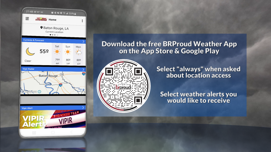
Remember that you can download our weather app in the App Store and on Google Play. Just search for “BR Proud Weather.”
Follow and keep up to date with the Storm Tracker Team:
Chief Meteorologist Sam Parish – Twitter | Facebook | sparish@brproud.com
Meteorologist Brandon Lashbrook – Twitter | Facebook | blashbrook@brproud.com
Meteorologist Ashley Renee – Twitter | Facebook | arenee@brproud.com
For the latest news, weather, sports, and streaming video, head to BRProud.com.

