Alberta welcomes in May with heavy bout of snow and slow commutes
The start of May will look more like the beginning of February in parts of Alberta as a round of heavy, wet snow will usher in the new month.
DON'T MISS: How the tropics help produce big springtime snows on the Prairies
The long-duration snowfall event will ramp up Wednesday morning, making for difficult travel conditions, as heavy, wet snow makes for slippery roads. Power outages are possible, so keep devices charged.
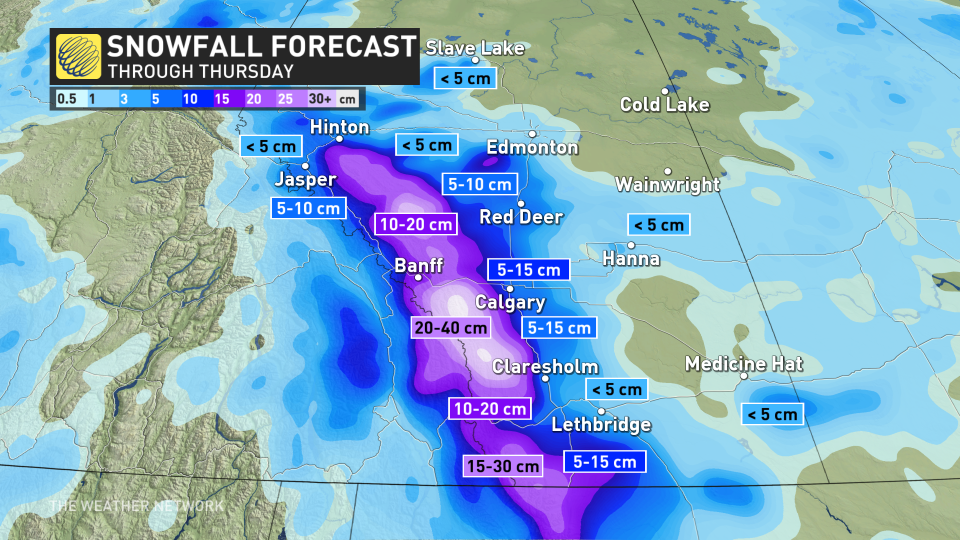
The heaviest snowfall amounts are expected for regions along the foothills and into the mountains, with 20-40 cm possible, Calgary could end up with 5-15 cm by the time the snow comes to an end.
Wednesday to Thursday morning: Poor travel conditions, power outage risk from heavy, wet snow
The centre of low pressure will remain stalled across Saskatchewan, locking in the chilly north flow over Alberta. This will enhance the risk for localized heavy, wet snow around central and southern portions of the foothills.
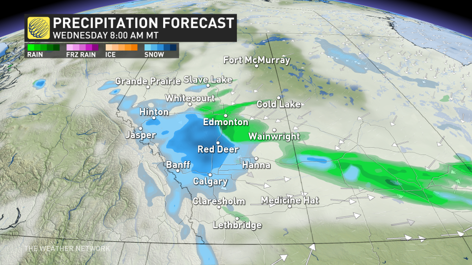
By Wednesday morning, snow heavy at times could fall along the QE2, affecting Red Deer, Calgary and areas south to the U.S. border.
Accumulations away from the foothills will remain fairly limited, regions along them and into the mountains could see between 20-40 cm of snow. Calgary could see 5-15 cm of snowfall.
CANADA'S WILDFIRES: Visit The Weather Network's wildfire hub to keep up with the latest on the active start to wildfire season across Canada
The heavy, wet snowfall could spark power outages during this system.
WATCH: Wet spring snow causing power outages and travel issues in Alberta
A period of rainfall is also likely in Red Deer and areas east of the QE2 by the afternoon. However, snow will persist for Calgary and the southern foothills for most of the day.
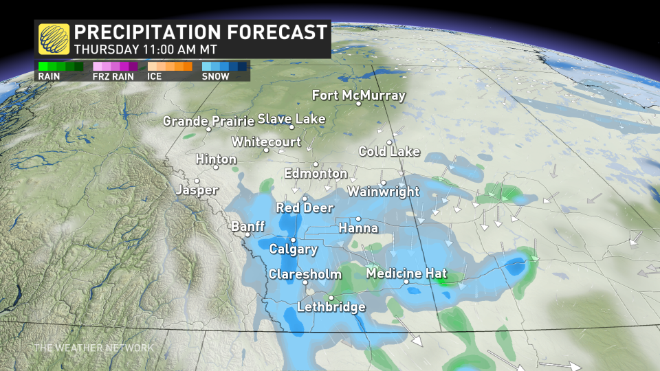
As temperatures drop from Wednesday overnight into Thursday morning, precipitation will change back into scattered snow mostly, especially for Red Deer, Calgary, QE2 and areas south. Regions farther east remain in a rain-snow mix.
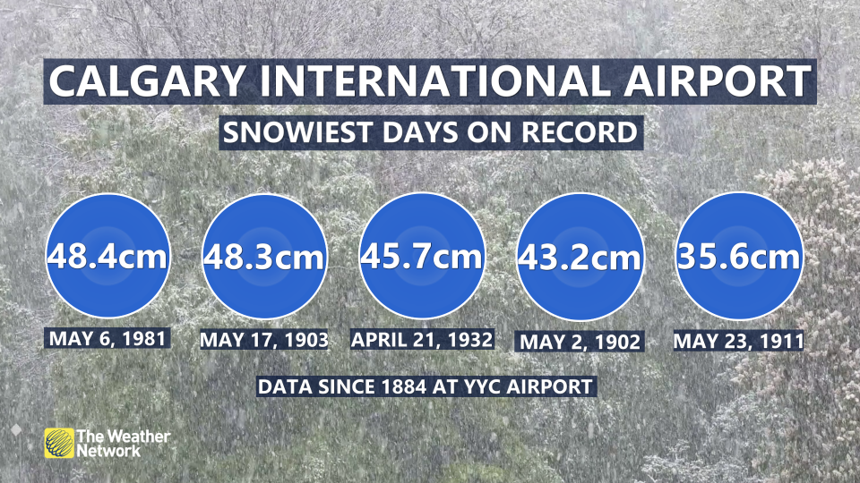
For folks annoyed at this springtime snowfall, it's important to remember that snow in April and May are normal for the province and that they are actually some of the snowiest months.
In fact, the top five largest snowfalls in Calgary took place in April and May.
MUST SEE: Bear-tracking study celebrates citizen science in Alberta's grizzly country
Be sure to check back for the latest weather updates across Alberta.

