Afternoon shower and storm chance on Mothers Day
The Latest Northeast Wisconsin Forecast from Storm Team 5…
Today turned out to be quiet the nice day with highs at average around the low to mid 60s. Puffy cumulus clouds grazed the sky and a few absorbed enough moisture to bring a pop up shower, but most of the day was pleasent.
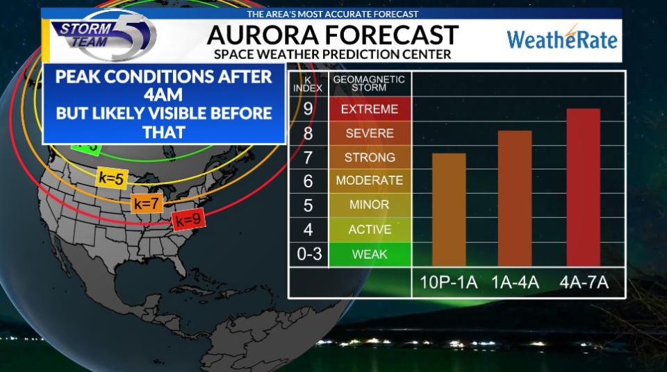
For tonight those clouds will clear and temperatures fall to the mid 40s. A warm front will approach and that will bring a chance of a shower and a few clouds north of Green Bay. That will sadly slightly obscure chances to see the beautiful northern lights up there tonight. Latest numbers as of tonight from the space weather prediction center forecast it will be likely to see again tonight, but will depend on cloud coverage.
Mothers Day will start off partly to mostly cloudy with some decrease in the clouds during the mid day hours. This will help charge the atmosphere as a cold front starts to approach, bringing a broken line of showers and storms with it. The time frame looks to be around 4pm up north and will start to slide its way through after that. While no severe weather is expected, a stronger storm containing gusty winds, small hail up to 1in and downpours is expected.

Highs tomorrow while wont be record breaking, will be very warm with temperatures in the low to mid 80s, 70s lakeside. The rain should exit over the lake by 9pm with the exception of a stray shower south. After that point, look for decreasing clouds and temperatures into the low 50s.
A system will try to work its way into the area Monday, but appears rain will only reach our southern counties and maybe as far north as Oshkosh. Look for partly cloudy skies otherwise and temperatures around 70. Tuesday and Wednesday expect beautiful weather before rain arrives late Thursday and into early Friday AM.


