Zoom through a 'spectacular' chain of ancient underwater volcanoes on Antarctic ocean floor
New high-resolution maps of the seafloor halfway between Tasmania and Antarctica have revealed a chain of underwater volcanoes whose towering peaks may sculpt ocean currents above.
The submarine volcanoes, or seamounts, sit 13,000 feet (4,000 meters) below the waves and directly in the path of the strongest ocean current on Earth — the Antarctic Circumpolar Current — which flows clockwise around Antarctica and acts as a barrier that helps keep the icy continent frozen. Now, scientists have mapped an area where this barrier appears to be leaking, which is enabling swirls of warm water to reach the shores of Antarctica.
The region is a "gateway where heat is funneled toward Antarctica, contributing to ice melt and sea level rise," Benoit Legresy, the chief scientist on the mapping expedition and a sea level scientist at the University of Tasmania, said in a statement.
The leak isn't new, according to the statement, but the scientists hope the new maps could help predict how the leak will evolve as oceans warm due to climate change and meltwater floods into the Southern Ocean.
Legresy and his colleagues collected ocean data inside the circumpolar current from aboard the Australian research vessel "Investigator". They also used NASA's and the French National Center for Space Studies' new Surface Water and Ocean Topography (SWOT) satellite, which measures the height of the ocean surface from space to glean what lay beneath.
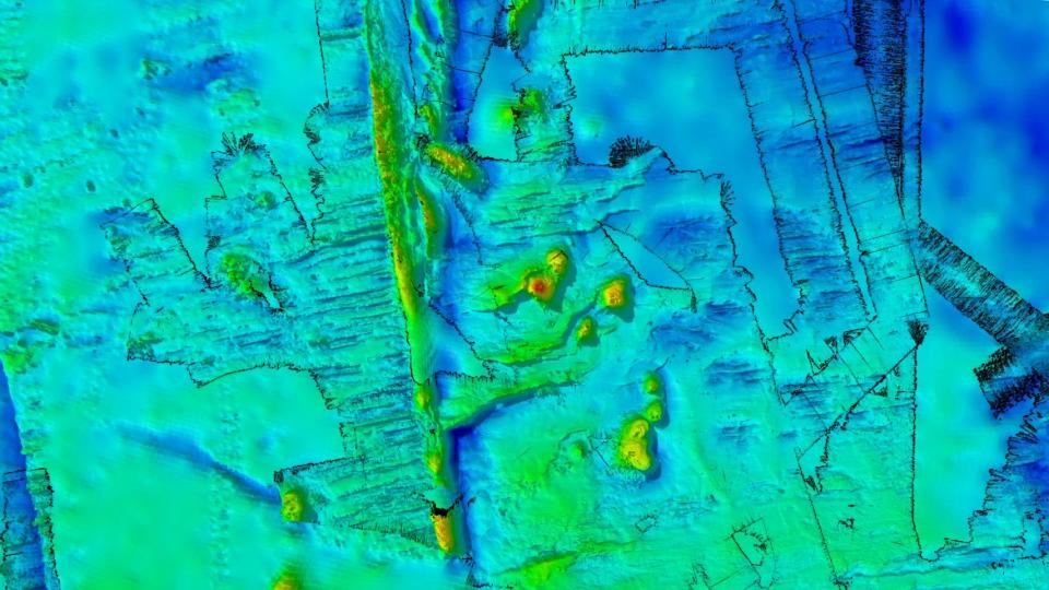
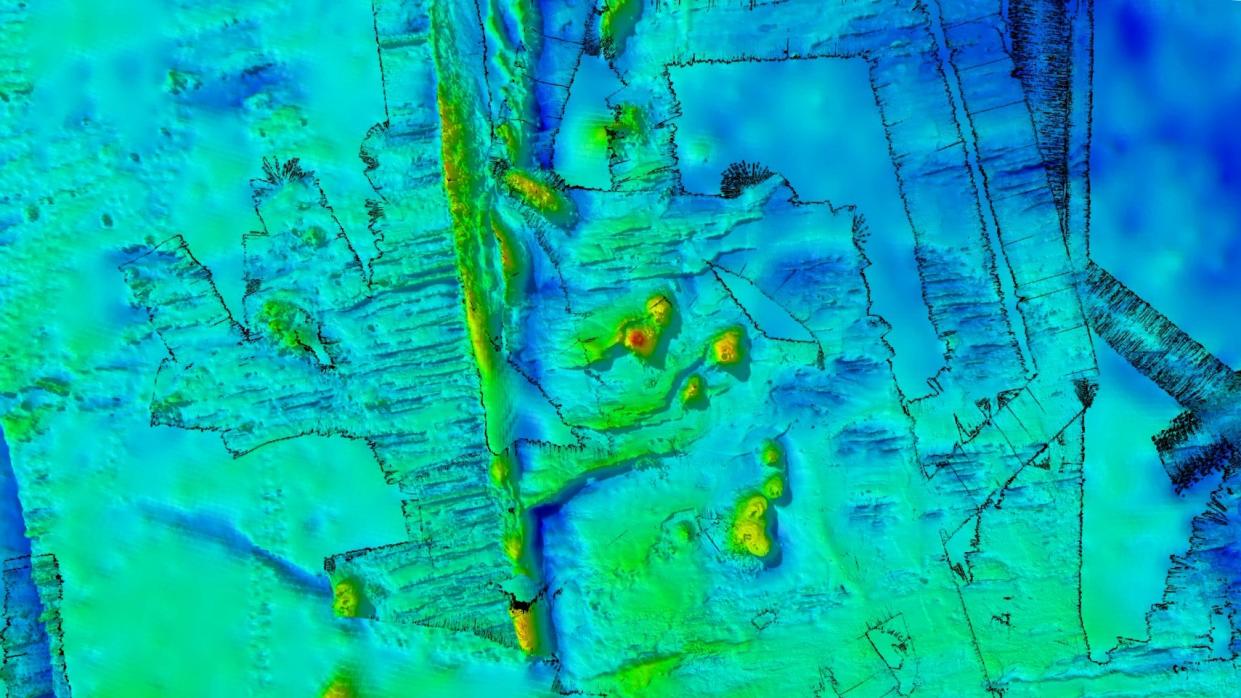
The satellite measurements revealed a chain of mountains within the survey area, which spanned 7,700 square miles (20,000 square kilometers) of a region west of Macquarie Island and the tectonically active Macquarie Ridge.
"To our delight, we've discovered a spectacular chain of ancient seamounts, comprising eight long-dormant volcanoes with peaks up to 1,500 meters [4,900 feet] high and one with a double vent," Christopher Yule, a doctoral student of marine geophysics at James Cook University in Australia who was part of the expedition, said in the statement. Four of the seamounts were new to science, Yule said.
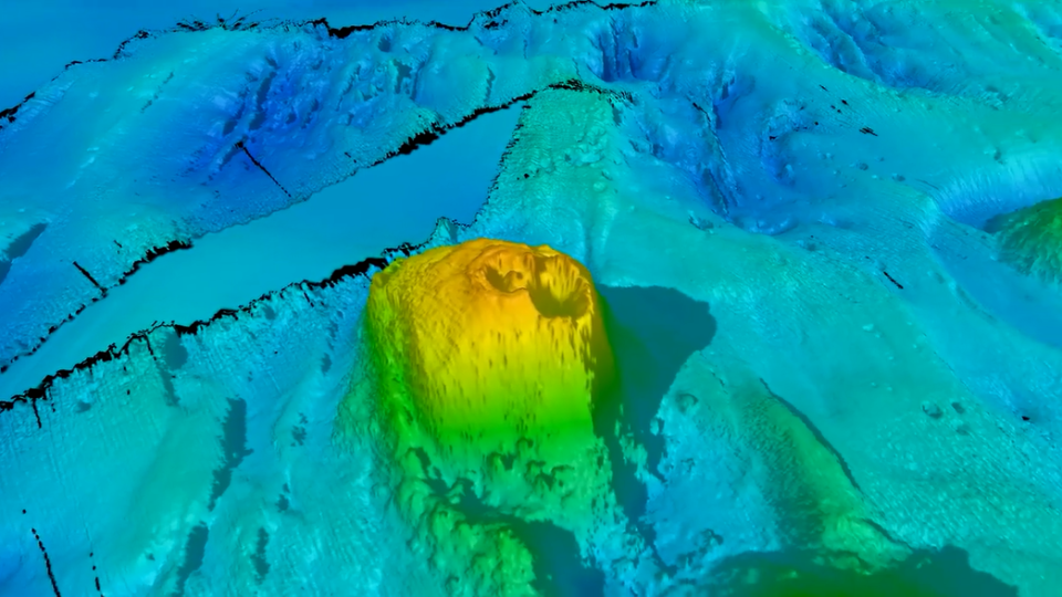
The volcanoes formed within the last 20 million years ago, according to the statement, and likely play a role in shaping ocean currents around Antarctica. "The Antarctic Circumpolar Current 'feels' the seafloor and the mountains in its path, and where it encounters barriers like ridges or seamounts, 'wiggles' are created in the water flow," Helen Phillips, the co-chief scientist on the voyage and an associate professor of oceanography at the University of Tasmania, said in the statement.
RELATED STORIES
—Collapse of the West Antarctic ice sheet is 'unavoidable,' study finds
—'Ghost' of ancient river-carved landscape discovered beneath Antarctica
—Ethereal ice swirls dance around Arctic peninsula in stunning new satellite image
These wiggles form eddies, or circular currents that pinch off from ocean currents. "Eddies are like the weather systems of the ocean, playing a major role in transporting heat and carbon from the upper ocean to deeper layers — a critical buffer against global warming," Phillips said. "Knowledge of the depth and shape of the sea floor is crucial for us to quantify the influence of undersea mountains, hills and valleys on the Antarctic Circumpolar Current and the leaking of heat toward Antarctica."
Ultimately, mapping the Southern Ocean will deliver clues about the extent of ice melt in Antarctica and help predict the resulting rise in sea levels, Phillips added.

