UK weather: New thunderstorm warning from Met Office after 35,000 lightning strikes overnight
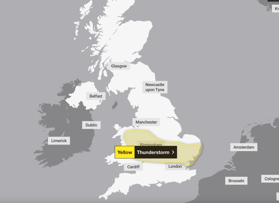
England and Wales are set to be battered by thunderstorms on Thursday as the Met Office issued a 12-hour warning for bad weather.
Lightning strikes, sudden flooding, and strong winds are expected between 12pm and midnight the forecaster has said.
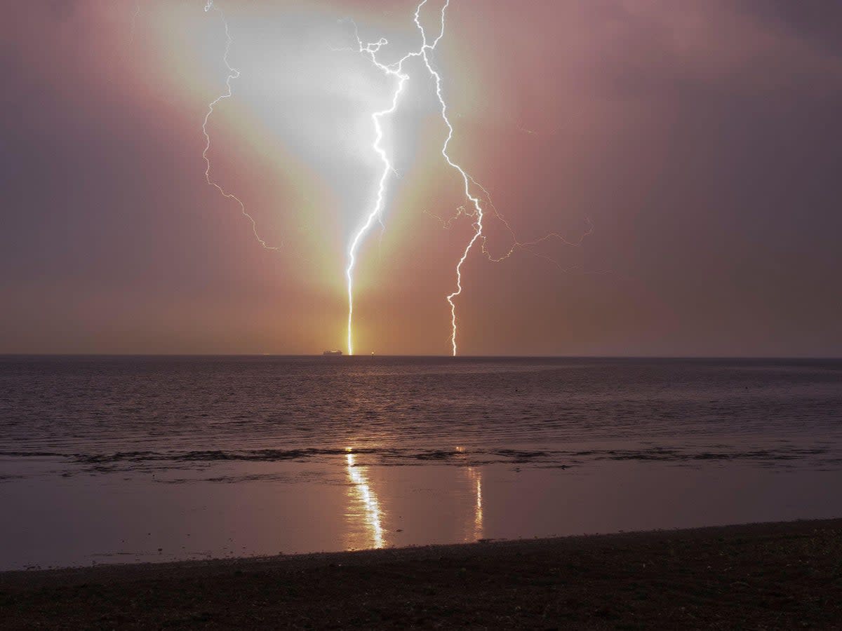
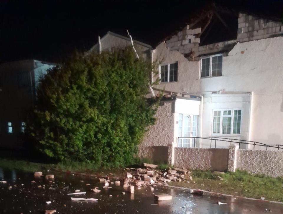
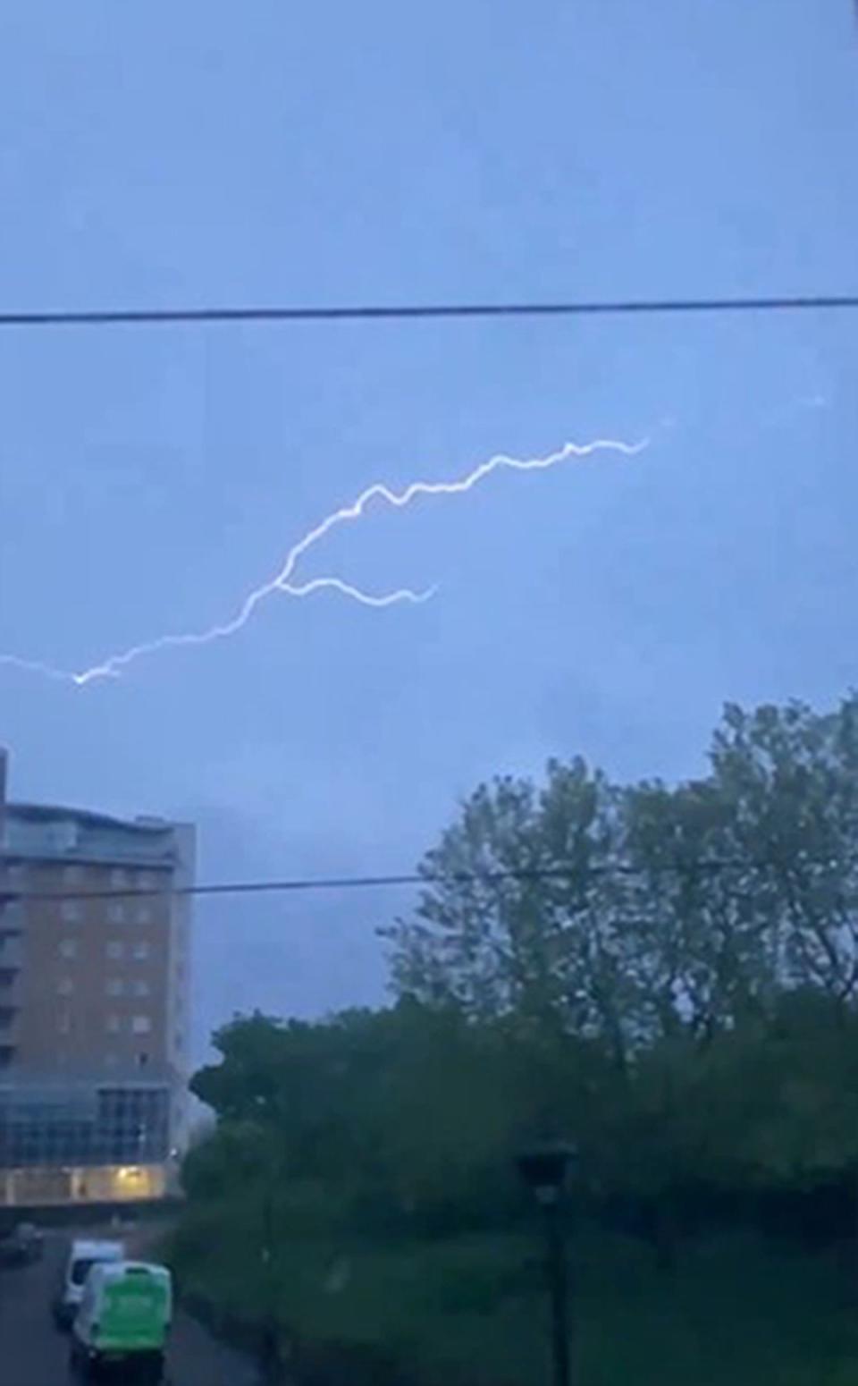
It comes after more than 35,000 lightning strikes lit up the skies of southern England overnight - two of which destroyed the roofs of properties in West Sussex.
Overnight, a care home in Elmer, West Sussex, was struck by lightning and sustained damage to its roof, according to West Sussex Fire & Rescue.
Were you affected by lightning strikes? Email alexander.butler@independent.co.uk
A university building in Chichester was also struck, causing damage to its roof and power system, the city’s fire service said.
One resident who lived nearby the care home told the BBC: “I was looking up at the lightning. The thunder had rumbled around. I got up because I was concerned about the dog.
“And then suddenly there was a massive bang and a massive flash all at the same time. There were fire engines and ambulances and people were being removed from the home.”
Southern England and Wales bore the brunt of the heavy rain and thunderstorms last night, with two weather warnings in place throughout the night and into this morning.
There were also delays on some Great Western Railway services this morning after lightning damaged the electricity supply between Westbury and Castle Cary.
Commuters were warned of travel chaos this morning, due to spray and sudden flooding, while trains and buses may be delayed or cancelled.
On the new warning, the Met Office said: “While some areas will remain dry, thunderstorms are likely to develop this afternoon and evening from the east and move relatively slowly westwards or northwestwards.
“Where thunderstorms occur, heavy rain accompanied by frequent lightning is likely with potential for 25 to 30 mm of rain to fall in 1 or 2 hours in a few places and perhaps as much as 50 mm could fall in one or two spots. In a few places there may also be some hail.”
Marco Petagna, a meteorologist at the Met Office, said: “After a night of storms, the rain will ease in the south of England for a while.
“We could see the skies brightening up in a few places and it will be another warm day. Parts of the South East could even get to 24 degrees and beat today’s temperatures.”
Looking ahead to the bank holiday weekend, Mr Petagna added that the forecast showed a “very mixed picture”.
Temperatures could reach 24C in parts of the south east, following a high of 22.1C on Wednesday which was the warmest UK temperature yet for 2024.
MET OFFICE OUTLOOK
Thursday
Early thundery rain across southern England and south Wales easing. Some bright spells developing, although further thundery showers may develop later. Some warm sunshine elsewhere, but chilly around North Sea coasts where there could be some low cloud.
Thursday night:
Areas of rain over the southern half of the UK spread west with the risk of thunderstorms. Dry elsewhere with low cloud reforming in some northern and eastern parts.
Friday:
Cloudy with some heavy showers across central parts which can be thundery. Mainly dry with sunny spells across north Scotland, Northern Ireland and the southwest. Temperatures just above average.
Outlook for Saturday to Monday:
Remaining unsettled for the bank holiday. Rain at times, with heavy showers but sunnier spells from time to time. Temperatures generally above average way from cloud and rain.

