From Summit to Sea—Tracing the Cascading Journey of Water From Glacier to Ocean (An Ode to the PNW)
Tracing the Cascading Journey of Water From Mount Baker to Bellingham Bay
Words and Photos by Jason Hummel
From snowflake to sea swell, water has a cycle—a circulatory system whose seasonal heartbeats pump snowmelt into this green and gracious land so many of us have come to call home. Yet for years, any appreciation I had for Washington State and its famous precipitation was limited to the Cascade Mountains and their mantles of ice. Once those rivulets traced away from the glacier, it was out of sight, out of mind, and I ignored the impact their accumulations had upon the fabric of our environment. Once I realized that, it became imperative for me to trace that story of ice and snowmelt from summit to sea.
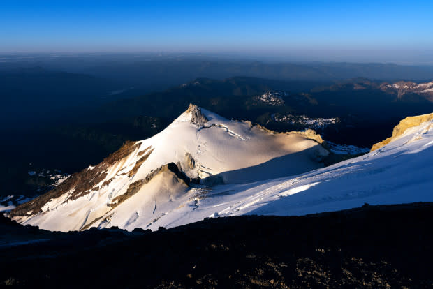
Photo: Jason Hummel
With the thesis for my project established, I needed a destination. I found it on Washington State’s northernmost volcano, Mount Baker (10,786 feet). From it flows the Nooksack River, a free-flowing stream that is nearest to its pre-industrial state, headwaters to the estuary, as any other river in this region. For that reason, among others, it became my path of least resistance.
With a mountain and river in mind, a logistically feasible plan was my next obstacle. I decided on a transit over Mount Baker’s summit with skis, ascending via the Easton Glacier (with a camp on the summit) and descending via the Coleman-Deming route. For the transition to water, I would begin with a pack raft at Glacier Creek bridge (III-IV), and from its confluence with the Nooksack River (I-III), I’d continue to Bellingham Bay and the Salish Sea.
If completed, I’d reach wave-torn beaches full of driftwood and saltwater spray. Only then would I have seen with my own eyes the path water takes once the snows melt.
Easton Glacier
The way toward Mount Baker’s upper slopes is all flowers and viridescent forest, the landscape bursting with life after yet another winter. Murmuring in every low vale are streams, and shouting from every high cliff are waterfalls. Fracturing the broad flanks are slopes riddled with crevasses, and piercing the sky are sub-peaks sharpened by time’s careful hand. Nothing of man except a path and tents mar the pristine parklands.
Together with my partner for this adventure, Sage Vogt, we entered that country at 1 PM with strides as wide as our smiles. Behind us, Delilah (Sage’s better half) drove off after shuttling us around the mountain. Before she left, we named her hero, goddess and angel. She shrugged off these accolades and set out on her own adventure.
Sage and I raised our eyes toward the Easton Glacier and the summit 7,500 vertical feet above us. Then we started climbing.
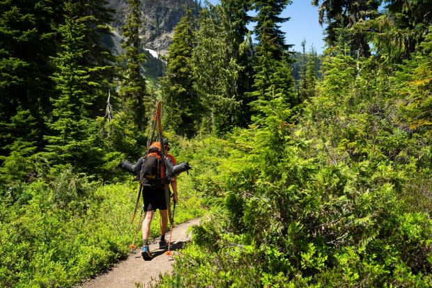
Photo: Jason Hummel
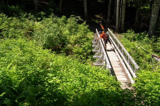
Photo: Jason Hummel
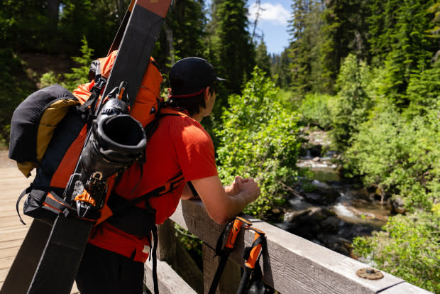
Photo: Jason Hummel
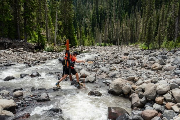
Photo: Jason Hummel
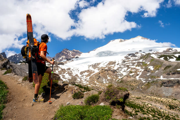
Photo: Jason Hummel
Charles Easton
As we went, I thought of how this glacier was named, how in 1909, the Mazama Club asked Charles Easton (1858–1931) what he would call it. He suggested Twin Glacier, but after he departed for home, the Mazama members christened it Easton Glacier.
Outside Easton’s work as a local historian, his greatest contribution to Mount Baker was a map he published in 1912 (shown below). What I love about maps are the stories hidden behind the names and symbols. For example, below the Bastille Glacier, barely discernible, is a cross. Written below it is “grave.” But whose grave? When and how did they die?
Richard L. Smith
The story can be traced back to July, 1891. At that time, three prospectors from Blaine, Washington, were attempting to climb Mount Baker. They never made it. As they reached a point above the timberline, one member, Richard L. Smith, spotted mountain goats. In those days, so far from civilization, hunting meant sustenance as well as sport, and getting off a fine shot earned you both bragging rights and a full belly.
Sadly, in Smith’s exuberance, he inadvertently shot himself through the arm, severing his brachial artery. Within seconds, he fell to his knees and tumbled 200 feet down the steep moraine walls that they were ascending. By the time his friends made it to his side, it was already too late. With extreme difficulty, his body was carried back up the moraine, and he’s there still, buried above the headwaters of what has long since been called Smith Creek.
Skinning Up the Glacier
At the cusp of bedrock and glacier, we transitioned to skis. So many miles and years on these two planks, I sometimes wonder if somewhere out there in the greater cosmos, evolution has created a creature with skis for feet.
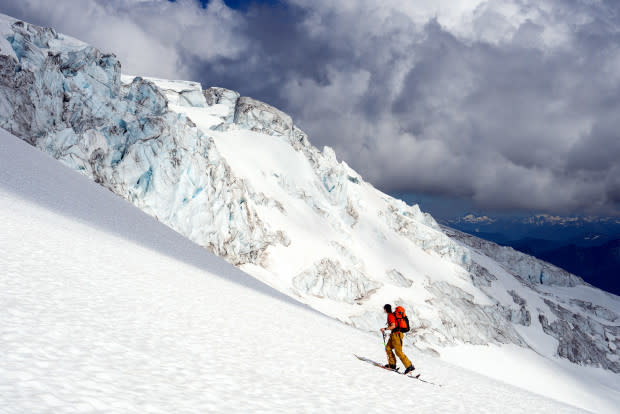
Photo: Jason Hummel
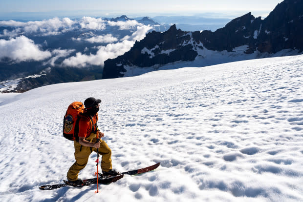
Photo: Jason Hummel
We soon climbed by serac fields, tottering towers of ice jumbled and spit out by gravity. Chasing sunset, we were swept by them, following cloud shadows that cooled us until they passed. Then, heat would blast us, feeling as fierce as any desert sun. Only as we made it to the final headwall did the temperatures normalize.
Sherman Crater
At Sherman Crater, we climbed frozen ash and pumice and stared into the grumbling earth, blasting with steam and stale air. This place, some 1,300 feet below the summit of Mount Baker, is a cauldron of fire and ice and full of the sort of power my inner soul-fire leans out toward. The kind my body, in turn, follows. Only as rocks danced down the slope and plopped into grayed and pitted ice and snow was I compelled to turn away. Life may not wilt in the presence of power, but it will respect it.
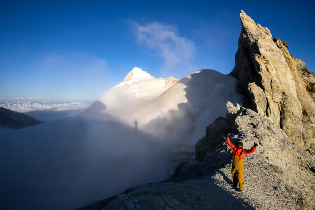
Photo: Jason Hummel
The first rays of orange and yellow blushed the horizon, and our goal of reaching the top at sunset seemed all but met until. a blanket of clouds was yanked right over the top of our heads. Mouths agape, we were left speechless and scrambling for our coats. Before I’d even taken in the view, my perception orbited my feet. Anything beyond was transformed into an icy moonscape with no definable end. No sky or horizon, nothing but void and vast nothingness.
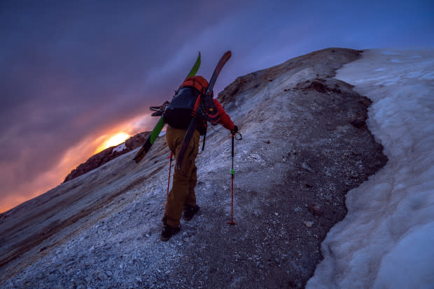
Photo: Jason Hummel
Summiting Mount Baker
At the summit, freezing fingers yanked my tent from my bag, and Sage helped me pitch it. An hour later, the most salient stars shone, bleeding through the blue hour's bright facade. By then, the clouds had lost cohesion, their meddling complete. While we sat alone on this mountainous roof, I gazed upward, transfixed, soon lost in the night sky. Without conscious awareness of it, I unanchored myself. Adrift between terrestrial and intergalactic planes, I paddled into that gulf that separated me from everything and fell asleep dreaming of star clusters and supermassive black holes.
I awoke in Jupiter’s red eye, and like the gas giant’s storm, I felt like the wind had been raging for hundreds of years. Once free of the tent, I laughed. From within our night’s home, the winds pressing in on the walls of the tent had created another illusion—instead of a storm on some distant world, we were instead within the gullet of some great and terrible beast.
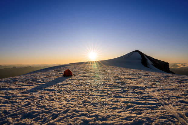
Photo: Jason Hummel
A side trip to the true summit of Mount Baker around 8 AM placed Sage on top of his very first volcano! The view reveals half a dozen ecological zones. The Pacific Ocean lies to the west, Canada to the north, the spine of the Cascade Mountains to the south and the dry scablands to the east.
A Jarring Descent
From the crest of the summit dome, we cut our skis into ice-ribbed slopes, sun-cupped and pockmarked by old steps and rocks. We knew that the price of our night’s camp was an icy ski but still held out hope that the snow would soften. Yet hope has as much currency with reality as “abracadabra”. Each turn clattered our teeth. Every stop strummed frayed nerves across shaky knees.
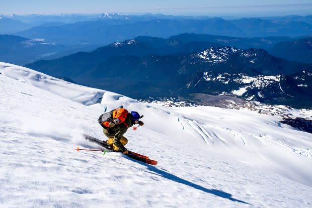
Photo: Jason Hummel
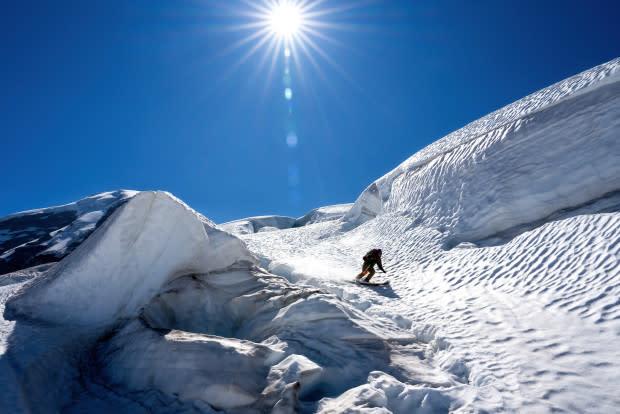
Photo: Jason Hummel
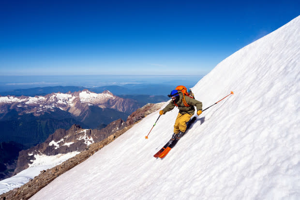
Photo: Jason Hummel
After a vertical mile of descent, we reached dry ground. Numerous streams catapulted from snow onto rock. Flowers wilted by the season's early heat lay browned against gray stones. Lush grass and various bushes sprouted wherever they could take root, all of them newly arrived tenants to replace evicted glaciers, glaciers I’d seen covering this very earth just two decades earlier.
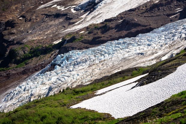
Photo: Jason Hummel
Photo: Jason Hummel
En Route to Glacier Creek
Back to walking, we strode once more into forested canopies of subalpine fir, hemlock and Douglas fir, among others. In between grew salmon berries and devil’s club, blueberries and ferns. This way, a waterfall. That way, a glacial icefall. Birds sang and far-off rivers roared.
At the trailhead, Sage and I continued another five miles to Glacier Creek bridge, a half mile past the current road washout. Once again, Delilah, our knight in shining armor, came to our aid. This time she had our freshwater steeds (i.e., pack rafts), on board.
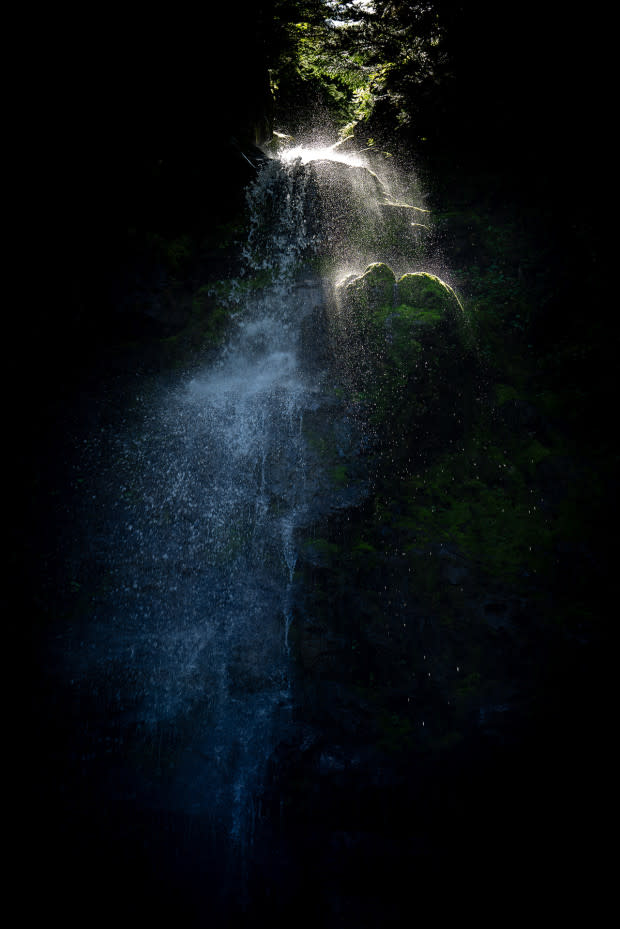
Photo: Jason Hummel
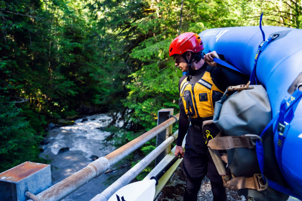
Photo: Jason Hummel
Paddling Glacier Creek
It was an hour later, with an empty beer and a prepped boat, that I scouted Glacier Creek from the bridge. Nostalgia traced the rapids downstream. Twenty-one years ago, I paddled this creek, and in all those intervening years, I’d only read about a few other descents. Luckily for us, one of those was just two weeks earlier! Conditions were touted as good enough, and good enough is all you can ask for.
Once within those accumulated waters from Mount Baker, my control was limited to paddle strokes. As I slid from a car-sized boulder into the swift current, hardwired instincts took over. In seconds, I slipped between a narrow channel, dove off a pour-over and spun out into an eddy. Upstream, I watched Sage hit every mark he needed and knew we had an easygoing 65 miles ahead and nothing more to stop us.
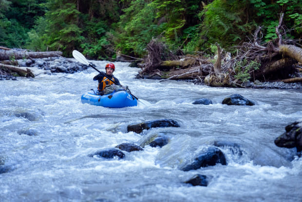
Photo: Jason Hummel
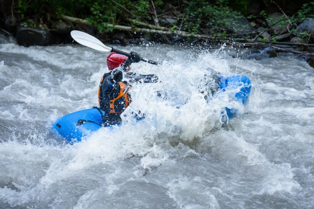
Photo: Jason Hummel
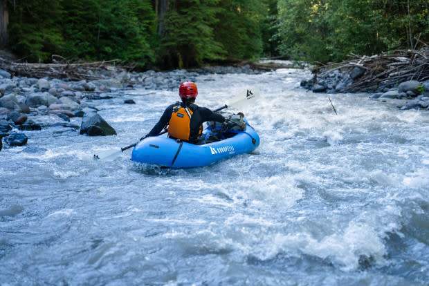
Photo: Jason Hummel

Photo: Jason Hummel
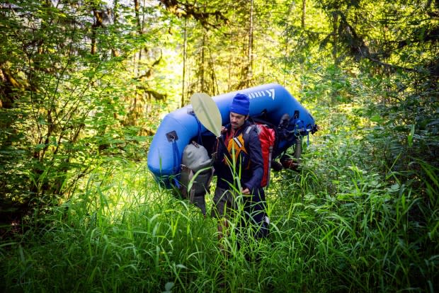
Photo: Jason Hummel
Of course, we spoke too soon. Smiles faded as we climbed around yet another logjam. Each time hopes would rise, another pile would appear. Below one such feature, while waiting, I remembered how my friend Ben passed away 20 years ago while kayaking the Grand Canyon of the Elwha. It was his PFD I wore right then. I wear it to remind me that fear and danger, thrill and challenge are currents all their own, and that we have to balance those base realities with our own skills and the conditions we find.
After several hours, we stashed our boats just outside the town of Glacier. Hopes had been hitched to its sole restaurant being open, but it was closed up. With few options, we raided the local market and soon returned to camp.
Before sleeping, I wondered how far we could boat each day in pack rafts, where we could legally camp and, “what if there are endless miles of flat water with strong headwinds threatening to blow us all the way back to Mount Baker?” Small worries, because in the end, all rivers lead to the sea. All we had to do was paddle.
Joining the Nooksack River
Mosquitoes and stinging nettles battled us as we packed bags and sorted gear. A side trip to Glacier’s Waken Bakery salved all wounds, and cold water from the Nooksack River an hour later further mended us. In fact, I couldn’t imagine a more idyllic way to begin the day.
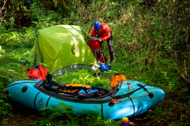
Photo: Jason Hummel
Photo: Jason Hummel
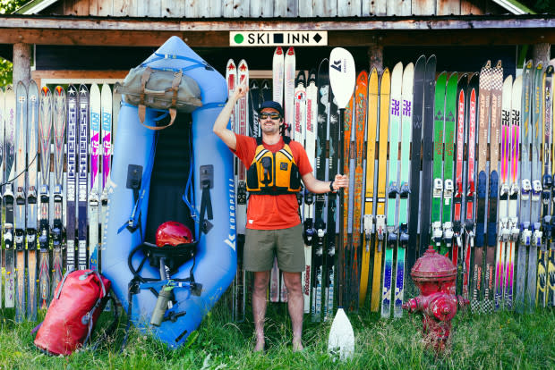
Photo: Jason Hummel
Good thing Mother Nature has a better imagination than I do. With morning air to our backs, eagles and hawks taking wing, salmon leaping and—bringing it all together—Mount Baker rising in the background, I was left speechless. For those who know me, this is no small feat.
Hours later, there was yelling from shore. Crossing the current, I made out, “Beer?”
An emphatic “Yes!” was my response! They dove into their cooler and tossed. Spun away by the current, I caught. With my prize in hand, a crack broke through the monotonous river sounds, followed by a satisfied “Ahhhh.” Sage had snagged his prize, too.
Could this morning get any better?
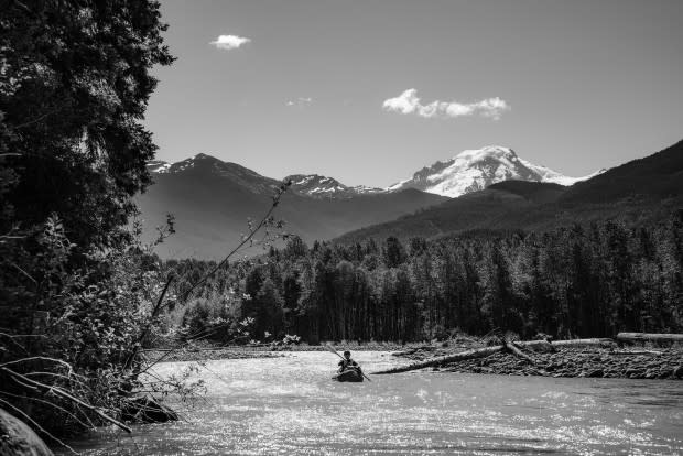
Photo: Jason Hummel
In a mid-river transfer of gear, we attempted to make it worse. After Sage left his boat and paddle atop logs, he pulled my boat up. Soon after, he cried, “Where’s my paddle? Did you see my paddle?” Arms waving and fear beginning to spike, he said again with growing suspicion, “Where’s my paddle?” We both looked downstream at the same time. Glinting in the waves, in the far distance, was his paddle!
I leapt in my boat, and Sage flung me from the logs. I paddled like a man possessed. Just before another logjam, breathless, I managed to snag it.
As I waited for Sage to come down, what I craved right then was another river beer. But even if I had one at hand, it couldn’t have competed with the thrill I got when I saw Sage nearing with a substitute paddle, an 8-foot log!
Tired and ready to be done, we pulled our boats up fist-sized rocks to a sandy patch just big enough for our tent. Sage’s watch told him we’d gone 30 miles. After camp was pitched, we rested our backs on a log. Radiant heat from river rocks warmed the cool evening, the shuffle of water accentuated the silence [1] and birds swooped past a muted sky that blushed orange.
Thoughts of the day flowed back upriver. Few houses were seen. Diverse forests and natural shorelines reigned throughout, a surprise to me. Besides that which I couldn’t see (such as farm water runoff), the most unnatural thing I saw was remedial work created for fish habitats.
All Rivers Flow to the Ocean
With an early rise, we set our goal to be in salt water before the sun set. Every trip has a turning point, when the momentum of the end pulls you toward the finish line. With 30 miles done the day before, we saw no reason it couldn’t be done again.
With each paddle stroke, we were drained through Cottonwoods and alders, pulled past frothing and boiling water into green and turbid pools. Miles melted into the horizon like any number of eagles that soared above us. So many times, I thought the water would slow, but outside strong breezes around several bends, we found the going as good as we’d hoped for, and nothing short of another perfect day.
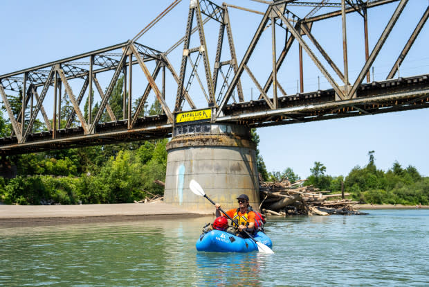
Photo: Jason Hummel
We passed beneath numerous bridges for railroads and cars, but none so thunderous as Interstate 5. From all appearances, the health of the river there was undeniably changed for the worse, but as the miles again gathered behind each paddle stroke, we found the river recovering.
Entering the Nooksack Wildlife Area
Around 3 PM, we entered the Nooksack Wildlife area, an estuary whose outlines are made up of muddy shores and stacks of driftwood. Through its watery center, we kept moving, afraid that we’d be fighting tides.
Then, just like that, we were there. From Bellingham Bay, Mount Baker rose like a cloud cap, white and bulbous. Even without the thunder such clouds usually bring, the feeling of this incredible sight rang between our ears.
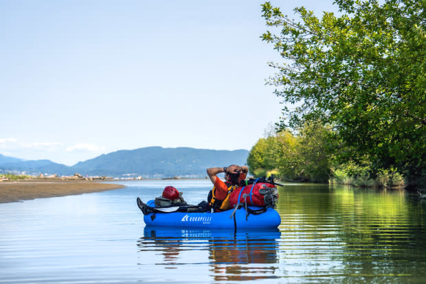
Photo: Jason Hummel
From the billions of accumulated snowflakes on Baker’s summit to the billions of accumulated raindrops crashing onto the shores of the Salish Sea, I asked myself what I had learned. What wisdom was spun out of the endless eddies? This is it: Water will outlive us. The Earth will outlive us. How we live and what balance humans strike with nature—that alone will determine if our story will move with the current or against it.
