New projects could make Columbus bike & walk-friendly. Critics call sections ‘Wasteland’
When Pat McHenry moved to Columbus nearly 20 years ago to teach English at Columbus State University, most streets didn’t have sidewalks, much less bike lanes.
McHenry, now provost of undergraduate education at CSU, remembers getting harassed by motorists when he pedaled to work in the late ‘90s.
Undaunted, McHenry has biked for nearly three decades in Columbus, founded a bicycle group (Bicycle Columbus), and advocated for bicycle and pedestrian-friendly streets in Columbus with nonprofits and with the city.
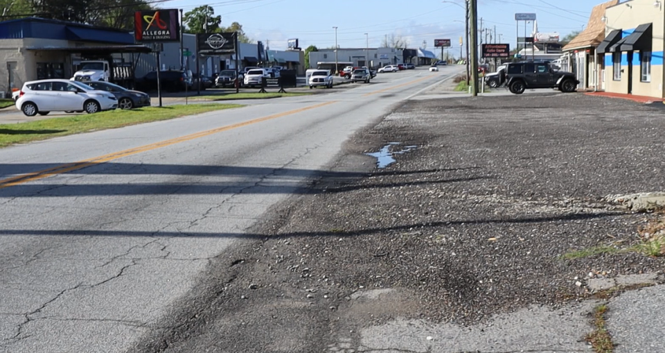
“Biking in the city is very uneven,” McHenry said. “There are good parts like Fall Line Trace but other parts are a wasteland for biking and walking, especially in north Columbus where it’s impossible.”
In the decades since McHenry moved here, it’s been a slow burn of marginal transition toward a city with more mobility options that are not reliant on fossil fuels.
After years of COVID lulls and weather delays, the city planning department says 11 projects are underway from funding by the 2022 transportation sales tax, called TSPLOST.
The Transportation Local Option Sales Tax taxes a penny on the dollar to fund road projects and gives money to the city immediately. Seven of the 11 include sidewalks, and multi-use paths that will create more options for getting around Columbus.
University Avenue, Buena Vista, Andrews Road, Steam Mill Road, Whitesville Road, Brennan Road, and South Lumpkin are all going to have complete streets. Meaning, they will have safe, accessible, and convenient streets for walking and biking.
These areas are part of what will be 11 projects in the first band (2023-2026) of TSPLOST-funded projects, with 10 projects in the second and third band (2026-2033).
Decades of Disconnection
It wasn’t until 2005 that sidewalks were a required part of construction during residential development in Columbus. Today, 31% (381 streets) are paved with sidewalks, according to Will Johnson, the city’s planning director.
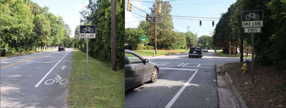
Currently, Columbus has just six miles of bike lanes on city streets. And only a strip of white paint separates cars from cyclists along the half-mile bike lane on Hilton Avenue, one of a handful of city bike lanes.
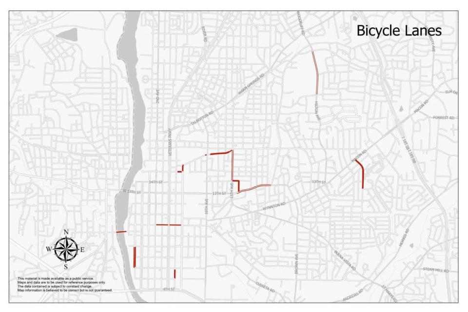
“Six disconnected miles is not as effective as two connected miles,” McHenry lamented.
Macon-Bibb County has double that of Columbus, with 13 miles of dedicated bike lanes. All have been added since 2015, according to Rachel Humana, executive director of Bike Walk Macon.
Rochester, New York– a city with 211,000 residents, about the same as Columbus– has more than 40 miles of bike lanes, a 6-fold difference. At the high-end of the spectrum, New York City boasts over 1,500 “lane miles of bike lanes,” according to its website.
The arbitrarily designated bike lanes were instituted during Mayor Teresa Tomlinson’s time in office, 10 years ago, in an attempt to propel Columbus toward being a bike-friendly city. These efforts and the work of the nonprofit Dragonfly Trail moved the city from an “honorable mention” in 2010 to a “bronze” level classification in 2015 by the American League of Bicyclists. But since then, the needle hasn’t moved.
“Tomlinson made a goal for the silver level, we have not yet achieved that,” McHenry said.
Metrics tell the story
Last spring, the American League of Bicyclists ranked Georgia 24th out of 50 states with nearly every city in the state at a bronze level, except Decatur in Atlanta, which earned a silver level.
The latest report card for Columbus shows a failing level across the board with engineering and equity/accessibility at just 24% and 20%.
Lt. Fred Carnes of the Columbus Police Department Traffic Control Division said more sidewalks are essential.
“If we do have bike lanes people need to follow the rules,” he said.
There were two bike fatalities and nine pedestrian fatalities in 2021. No bike fatalities have occurred since then, but there have been 11 pedestrian fatalities in 2022, six in 2023, and one this year, according to authorities.
Steam Mill Road, which is in the first band of TSPLOST projects, is where a boy and a girl were hit by a car, killing the 13-year-old in October 2022.
But the American League of Bicyclists applauded the work of the Dragonfly Trails in its feedback on the 2023 spring report.
“The progress made on the Dragonfly Trail Network is impressive, but additional work is needed to ensure that the non-trail bike system is developed as it is critical to achieving a comprehensive bike network,” the Columbus report card said.
During a ribbon-cutting ceremony on May 1 at the new W.C. Bradley apartment complex, The Currents, District 7 Councilwoman Joanne Cogle called Columbus walkable and bikeable saying, “many of you walked here today from other businesses. Now we will have ample parking and ample walkability to visit businesses.”
The district that Cogle oversees has the highest concentration of sidewalks and several bike paths.
Nonprofits and policy drive the transition
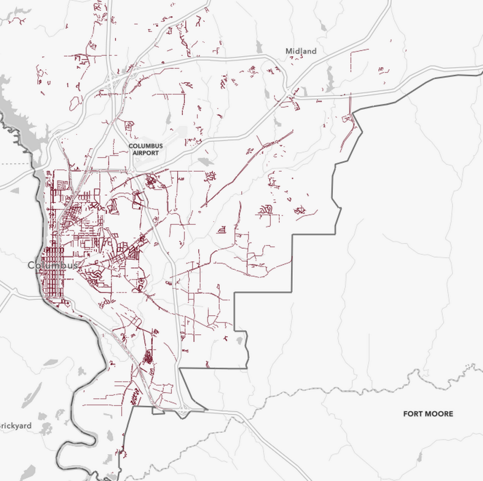
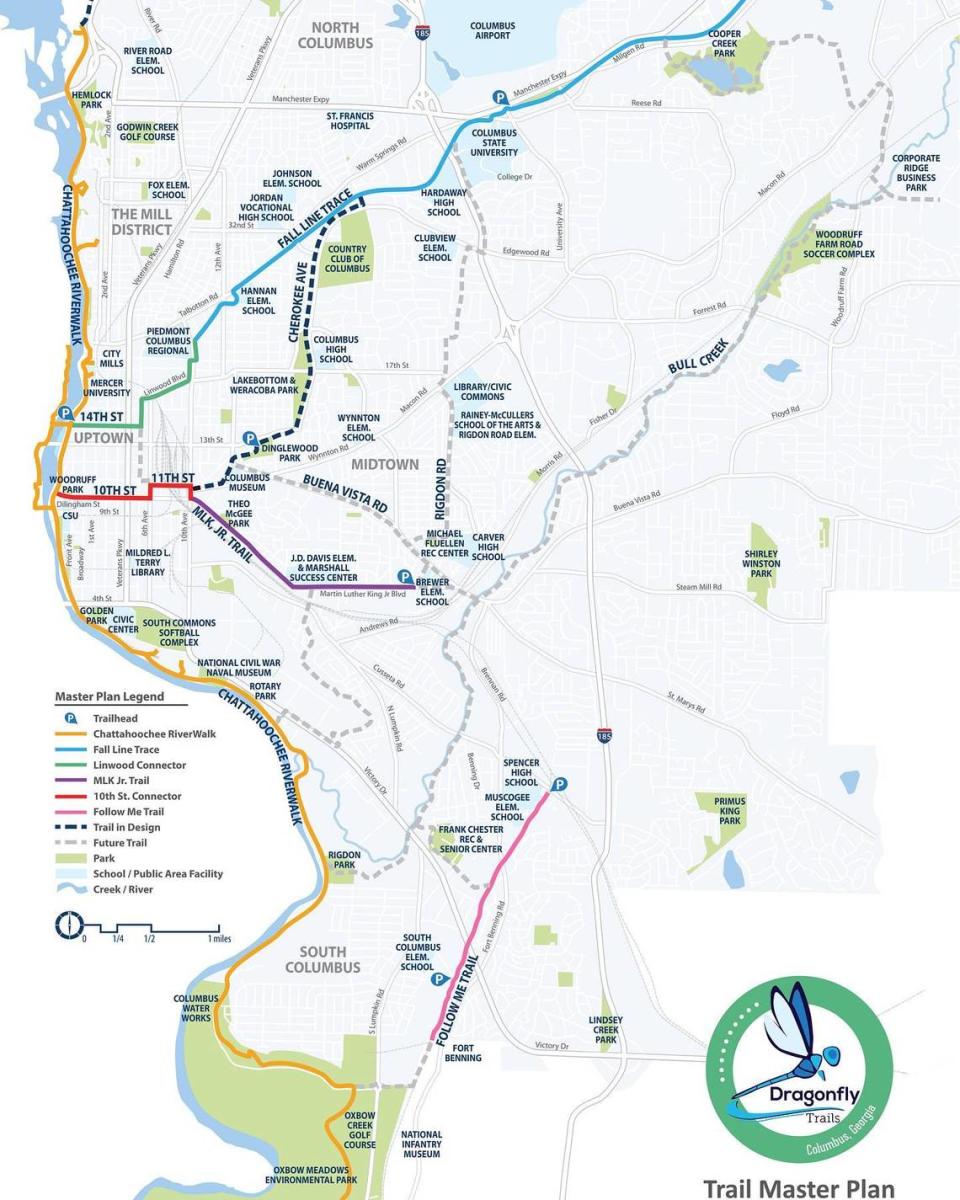
Dragonfly Trails Network dominates cycling and walking accessibility in Columbus, with 32 miles of multi-use trail paths, and another 36.7 miles planned.
“They are a trail system, not a bike lane system,” McHenry said. “Dragonfly concentrates on high quality, long-term infrastructure. They are doing the most work in Columbus [as far as bike access]. But, it moves very slowly.”
The city coordinates heavily with Dragonfly Trails to create better connectivity.
“The overall plan is to get new bike lanes significantly tied to Dragonfly,” Johnson, the city planning director said. “We coordinate everything through them.”
In 2018, the nonprofit trail system started significant construction outside of the existing Riverwalk and Fall Line Trace trails. These two largest trails, which together make up 22 miles of the 33 miles of trail system in Columbus, were completed by Path, a nonprofit based in Atlanta from which the Dragonfly Trail was conceived.
Dragonfly Trails is the designer and engineer, and the city pays for the construction. Many of the past and upcoming projects are being paid for by the 2010 and 2022 TSPLOST.
“When the 2022 TSPLOST passed that was a game-changer,” Becca Zajac, the executive director of Dragonfly Trails, said.
“Macon Road took decades for a four and five-lane project, this was pre-TSPLOST,” Johnson said. “The TSPLOST process requires us to put the projects before the people so they know what they are voting for.”
In February, the city approved a trail connecting Lakebottom Park from 13th Street to Garrard Street along Cherokee Avenue after Zajac presented the plan to city council.
She said it will probably take three years to complete the new 10 foot wide concrete trail and 5-foot landscape buffer.
Zajac is expecting Dragonfly to grow this year into a “full functioning nonprofit that has a more active board.”
“People want to be more environmentally friendly and commute to work,” she said. “There is so much room to expand to the northeast and the south…we can’t build trails fast enough, we need more people, more funding, and city approval.”
Thanks to TSPLOST funding, the city can finally put it’s Complete Street Policy, established in 2014 and amended in 2018, to use.
In 2014 Columbus adopted a ‘Complete Street Policy’ and amended it in 2018.
In addition to the work of Dragonfly Trails, one neighborhood development nonprofit, Midtown Inc., created a blueprint to maximize other forms of transit in Columbus back in 2015. It is now being put to use.
Midtown is famously partitioned from Uptown by the 13th Street Bridge, which has no bike lanes.
“How do we connect Midtown to Uptown?” asked Portillo, executive director of Midtown Inc.. “Midtown to Uptown is a short walk and should be an easy bike ride.”
The Knight Foundation granted Midtown Inc. $240,000 in 2014 to find gaps in safe and multi-use transit and connect the area to Uptown. Columbus was one of 32 cities in the country to receive this grant dubbed “Minimum Grid Maximum Impact.”
Thousands across the country applied.
After nearly a year of public meetings, surveying car behavior, pedestrian and cyclist interests and needs and concerns, a plan was delivered by Gehl Studios of Copenhagen.
Portillo believes transportation is a tool to foster economic growth. He started at his role in 2018 after the grant and mobility analysis was complete. He credits city manager Isaiah Hugley and Richard Bishop, former president of Uptown Columbus, for getting the year-long project complete.
The four takeaways of the study include:
it’s difficult to navigate somewhere that is considered close by
streets are not seen as public spaces
people want more options to move around than currently exist
when people feel invited, they come.
The grant is responsible for the 13th Avenue to 13th Street to Lindwood bike lanes and crosswalks near Jarfly.
Now, phase two of the blueprint, 13th Avenue to 5th Avenue, is resurfacing and striping the road. It was scheduled to happen in 2019, but engineering and COVID-19 added significant delays, according to Portillo. This is one of the handful of TSPLOST projects and will happen as soon as the 13th Street culvert is finished.
“The 13th Street bridge will have bike lanes,” Portillo said. “We’re working with Norfolk Southern with maintenance and managing beautification on the chainlink fence,” Portillo said.
The full list of the $303 million in TSPLOST projects is available on the city’s website.

