Old Fall River Road in Rocky Mountain National Park
This article originally appeared on My Colorado Parks
Old Fall River Road is a seasonal road that’s striking and well-worth driving. The road is usually open from early July to early October.
Why the Road is Called “Old”
Old Fall River Road was the first auto route that led to the high country in Rocky Mountain National Park. It opened in 1920. Unlike the newer Trail Ridge Road, which is well known for being the highest continuous paved road in the nation, the Old Fall River Road is much more a motor nature trail.
A Gravel, One-Way Uphill Road
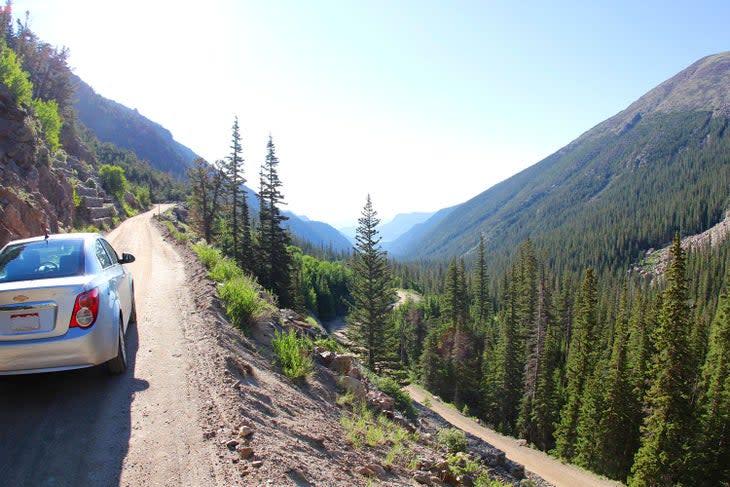
The 9.4-mile gravel, one-way uphill road is dotted with switchbacks. It leads cars along the steep slope of Mount Chapin’s south face past waterfalls, pine forests, and Fall River Pass (11,796 feet above sea level).
The posted speed limit on Old Fall River Road is 15 miles per hour. It’s a good thing because there are no guard rails and the road is narrow and curved. Yet the road is safe and there are many pull-offs. You do not need a four-wheel-drive vehicle.
To drive Old Fall River Road, enter the park at Fall River Entrance Station and head west along CO-34. Turn right at West Horseshoe Park onto Old Fall River Road and head up to Endovalley, a small turnout with bathrooms and picnic areas.
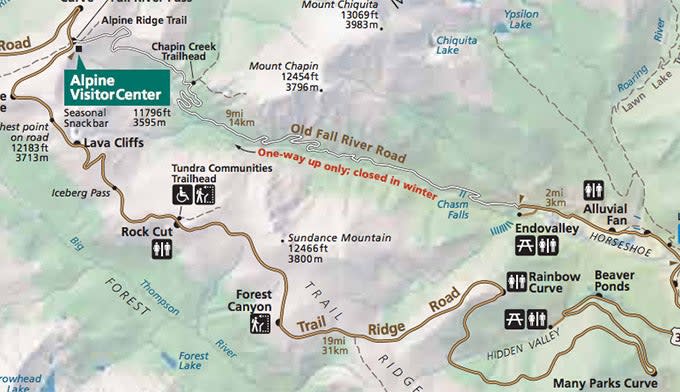
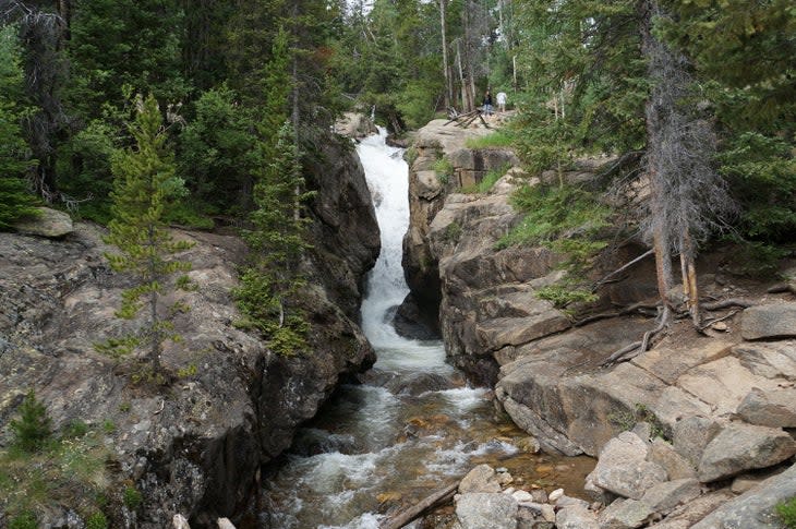
As you begin climbing, the road passes through ponderosa pine en route to Chasm Falls – a beautiful waterfall leaping 25-feet from a tight narrow rock slot.
After the falls, the road continues climbing passing into a subalpine ecosystem filled with Englemann Spruce and fir. Views soon open up and if time permits make sure to take a moment and stop at Down Valley View. From the turnout the view looking back down Fall River Valley is spectacular.
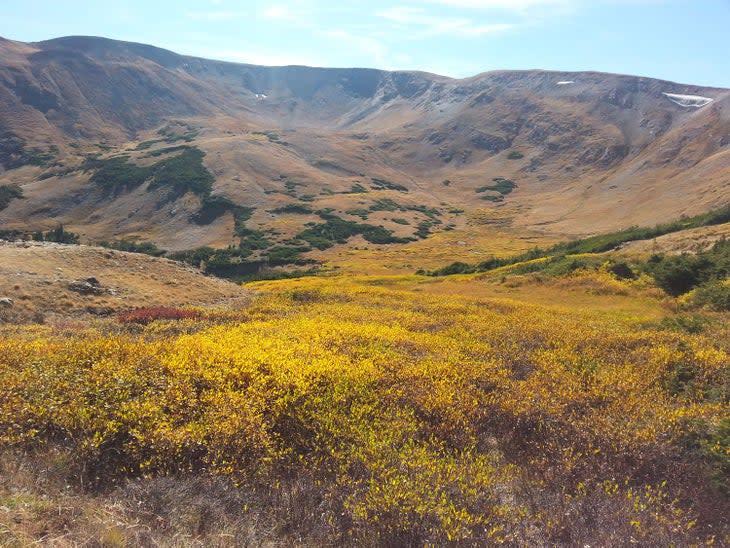
After snapping a few pictures continue ascending to Willow Park, a popular summertime viewing area for Elk and Mule Deer. Past Willow Park, the forest begins to shrink as the high-elevation climate becomes more treacherous. Soon the road passes Fall River Cirque – the top of the valley, which looks as if a scoop was taken out, and then crests tree line into open tundra.
Here Old Fall River meets up with the Alpine Visitor Center and Trail Ridge Road. To return back to Estes Park turn left and head east on Trail Ridge. Turning right takes you west to Grand Lake.
Related Read: Drive Trail Ridge Road
For exclusive access to all of our fitness, gear, adventure, and travel stories, plus discounts on trips, events, and gear, sign up for Outside+ today.

