How many neighborhoods are there in Milwaukee? Here's why there's no 'right' answer.
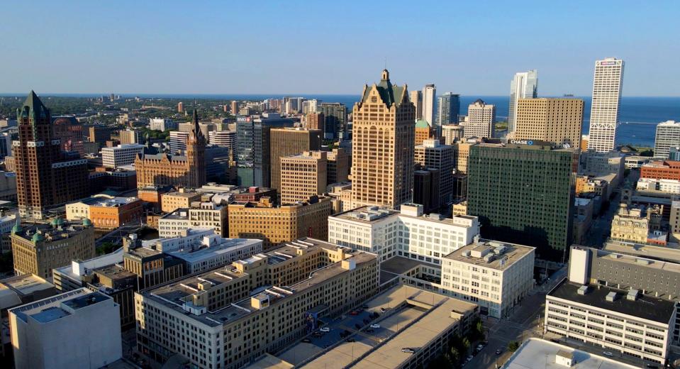
Many call Milwaukee a "city of neighborhoods."
The Cream City is known for its large number of neighborhoods, each with unique character, landmarks and histories.
But how many neighborhoods are there in Milwaukee? And how do we know which parts of the city are in which one?
That's what one reader asked What the Wisconsin? ― our series where reporters take on questions about our state, our communities and the people in them.
Speaking with a range of experts, we explored these questions ― and a few related ones ― about Milwaukee's many neighborhoods.
So, how many neighborhoods are there in Milwaukee?
Spoiler alert: There is no universally agreed upon number of Milwaukee neighborhoods. Not even John Gurda, a Milwaukee writer, historian and widely recognized authority on the city's neighborhoods, claims to have one.
Unlike state or county boundaries, there's no government edict or legislative action that officially delineates neighborhood boundaries, Gurda said. Neighborhoods are instead largely determined by the "common consensus" of their residents, as well as city officials, academics, and real estate and nonprofit organizations.
Amanda Seligman is an urban history professor at the University of Wisconsin-Milwaukee who wrote on neighborhoods for UWM's "Encyclopedia of Milwaukee." In the written and human sources she's consulted in her research, Seligman said the number of neighborhoods in Milwaukee generally ranges "somewhere between 50 and 200." The most she's ever seen is 202.
Anthropologists Jill Lackey and Rick Petrie, who've studied Milwaukee's neighborhoods for over two decades as part of Urban Anthropology, Inc., or UrbAn, have a stronger opinion on the definitive number of neighborhoods: 190, which they include in the name of their extensive oral history project "190 Milwaukee Neighborhoods."
Lackey said this number, and the neighborhood boundaries UrbAn used in their project, come from maps created by UWM.
The UWM maps are similar to another widely accepted map created by the city of Milwaukee.
According to city officials, the city's map was developed in the 1990s under the Department of City Development. The project's goal was to assign every part of Milwaukee to an individual neighborhood. Some of the neighborhoods on the map were based on established neighborhood association boundaries and "well-known neighborhoods," while others were based on landmarks, history and other factors. The city says it does not use the map for any official city purposes.
How are neighborhoods divided? Who determines their borders?
As in most cities, Milwaukee's neighborhood borders are largely based on the natural environment and both intentional and unintentional human action.
Rivers and parks are two of the most common natural boundaries. The Riverwest neighborhood, for example, is bounded on the south and east by the Milwaukee River. The same river separated Milwaukee's first two neighborhood-like settlements ― Juneautown to the east and Kilbourntown to the west ― in the early 19th century.
Man-made physical boundaries, namely railroads, highways and major roads, often serve as neighborhood borders as well, said Arijit Sen, a UWM architecture and urban history professor.
Sen runs a fieldwork project through the UWM School of Architecture and Urban Planning's Buildings-Landscapes-Cultures program where students go into neighborhoods and collect oral histories on topics like acts of stewardship and heritage and how communities address food and housing injustices. Sen has done this work in the Midtown neighborhood, where he said many residents view busy Lisbon Avenue as the northern boundary of their neighborhood.
Meanwhile, the city and other sources like the "Encyclopedia of Milwaukee" delineate Midtown's border farther north, at North Avenue. The neighborhood's western border has traditionally been marked by the railroad track that runs from about 30th St. and North Ave. to 37th St.
Seligman said real estate companies and social institutions also define neighborhood boundaries.
Real estate agents and developers designate particular areas as "neighborhoods" to separate places they're interested in investing in from places that "might not be as well off financially," Seligman said.
Especially in the past, neighborhoods were often based on religious or ethnic demographics. For many Catholics, their sense of neighborhood corresponded to the parish they were assigned to.
As for ethnic demographics, for example, the south side's Polonia neighborhood resulted from the arrival of a large wave of Polish immigrants in the 19th century. With time, Latinos and other groups began settling among the Poles, and the neighborhood is now mostly Latino, though residents with Polish and German heritage remain as well.
According to Polonia's entry on "190 Milwaukee Neighborhoods," the Latinos settled successfully among the Poles because they had many shared cultural practices, including Catholicism, polka music and similar family care structures.

Why are neighborhood boundaries different depending on who you ask?
Residents tend to think of their neighborhoods as a space they can get around in easily on a daily basis, Seligman said.
This is often defined as an area that is safely walkable, and it can differ from more official boundaries. But these unofficial boundaries can also vary because, as Seligman explained, "different people have a different sense of how to go around" their neighborhoods.
Residents also often craft their sense of neighborhood based on personal connections and human relationships. Sen regularly sees this is his fieldwork.
"People in Midtown and people in Washington Park don't see themselves as being different. There's no moat with alligators between these spaces," he said.
There have been many attempts to map Milwaukee's neighborhoods
In the 1830s, Milwaukee had just three neighborhoods: Juneautown, Kilbourntown and Walker's Point. The neighborhoods were designated as the city's first three wards, giving them each political power and relative autonomy.
As the city expanded throughout the 19th and early 20th centuries, the number of wards eventually grew to 27 by 1934. But, because wards were political units, they shifted often with redistricting, meaning "they did not function as socially cohesive or stable neighborhoods," Seligman wrote.
In 1940, the Federal Writers Project produced a map of Milwaukee with 13 districts. This map featured some neighborhoods that past and current residents would recognize, like Bay View and Walker's Point. But it also invented some names that residents did not use. For example, the area corresponding approximately to modern-day Riverwest was the "Wooden Shoe."
"Nobody called it that," Gurda said.
After the 1940 census, the U.S. Census Bureau divided Milwaukee into 153 tracts. This served as a building block for further work through the 1970s by UWM social scientists and other organizations who used census, health department and other data to divide the city into "community areas," which were larger than what most residents would view as neighborhoods.
Probably the most influential historical attempt at delineating Milwaukee's neighborhoods was the Department of City Development's "Neighborhood Identification Project," which took place during the 1980 and '90s.
The problem with this project, Gurda wrote in "Milwaukee: City of Neighborhoods," is that it was "determined to put every square inch of the city in one named neighborhood or another," even when lacking historical or organizational context. As with the Federal Writer's Project, this created made-up neighborhoods, with names and boundaries that residents did not recognize.
Gurda's favorite example of this was the area just east of the Rockwell Automation clock, dubbed "Clock Tower Acres" on the Department of City Development's map.
"People living there woke up in the morning and learned they lived in 'Clock Tower Acres,'" Gurda said. "It was just made up."
How do neighborhood borders affect residents' lives?
Although residents' ideas of borders may be fluid, the city and other organizations often have to draw definitive lines in order to provide services to communities. Money for urban renewal, conservation and revitalization projects can only be spent within a particular designated area, Seligman said.
For example, the city Neighborhood Improvement Development Corporation's Targeted Investment Neighborhood initiative, or TIN, focuses resources on small areas of six-to-12-square blocks for three years at a time. The program provides forgivable home or rental rehabilitation loans to income-qualified homeowners or to landlords whose tenants qualify.
The loans help fund updates and repairs for lower-income households, like resolving code violations, removing lead paint, and heating, plumbing and electrical upgrades. NIDC housing program manager Aaron Helt said the loans are funded through federal funds from the U.S. Department of Housing and Urban Development.
There are currently 10 TIN areas in the city. Some, like the Merrill Park and Roosevelt Grove, share names with official neighborhoods but have tighter boundaries. For example, Merrill's Park's city boundary stretches from 27th Street to 39th Street, but its TIN only goes from 29th Street to 35th Street.
Nonprofit organizations also must draw definitive boundaries when serving particular neighborhoods. For example, the Dominican Center, which serves the Amani neighborhood, defines the neighborhood's boundaries as Keefe Avenue to the north, North Avenue to the south, 30th Street to the west and 20th Street to the east. This differs from UrbAn's delineation, which caps Amani north at Capitol Drive and south at Burleigh Street.
When determining boundaries in which to invest, organizations usually identify a major street with lots of businesses as the "center" of the neighborhood and build out from there, Sen said. This means "border areas" that aren't near that center street are often overlooked.
Sen has been working with residents living in a "border zone" between 38th and 41st Streets, located in the middle of the Sherman Park, Metcalfe Park and Washington Park neighborhoods. Residents of this zone call it "Center Peace," though this is not an official neighborhood name, and most Milwaukeeans outside of the zone haven't heard of it, Sen said.
"The reason they named it Center Peace was to remember Center Street., which has a long history, but it's now kind of a sense of a place where the city has abandoned them," Sen said. "And 'peace' because peace and love enable the connections they're going to create and remaking that history."
What makes some neighborhoods more well known than others?
Because neighborhoods are always evolving, it's possible that someday Center Peace will become widely known like Bay View, the Third Ward or Walker's Point.
But what makes these latter neighborhoods so well known and others not?
As Gurda puts it, "Neighborhoods are like stars. They have different orders of magnitude. You can have some that shine very brightly like a Bay View or a Sherman Park, and there are others ... that are somewhat interchangeable to people that live there."
Seligman said neighborhoods gain recognition through a combination of top-down approaches ― they receive "brand recognition" and official borders from the city ― and bottom-up approaches: they're identities are legitimized through resident action, organizations and events.
A big part of it is "the extent to which the people who live in those neighborhoods work to reinforce that designation," Seligman said. "Whether it's through block parties or neighborhood traditions like Christmas lighting or crime-watch activities, all those things can reinforce the sense of connection that neighbors feel with each other and with a particular place that they are a part of."
Almost all of the experts we spoke to mentioned that resident-run neighborhood groups and associations play a crucial role in organizing community-building avenues. A prime example is the Bay View Neighborhood Association. It puts on a wide variety of easily accessible, recurring events ― including free "Chill on the Hill" concerts weekly in the summer, yearly plant and rummage sales in the spring, and running and bike races.
Gurda suggested that "internal coherence" also helps form strong neighborhood identities.
"The Third Ward was very heavily Irish, then very heavily Italian, then upscale business and residential," he said. "So, it's always kind of done one thing at a time."
Brewer's Hill, he continued, is also known for doing one thing: preserving historic homes.
Neighborhood with time and history on their side typically have strong identities and borders.
Contrastingly, "neighborhoods that have had lots of urban renewal have a less strong sense of identity because there's been a lot of removal and decline in population density," Gurda said.
This can be seen clearly in the case of Bronzeville, a historically Black neighborhood on Milwaukee's north side, bordered roughly at State Street, North Avenue, King Drive and 12th Street.
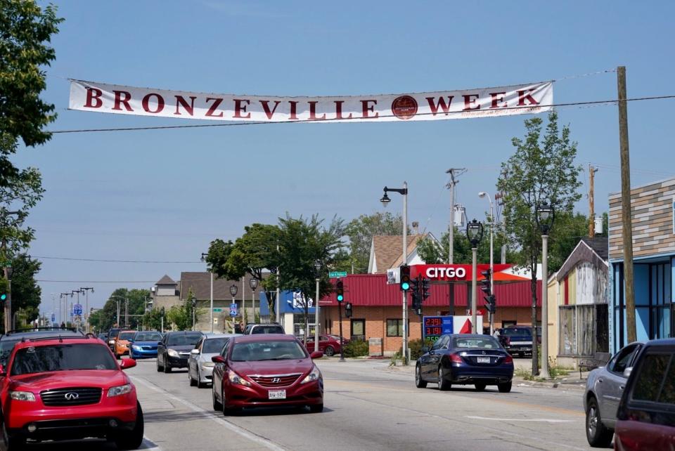
In the early and mid-20th century, many African Americans coming from the south during the Great Migration settled in Bronzeville, which had been home to Eastern European Jewish and German immigrants since the 19th century. Bronzeville was one of the few places African Americans could settle in Milwaukee at the time due to "tremendous segregation," said Lackey, one of the anthropologists with the "190 Milwaukee Neighborhoods" project.
Many of the new African American residents started businesses alongside the Jews and Germans in the neighborhood's central business district along Walnut Street, creating what one observer cited in the "Encyclopedia of Milwaukee" called "a city within a city, full of leadership, a sense of community and a focus on entrepreneurship."
In the 1960s, construction related to Interstate 43 and the proposed Park East freeway, which was ultimately never built, "destroyed many Bronzeville homes and businesses, displaced numerous residents and disrupted community life," the encyclopedia says.
"A very vital and functioning neighborhood was declared a slum," said anthropologist Rick Petrie. "They tore down the homes and the church and put up a freeway ramp."
What was once Bronzeville evolved into "distinct neighborhoods, including Haymarket, Hillside, Halyard Park and Triangle North," the encyclopedia reads.
Organizations like the Walnut Area Improvement Council and Walnut Way Conservation Corp. and the Bronzeville Cultural and Entertainment District carry the former neighborhood's legacy into the 21st century.
What is the city's role in building strong neighborhoods?
In addition to projects with small focus areas like the TIN initiative, the city sponsors multi-neighborhood and citywide improvement efforts like the STRONG Homes Loan Program, which provides emergency and essential home repair loans, as well as technical assistance, to income-qualified residents across the city.
Commissioner of City Development Lafayette Crump said his department also focuses on "area plans," which encompass multiple neighborhoods and strive to address everything from housing to transportation to arts and culture.
The city's comprehensive plan is "made up of 14 different area plans that are reviewed and refreshed every 10-to-15 years or so," he said.
Crump said the city's goal is to ensure that all neighborhoods are places people are proud to live in and are "interested and excited" to work in and visit. In meeting these goals, the city often collaborates with neighborhood groups and associations to bring residents' "neighborhood visions to fruition."
"We don't ever want to be imposing our perspective on what should happen in a certain neighborhood," Crump said. "Neighborhoods, in many ways, are what people want them to be."
Oftentimes, residents, alderpeople and neighborhood groups are the ones that reach out to the city for help with neighborhood projects.
"If there's someone who's interested in making something happen in their neighborhood, if they reach out to us, we can get them connected to something we're already doing or help them learn how we can help them moving forward," Crump said.
He said he recognizes there are a "multitude of reasons" why residents of some neighborhoods might not be as vocal about what local government could do to help them, including a lack of awareness surrounding available resources. Therefore, his team engages in a variety of outreach efforts ― including phone calls, neighborhood meetings, flyers and social media ― to raise awareness of neighborhood improvement programs.
What is the future of Milwaukee's neighborhoods, and will there ever be a definitive number?
Even if we were to agree on an authoritative number of neighborhoods, experts say it wouldn't last long. In the relatively short time UrbAn spent developing the "190 Milwaukee Neighborhoods" website, Lackey and Petrie said they witnessed "subtle changes" in how the city defined particular neighborhoods.
"I don't think it's possible to create a system that will be satisfying across time," Seligman said. "Even if you did the research to make a perfect system in 2023, the way people understand space in Milwaukee will have changed in the future."
Neighborhoods "will always change," Gurda said. "Again, the star analogy ― some will fade, and some will get brighter."
For example, he said, the Third Ward was once a "forbidding" area, and now it’s one of the hottest neighborhoods in Milwaukee.
Gurda said he's noticed that while many people are still moving out to the suburbs, more young people are moving back to older areas out of a desire to be closer to the city center.
Another factor likely to affect the makeup of Milwaukee's neighborhoods in the next decades is the arrival of "climate refugees" ― people escaping hotter climates and places that will become uninhabitable due to heat, rising sea levels and hurricanes, Gurda said.
So, there's no way to know what Milwaukee's neighborhoods will look like in 20, 50 or 100 years. After all, as Gurda wrote, neighborhoods are "quicksilver creations, constantly changing residents, borders and even names."
What's 'What the Wisconsin'?
Is there something about Milwaukee or Wisconsin that's been puzzling you? We've got experts who know how to find answers to even the smallest (and sometimes the most interesting) questions. When we can, we'll answer with stories. Submit your question at bit.ly/whatthewisconsin.
This article originally appeared on Milwaukee Journal Sentinel: How many neighborhoods are in Milwaukee? What are their histories?

