Interactive map reveals the 68 volcanoes that once covered the UK
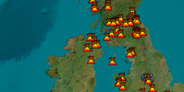
An interactive map has revealed Britain's 68 forgotten volcanoes that once covered the country — and it's fascinating.
Created by Heritage Daily, the clever tool shows active regions of volcanism are evident across the Lake District, Snowdonia, Northern Ireland, Southern Scotland, Western Scotland, Dartmoor, parts of central England, and along the sills of Northumberland.
Rhobell Fawr, situated within the Snowdonia National Park, is among one of the extinct volcanoes on the map. Active during the Early Ordovician period in the Arenig range, it's now one of the best viewpoints in southern Snowdonia.
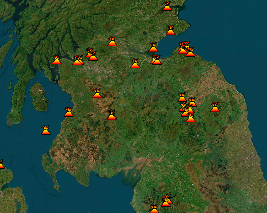
Elsewhere, Dunbowie Dun, a small freshwater loch located in Scotland, is an iron age hill that was built on the remains of an ancient volcanic plug. The map also shows Deganwy Castle in Deganwy, which lies at an elevation of 110m on a volcanic neck.
"There are no active volcanoes in the UK today, but the UK's volcanic past tells a story spanning hundreds of millions of years," say Heritage Daily. "The last active volcanoes erupted about 60 mya, by this time the UK was moving away from the tectonic boundaries and geologically active areas."
Another volcanic plug exists at Brentor Church in Devon, meanwhile the map also shows geothermal springs in Bristol, Bath, Worcestershire, and Matlock and Buxton in Derbyshire.
You Might Also Like

