Indiana Task Force 1 deploys for Hurricane Ian response
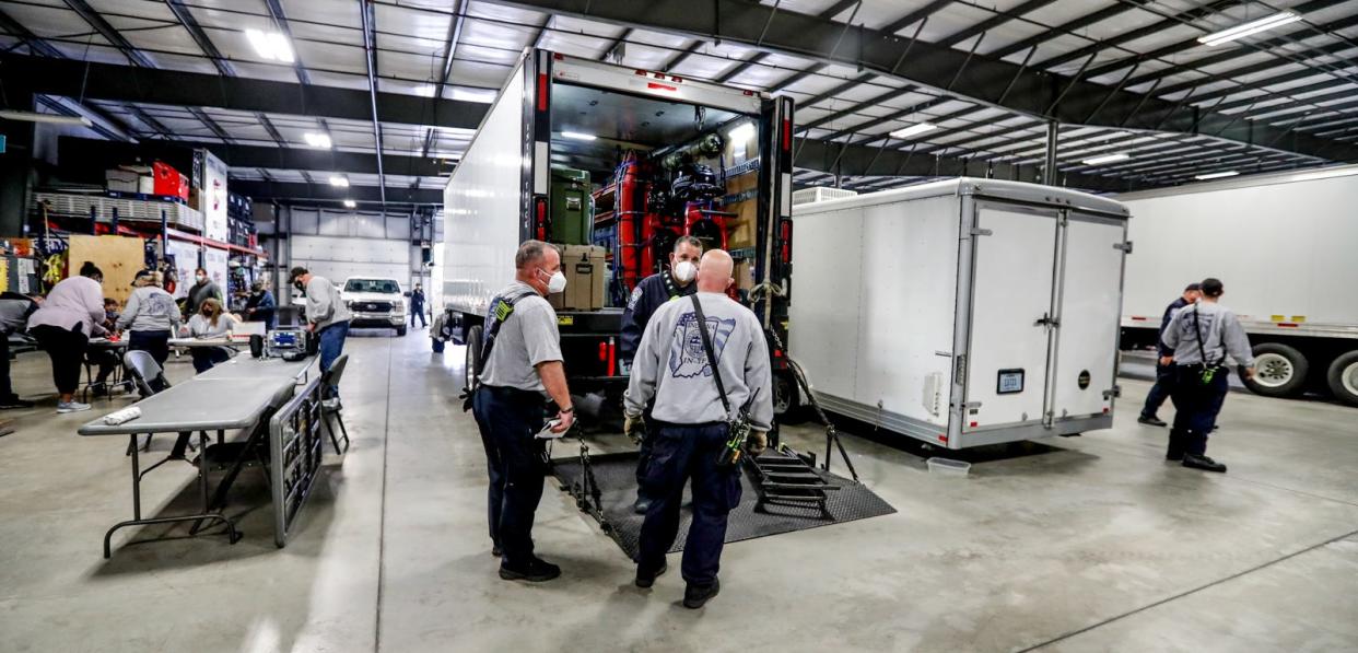
First responders with Indiana Task Force 1 have deployed and are prepared to assist in response to Hurricane Ian.
Hurricane Ian made landfall Wednesday afternoon in Southwest Florida as a Category 4 storm. The storm’s winds had increased to near Category 5 strength of 155 mph, according to the Naples Daily News.
Indiana Task Force 1 was activated for hurricane response at 7 a.m. Tuesday and 45 team members with six support staff personnel deployed, according to the task force’s Twitter account.
The team made their way to southern Alabama to stage and await further orders. Team members from the Indianapolis Fire Department, Indianapolis Metropolitan Police Department and several other agencies are part of the response team.
Indiana Task Force 1 has been activated this morning at 7am for response to Hurricane Ian. 45 team members and 6 support personnel will be deployed mid morning today. @fema @NAT_USAR_NEWS #Ian pic.twitter.com/OwW4qbHPHY
— Indiana Task Force 1 (@IN_Task_Force_1) September 27, 2022
Previously:Indiana Task Force 1 headed to Florida to aid in building collapse search and rescue
Other rescues:Indiana Task Force part of search and rescue at Mayfield candle factory
Indiana Task Force One is one of 28 highly trained Department of Homeland Security and Federal Emergency Management Agency-sponsored Urban Search and Rescue teams in the U.S.
The task force has been in existence since 1992 and has seen operational deployments nationally to Oklahoma City in 1995, the World Trade Center in 2002 and more recently to Surfside, Florida, and Mayfield, Kentucky, in 2021 for building collapses.
Locally the Task Force has responded to Lafayette, Evansville, Henryville and Indianapolis for tornado events.
When will Hurricane Ian hit Florida?
Hurricane Ian is expected to make landfall in Florida at about 2 p.m. Wednesday. It is currently at Category 4 storm, but is on the brink of reaching Category 5 status.
Where is Hurricane Ian going to hit?
AccuWeather forecasters predicted landfall just northwest of Fort Myers, between Don Pedro Island and Boca Grande. It will slam much of the state with life-threatening storm surge, catastrophic winds and flooding, the National Hurricane Center said. At 8 a.m., the center of Ian was located 55 miles west of Naples.
"We are now forecasting a catastrophic storm surge of 12 to 16 feet from Englewood to Bonita Beach," the hurricane center advisory warned.
Category 5 hurricane wind speed
Hurricane Ian's wind speeds as a Category 4 are around 155 mph, but are within 2 mph of Category 5, the highest status on the Saffir-Simpson Hurricane Scale. A Category 5 hurricane is rated at winds speeds 157 or higher.
The Saffir-Simpson Hurricane Scale says in a Category 5, catastrophic damage will occur. A high percentage of framed homes will be destroyed; there will be total roof failure and wall collapse. Fallen trees and power poles will isolate residential areas. Power outages will last for weeks to possibly months. Most of the area will be uninhabitable for weeks or months.
Contact Jake Allen at jake.allen@indystar.com. Follow him on Twitter @Jake_Allen19.
USA Today contributed to this report.
This article originally appeared on Indianapolis Star: Indiana Task Force 1 deploys, to assist in Hurricane Ian response

