A Hurricane Hunter Tells Us What It's Like to Fly Through a Category 4 Hurricane
Here in 2022, you might think that we monitor hurricanes with a network of satellites and drones and other long-distance tools from the placid safety of some government bunker. But the only way to really know what a storm is doing is for five people to get on a plane and fly into it. They fly through the eyewall, the most ferocious part of the storm, and send information back to the National Hurricane Center so that folks there can issue advisories to the rest of us. We take this knowledge for granted, that we have a decent idea of how strong each storm is and where it will make landfall. But for most of human history, we would have just opened up the front door one day to find a cyclone on the doorstep.
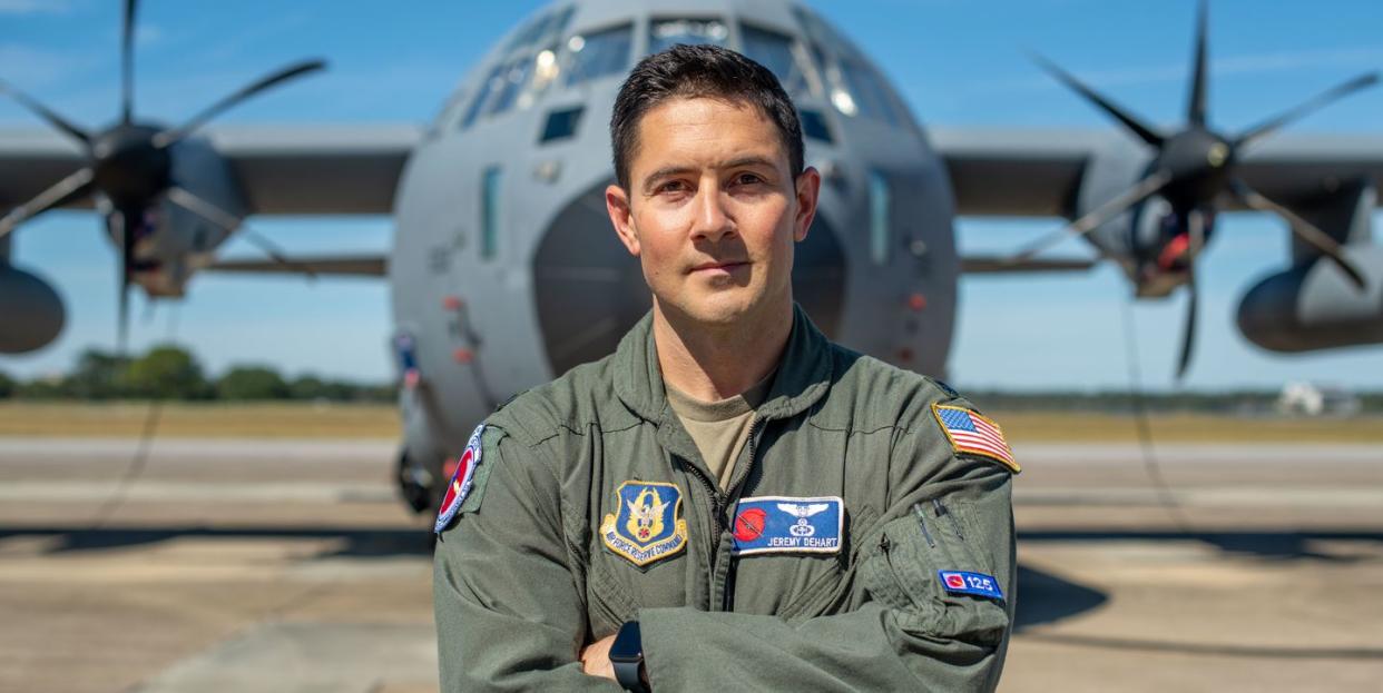
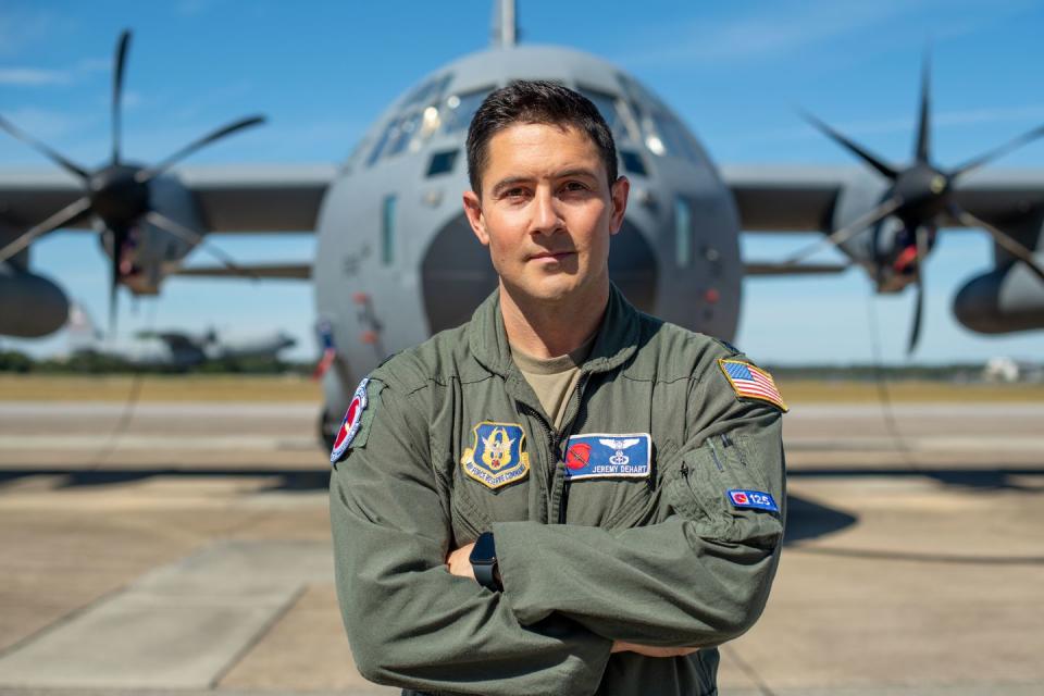
So who’s flying these planes, anyway? Well, there’s a team at National Oceanic and Atmospheric Administration, but there’s also the 53rd Weather Reconnaissance Squadron, a unit of the Air Force Reserve based in Biloxi, Mississippi. Jeremy DeHart is an Airborne Weather Officer with the Hurricane Hunters. He’s a meteorologist by training who’s tasked with gathering and parsing data on the storm as they fly through it. In a conversation edited for length and clarity below, he told us about the job, the kind of turbulence where you can lose a thousand feet of altitude in a moment, and how storms with that kind of awesome power have become more and more common in recent years. Oh, and he can tell you about the breathtaking beauty to be found in the eye of a hurricane.
How would you describe your job?
Our primary mission is public safety. This isn’t just for fun. The data that we provide flying through these storms is critical to the National Hurricane Center, for them to get a complete grasp on how strong the storm is and on its location, so that they can better forecast where it's going to go and the impacts. Then they can issue their watch, warning, and advisory products for the public.
For hurricane missions, we typically fly through at about 10,000 feet, and the plane is continuously gathering data as we're flying through. We're gathering wind speed, wind direction, pressure, temperature, humidity. And our primary responsibility is to “fix” the exact storm center.
First person view of #HurricaneMichael and its southern eyewall as it made landfall. Turbulence was the worst the pilot had experienced and he flew through #Ivan, #Katrina, #Rita, and #Sandy. #roughride @53rdWRS #eyewall #michael @DavidMuir @ABC @WGNOtv @HankAllenWX #landfall pic.twitter.com/auCTU1tu0B
— Jason Disharoon (@Jason_Disharoon) October 11, 2018
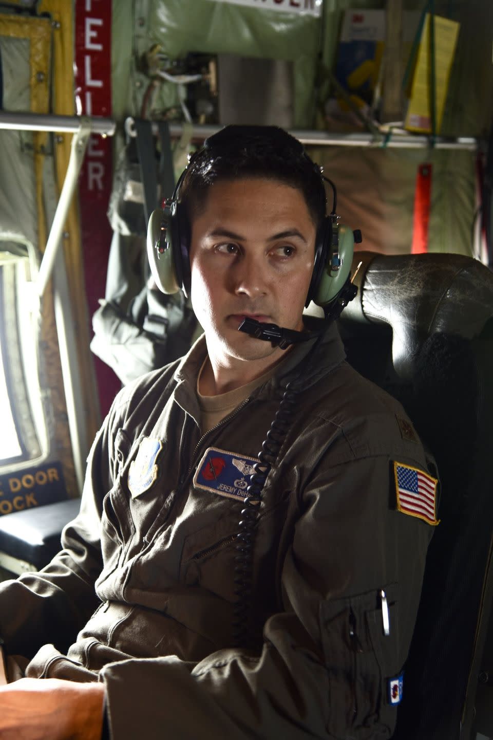
I'm a meteorologist. I'm one of the airborne weather officers, and it's my job to direct the mission to be able to do that. So I will literally call turns—10 degrees right, five degrees left—out to the pilot and the navigator [while] watching the data come in, to steer us to the exact center of the storm. We'll mark it, and then we'll send that off the plane via satellite to the National Hurricane Center.
Then also we're releasing dropsondes, instruments from the aircraft [that fall] all the way down to the sea surface. And they're gathering the same data that we see at the flight level in the vertical, all the way down, and reporting back to the plane. And we send those off the plane via satellite as well.
So is most of the data that the National Weather Service is operating on, is that mostly from what you guys are doing?
When [the storm]'s out over the water, it's almost 100% us. They can look at satellites, but there's only so much you can glean. Especially earlier on in the storm's intensification cycle—right as it's getting its act together, strengthening from what we call an invest, into a depression, tropical storm, and eventually into a hurricane—there's only so much you can tell from satellite. A lot of the lower-level features are obscured. Until we get out there and can sample the storm in the actual environment, they don't know a lot of how the storm's behaving.
How many people are in the crew?
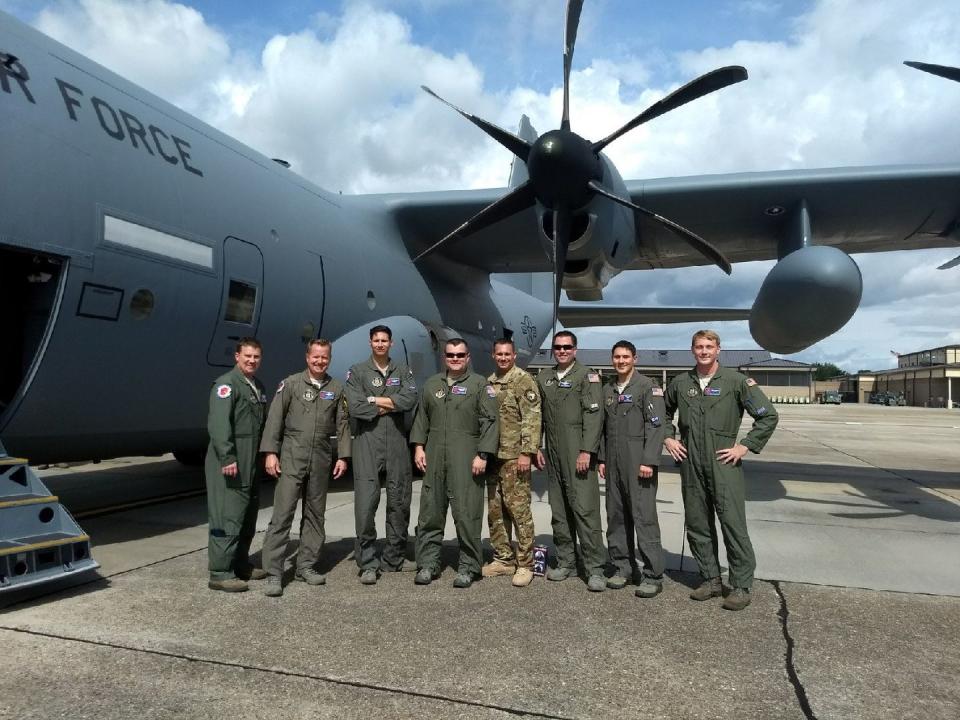
It’s a minimum five-member crew: two pilots, a navigator who kind of plots our course through the storm, and a loadmaster who sits in the back with myself, the weather officer. The loadmaster actually releases the dropsondes, so the weather officer directs when to release those from the aircraft. And then I'm kind of a mission director for the overall mission, to accomplish what we need to, in terms of gathering the data and fixing the center location of the storm.
When I say this was the roughest flight of my career so far, I mean it. I have never seen the bunks come out like that. There was coffee everywhere. I have never felt such lateral motion.
Aboard Kermit (#NOAA42) this morning into Hurricane #Ian. Please stay safe out there. https://t.co/DQwqBwAE6v pic.twitter.com/gvV7WUJ6aS— Tropical Nick Underwood (@TheTropicNick) September 28, 2022
What kind of aircraft is it?
It is a WC-130J. The C-130 is a standard C-130 that you would see in other missions in the Air Force and around the world. The W prefix is just for “weather”—the weather equipment that we have on the airplane to enable us to do this reconnaissance mission.
These storms usually kick off the coast of Africa, or at least beyond the Caribbean. When do you guys come into the equation?
We technically have an eastward boundary on the Atlantic. I want to say it's 52 and a half degrees longitude. Once it passes that to the west, that's our operational area of responsibility. Our unit is located at Keesler Air Force Base in Biloxi, Mississippi. That's a pretty far haul to be able to hit those storms way out in the Western Atlantic. So we will typically forward locate somewhere down in the Caribbean to be able to fly those storms right as they're crossing in. And then we're basically responsible for climate reconnaissance on those storms as they continue westward into the Caribbean or curve north along the eastern seaboard or into the Gulf of Mexico.
Is yours the only branch of the service that’s working on this? Are there a couple different bases that people fly out of?
We're the only branch on the DOD side, the 53rd Weather Reconnaissance Squadron. We have a civilian counterpart under the Department of Commerce, the NOAA Hurricane Hunter mission. We complement each other. Our missions are a little different, though. A lot of people don't understand the difference between what we do and what they do.
We're more like the operational backbone for the Hurricane Center. They have criteria for the exact times that we need to be in the storm environment to fix it, to gather where the exact center is. That's usually us. The NOAA Hurricane Hunters have more of a research-oriented mission. They'll do other things, like tail doppler radar missions, where you'll see them fly through the eyewall in butterfly patterns. They'll do a synoptic mission, where they fly high altitude and circumnavigate the storm and drop a lot of dropsondes.
I saw you chatting about how Hurricane Ian was extraordinary, and these planes dropped 1,200 feet in a moment. How was Ian different?
Yeah, that's not typical, and we only see that sort of thing with the strongest hurricanes. It's been kind of a common theme the last four or five years with these rapidly intensifying hurricanes. Some of them reach Category 5 status as they're approaching land. Ian certainly met that criteria.
I flew the landfall mission of Hurricane Michael in 2018, which was almost exactly the same experience I had with the turbulence through the eyewall, dropping and raising altitude almost instantaneously 500 to a thousand feet. So it's not commonplace, but we've seen it quite a bit the last couple of years.
What does that feel like? Most of us have been in turbulence on commercial airplanes, but how does this compare? What is happening inside the airplane?
If you can imagine the worst "pit of your stomach" feeling on a roller coaster when you're hitting the peaks and the valleys—that times about a hundred is about what it feels like. We get turbulence, of course. We're always expecting turbulence. It's never a completely smooth flight into a hurricane. But to have those sudden changes in altitude, you're hitting Gs that you don't normally hit. You can definitely feel it in the pit of your stomach.
And you can gain altitude really quickly as well?
Yeah, it’s not just a shaking when you hit those patches of turbulence. It’s a series of updrafts and downdrafts, and you can hit that updraft first, where you're actually getting rising air from below throwing you up and then slamming the plane back down, [all] in a series of 30 seconds to a minute. It's really not that long in scope of time, but it feels like an eternity when you're going through it in the plane.
What is the most concerned you've been when flying one of these missions?
That experience I had with Hurricane Michael, for sure. It was the very last time through the storm as it was making landfall. So it was similar to Ian, where it was intensifying right up until it made landfall, and it was coming through the southern eyewall, and we had one of those pockets where we were getting just thrown up and down. And then by the time we got into the eye, we had lost about 2,000 feet in altitude. A lot of that is expected, because we fly with what we call a constant pressure altitude. So we want to try to maintain 10,000 feet of pressure altitude, but the pressure is so low—especially a Category 5 hurricane—that your actually-above-ground altitude can be a thousand feet lower. We lost a significant amount of that altitude in probably a minute in the eyewall, where you can actually feel it in the descent, and that was kind of unnerving.
Two aircraft reconnaissance missions sampled Hurricane Ian as it unexpectedly rapidly intensified into a high-end Category 4 hurricane with 155 mph sustained winds.
Ian is now nearing Port Charlotte, FL as one of the most intense hurricanes to make landfall in US records. pic.twitter.com/YJOZbGWK8I— Tomer Burg (@burgwx) September 28, 2022
Are the lights on the plane going off and stuff?
No, it's really the movement. These planes are not necessarily built to withstand hurricanes, but they are. I mean, that's why we fly this platform. The C-130 is kind of like a tank in the sky, and we can fly them slow so we don't feel as much of that turbulence. We fly about half the speed as a commercial airliner. So you'd be feeling every little bump in a jet plane, whereas a prop plane like we fly, we don't feel it quite as much, except for the most extreme instances.
How many passes do you make?
We will fly what's called an alpha pattern, that's our standard pattern through the storm. It's kind of like a big X. So you start from the northwest, you fly straight across it through the eye and exit to the southeast. You turn left for a cross leg, and then you come back in from the northeast to the southwest so it's made a big X, and that's considered one alpha pattern. That's what we'll typically fly, and especially as it gets closer to land, we have more requirements to be in the storm for a longer period of time. So we'll fly two full alpha patterns, which is about four or five times through the storm for any given mission.
Has there ever been a time when, for safety reasons, you decide not to double back again?
That mission I was talking about with Michael was one of those, where it had made landfall already. Oftentimes, even after it makes landfall, we'll still do what we call shore patrol, where we'll go up and down and sample the backside of the storm as it's making landfall. We didn't do that for that mission, we were done. At some point it becomes a safety call with the crew. We talk about it in the airplane, and we'll just communicate that back to the hurricane center: "We don't feel like it's safe to be out here anymore."
If you go back and look at some of the flight paths for Ian, both our 53rd crew and the NOAA crew that was out there at that same time did some circling, both in the eye. They were going inbound, kind of talking about it before they decided whether to go back in or not.
I saw you talking about the “fingers” in Hurricane Ian’s eyewall. Can you elaborate on that?
Yeah, those formations in radar again are rare, and we only see those in some of the strongest storms. So really what that is, it's like a hook echo. And if you're familiar with a Supercell thunderstorm in the Midwest that produces tornadoes, it's very similar in structure, and that's kind of what that is. You can get what’s called mesovortices embedded in the eyewall, and it's basically like flying through a tornadic signature.
The updraft and the tight turning of the winds in those is what is creating a lot of that turbulence and rough air. We expect it to be rough flying through an eye wall, but you want to try to avoid those types of signatures if you can. A lot of times, though, you can't really see that heading inbound into the eye, because the radar picture is attenuated. There's so much precipitation out ahead of you, you can't see the features on the backside. And so you don't see some of that until you've already gone through it, and then you exit into the eye and say, "Wow, look at all this behind us that we just blew through."
When you're going through the eyewall, what does it look like outside?
We say it’s like a bumpy car wash, a roller coaster going through a car wash. If you look out the window, you can see you're just inundated in that precipitation and strong winds and cloud cover. But especially with the strongest storms, you instantly break out of that into the eye, which can be completely clear on the inside. Pictures and videos don't even do it justice. It's pretty awe-inspiring to see.
So then you’re in the eye, where it’s relatively calm, but you can see the contours of the eyewall and the hurricane itself?
We call that the stadium effect, where if you can imagine standing in the center of a football field, and looking up at the stadium seats going up and around you, all the way around 360 degrees, that's exactly what it looks like for some of the strongest storms.
(1/3) #Michael at landfall. The normal "stadium effect" was more like a cylinder, a straight vertical wall 50K ft high. Saw 175 mph flight level winds, ~155 mph at surface. Entered eyewall at 10K ft, ended up in eye down at 8K! Need another tweet to explain what that felt like… pic.twitter.com/lUqIhX9K0D
— Jeremy DeHart (@JeremyDeHart53d) October 11, 2018
This might be kind of silly, but are you also dealing with lightning and thunder up there?
Lightning is something that's not typical to tropical systems, but again, we've seen that a lot the last couple years with the stronger ones. It is characteristic of rapidly intensifying tropical systems, where you get lightning in the eyewall especially. We saw that last week, both with Ian and Fiona.
If you get a free moment when you're up there, what are you thinking about?
For the weather officer, [the eye] is typically where we're the busiest, and so unfortunately all the best videos and pictures you're going to see are probably from up front in the flight deck where they can take a breather and take it in. There's a few minutes for us to do so, but that's when our job really starts, because I'm trying to find the exact center of the storm, so I'm digging into the data. And then outbound, I'm doing a quality control of the data. So unfortunately I don't, as a weather officer, have as much time as I would like to take that in.
But with Michael, we actually had to circle in the eye for a little bit to find a smoother patch of air to exit, and so I took that opportunity to really appreciate the environment I was in and take in the beauty of it. Because it is beautiful.
You Might Also Like

