Hiking the Forgotten Royal Inca Trails of Ecuador
On a rainy day, I find out about the kind of middle-of-nowhere adventure that I live for. Three parts of Ecuador’s Inca Trail happening on three separate weekends. One involves camping in the wild, another features a waterfall. My heart skips a beat.
Already I know this landscape: the shark-tooth rows of Andean ridge line, the revitalizing mountain air, llamas chilling in open spaces. Here at 11,500, feet along the world’s longest mountain range, adventures are unpredictable. Anything from hot sunshine, to pouring rain, to chunks of hail pelting from the sky are par for the course. Add the reconnection with a past civilization—the Incas—who ruled here during the 15th and 16th centuries, and this sounds like a great adventure. I’m in.
This will be no ordinary Inca Trail trek. We’ve all heard of the infamous routes that retrace steps of ancient civilizations in South America: Peru’s route to Machu Picchu and Colombia’s Lost City being two such examples. There, hordes of tourists lace up their boots and hit the trail. Here in Ecuador though, we’ll see a quieter side of the Inca Trail along sections of nearly forgotten Incan territory. Sure, these trails won’t have grandiose ancient ruins, but they will have miles of untouched spaces where the only things to interrupt your thoughts are whispering Andean breezes. This is the Inca Trail that most will never see. And since so many favor Colombia or Peru over Ecuador, these segments don’t even bother to compete for international attention. They’re just as they are: rugged, wild, and unedited.
With an adventurous heart, I set out.
Oña, March 12
The water is so cold it feels like tiny needles pricking the surface of my skin. Right now I’m reminded that the Andes are a place of extremes—extreme inclines, bone-chilling winds, and water that runs unforgivingly cold. But to be someone who loves the outdoors means I either embrace what Ecuador’s mountains throw at me, or short myself of an experience. So I swim. The river runs white as it collides against the rocks at its bottom.
This is Oña—a scenic place in the south of Ecuador. The Incas once walked along this very spot and, today, we’re retracing their steps. The grand finale is a waterfall that we’ll hit by lunch.
The Inca Trail as a North American like me knows it, is a little deceptive. For starters, its name implies that it was created by and for the Incas. But as Miguel Wladimir Galarza Ordóñez who has a PhD in archaeology here in Ecuador tells me, that’s not the case. The Incas didn’t build this road which has been made world-famous by the likes of Machu Picchu. In reality, it was the civilizations that came before them (like the Cañaris in Ecuador) who really blazed this trail. The Incas (or more accurately, their slaves) merely maintained and extended it. Second of all, there’s another name for it which the world isn’t familiar with: Qhapaq Ñan, which loosely translates from Quechua (an Indigenous Andean language) as “great trail of the high Andes.”
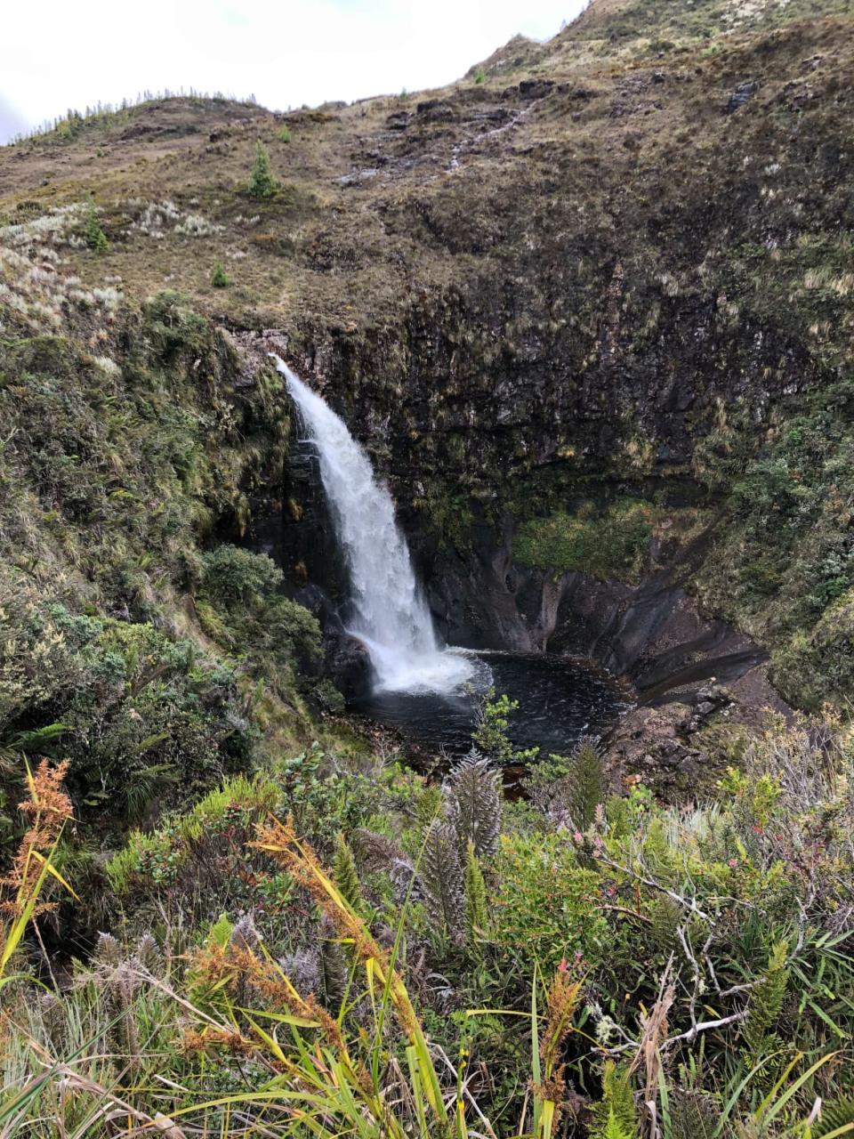
A waterfall along the Inca trail near Oña.
Some of Ecuador’s most important sections of the trail are located around Oña. Where I’m walking now was an exclusive part of the Qhapaq Ñan where only royals and messengers (called chasquis) were permitted. Back in the day, an important message would have triggered a network on chasquis to kick it into high gear bounding from the coast up through the Andes in a relay-style race passing crucial news from one runner to the next. For these highland messengers, the piercing sound of a whistle would have been your cue. The Incas found out about Spanish invasion this way. When ships docked, word spread through these mountains.
That life-or-death urgency might be hard to relate to if you hike in Oña today. With trickling water as its soundtrack, it’s incredibly peaceful. We reach the waterfall and it’s terrifying, magical, and beautiful all at once. Gallons of water are sent soaring over the edge. Our trekking guide asks me what I think and all I can say is that it’s wonderful.
Truthfully, I’m mesmerized and a little stuck for words.
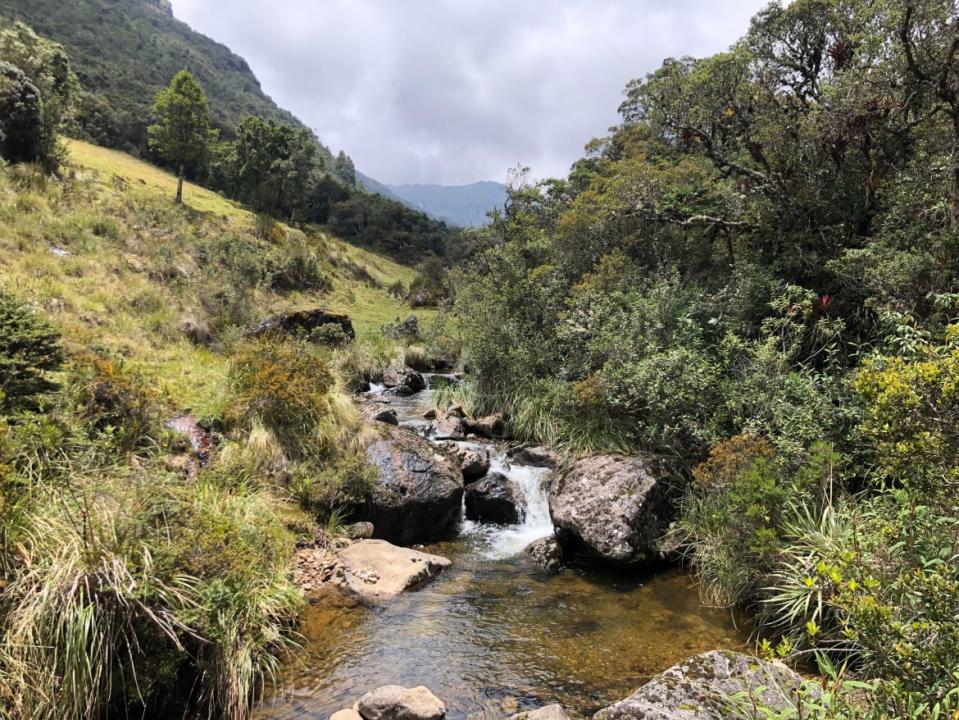
Carachula, March 26
It’s dark and the Andean sky is splattered with constellations. These cliffs where I’m standing, extraordinary and dramatic, were carved eons ago by glaciers. They’re like giant boulders that reach towards the sky. Tonight, I feel a magical energy here.
Carachula. La ciudad de las piedras. City of stone. This is an archaeological site overlooking a valley near the town of Santa Isabel. To get here, we survived a car breakdown, a subtropical storm, and then a thick fog that smothered the landscape as we maneuvered the car around corkscrew roads up to 12,000 feet. We warmed our bones with canelazo, a hot drink made from spices and sugar cane alcohol. Classic Ecuador.
Now I’m here watching the speckled sky. We spot constellations, a shooting star, and tip-toe along a ledge for a better view. Finally, it’s time to head down to camp. I layer up in my warmest hiking attire and woolen knits. I’m about to crawl into my tent when I notice the glow of a pair of eyes at the edge of the woods. A fox. We lock each other into a staring contest for a few moments before it scampers away.
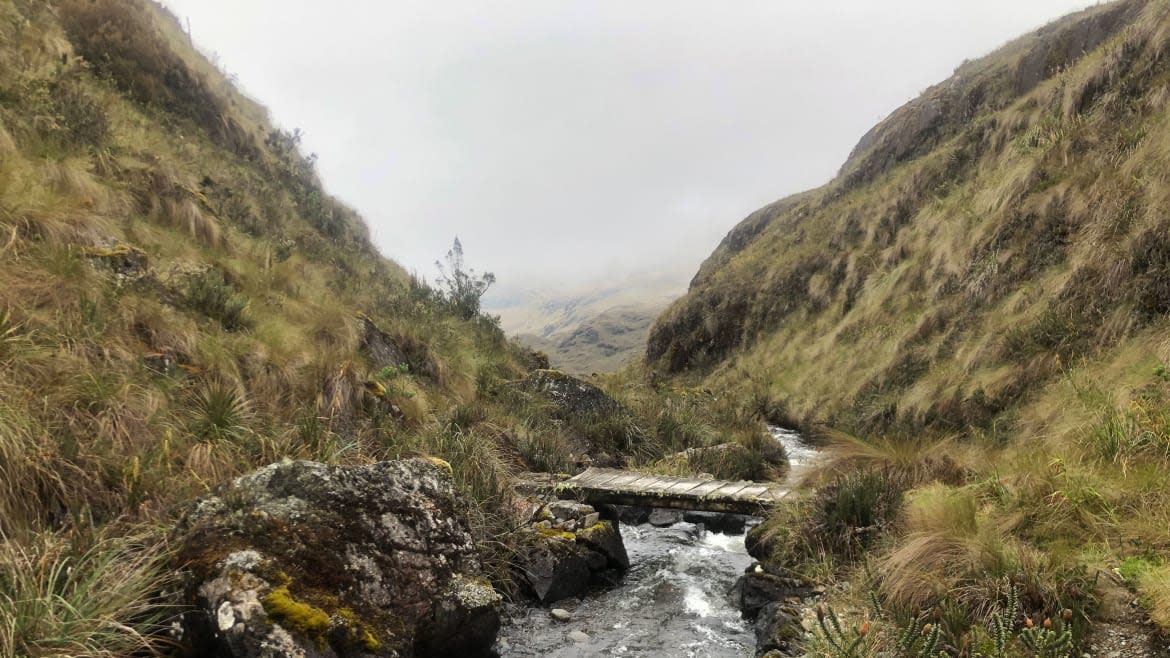
A stream along the Inca trail near Carachula.
The night gives way to dawn and after coffee, we set off to explore. When I talk to Galarza Ordóñez later, he explains the main uses of the Inca Trail. There’s the primary trail, a main artery used to transport products around Ecuador and down to Peru. Then, there’s the secondary trail where the messengers and royals walked. Carachula is the latter and is an important spot as it connected major hubs like Cuenca, the southern city of Loja, and Piura on Peru’s northern coast.
That’s matter-of-fact compared to the legends I hear about Carachula. As the story goes, there’s both a giant condor shaped out of stone that keeps watch on the whole valley and a teetering boulder which can be shifted only by the power of a single person. Today we’re going to the condor. It’s a route that weaves across wildflower fields, along mountain streams, through the bouncy floor of a pine forest, and up a steep incline towards the condor.
The woman I’m hiking with is tired. None of us slept well and this mountain is so steeply sloped it’s like it’s trying to block us from the top. I’m tired too. We decide to take a break and sit in the tall grasses while we share snacks. This mountain range has a tendency to try to defeat hikers. But that won’t be us today. We continue to climb and soon, the fog thins enough for us to see it. The condor.
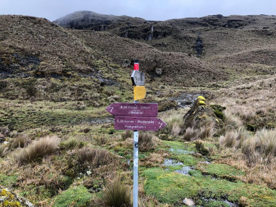
A trail marker on the Inca trail near Carachula.
In a final push, we make it to the base of this oddly-shaped rock. It really does look like a condor—Ecuador’s national bird pictured on its flag. This place, with its heavy mists and strange craggy stone has a majestic feel to it. It could be the setting of a fantasy movie.
The five of us relax here for a little while, sharing cookies, snapping photos, and playing with a drone. The Inca Trail urges you to reconnect with a past civilization but here, I’m focused on those who are from Ecuador and live here today. That they have the generosity to bring me along, answer my questions, and share these stories isn’t lost on me. And I don’t take it for granted. As they pose, play and appreciate this part of their country, I’m glad this part of the Inca Trail is mostly empty of international tourists. It exists mainly for those who have always been here.
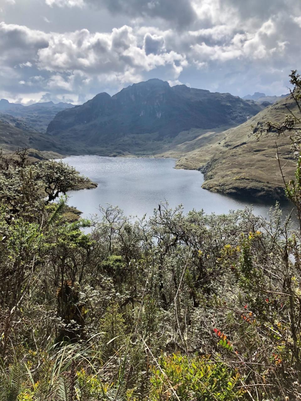
Llaviucu, May 26
I’m on a peak overlooking Laguna Mamamag and the sun has turned the lake into a vast sparkling surface at the base of the mountains. Its waves ripple lazily while glimmering in the afternoon light. It’s a sight so pretty it draws a gasp out of me. It occurs to me that my hiking buddy, Jess, and I are likely the only people on Earth to observe this beauty today. This is a remote trail in the middle of Cajas National Park—a rugged part of the Ecuadorian Andes which is equal parts stunning and intimidating. It’ll be miles and about five hours until we spot another soul.
We stop for a moment on the top of this mountain and slather ourselves with sunscreen. I’ve fallen in love with this route. It’s wild, serene, and offers a great sense of solitude. This is just here for anyone who can make their way from the nearby city of Cuenca—or Tumipamba, as the Incas would have known it—with a $2.50 bus ticket. This is so accessible and we have it all to ourselves. No crowds. No pricey tour fees. I say this earlier as the valley opens up and we spot jagged mountains in the background. Silvery clouds sit at their peaks.
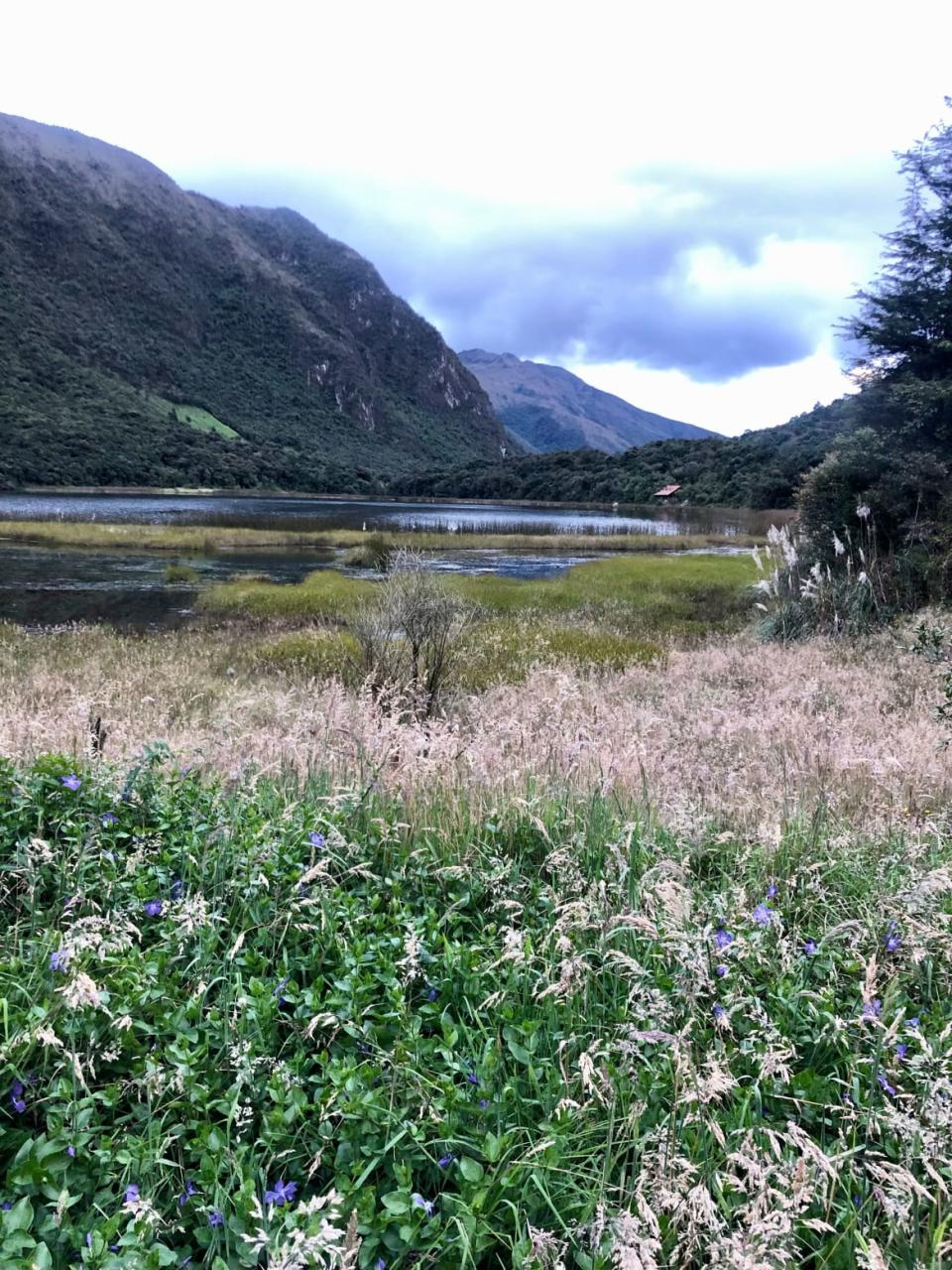
The view of Llaviucu Lake along the Inca trail.
From where we are now, the trail takes us down. This is a section of boulders, deep mud, gnarled roots, and a forest choked by vines. I feel like goblins would live here. My sense of gratitude wanes. Now, I curse this part of the trail all the while wondering how tough existence would have been during Incan times. Jess and I wonder about the Incas and their life. We hear about their stories in broad strokes: this ancient highway of theirs, lost cities like Machu Picchu (or, in Ecuador, Ingapirca), their impressive architectural skills, and their eventual demise to the Spanish.
In between muddy steps, Jess offers a glimpse into daily lives of runners of the Inca Trail who could be summoned by royalty to bring saltwater fish fresh from the ocean. After all, this part of the road did connect the highlands with the coast, passing through a town which was a commercial center here in Ecuador back in the day. The gulf of Guayaquil was where the Incas collected spondylus shells for rain and fertility rituals. It was also where products were shipped to Spain. (Today, Guayaquil’s still a port city and one of the most important not only to Ecuador, but along the eastern Pacific.) I imagine Incan runners as I sink into a shin-deep mud puddle. Ancient Uber Eats, I think with a scoff. All this for a fish.
A flower meadow along the Inca trail near Llaviucu Lake.
When we finish this part of the Inca Trail, dusk has taken over. It’s time to go. We return to Cuenca exhausted but not too beat for pizza. We’re feeding our battered bodies when we notice we’re getting A Look from a local family. Maybe it’s the muddy hiking attire or the giant map we’re poring over. They stare with confusion.
It’s as if they don’t recognize what’s in their own backyard and the memories these mountains would share if only they could talk.
Get the Daily Beast's biggest scoops and scandals delivered right to your inbox. Sign up now.
Stay informed and gain unlimited access to the Daily Beast's unmatched reporting. Subscribe now.

