What is the famous, curvy road in Door County? Here's the story behind the Wisconsin highway.
Of Wisconsin's many iconic landmarks, one of the most unusual and most scenic is the curvy road in Door County.
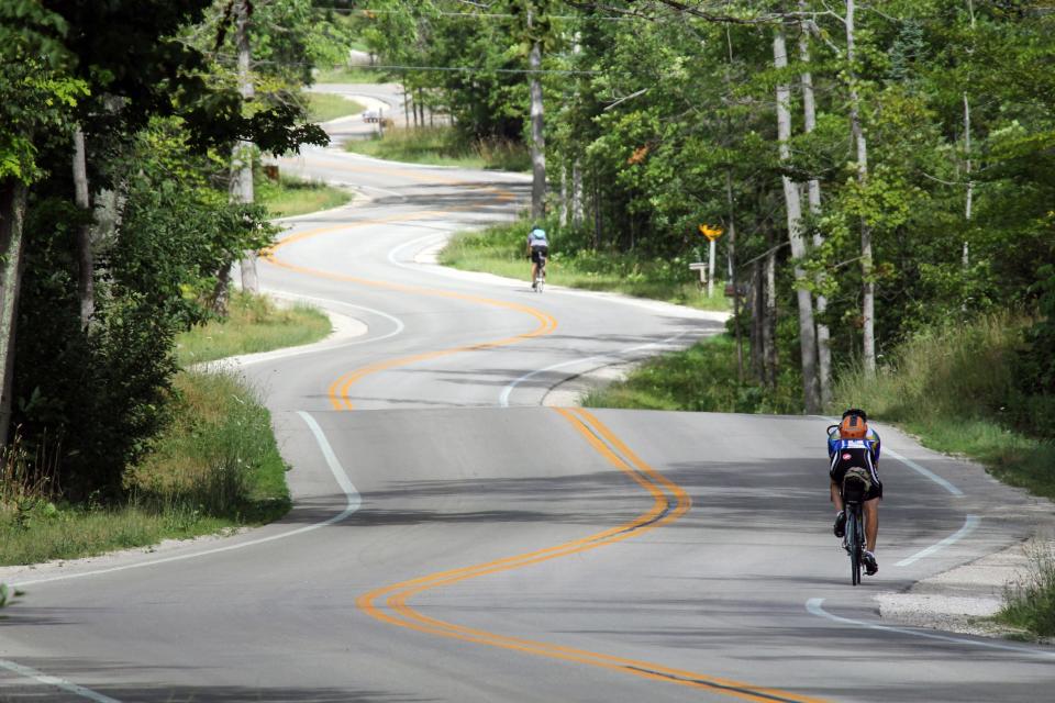
You've probably seen pictures of it, especially in the fall when the leaves turn. It confounds many who encounter it because of its short, quick curves.
If you are interested in learning more about the road and why it swerves and curves, here's what you should know.
When was the curvy road in Door County built?
According to the Door County Pulse, the road between Gills Rock and Northport was built sometime in the mid 1930s.
Why is the road curvy in Door County?
That is somewhat uncertain, but there appear to be parts to the story. The first, according to the Door County Pulse, is that the telephone lines once lined down the center of the road. So vehicles could drive the section, the road was built winding between them until the lines were removed 1986. The curvy highway was proposed because there was no public road beyond Gills Rock in 1934 and there was a desire to connect the northern ends of Door County by road.
The other part of the story, which is disputed, is that famous landscape artist Jens Jensen, who is a member of the Wisconsin Conservation Hall of Fame, was tasked with helping create the road between Gills Rock and Northport. In keeping with Jensen's conservationist ideals, he, along with the Door County board members, purposely designed the road with many tight curves and with minimal cutting of trees, particularly sparing the larger trees.
However, this part might not be true. “There is no evidence that Jens Jensen was directly involved with the design of the winding road. He was aware of the project and publicly approved of it,” Steven Rice, Museum and Archives Manager at the Door County Historical Museum, told Atlas Obscura. Rice added that a local farmer and road supervisor, George Schultz, was head of the highway project.
Where is the famous curvy road in Door County?
The curvy road on Highway 42 is at the northern tip of mainland Door County. It leads right into Northport where the Washington Island Ferry operates. It also leads to what is known as "Death's Door," which is a section of water between Door County's northern mainland tip and Washington Island. It is given this name because it has over 275 shipwrecks beneath its waters.
How long is the curvy road in Door County?
The section known as the curvy road is a little over a mile long.
More: Things to do in every town in Door County, from Sturgeon Bay to Egg Harbor
When is the best time to photograph the curvy road in Door County?
Pretty much any time of year is good to visit Door County's winding road, but the best time to witness its magnificence is when its fall colors peak from late-September to mid-October, according to doorcounty.com.
Have there been attempts to straighten the curvy road?
Yes. According to Atlas Obscura, there were attempts by planners to straighten the road in the 1970s. It was publicly opposed and the road remained curvy.
Does the Door County curvy road have any designations?
The curvy road is part of the the Door County Coastal Byway, which is one of three National Scenic Byways in Wisconsin. The other two are the Wisconsin Lake Superior Scenic Byway near the Apostle Islands and Wisconsin's Great River Road.
Drew Dawson can be reached at ddawson@jrn.com or 262-289-1324.
Our subscribers make this reporting possible. Please consider supporting local journalism by subscribing to the Journal Sentinel at jsonline.com/deal.
DOWNLOAD THE APP: Get the latest news, sports and more
This article originally appeared on Milwaukee Journal Sentinel: Why is road curvy in Door County? What to know about famous highway

