Extreme Adventures in Rocky Mountain National Park
This article originally appeared on My Colorado Parks
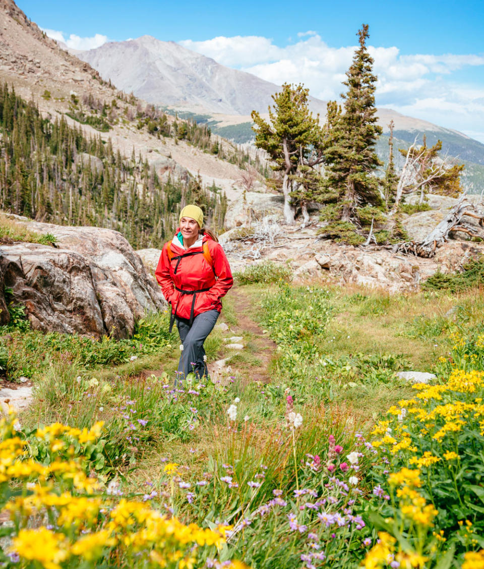
Rocky Mountain National Park is full of extremes. All it takes is a glance at the park's photo gallery to see that this is not a gentle place. From towering 14,000-foot peaks to bull elk clashing during the fall rut to summer storms bringing lightning and winter storms bringing feet of snow, the park deals in extremes. While you don't have to be an athlete committed to extreme adventures to enjoy the park, it does lend itself to being a perfect playground for those looking for more intense adventures. There's a reason so many mountaineers, rock climbers and professional skiers call this area of the country home.
From summiting the park's highest peak to a 48-mile bike ride to setting up camp under the stars, we've compiled a list of our favorite adventures that push the limits in Rocky Mountain National Park.
Note: One of the biggest challenges of recreating in Rocky Mountain National Park is the altitude. Most of the park sits between 8,000 and 14,000 feet. Recreating at these elevations will feel much harder than closer to sea level. Give yourself time to acclimatize if coming from lower elevations before setting out on any of these adventures. Be sure to drink lots of water to help combat the altitude sickness and if you start to feel dizzy or nauseous, head to lower elevations.
Summit Longs Peak
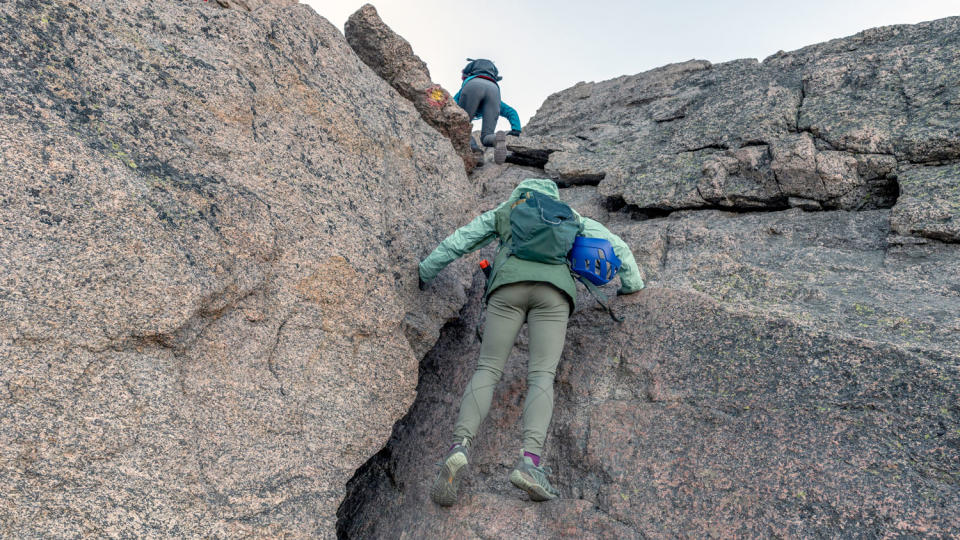
Colorado is known for its 14ers - mountains which have an elevation over 14,000 feet - and perhaps one of the most well-known is Longs Peak in Rocky Mountain National Park. It's impossible to stare at the eastern skyline of the park and not be compelled to at least wonder what it would be like to climb Longs Peak. Dominating the skyline, and topping out at 14,259 feet, Longs is the ultimate adventure for experienced hikers.
The mountain has one non-technical route to the summit: The Keyhole Route. Start well before dawn from the Longs Peak Trailhead to ensure you have time to summit and get back down below tree line before afternoon thunderstorms hit. Get more information on summiting Longs Peak.
Rock Climb with a Guide
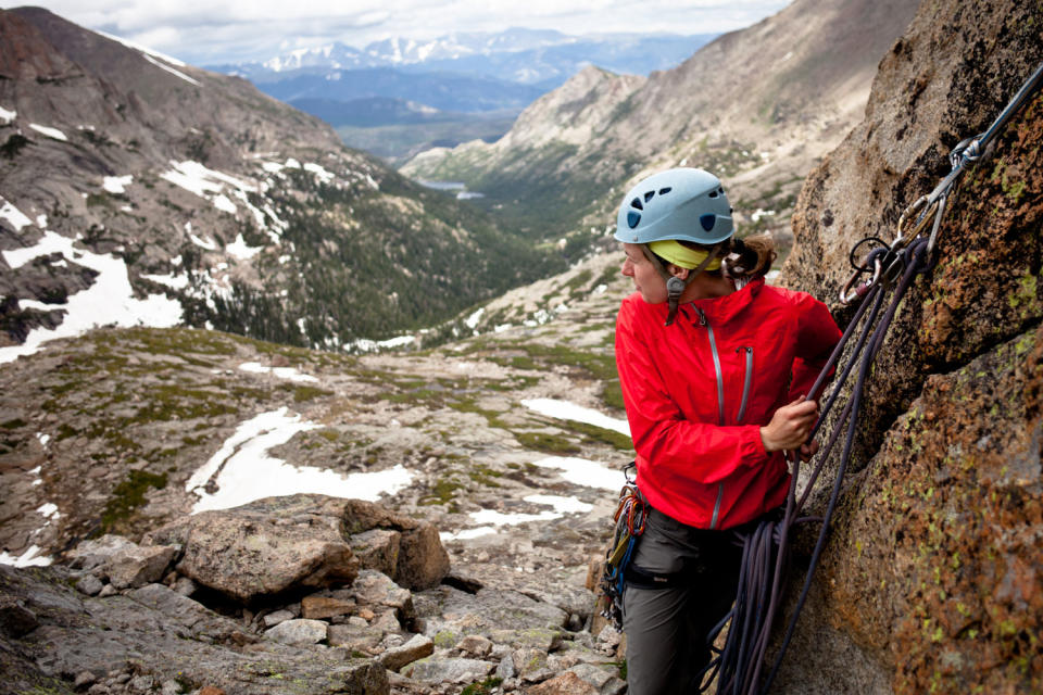
Rocky Mountain National Park is well-known in rock climbing communities for its iconic and beautiful climbs, but it's not typically a very beginner-friendly area. Most of the routes in the park are trad, which means climbers will have to set their own protection rather than following a bolted route. Many climbs also require long approaches and are multi-pitch, meaning climbers ascend the route in sections, stopping at belay stations in between.
A great way to experience the park's stunning rock formations is with a guide. Colorado Mountain School (coloradomountainschool.com) offers intro classes for beginners, along with skills classes to learn how to do everything from lead trad routes to climb big walls. These classes take place across Colorado's Front Range.
If you're a more experienced climber, Colorado Mountain School offers experiences on many of the park's best walls. Climbers can choose routes ranging from Lumpy Ridge's more moderate multi-pitch grades to the grueling and classic ascent of Longs Peak's Diamond face. Climbers can also book a guide if they have a specific route in mind that is not offered as an experience.
When you book a course, experience or guide, you can also stay at Colorado Mountain School's Estes Park Adventure Lodge located in downtown Estes Park, just outside of Rocky Mountain's entrance.
Bike Trail Ridge Road
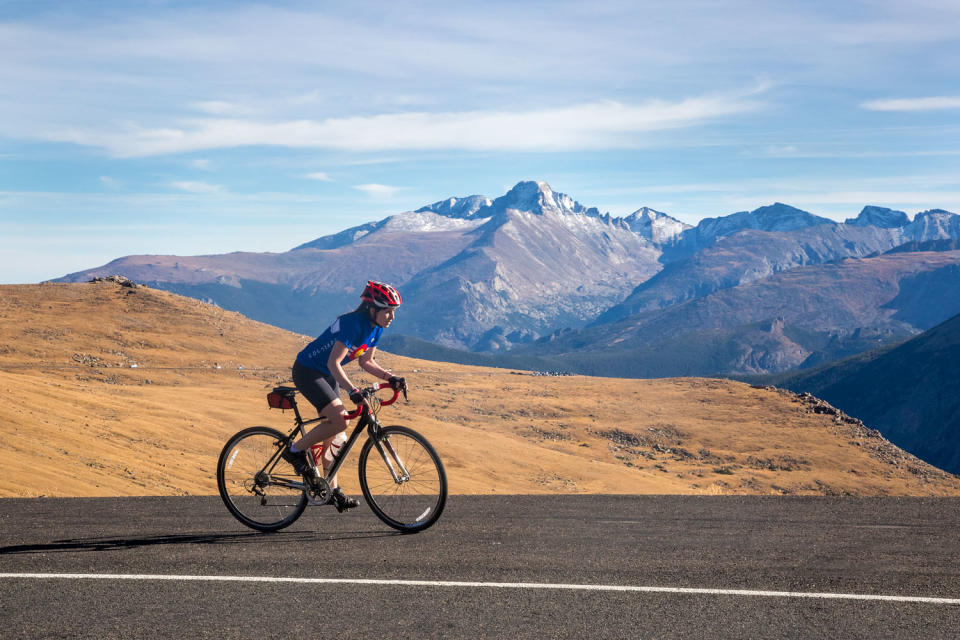
Trail Ridge Road is the highest paved road in any U.S. National Park, topping out at 12,183 feet in elevation. From the Kawuneeche Visitor Center on the park's west side to the Beaver Meadows Visitor Center in the east, it's a 48 mile ride with 4,170 feet of elevation gain.
Trail Ridge Road is extremely popular and the shoulders are narrow, making it hazardous to bike when the road is open to cars. However, there's a short period of time each spring where the road is plowed, but still closed to vehicle traffic. During this window is the perfect time for intrepid cyclists to attempt this grueling ride.
The road opens to vehicles Memorial Day Weekend (or later if the park experiences a late snow), but it opens to bicycles on April 1, weather dependent. Keep an eye on plowing updates at @RockyNPS to see when the road is completely plowed. Then, watch the weather to make sure a spring snowstorm hasn't covered the road again. You can also call the recorded Trail Ridge Road Status Line at (970) 586-1222.
If the stars align and the magical weather window hits, you can ride the entire route passing under towering walls of snow on the edges of the road and taking in the views all without any traffic. When Trail Ridge Road is closed, getting between Grand Lake and Estes Park by car takes several hours. The best way to do this ride is to park your car at the Beaver Meadows Visitor Center and then have a friend drop you off on the park's west side at the Kawuneeche Visitor Center.
Even if the forecast looks good, spring weather can be fickle in the Rockies. Eleven miles of the road are above treeline so you might encounter blowing winds, snowstorms and suddenly dropping temperatures. Watch the skies for building storm clouds and turn around if it looks like the weather is going to turn. Pack wind and waterproof layers, a hat that fits under your helmet, and gloves. Keep a vigilant eye out for black ice, especially on the descent.

Remember that the road is closed to vehicle traffic, so you'll need to be self-sufficient. Bring bike tools and a spare innertube in case you get a flat and make sure you know how to fix anything that might go wrong on your bike. You'll also want to make sure you have plenty of water and snacks.
While the road is closed to visitor vehicles before Memorial Day, you might still encounter park vehicles on the road. Stay on the right side of the road, never crossing the yellow lines and obey posted speed limit signs.
Snowshoe to Emerald Lake
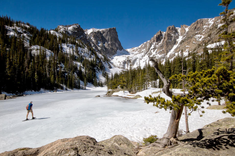
When winter rolls around and snow begins to fall, Rocky Mountain National Park turns into a winter wonderland. There's lots of opportunities to snowshoe and cross-country ski on the park's trails, but a favorite is the 3.5-mile round-trip excursion to Emerald Lake.
Rent snowshoes and poles from Estes Park Mountain Shop if you don't have your own, and head to the Bear Lake Trailhead. This part of the park is very popular and the shuttle that accesses it in the summer doesn't run in the winter. Get there early, especially on weekends, to make sure you get a parking spot. The winding mountain road to the parking area can be slick (or even closed – be sure to check conditions before setting out) in the winter, so make sure you're in a vehicle with good tread on your tires and drive slowly.
It’s important to make sure you're properly outfitted before hitting the trails in the winter. Waterproof boots are a must, along with waterproof pants, a warm jacket, a hat and gloves. The weather can change quickly in the winter and it's often windy at Emerald Lake, so be prepared with plenty of warm layers. The sun is especially intense at high elevations and it reflects off the snow so you'll want sunglasses and sunscreen to protect yourself.
The trail gains 700 feet in elevation and passes through coniferous forests before crossing Nymph Lake and then, Dream Lake, providing spectacular views of Hallett Peak before continuing on to the final destination of Emerald Lake.
While you don't need to worry about thunderstorms in the winter, there are other hazards to keep an eye out for. In early and late season the ice on the lakes may be thin. Check conditions with a ranger if the temperatures have been warm and when in doubt, skirt the lakes rather than crossing thin ice.
Avalanches are a very real possibility in the winter months as well. Always check the forecast before hitting the trails at www.avalanche.state.co.us and stay home if the risk is elevated. When you reach Emerald Lake, avoid crossing to the opposite shore if you don't have avalanche training since the steeper slopes on that side of the lake are at higher risk for a slide.
Get more information on the trail to Emerald Lake. The only change to the route in the winter is that the trail goes directly across the frozen Nymph and Dream lakes.
Backpack Wild Basin
While Rocky Mountain National Park was the fifth most visited park in the country in 2021, you can still escape the crowds in the less-visited Wild Basin area. A narrow dirt road leads to the Wild Basin Trailhead, making it feel less like a national park and more like a local secret. From the trailhead, you can access dozens of stunning lakes and several waterfalls. When you opt to spend the night, you'll get to experience this wild-feeling area without even the day-hikers. Your only company will be marmots, moose and the few other savvy backpackers who snagged a wilderness permit.
From the trailhead, the possibilities for an incredible backpacking trip are numerous. Favorite campsites include Thunder Lake, a 6.8-mile one-way hike with 2,000 feet of elevation gain, Ouzel Lake at 4.9 miles one way with 1,500 feet of elevation gain and Upper Ouzel Creek, which is near Bluebird Lake and is 5.6 miles one-way with 2,100 feet of elevation gain. Backcountry campsites in the Wild Basin area are great for overnight trips or can be strung together for multi-day excursions.
Because there is so much to explore in this area, one of the best ways to narrow down where to go is based on availability. No matter where you end up spending the night in Wild Basin, it will be incredible. Wilderness permits are very competitive, especially for summer weekends. Make a list of all the campsites you'd consider for your desired trip dates and then log on to recreation.gov as soon as reservations open on March 2 at 8 a.m. MST. Wilderness permits can be reserved throughout the summer, but for your best chance of getting sites in Wild Basin on your desired trip dates, be ready to book as soon as the window opens. Reserving wilderness permits costs $36 per itinerary, per party.
Backpackers are required to store all food, garbage and scented items in a hard sided bear canister.
For exclusive access to all of our fitness, gear, adventure, and travel stories, plus discounts on trips, events, and gear, sign up for Outside+ today.

