A Crucial Part of the San Andreas Fault Has Been Disturbingly Quiet for Too Long
"Hearst Magazines and Yahoo may earn commission or revenue on some items through these links."
The southern section of California’s San Andreas fault hasn’t experienced a major earthquake in 300 years, and is around a century overdo for a “big one.”
To understand this earthquake “drought,” scientists used computer modeling and analyzed 1,000 years of palaeoseismic data to figure out its cause.
A new paper details how low water levels of the Salton Sea, which was once a part of a much larger lake, could explain why earthquakes along this southern fault line have been less frequent.
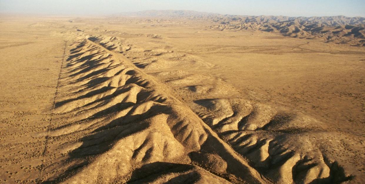
The 800-mile San Andreas Fault is one of the largest fault lines in the world. A meeting of the North American and Pacific tectonic plates, this transform fault (where two tectonic plates move past each other) runs nearly the entire length of California, from Cape Mendocino in Redwood country to the desert landscapes of Joshua Tree National Park. Scientists divide the fault into three distinct areas—northern, central, and southern—and while the entire fault is a clear and present earthquake danger, it’s the Los Angeles-adjacent southern section that’s most concerning.
Scientists estimate that this section of fault—over the past 1,000 years—usually triggered a sizable earthquake every 180 years (give or take 40). But the southern San Andreas Fault (SSAF) hasn’t had a good shaking for more than 300 years (despite what mediocre Hollywood disaster films would have you believe).
Wanting to better understand this seismic outlier, scientists from San Diego State University (SDSU) and UC San Diego’s Scripps Institution of Oceanography investigated why the fault is behaving differently today than it has in the past. Their answer? Water, or to be more specific, the lack thereof. According to their paper—published on Wednesday in the journal Nature—the low water levels of the Salton Sea, located at the most southern end of the San Andreas Fault, could explain why this section of fault line has seen less movement over the past few centuries.
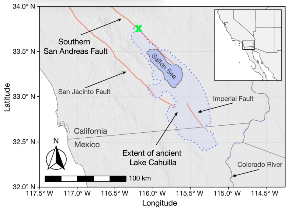
The Salton Sea is a modern remnant of a much larger prehistoric lake called Lake Cahuilla. Some 32 times bigger than today’s landlocked sea, the water levels of Lake Cahuilla rose and fell over a millennia, and using new geologic and palaeoseismic data, scientists confirmed that the past six major earthquakes along the SSAF occurred when the lake was at its fullest. The frequency of earthquakes in China and around the Dead Sea have also previously been connected to water levels of nearby lakes.
But how does the full-ness of a lake impact something like an earthquake? Using computer models, scientists analyzed how the large, ancient Lake Cahuilla affected the fault line, and discovered two primary impacts. First, large volumes of water can cause the Earth’s crust to bend, which has the effect of unlocking the two plates and allowing for more seismic movement. Second, water can penetrate cracks in the Earth’s crust and increase fluid pressure, which also makes earthquakes more likely.
In a press statement, UC San Diego scientists described this hydraulic phenomenon like an air hockey table:
“The effect of increased fluid pressure in a fault is a bit like an air hockey table. With the air on, the puck glides easily, but when the air is off, friction makes it hard to slide the puck. So too with an increase in fluid pressure inside the fault, the water pushes out against the two sides of the fault, making it easier for them to overcome friction, slide by one another and trigger an earthquake.”
This new research adds even more complexity to proposed projects to ferry water from the Gulf of California into the Salton Sea, as adding more water too quickly could trigger potentially deadly seismic activity.
Unfortunately, the drought-like state of the Salton Sea is only one cog in a very complex seismic machine, and isn’t enough to stop earthquakes along the SSAF entirely. Scientists estimate that a magnitude 6.7 earthquake or higher will likely hit the greater Los Angeles area within the next 30 years as pressure continues to building.
When the SSAF finally breaks its 300-year-long silence, it’ll likely do so with an enormous bang.
You Might Also Like

