What It’s Like to Create a Cross-Country Bikepacking Route
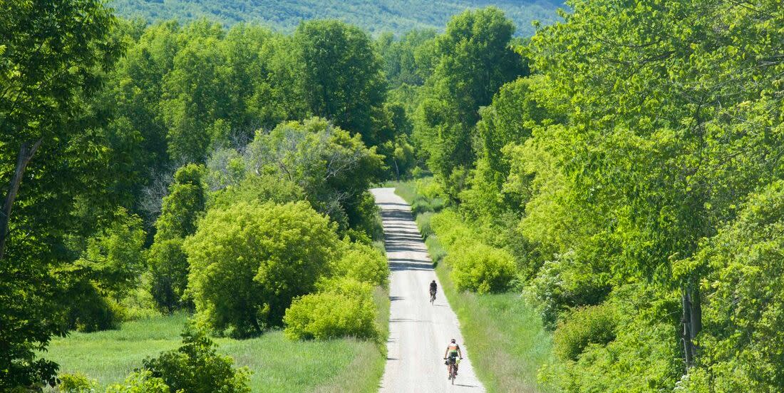
To different people, bikepacking means different things. But a common thread among the ride-and-camp crowd is a two-wheel adventure that should, at times, nudge you out of your comfort zone. More dirt and less pavement is the name of the game.
There’s never been a better time than now to have a crush on bikepacking, as routes spring up seemingly everywhere these days. Some of those routes require a bit of commitment in time and energy—maybe even a period of unemployment.
Arguably, long-haul bikepacking all started back in 1997 with the Adventure Cycling Association’s Great Divide Mountain Bike Route, which may be where the concept of “bikepacking” sprung to life. At roughly 2,700 miles in length, it proved that multi-day off-pavement bike touring was possible, if not a bit painful. Now we have the European Divide trail (4,723 miles), the Eastern Divide trail (5,950 miles), The Western Wildlands Route (2,700 miles), the Baja Divide (1,700 miles), among others.
What has been lacking in this library of famed routes is a proper bikepacking option that traverses Canada from ocean to ocean, left to right. So I decided to run wild with mapping sites and build one. It’s dubbed the Great Northern Bikepacking Route (GNBR) and it’s a long, long ride.
Commencing in Victoria on Canada’s rain-soaked and, as a result, mossy Vancouver Island it wanders about 8,700 miles through 10 provinces and three states and in doing so, takes riders through a panoply of landscapes that will clog any Instagram feed.
The GNBR is now fully mapped but will require some tires on the ground this season to test out various sections before it’s considered a fully rideable west-to-east route. Luckily, there are eager bikepackers in the provinces and states on the route who want to be a part of this mega-route project and are eager for a little bit of unknown exploration.
The Motivation Behind the Great Northern Bikepacking Route
A leading goal of the GNBR is to offer up a smorgasbord of riding surfaces and breathe new life into what I believe has become a stale pavement and rail trail dominated cross-country bike trip. With the route, riders will push forward through a stew of groads, forest paths, rowdy unmaintained roads, community paths, and the requisite singletrack.
One objective of the GNBR is to create a route that can satisfy both gravel and MTB enthusiasts. In other words, this is a beast of route better suited to beefier bike set-ups than stealthy cross machines. Yes, there is tarmac but every attempt has been taken to limit the amount and only to less traffic-laced options.
This alone was a major undertaking as there can be many unknowns when it comes to trying to connect trails and forest roads. Does a “backroad” actually go through or will it end in heartache? Also, will a certain singletrack section or ATV path be too arduous for a bikepacking set-up? These are all concerns I needed to address through diligent mapping and route scouting.
Pavement is much more predictable when it comes to plotting a route. Luckily, modern heatmap software gives route builders, like me, a better sense if an area has been well-trodden or if it is more a question mark.
The Tools Involved in Creating a New Cross-Country Bikepacking Route
Building bikepacking routes over the years in my home province of Ontario, including the BT 700 and Hasty Highlander, has helped me hone my route creation technique to a point where I was confident enough to tackle this major project. And the tools available to route builders of all stripes have never been better.
I heavily lean on Ride with GPS, which provides an impressive arsenal of options to make bikepacking route-building easier and certainly more enjoyable.
The Ride with GPS Inspect tool, which helps you find existing routes out in the wild, is a game changer. With a simple click on the map you can find where other riders have explored in the area, which gives you more confidence in plotting a path.
The bounty of editing tools in the Ride with GPS route planner, including the ability to split a route and delete a particular highlighted section to effortlessly re-route an area, are hugely helpful in creating a better and more accurate route.
Heatmaps, both global and personal, in the route planner are also useful in learning what dirt and gravel paths riders love the most. Although, a good bikepacking route should stray at times from the familiar.
The ability to populate a route with Points of Interest enhances the users experience, too. Each of the sections for the GNBR have numerous listings for camping and food options.
There have been many weary-eyed sessions staring at countless satellite views trying to find the most interesting ways to move the route forward. The heartache felt over dead ends and private property never seems to subside.
Overall though, I would be amiss if I took sole credit for the GNBR as the number of bikepacking routes available in Canada created by adventurous riders has exploded in recent years, some of which I’ve been able to fold into this grand route. These include the Log Driver’s Waltz, Sea to Sky Trail, and Newfoundland’s rugged T’Railway. It’s a golden age for riders who prefer dirt over rumble strips.
How to Troubleshoot a Bikepacking Route to Avoid Roadways

Full disclosure, this cross-Canada route does not solely take place on Canadian soil. It also includes routing in Minnesota, Wisconsin, and Michigan. But why would a trans-Canada bike route leave Canada?
You see, a large swath of Northwestern Ontario is a bikepacking black hole where the only feasible option is to pedal roughly 1,000 miles on the main highway, many miles of which lack a reasonable shoulder. Many cyclists have emerged from this section of a cross-country ride looking dazed and confused. I’ve heard the horror stories—transport trucks threading the needle is fun, said nobody. So sometimes a good route needs to pivot.
That’s why the GNBR veers into the U.S.. During this section of the route, truck- and RV-choked highway riding is traded in for 1,200 miles of mixed-terrain, including gravel paths wandering through forested lands, barely-their dirt roads, and some smartly built trail systems including the flow-y 50-mile Duluth Traverse that is part of the Northwoods bikepacking route.
Widescreen views of Lake Superior, the largest of the large Great Lakes, is a prominent fixture of this part of the GNBR. And you can even take part in a little beach camping if that pleases you. So unless you are hell-bent on being a trans-Canada purist don’t forget to pack your passport.
How to Actually Ride a Cross-Country Bikepacking Route Like the GNBR

Not every bikepacker will be able to tackle the GNBR. Once the wheels touch base at Newfoundland’s Signal Hill, the route’s endpoint, it will put Everesting to shame—a more humble 8,848 meters compared to the 150,000 meters or so of elevation gain on the GNBR.
However, a casual touring pace could see a rider finishing in about four months, and for those aiming to go light and fast, two might be possible. But to be honest, the route has also been designed with the understanding that many people will not try to tackle the whole thing at one go, but instead take on more manageable, slightly less epic chunks at a time.
One could traverse British Columbia and its voluminous mountains, rushing rivers, and glacier-fed lakes and this would be a brag-worthy adventure in itself. At more than 132,000 feet of elevation gain over 1,500 miles and with no shortage of testy trail sections, it might not be the best option for your first bikepacking adventure (one that requires keeping bear spray within reach), but a way to take your treks to a new level.
Another shorter, must-see section: The 1,500-mile, certainly bumpy at times, ride across Quebec. It takes you into deep, off-grid woodlands and through Quebec City, perhaps the most fetching metropolis in the country. I promise the Gaspé and its postcard-worthy views will not disappoint.
The prairie portion of the GNBR (Alberta, Saskatchewan, and Manitoba) isn’t all about canola fields and grain elevators, either. Expect some big sky views, shady parkland, and small town hospitality—but cross your fingers the wind gods are in your favor.
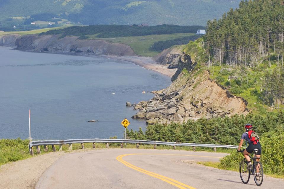
Just remember: It’s certainly possible to create your own bikepacking adventure using snipits of this route. Nobody would say that simply riding Nova Scotia’s stunning coastal Cabot Trail or the rockies portion of the GNBR in Alberta isn’t a rewarding time spent on two-wheels. The only real goal is to push you out of your comfort zone and to ride routes and see sights you wouldn’t get to without two wheels.
You can learn more about the Great Northern Bikepacking Route and how you can help contribute to its final creation at the website.
You Might Also Like

