The Best Hikes in Colorado
This article originally appeared on Backpacker
Colorado is home to more than 50 peaks measuring over 14,000 feet, 10 national parks, monuments, and recreation areas, and dozens of wildernesses and state and regional parks. Though Rocky Mountain National Park garners plenty of international attention, you'll find memorable dayhikes in downtown Colorado Springs and in the woods outside of Durango, in the outskirts of Pueblo and among the Ancestral Puebloan dwellings in Mesa Verde.
Are we biased? Maybe a little: Backpacker is based in Colorado, after all, and more of our editors call it home than anywhere else. But take the time to enjoy a few of these trails, and we think you'll agree: It doesn't get better than this.
Best Dayhikes Near Denver
Within easy access to Colorado's premier museums, cultural attractions and airport lie plenty of opportunities for memorable dayhikes.
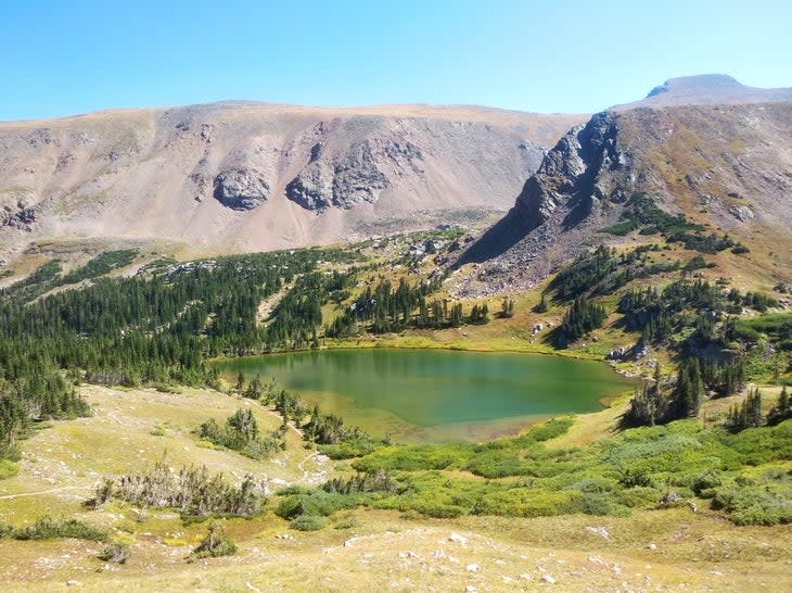
Skyscraper Reservoir
Length: 10.5 miles
Elevation Gain: 2,263 feet
Trail Type: Out and back
Difficulty: Moderate
Located within the Indian Peaks Wilderness, the Woodland Lake Trail to Skyscraper Reservoir meanders through thick evergreen and aspen forest, a boon on hot summer days. Several small waterfalls and wildflowers line the path, and you may even spy the occasional moose. The rocky trail rewards hikers' efforts with two glassy lakes: Woodland Lake, half a mile from the trail's end, and Skyscraper Reservoir, which sits in the shadow of Skyscraper Peak.
Find the route on Gaia GPS here.
South Boulder Creek Trail to Rogers Pass
Length: 9 miles
Elevation Gain: 1,952 feet
Trail Type: Out and back
Difficulty: Hard
This challenging hike in the James Peak Wilderness offers sweeping views from Boulder to Winter Park. South Boulder Creek Trail steadily climbs along the stream of the same name en route to the base of Haystack Mountain. Rogers Pass Lake marks your first major milestone, a cold, snow-fed lake surrounded by three smaller lakes. Power forward up the steep final quarter mile to Heart Lake, sitting beneath high, snowy peaks.
Find the route on Gaia GPS here.
Castle Trail
Length: 6.5 miles
Elevation Gain: 1,601 feet
Trail Type: Out and back
Difficulty: Moderate
Located just 30 minutes from downtown Denver, Castle Trail sits within Mt. Falcon Open Space park. Red rock formations, the ridge of Mt. Glennon, and the Red Rocks Amphitheater are visible from this trail, which leads ultimately to Walker House Ruins, the remains of a stately 1909 mansion (hence the trail's name) built by a Colorado conservationist but destroyed less than a decade later by lightning. The grounds at trail's end are so lovely, Woodrow Wilson once considered them for his Summer White House.
Find the route on Gaia GPS here.
Best Dayhikes Near Colorado Springs
The dramatic rock formations and canyons of the Garden of the Gods, Royal Gorge and Pikes Peak are crisscrossed by scenic hiking trails just a short distance from Colorado's second largest city.
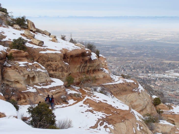
Palmer Trail Loop
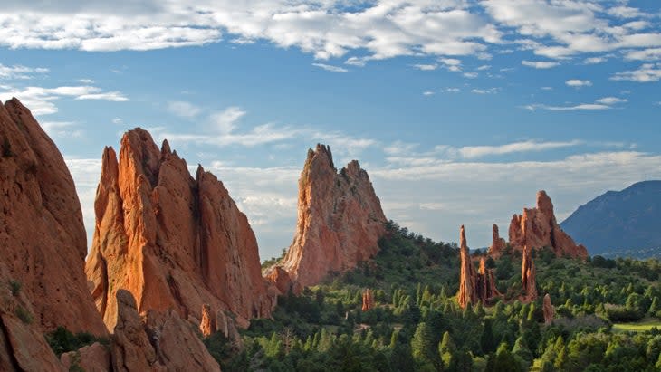
Length: 4 miles
Elevation Gain: 597 feet
Trail Type: Loop
Difficulty: Moderate
Winding its way around Colorado Springs' most popular park, the Garden of the Gods, the Palmer Trail Loop is filled with views of the park's most spectacular rock formations. Red rock monoliths burst above the landscape in enormous slabs, with names like the Siamese Twins, Balanced Rock, and Kissing Camels. The Palmer Trail includes a small stretch of paved pathway before branching out on a hard-packed trail into more natural areas overlooking the park's Central Garden and Colorado Springs below.
Find the route on Gaia GPS here.
Seven Bridges Trail
Length: 3.5 miles
Elevation Gain: 912 feet
Trail Type: Out and back
Difficulty: Moderate
Pretty North Cheyenne Creek gurgles along the Seven Bridges Trail, which takes its name from the seven attractive wooden bridges that lead hikers back and forth across the water. The path follows a rocky cut near the base of Kineo Mountain through North Cheyenne Canon Park over small boulders, twisted tree roots, and those little bridges. Continue onward to connect the Seven Bridges Trail with other area trails, or head back to your car after the seventh bridge.
Find the route on Gaia GPS here.
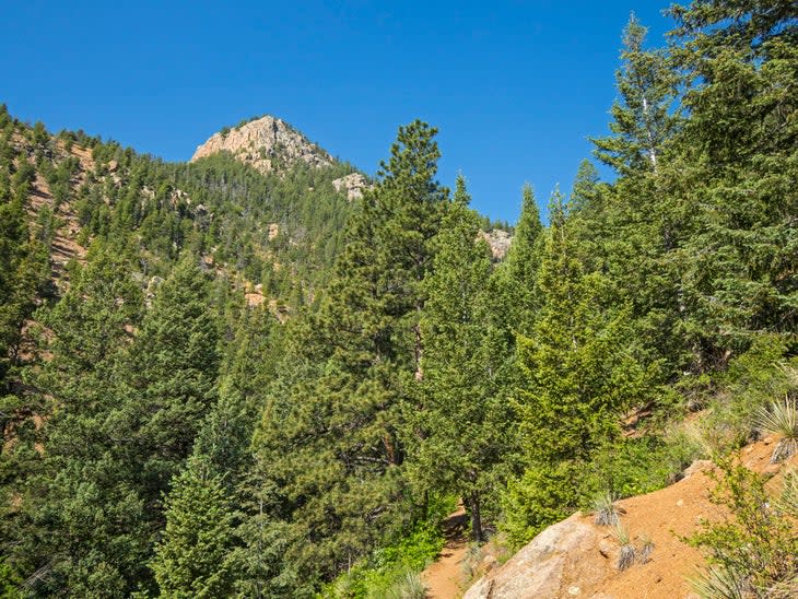
The Crags Trail
Length: 5 miles
Elevation Gain: 820 feet
Trail Type: Out and back
Difficulty: Moderate
This popular Front Range route is a good choice for flatlanders who haven't fully accustomed themselves to Colorado's altitude but still want to enjoy a beautiful mountain hike. The Crags Trail makes its way through colorful wildflowers and stands of towering aspens and bristlecone pines to reward hikers with expansive Rocky Mountain views. The Crags Trail also connects to the Devil's Playground Trail, from which hikers can embark on a rewarding, if challenging, ascent of Pikes Peak.
Find the route on Gaia GPS here.
Best Dayhikes Near Fort Collins
Live music, craft beer breweries and the cultural institutions of Colorado State University are surrounded by the natural beauty of national forest land, wildlife preserves, state and public parks. And Fort Collins lies just one hour from Rocky Mountain National Park.
Coyote Ridge Trail
Length: 4 miles
Elevation Gain: 564 feet
Trail Type: Out and back
Difficulty: Easy
The perfect trail for those not yet acclimated to Colorado's elevation or those with young children, the Coyote Ridge Trail is a favorite spring hike, with its wide-open grassland and abundant wildflowers. After a brief stretch along an abandoned roadway, the trail heads up the ridge, with views of the plains to the east and Milner Mountain to the west.
Find the route on Gaia GPS here.
Horsetooth Falls and Horsetooth Rock Trail
Length: 6.5 miles
Elevation Gain: 1,584 feet
Trail Type: Loop
Difficulty: Moderate
Varied landscapes, from conifer and deciduous forests to exposed rock promontories and wildflower meadows, make this trail a popular destination for visitors to Fort Collins' Horsetooth Mountain Open Space. For those looking for a less strenuous hike, the 2-mile route to Horseshoe Falls follows an easy, reasonably flat trail to the falls. Continue along the more arduous Horsetooth Rock Trail to the peak of Horsetooth Mountain for broad views of Fort Collins and the Front Range.
Find the route on Gaia GPS here.
Best Dayhikes Near Grand Junction
Impressive hoodoos, rock formations and a landscape of red- and gold-colored rock provide an enjoyable hiking destination in an area known for its wineries.
Mica Mines Trail
Length: 2.5 miles
Elevation Gain: 291 feet
Trail Type: Out and back
Difficulty: Easy
Fabulous sandstone cliff faces, towering hoodoos and a historic abandoned mica and quartz mining operation combine on a trail that is accessible for hikers of any age and ability. The circuitous route leads through Rough and Ladder Canyons, ending at a mica mine that was used only briefly in the late 1800s.
Find the route on Gaia GPS here.
Liberty Cap Trail
Length: 13 miles
Elevation Gain: 2,004 feet
Trail Type: Out and back
Difficulty: Moderate
Spanning Colorado National Monument from east to west, the Liberty Cap Trail quickly ascends the monument's dominant mesa with tight switchbacks and rock scrambles to approach the trail's namesake. The 160-million-year-old remnant sand dune, the Liberty Cap, stands in stark contrast to the surrounding landscape of russet- and golden-colored rock. Once you've reached altitude, the trail flattens out and continues west through pinyon-juniper forest and prickly pear habitat among the steep rock faces. Turn back at Rim Rock Drive or continue on Black Ridge Trail for a multi-day excursion.
Find the route on Gaia GPS here.
Best Dayhikes Near Durango
Set in an area known for its ancient culture (Mesa Verde National Park is the best known), gold mining history and Hollywood-worthy scenery (think "Butch Cassidy and the Sundance Kid" and "City Slickers"), this city in southwestern Colorado also includes hiking trails for all abilities.
Fourmile Falls, Wenimuche Wilderness
Length: 6 miles
Elevation Gain: 1,112 feet
Trail Type: Out and Back
Difficulty: Moderate
Located within Colorado's largest wilderness area, this trail winds its way beneath aspen trees and through meadows, squeezing between Pagosa and Eagle Mountain, which measure 12,556 and 11,766 feet high respectively. Beyond the beauty of the San Juan Mountains, the hike offers views of rocky cliff faces on its way past two waterfalls and fields of brilliant wildflowers.
Find the route on Gaia GPS here.
Highland Mary Lakes Trail, Wenimuche Wilderness
Length: 8 miles
Elevation Gain: 1,690 feet
Trail Type: Out and back
Difficulty: Hard
The ascent into this subalpine basin begins quickly as the trail heads steadily upward over hard-packed earth and a series of boulder scrambles over Cunningham Creek. The payoff: spectacular wildflower meadows, views of the San Juans and, as the trail name promises, the sparkling Highland Mary and Verde Lakes. Fuse the Highland Mary Lakes Trail with the Whitehead and Continental Divide Trails to create a stunning 8-mile loop.
Find the route on Gaia GPS here.
Best Dayhikes Near Pueblo
Set on the edge Colorado's Front Range and home to the Pueblo Reservoir, popular for fishing and boating, Pueblo lies one hour east of Royal Gorge and offers a variety of hiking trails within Lake Pueblo State Park.
Stonehenge and Rock Canyon Loop
Length: 2.5 miles
Elevation Gain: 230 feet
Trail Type: Lollipop
Difficulty: Easy
Located west of Pueblo on the eastern side of Lake Pueblo State Park, this loop trail begins flat, through open scrub that can be hot in summer. The trail's highlights appear one mile in, when the path begins to wind its way through stacked layers of shale (some natural, some human-made cairns) and the wind- and water-sculpted rock formations that give this trail its name. At the midpoint of the hike the path reaches the banks of the Pueblo Reservoir. Take a side trip along the South Shore trail (1 mile each way) to enjoy the lake views.
Find the route on Gaia GPS here.
Voodoo Trail
Length: 8.7 miles
Elevation Gain: 456 feet
Trail Type: Loop
Difficulty: Easy
This trail follows a twisting route along the southern banks of the sprawling Pueblo Reservoir. Part of Lake Pueblo State Park, the trail offers nice views of the Front Range of the Rockies and the Sangre de Cristo Range beyond. Reasonably flat, the trail traces the water's edge over a landscape of shale and limestone. Hike early, to avoid the midday heat and to take in sunrise over the lake.
Find the route on Gaia GPS here.
Best Dayhikes Near Aspen and Vail
Set high in the Rocky Mountains, traversed by the Continental Divide Trail and known for its premier ski resorts, Aspen and Vail offer first-rate opportunities for memorable hiking.
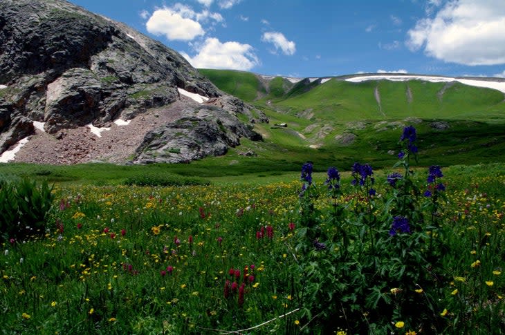
Mount of the Holy Cross Loop
Length: 12 miles
Elevation Gain: 6,134 feet
Trail Type: Out and back
Difficulty: Hard
Named for the snowy cross visible on the mountain's slopes into the early summer months, the Mount of the Holy Cross ranks as one of the most beautiful in the Sawatch Range. At 14,005 feet, the summit just barely qualifies as a 14er, but the peak looks more dramatic than many that are taller. The large elevation gain, boulder scrambling and steep final steps to the top make this a challenging hike, but you'll be rewarded with some of the most spectacular mountain views in Colorado.
Find the route on Gaia GPS here.
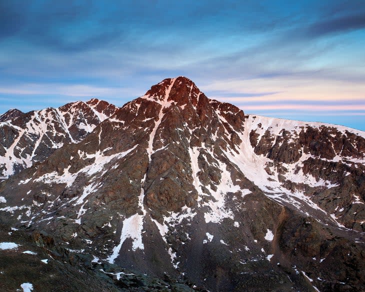
Grays and Torreys Peaks
Length: 8 miles
Elevation Gain: 3,622 feet
Trail Type: Out and back
Difficulty: Hard
Bag two 14ers in one day on this challenging but beautiful hike midway between Vail and Denver. The trail passes near several abandoned mining camps from the early 1900s before winding upward, connecting to the Continental Divide Trail atop Grays Peak (at 14,270 feet the highest point along the CDT). Enjoy stellar views of the Rocky Mountains to the west.
Find the route on Gaia GPS here.
Maroon Bells Scenic Loop
Length: 2 miles
Elevation Gain: 160 feet
Trail Type: Loop
Difficulty: Easy
Considered one of the most photographed scenes in all of Colorado, the Maroon Bells Scenic Loop offers a spectacular hiking opportunity even for those with limited hiking experience. Located within an easy drive of Aspen and Snowmass Village, the route provides views of the iconic pyramid-shaped peaks mirrored in the waters of Maroon Lake. The 26-mile Four Pass Loop is a good option for fit hikers who want a challenging multi-day adventure.
Find the route on Gaia GPS here.
Best Long-Distance Hikes in Colorado
The Colorado Trail
Length: 485 miles
Trail Type: Point to point
Difficulty: Hard
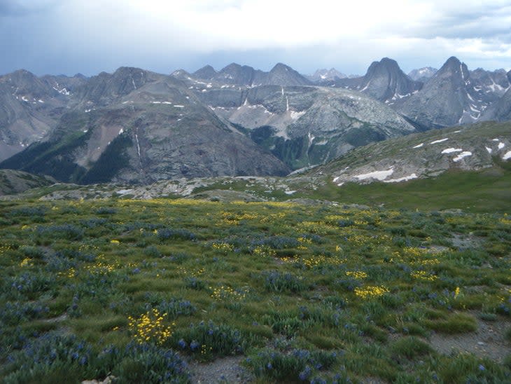
Running diagonally through Colorado from Denver to Durango, the Colorado Trail is a classic high-alpine hike linking eight mountain ranges. The challenge takes hikers across 13,000+-foot peaks and through mountain valleys on a month-long journey often used as preparation for hiking the longer Continental Divide Trail (which piggybacks on the Colorado Trail for some 200 miles). But the Colorado Trail is worth exploring for its own sake, in its entirety or piecemeal, with its snow-capped mountain vistas and wildflower meadows, historic mining towns, starlit skies and, not least, its bragging rights. Highlights include the ascent of Mt. Elbert, the views at Hope Pass and throughout the San Juans, and a hot meal and shower at Mount Princeton Hot Springs Resort.
The Continental Divide National Scenic Trail
Length: 3,100 miles
Trail Type: Point to point
Difficulty: Hard
Considered one of America's best long trails, the Continental Divide Trail stretches from the Canadian border in Montana to the Mexican border in New Mexico, with 800 of its 3,100 miles passing through Colorado. The Colorado leg of the trail ranks as a true Rocky Mountain adventure, entering Colorado in the Medicine Bow-Routt National Forest north of Steamboat Springs and leaving the state in the South San Juan Wilderness north of Chama, New Mexico.
Best Hikes in Colorado National Parks
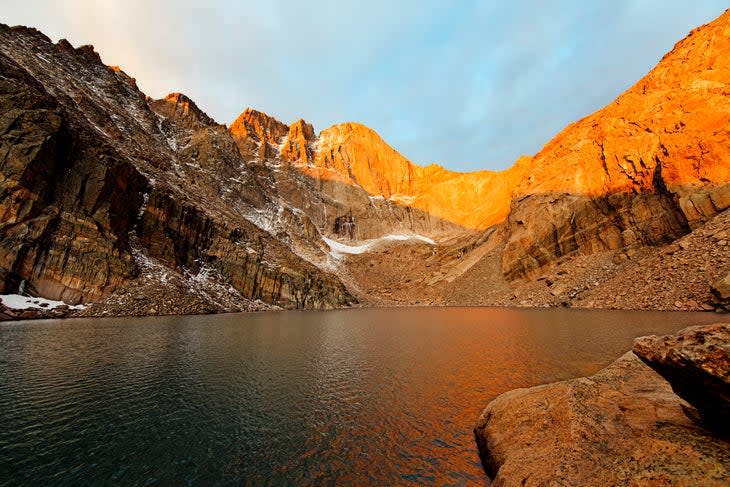
Best Hikes in Rocky Mountain National Park
With more than 415 square miles of mountains within its boundaries, it's no wonder that Rocky Mountain National Park is home to some of America's finest hiking trails.
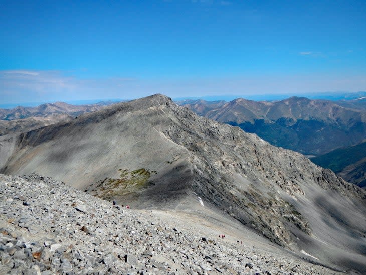
Longs Peak
Length: 13 miles
Elevation Gain: 6,300 feet
Trail Type: Loop
Difficulty: Hard
Longs Peak ranks as Rocky Mountain National Park's lone 14er, and its shear rock Diamond face is popular material for picture postcards and Instagram posts, particularly when illuminated by the morning sun. Those factors combine to make this mountain a target for hiking- and climbing-minded park visitors. At first a well-marked path, the Keyhole Route up Longs Peak transforms into a scramble over boulders and through slots with aptly descriptive names like the namesake Keyhole, The Ledges, The Trough and The Narrows. The trail's final stretch, a smooth granite wall known as The Homestretch, leads to the summit, with remarkable 360-degree Rocky Mountain views.
Find the route on Gaia GPS here.
Cub Lake Trail
Length: 6 miles
Elevation Gain: 744 feet
Trail Type: Loop
Difficulty: Moderate
The Big Thompson River (a fly-fishing nirvana), abundant mule deer, elk and moose and the relative accessibility of this Rocky Mountain trail make the Cub Lake Trail a popular one for average hikers. The route culminates at the lily pad-strewn lake, framed by the Rockies, the most dramatic being Stones Peak at the lake's far end.
Find the route on Gaia GPS here.
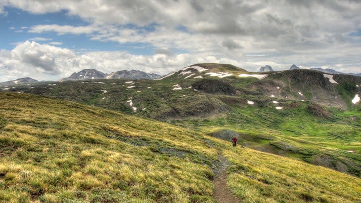
Never Summer Wilderness

Length: 19 miles
Elevation Gain: 4,757 feet
Trail Type: Loop
Difficulty: Moderate
This multi-day hike from Baker Gulch to Bowen Gulch Lake offers a spectacular mountain getaway just two hours northwest of Denver. The route loops through the 21,000-acre Never Summer Range, through tree-covered ridges to open tundra. 17 peaks rise above the trail, all measuring more than 12,000 feet and boasting their height with names like Cirrus, Nimbus, Stratus and Cumulus. You can fish for trout at Parika Lake.
Find the route on Gaia GPS here.
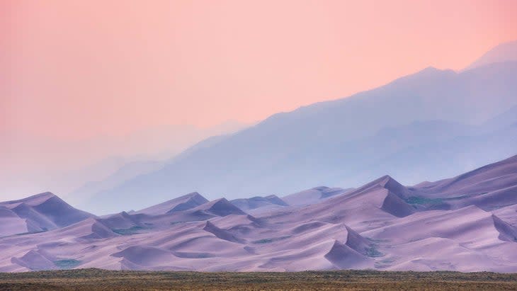
Best Hikes in Great Sand Dunes National Park
The continent's tallest sand dunes are located not on the seashore, but in the heart of Colorado, where an assortment of trails allow hikers to explore their stark beauty.
High and Star Dune Loop
Length: 7 miles
Elevation Gain: 1,309 feet
Trail Type: Loop
Difficulty: Hard
The loose sands of the monumental High and Star Dunes (the latter tied with nearby Hidden Dune as the tallest in North America at 741 feet) makes this hike more challenging than it would seem. Summit the slopes in hiking boots or barefoot and enjoy a sweeping view of the dunes and the Sangre de Cristo peaks. Carry a rented sand sled or sandboard for a thrilling trip back downhill.
Find the route on Gaia GPS here.
Mosca Pass Trail
Length: 6.5 miles
Elevation Gain: 1,459 feet
Trail Type: Out and back
Difficulty: Moderate
Varied hiking terrain, from shady forest to exposed rock outcroppings, accompany hikers up a steady but gradual climb and provide a break from hiking in the sand. Look for views of the park's famous dunes two miles into the route.
Find the route on Gaia GPS here.
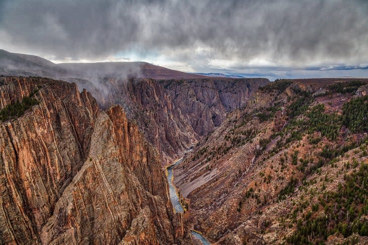
Best Hikes in Black Canyon of the Gunnison
Home to some of the steepest and most highly-weathered rock faces in North America, this largely vertical national park offers trails that are short on distance, but long on drama.
Exclamation Point
Length: 6 miles
Elevation Gain: 364 feet
Trail Type: Out and back
Difficulty: Easy
Easy on your feet and accessible to all members of the family, Exclamation Point promises some of the Black Canyon's most awe-inspiring views. Expect remarkable photo ops of the canyon's steep rock walls and the silver glimmer of the Gunnison River some 2,000 feet below.
Find the route on Gaia GPS here.
Deadhorse Loop Trail
Length: 4 miles
Elevation Gain: 561 feet
Trail Type: Lollipop
Difficulty: Moderate
Starting from Kneeling Camel Overlook, the Deadhorse Loop leads briefly away from the Black Canyon to wind past an old ranger station and into a steep, rocky side canyon, Deadhorse Gulch. Power back to the top of the gulch where the trail loops back to the Black Canyon for awe-inspiring views before returning to your car.
Find the route on Gaia GPS here.
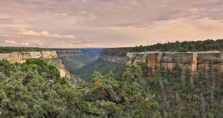
Best Hikes in Mesa Verde National Park
Hikers to Mesa Verde enjoy remarkable scenery and a window into the centuries-old past of the Pueblo people.
Petroglyph Point Trail
Length: 2.5 miles
Elevation Gain: 587 feet
Trail Type: out-and-back
Difficulty: Moderate
A juniper forest trail with some boulder scrambles leads to remarkable views of Mesa Verde's canyon and the mountainous wilderness beyond. The route also leads past postcard views of the cliffside dwellings where Ancestral Puebloan people lived for more than 700 years. A sign directs hikers to a wall of petroglyphs.
Find the route on Gaia GPS here.
Spruce Canyon Trail
Length: 2.5 miles
Elevation Gain: 675 feet
Trail Type: Loop
Difficulty: Moderate
Follow this route on the Chapin Mesa, descending into the cool, shady Spruce Tree Canyon for a look at rock walls eroded into fantastical shapes by wind and water. Lush green plant life grows along the seasonal creek bed, a strong contrast to the browns and grays of the surrounding cliff faces. Combine the Spruce Canyon Trail with Petroglyph Trail for a memorable 5-mile dayhike.
Find the route on Gaia GPS here.
For exclusive access to all of our fitness, gear, adventure, and travel stories, plus discounts on trips, events, and gear, sign up for Outside+ today.

