Atmospheric Rivers Pound California, Closing Multiple Parks and Recreation Sites
This article originally appeared on Outside
Atmospheric rivers are wreaking havoc in Northern and central California, causing unprecedented flooding and mudslides and prompting the closure of many state and regional parks. These weather events are impacting national parks in the region as well.
"We anticipate this may be one of the most challenging and impactful series of storms to touch down in California in the last five years," said Nancy Ward, director of the Governor's Office of Emergency Services, during a press conference on Wednesday.
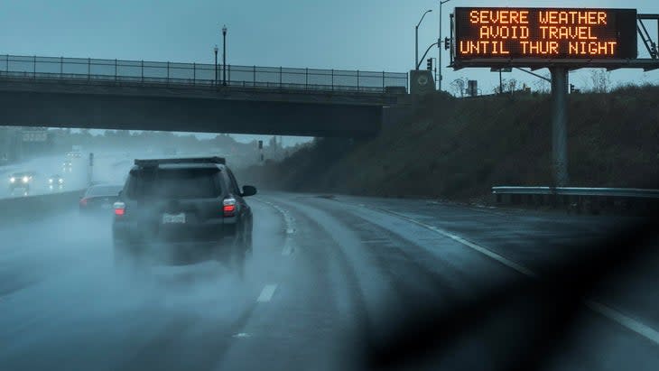
Some communities in Santa Cruz County, and along the Russian River, to the north in Mendocino and Sonoma Counties, are under a mandatory evacuation order, while the entire San Francisco Bay Area is operating under a state of emergency, with residents urged to stay home. California has closed 16 regional, state and national park units, with partial closings affecting 37 others, in anticipation of floods and severe winter weather. Golden Gate National Recreation Area closed several popular visitor sites, including Muir Woods National Monument, Muir Beach, Stinson Beach, and Alcatraz Island as of Wednesday, January 4. A week ago, at the end of December, parts of Golden Gate National Recreation Area closed for previous atmospheric-river events that caused flooding and downed trees. Redwood National Park, some 300 miles north of the Bay Area, temporarily closed starting January 4 for the storm event, which is taking out trees and power lines.
Atmospheric rivers are long, narrow streams in the atmosphere that transport water vapor from the tropics, according to the National Oceanic and Atmospheric Administration. Each "river," which can be up to 2,000 miles long, can carry roughly the same amount of water as the average flow of the mouth of the Mississippi, which is roughly 593,003 cubic feet per second. When these atmospheric rivers make landfall, they release massive amounts of rain or snow, depending on the location and area temperatures. Last June, an atmospheric river storm dumped 2.5 inches of rain in Yellowstone National Park between June 10 and June 13, causing rapid snowmelt and floods, and necessitating the closure of the park for over a week.
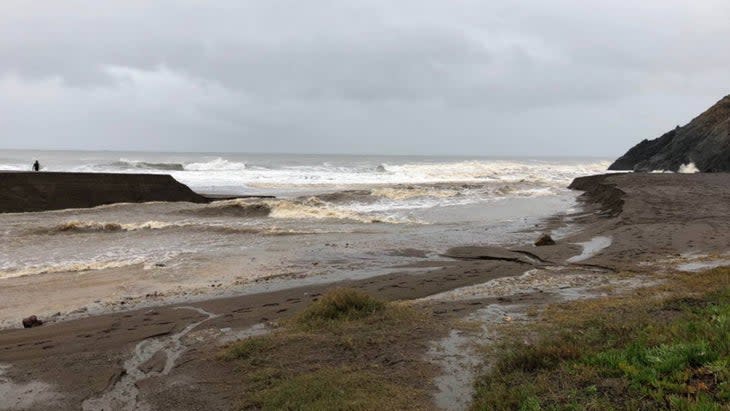
This current package of storms has been pummeling Northern California since the new year, and the current storm, which has been building since last night, is expected to result in floods, landslides, and power outages. Thousands of people are already without power and one child has been killed, struck by a falling tree. Flood watches are in effect throughout central and Northern California, with rivers expected to crest Thursday night. Due to the back-to-back storms, the ground has become saturated and vulnerable to rapid runoff; as a result, instead of penetrating the soil, rain begins to flow like a river across its surface.
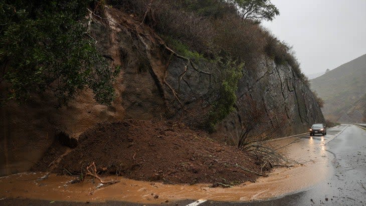
This storm could bring as much as four inches of rain in the next two days and wind speeds of up to 40 miles per hour, according to the National Weather Service. The first wave of the storm brought up to 2 inches of rain throughout the San Francisco Bay with more expected to come Thursday evening. Any damage will only compound recovery efforts by the state, faced with structural issues resulting from the late-December storm, which caused a levee breach on the Cosumnes River in Sacramento County. Five people were killed as a result of the New Year's storm.
National parks in the mountains of Northern and central California aren't escaping the storm's force either. The National Weather Service has issued a winter-storm warning for the western slope of the northern Sierra Nevada, including Yosemite National Park, until 4 A.M. Friday (although currently only seasonal road closures are in effect in the park area). Higher elevations of the park could see snow accumulations of up to four feet.
South of Yosemite, Sequoia and Kings Canyon National Parks are partially closed due to strong winter-storm conditions. These closures include Azalea Campground and Generals Highway, which provides access to Giant Forest, popular snow-play areas, and sequoia groves. The entire park is under a winter-storm and flood watch.
The current storm is just one of a series of atmospheric-river storms that climate scientists believe will continue throughout January, so California's national parks may well suffer from more temporary closures moving further into the winter.
For exclusive access to all of our fitness, gear, adventure, and travel stories, plus discounts on trips, events, and gear, sign up for Outside+ today.

