6 Best East Coast Road Trips for Fascinating History, Beautiful Beaches, and Delicious Seafood

The eastern coast of the lower 48 United States borders the Atlantic Ocean for a distance of about 2,370 miles. Unlike the West Coast, where only three states border the Pacific, a total of 14 states lie along the Atlantic shores. And three other states — Pennsylvania, Vermont, and West Virginia — are considered "East Coast" states, even though they don't touch the Atlantic. Plus, thousands of islands, islets, and peninsulas line the eastern shores of the U.S., from Maine to Florida.
In other words, this area is packed with enough to satisfy foodies, history buffs, beach lovers, and beyond. The original 13 colonies were located in the East Coast states, along with many cities prominent in the country's history. Road trips along the East Coast also pass through beaches, rugged seashores, large cities, small towns, and intracoastal waterways. To top it off, seafood, from Maine's lobsters to Maryland's oysters to Florida's stone crabs, is abundant. Nearly every East Coast state has a culinary specialty as well, making dining a memorable part of any Atlantic-adjacent road trip.
Interstate 95 runs about 2,000 miles between Miami and Maine, but you'll want to take some detours to explore various points of interest along the way. Slightly longer and mostly parallel, U.S. Highway 1 goes from the Canadian border in Maine to Key West, Florida. We've put together some of the best East Coast road trips, depending on how much time you have.
Boston, Massachusetts to Acadia National Park, Maine
Getty Images
There's no shortage of ways to explore Boston — self-guided walking tours, museum visits, and strolls through Little Italy and historic spots like Faneuil Hall and the Boston Commons are all great options for soaking in the city. Visitors can also take a harbor cruise or paddle a Swan Boat in the Public Garden lagoon. Don't leave town without sampling their famous clam chowder and Boston cream pie.
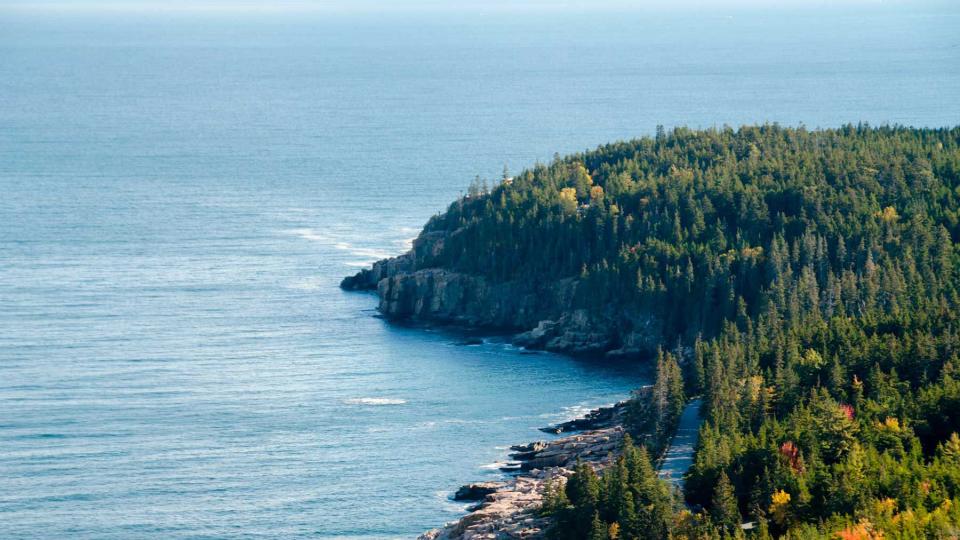
The fastest route on this 285-mile trip takes nearly five hours and passes through Salem, Massachusetts; Portsmouth, New Hampshire; Portland, Maine; and Augusta, Maine's capital, before reaching Bar Harbor. You'll experience New England's scenery and history if you take U.S. Route 1 with a few detours along the way.
Traveling north on U.S. Route 1 from Boston, you'll pass over the Mystic River. If time allows, watch for the Yankee Division Highway heading east toward Gloucester — a worthwhile detour if you're interested in seeing lighthouses, fishermen's memorial statues, and historic buildings. Back on the highway, you'll drive north, just a mile or so from the sea most of the time, briefly passing through New Hampshire until you reach Portsmouth and enter Maine. Continue through beach towns and the Rachel Carson National Wildlife Refuge, and take State Route 9 for a detour to Kennebunkport. Spend the night, dine on Maine lobster, and check out the stunning mansions in the 400-year-old town.
Take Route 9 around the shore and then head back to U.S. Route 1 on Route 208. Continue on U.S. Route 1 to Portland, another great option for an overnight stay. From Portland, three hours on the shore-hugging scenic route will get you to Bar Harbor and Acadia National Park.
New York, New York to Newport, Rhode Island
Getty Images
A few days in Manhattan is an ideal lead-in to a relaxing road trip to a quieter spot like Newport. After noshing on bagels or pizza, shopping, visiting museums, and strolling through Central Park, it could be time for a change. Don't leave without walking across the Brooklyn Bridge, meandering along the High Line, and experiencing the 9/11 Memorial.
When it's time to leave, head north on the FDR Drive along the East River to the Robert F. Kennedy Bridge, which spans the Harlem River. Interstate 278 then takes you through the Bronx and onto Interstate 95 through Westchester County. The highway runs northeast, close to the shore of the Long Island Sound into Connecticut. You'll pass through New Haven, home of Yale University, an opportunity to explore the campus.
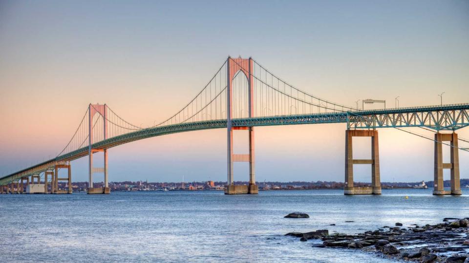
Shortly after the town of Guilford, exit onto State Route 1, which will take you closer to the sea and add about 30 minutes to the four-hour, 186-mile trip. But it's worth the stop for the views and beach access. You'll join Interstate 95 again and cross the Thames River near New London, Connecticut. Continue on Interstate 95 into Rhode Island, and then exit onto State Route 102, heading southeast. Watch for State Route 4, then Route 138. You'll go over the Jamestown Bridge and the Claiborne Pell Newport Bridge into Newport.
In Newport, park the vehicle and plan to spend a few car-free days along the shore, strolling along the three-and-a-half-mile Cliff Walk, exploring vintage mansions, and enjoying fresh seafood. Take a bike ride along one of many trails or relax on a sunset cruise.
New York, New York to Washington, D.C.
Greg Pease/Getty Images
This 227-mile trip takes approximately four hours, depending on traffic and road conditions. From lower Manhattan, take the Holland Tunnel that passes under the Hudson River to New Jersey. You'll be on Interstate 78 in Jersey City, with views of Manhattan and the Statue of Liberty. The interstate highway crosses Newark Bay on the Vincent R. Casciano Memorial Bridge, then meets Interstate 95 heading south.
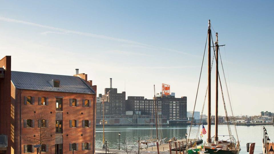
Driving south on Interstate 95 (New Jersey Turnpike), Staten Island, one of New York City's boroughs, will be on your left across a narrow body of water called Arthur Kill. (The word "kill" is derived from the Dutch language, influential in settling this part of the northeast). Continue south on Interstate 95 through New Jersey until you cross the Delaware River into the state of Delaware. You'll soon enter Maryland, where Interstate 95 is named John F. Kennedy Memorial Highway, cross the Susquehanna River, and then go on to Baltimore.
Continue south on the Baltimore-Washington Parkway (295) into Washington, D.C., where there's plenty to see and do, from museums to monuments to outdoor activities on the waterfront. The Smithsonian museums alone could fill several days, plus there's hiking, biking, and boating for those who want to spend some time outdoors.
Washington, D.C. to Nags Head, North Carolina
Getty Images
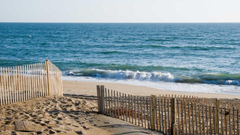
After taking in the sights, restaurants, and history of the nation's capital, you may be ready to head to the beach, and this trip takes you about 280 miles south to the Outer Banks of North Carolina. As with most of these road trips, there's the faster way and the more scenic route. In this case, the scenic drive adds nearly an hour to the approximately five-and-a-half-hour trip, but if you're on vacation, it's worth the additional time.
Head south out of Washington, D.C. on Interstate 395 (turns to Interstate 95). You'll pass the Jefferson Memorial and then cross the Potomac River into Virginia. Continue south until you reach State Route 3 around Fredericksburg, where you'll go east on Route 3 and then south on Route 17. Called Tidewater Trail, Route 17 meanders along next to the Rappahannock River, known for outdoor fun and delicious oysters.
You'll cross the York River and the James River, which empty into Chesapeake Bay. At Newport News, take Interstate 64 southeast, and at Chesapeake, take Route 168 into North Carolina. The highway meets up with Route 158, takes you along a narrow peninsula to the Wright Memorial Bridge, and south to the Outer Banks town of Nags Head. Relax on the beach, climb to the top of the still active Bodie Island Lighthouse, or watch the hang gliders at Jockey's Ridge State Park among massive sand dunes.
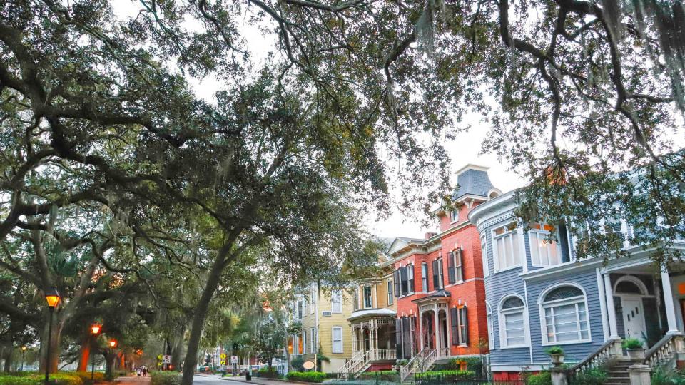
Wilmington, North Carolina to Savannah, Georgia
Daniela Duncan/Getty Images
Start or end this road trip by spending a few days in the riverfront city of Wilmington, strolling Cape Fear's 1.75-mile Riverwalk, browsing the shops, or dining at one of the waterfront cafes or restaurants. Tour Battleship North Carolina, just across the river from downtown, to catch a glimpse of its role in World War II's Pacific Theater. Spend a day at the beach or ride in a horse-drawn carriage among Wilmington's historic mansions.
When it's time to begin your drive south to Savannah, you have a few options. The fastest route is inland on Interstate 95, a little less than five hours for 300 miles. But take your time and drive near the coast on U.S. Route 17. This will add around an hour, if you drive straight through, but you'll pass through small towns and can perhaps stop for lunch on a nearby beach. If time allows, you could happily take three days or more to enjoy this scenic and historic section of the coast.
Head west across the Cape Fear River, then U.S. Route 17 takes you inland for a few miles south before you get close to the Atlantic shore for most of the drive. You'll pass Shallotte, its river of the same name, and the Brunswick Islands, five barrier islands with beaches, seafood, and a historic atmosphere. North Carolina's Outer Banks region, which comprises 100 miles shoreline, is a popular summer destination, and you might decide to spend some time (or even a night) in one of the beachside towns.
Myrtle Beach in South Carolina might be your next stop, or you can continue your scenic drive along the shore and spend the night in Charleston. Continue on U.S. Route 17, driving near the Sea Islands — hundreds of barrier islands along the shores of South Carolina, Georgia, and Florida — for about two hours, before arriving in Savannah.
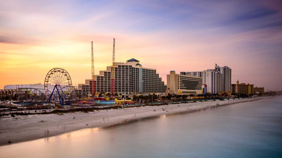
Savannah, Georgia to Orlando, Florida
Getty Images
It may not be easy to leave Savannah's squares, parks, riverfront, and restaurants, but if you're planning a visit to Orlando's theme parks and many attractions, it's time to get on the road. Most of the 300-mile trip will be on Interstate 95, which runs fairly close to the coast, but there's a short detour that takes you to Sea Island, Little St. Simons Island, and Jekyll Island that's well worth an extra hour or more.
Take Interstate 16 west out of Savannah to meet up with Interstate 95 south — you'll drive mostly inland, but pass over creeks and streams along the way. Shortly after the Altamaha River, watch for a turnoff onto State Route 99, and then take Route 17 south. Take a road to whichever island you want to visit. Then, continue on Route 17, which meets up with Interstate 95 again. Continue south, passing Amelia Island, and then on toward Jacksonville, where you'll cross the St. Johns River.
You'll drive near the coast as you pass St. Augustine, the nation's oldest city, and a variety of beach towns. At Daytona Beach, home of the Daytona International Speedway, head southwest on Interstate 4, passing Lake Monroe and on to Orlando, where hotels, Disney World, Epcot, Universal Studios, and entertainment of all kinds await. Explore the natural surroundings at Shingle Creek Regional Park, paddle a canoe or kayak, or enjoy a quiet picnic.

