3 Stops on Tioga Road in Yosemite
This article originally appeared on My Yosemite Park
Rolling through the thick forests from Big Oak and Crane Flats, Tioga Road (Highway 120) spans Yosemite National Park from the west to east gates, rising into the rugged Sierra Nevada high country. The seasonal road is normally open to vehicles from late May or June until sometime in November depending on snow levels.
Driving Tioga Road in summer is exhilarating. Meadows are laden with colorful wildflowers, pristine lakes are perfect for picnicking beside, and nearby peaks shed enough of their snow blanket to be accessible to hikers and alpine climbers. Although just about every bend in the road reveals another awesome view, here are three famous stops you won’t want to miss on the eastern section of the road at Tioga Pass.
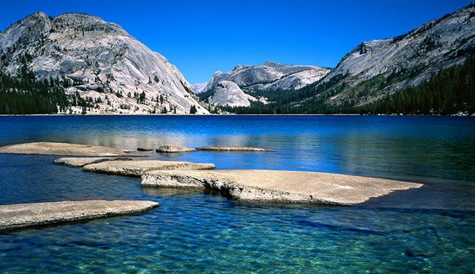
Olmsted Point
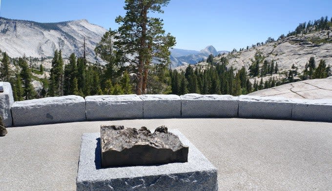
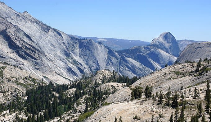
The iconic granite Half Dome is visible in many areas of the park, but pull over at the Olmsted Point parking area and you’ll see a different view. With a pair of binoculars, you can often see a line of hikers like ants, climbing up cable to the top of Half Dome. To the left is the northwest face of Cloud’s Rest at 9,926 feet above sea level. Its face drops nearly 5000 feet to lower Tenaya Creek.
Don’t get back in your car quite yet. Olmstead Point has one of the shortest hiking trails in the park at 0.2 miles. It opens up to spectacular views of Tenaya Peak, Tenaya Lake, and Mount Conness. As if by design, a boulder sits plunk in the middle of the flat, offering a place to lounge and soak in the view.
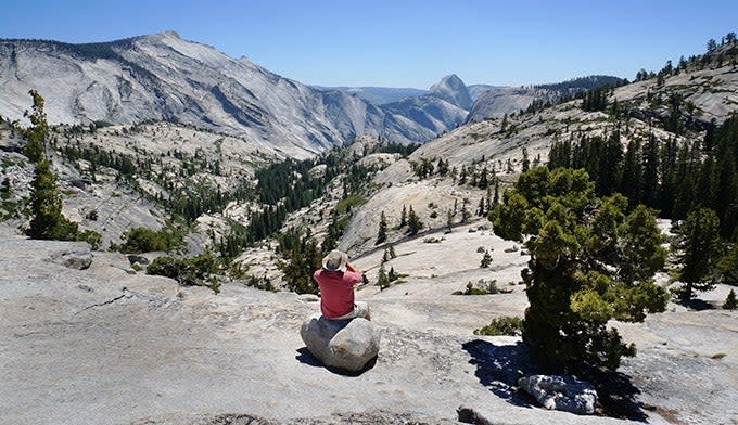
Olmstead Point is also a trailhead. Venture out on the Snow Creek Trail towards Tenaya Lake (16 miles) and further on to Tuolumne Meadows (another 10.3 miles). In the other direction you can hike to Yosemite Valley (9.6 miles) but this route is for experienced hikers only as it is a strenuous, full-sun hike.
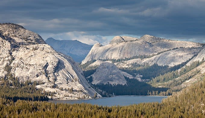
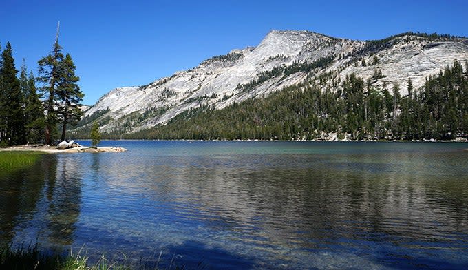
Tenaya Lake on Tioga Road
This roadside lake is the largest natural lake in Yosemite. It is also one of the easiest to get to while Tioga Road is open in the summer – steps from the road. Named after Chief Tenaya who met the Mariposa Brigade near its shores, the lake was formerly known as Pieweack (Lake of the Shining Rocks.)
Tenaya Lake is popular for water activities such as canoeing, kayaking, and sailing. You can fish with a license. You can also swim in the lake but the water is very cold. Two picnic areas are available, one of them is wheelchair accessible
Hiking is also a popular activity in the Tenaya Lake area. Trailheads lead to Cathedral Lakes, Clouds Rest, Half Dome, and the Yosemite Valley floor, the later passing by Olmsted Point (above.)
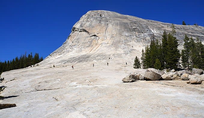
Lembert Dome
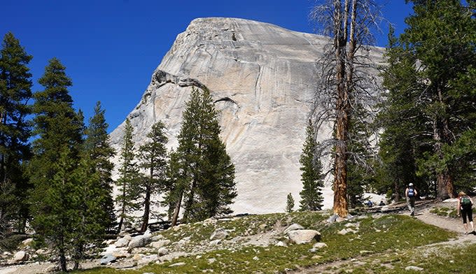
Venture into the Tuolumne Meadows visitors area off of Tioga Road, and you’ll find a short trail to this large white granite. It’s a popular spot for climbers and offers an excellent view across the meadows.
Not a climber? The dome’s backside is also fun to walk on as its base has a low incline. There is also a 2.8 mile round trip hiking path starting on the east side of the parking lot which is steeper and more challenging with an elevation gain of 800 feet. Be careful in rainy weather as the rock can get slick, and hold on to your hat. The dome has no obstruction to wind so it can get a little breezy.
It’s just another eight miles to the Tioga Pass entrance, Yosemite’s east portal. Time for more adventure? Head east to drive through the Lee Vining Canyon and visit the salty Mono Lake tufas.
Tioga Road Closes Seasonally for Winter
Tioga Road is only open from late May through early November, weather permitting. However, in 2017, the snow was piled so high that the road opened in late June. In 2022, Tioga Road opened May 27. Keep in mind the Tuolumne Meadows store and visitor center may not open when the road does. When Tioga Road is closed, it is not possible to drive to Tuolumne Meadows or enter the park through the east entrance. Check the road conditions at www.nps.gov/yose/planyourvisit/wroads.htm or at 209-372-0200.
For exclusive access to all of our fitness, gear, adventure, and travel stories, plus discounts on trips, events, and gear, sign up for Outside+ today.

