27 Facts About The Planet's Geography That Will Completely Distort Your Sense Of Being
Geology rocks. Geography, on the other hand, rules. Here are a bunch of facts about stuff that I think you might want to know. Or not! But if you want to seem smart and cool I'd memorize all these facts and show them off at the next party you go to. By the way, some of these facts were originally sourced from this Reddit thread, but I've made sure they are all true. Okay, let's go.
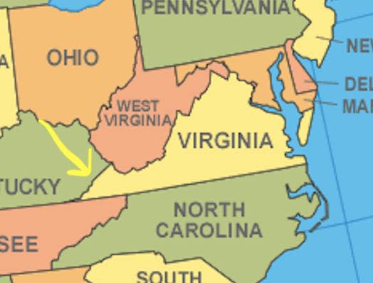
1."Virginia goes farther west than the western most point of West Virginia"
See:
2."Maine is the closest US state to Africa."
Whoda thunk:

3."If you travel from the Pacific Ocean to the Atlantic Ocean through the Panama canal, you go from east to west."
AKA, the "west" entrance is farther east than the "east" entrance

4."Reno is as far north as Philadelphia"
Speaking of Reno...
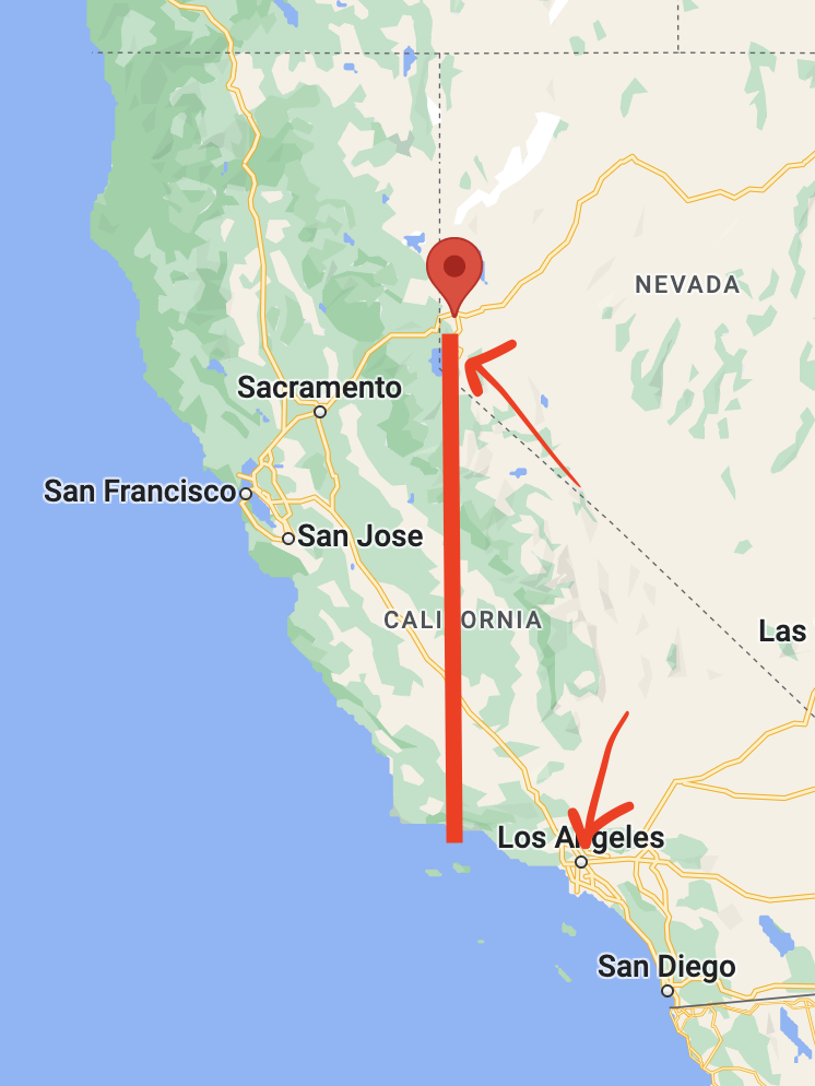
5."Reno, NV is farther west than Los Angeles, CA."
Proof:
6.Toronto, Canada and Monte Carlo, Monaco, are at the same latitude.
They are both at 43 degrees North.

7.Also, "Toronto, CA is south of Minneapolis, US"
8.Chile is very long. The pink is Chile:

9."Canada is 41 times the size of the UK and also has a Provincial park larger than Switzerland."
10."New York City (waaaay up there in North America) and Naples (waaaay down there in southern Italy) are on the same latitude."
11."Africa is HUGE, and maps you've seen your whole life are hugely misleading."
If you were to pick up The United States, India, and China, you could place them all inside Africa.

12."Palm trees grow in Ireland, at 53 degrees north."
This is in Culdaff, Ireland:

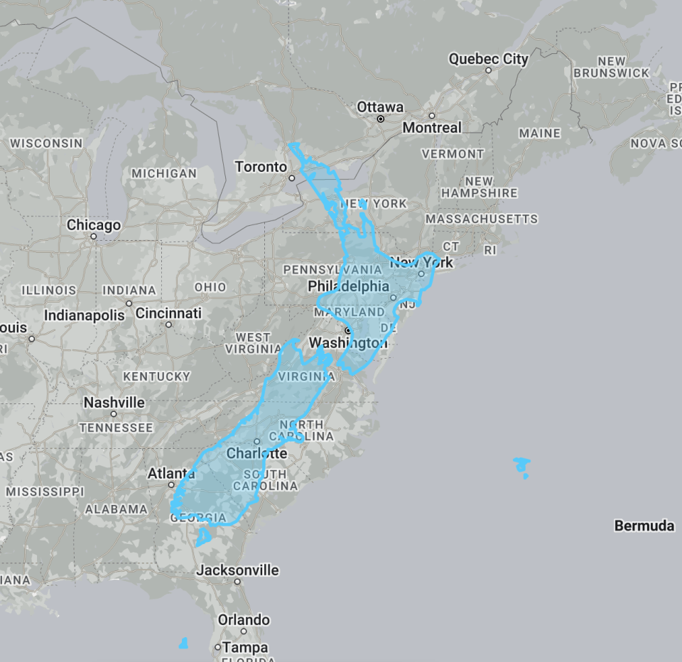
13.New Zealand is about as "long" as the Eastern Seaboard. The blue is New Zealand:
14."Australia is wider than the moon"
The moon is about 2,112 miles wide, while Australia is about 2,485 miles wide. Obviously, the moon has more surface area though, because it's a sphere.
Did you know Australia is bigger than the moon - the moon's diameter is 3400km and Australia is 4000km at its widest point. #factoftheday #aussiewine #australianwinediscovered
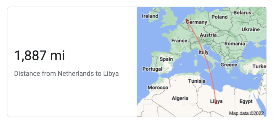
15."The distance between New Zealand and Australia is roughly the same as the distance between The Netherlands and Libya."
It's about a four-hour flight.
16. And the distance from the easternmost part of Brazil to Africa is shorter than Australia to New Zealand, at 1,801 miles.
17."If you took a boat out of Reykjavík and sailed directly south, the first land mass you'd hit would be Antarctica."
Here's my shitty rendition of the route:


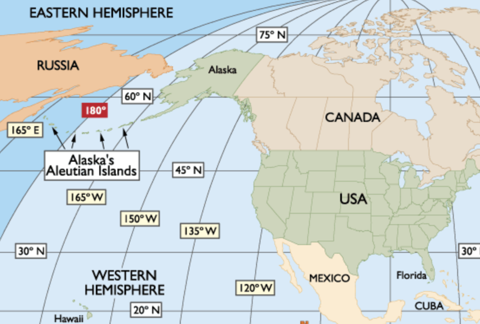
18."Alaska is simultaneously the furthest west, east, and northern point in the US."
To put it more scientifically: "Alaska’s Aleutian Islands arc right up to the edge of the Western Hemisphere at the 180th Meridian making Amatignak Island (179o West), Alaska the westernmost point in the US longitudinally. Alaska also has the easternmost point, Semisopochnoi Island (179o East), as the Aleutian Islands cross the 180º Meridian, into the Eastern Hemisphere. That makes Alaska the most northern, western, and eastern state, longitudinally, in the US."
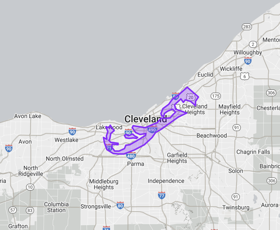
19.Bermuda is smaller than Cleveland, OH (purple is Bermuda).
20."Relatively speaking, we live on the skin of an apple. That's about how thick the Earth's crust is in proportion to its volume."
Pretttyyyy, prettyyyy, pretttyyy thin:

21."Detroit is farther east than Atlanta."
22.This is how big India is compared to the United States:

23. All of Europe can fit inside The United States:
24.Russia is bigger than the United States...but not THAT much bigger. The red is Russia:

25.Florida is at around the same latitude as Egypt.

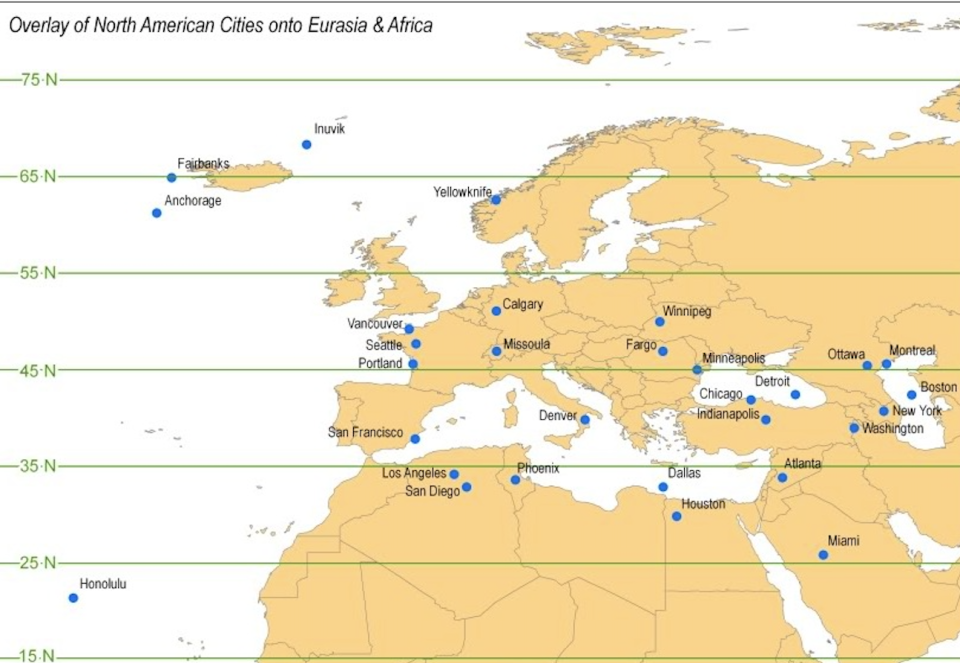
26.In general, the United States is more south than you probably realized, and here's where a bunch of cities in the US would be if they were in this part of Earth:
27.And finally, everything is not as big as it seems:
Animating the Mercator projection to the true size of each country in relation to all the others.Focusing on a single country helps to see effect best.#dataviz #maps #GIS #projectionmapping #mapping

