These 23 unique Missouri hikes show off the state's beauty and diversity
Take a hike, Missouri.
With the promise of better weather lasting, our state yields a number of wonderful trails to traverse.
We've collected just 23 of the many, many more that exist, culling hiking sites for highly-regarded and -rated trails, then looking for those which offer interesting scenes, wildlife or just a uniquely Missouri experience.
Hiking distances, times and difficulties are courtesy Missouri State Parks, unless noted otherwise. As always, check on conditions and potential closures before attempting any hike.
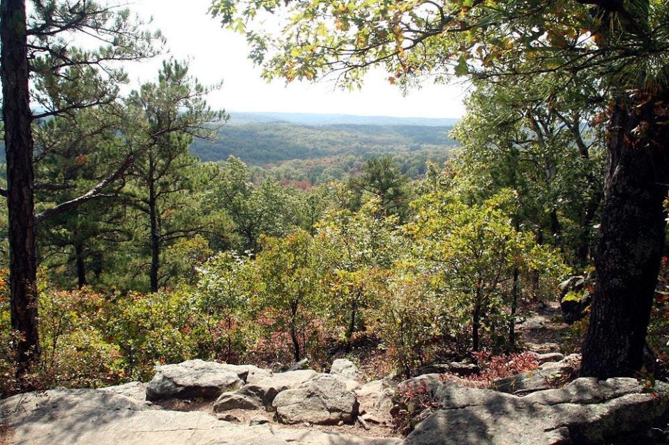
Bell Mountain Loop Trail
Where: Bell Mountain Wilderness, near Potosi
Distance: 11.8 miles
Difficulty: Challenging, per an AllTrails rating
Hike time: Around 5 hours, per an AllTrails estimate
Features: "Bell Mountain Wilderness provides a unique habitat not typical of the majority of Missouri's Ozarks," AllTrails notes, identifying the presence of numerous trees and grasses, as well as habitat for a variety of birds.
Big Piney Trail
Where: Paddy Creek Wilderness, Texas County
Distance: 16.1 miles
Difficulty: Hard, per an AllTrails rating
Hike time: About 6 1/2 hours, AllTrails notes
Features: Delivers on the promise of a true Ozarks landscape.
Colosseum Trail
Where: Ha Ha Tonka State Park in Camdenton
Distance: 0.6 miles
Difficulty: Rugged
Hike time: Under 40 minutes
Features: This trail "winds under the natural bridge and through a large sinkhole, the Colosseum, and is part of the Ha Ha Tonka Karst Natural Area," Missouri State Parks notes.
Frenchman's Bluff Trail
Where: Cuivre River State Park in Troy
Distance: 1.6 miles
Difficulty: Moderate
Hike time: About 70 minutes
Features: The trail leads hikers to the top of a limestone bluff, with lovely river vistas emerging below.
Goggins Mountain Trail
Where: Johnson's Shut-Ins State Park, southeast Missouri; it connects to the Taum Sauk section of the Ozark Trail
Distance: 10.1 miles
Difficulty: Moderate
Hike time: About 7 1/2 hours
Features: "Free of roads, power lines and other development, the area allows hikers and equestrians to experience something increasingly hard to find — wilderness," Missouri State Parks notes online.
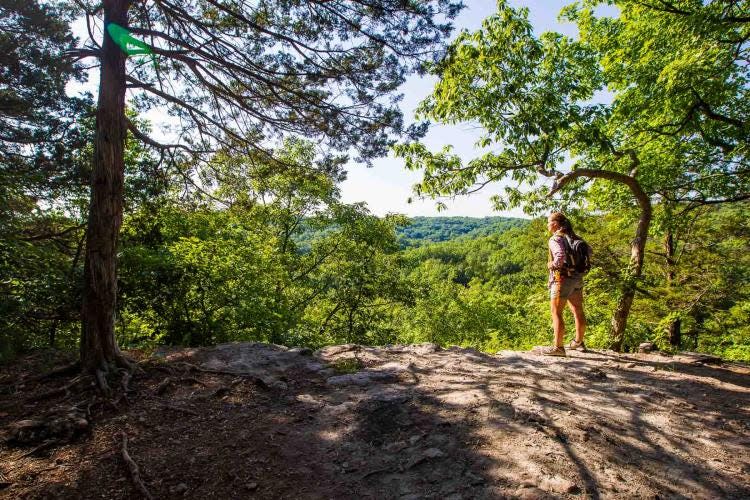
High Ridge Trail
Where: Rock Bridge Memorial State Park, Columbia
Distance: 1.7 miles
Difficulty: Moderate
Hike time: Around 1 hour, 15 minutes
Features: Rock Bridge features a number of popular trails such as Devil's Icebox and Sinkhole; High Ridge lives up to its name, offering unique views and grasslands atmosphere.
Lewis and Clark Trail
Where: Weldon Spring Conservation Area, St. Charles
Distance: 8.2 miles
Difficulty: Moderately challenging, per AllTrails
Hike time: About 3 hours, 16 minutes, according to AllTrails
Features: "Arguably one of the most scenic hikes in the Metro St. Louis Area," according to AllTrails, the trail features lovely cliffs and bluffs.
Lime Kiln Trail
Where: Rockwoods Reservation, St. Louis County
Distance: Around 2.8 miles
Difficulty: Moderate, per an AllTrails rating
Hike time: About 75 minutes or less, according to AllTrails
Features: Among them, the namesake lime kiln which juts out from the earth.
Marble Creek section, Ozark Trail
Where: Near Arcadia, in southeast Missouri
Distance: The out-and-back trail, per AllTrails, comprises 17.6 miles
Difficulty: Hard
Hike time: About 7 1/2 hours, per AllTrails
Features: The unique rock formations in this area commend the trail.
Mina Sauk Falls Trail
Where: Taum Sauk Mountain State Park, in the St. Francois Mountains of southeast Missouri
Distance: 2.9 miles
Difficulty: Rugged
Hike time: Just under 3 hours
Features: The trail takes hikers to Missouri's highest point at 1772 feet above sea level, and our state's tallest waterfall.
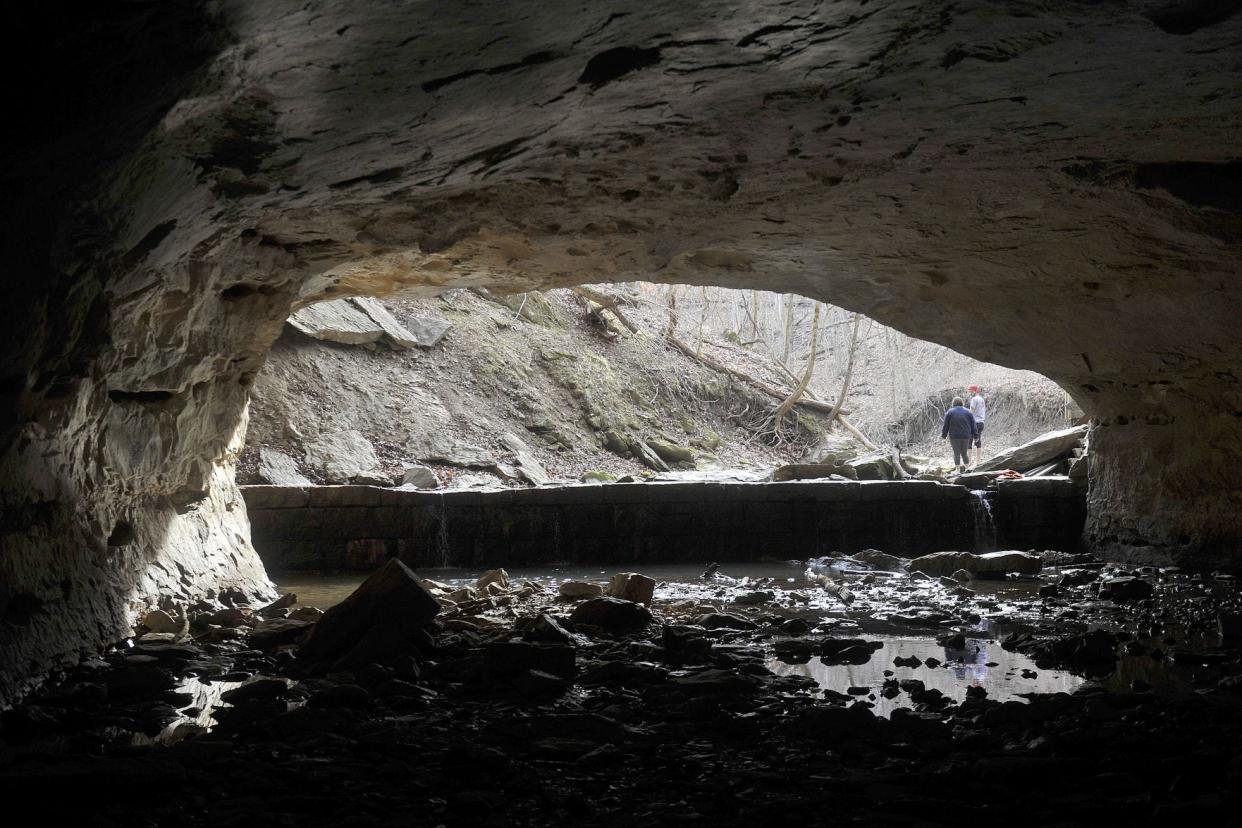
Natural Tunnel Trail
Where: Bennett Spring State Park, west of Lebanon
Distance: 7.4 miles
Difficulty: Moderate
Hike time: About 5 1/2 hours
Features: Hikers can experience the namesake natural tunnel, just less than 300 feet long, as well as varied vegetation and remnants from the past, including a 19th-century cemetery.
Ozark Chinquapin Trail
Where: Big Sugar Creek State Park, southwest Missouri
Distance: 3.3 miles
Difficulty: Rugged
Hike time: About 3 hours, 15 minutes
Features: Missouri State Parks promises a quieter, more solitary hike here, and the chance to take in stream and river views.
Pinewoods Trail
Where: Bryant Creek State Park, near Ava
Distance: 0.6 miles
Difficulty: Easy
Hike time: Less than 20 minutes
Features: Though quick and easy, Pinewoods offers the chance "to see Missouri's only native Shortleaf Pine," Missouri State Parks notes.
River Scene Trail
Where: Castlewood State Park in Ballwin
Distance: 3.4 miles
Difficulty: Moderate
Hike time: About 2 1/2 hours
Features: River Scene Trail features bluffside views of the Meramec River Valley below, and introduces the remnant of an early 20th-century resort and railway access.
Sandstone Trail
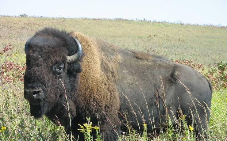
Where: Prairie State Park, Barton County in southwest Missouri
Distance: 4.25 miles
Difficulty: Easy
Hike time: 2 hours, 7 minutes
Features: This trail will lead hikers near East Drywood Creek, and toward wildlife views with bison, deer and a number of birds sometimes visible.
Sandstone Canyon Trail
Where: Don Robinson State Park, Jefferson County
Distance: 3.9 miles
Difficulty: Moderate
Hike time: Just under 3 hours
Features: Hikers will skirt the namesake canyon, and notice everything from "lush mesic bottoms to dry uplands," Missouri State Parks notes in its description; be prepared for elevation changes throughout.
Scour Trail
Where: Johnson's Shut-Ins State Park
Distance: 1.4 miles
Difficulty: Rugged
Hike time: 1 hour, 25 minutes
Features: The trail leads to a scour channel, or area in which water has washed away vegetation and soil, leaving a closer look at the foundational geology.
Tall Oaks Trail
Where: Crowder State Park, near Trenton
Distance: 2.9 miles
Difficulty: Rugged
Hike time: Just under 3 hours
Features: A remarkable gathering of trees, including sycamore, white oak, hickory, river birch, cottonwood and black walnut, Missouri State Parks says.
Three Creeks Conservation Area
Where: 5 miles south of Columbia
Distance: Several trails cut through the Three Creeks area. Among the most popular is the Turkey Creek Interpretative Trail, which runs about 2.9 miles.
Difficulty: Moderate, per AllTrails rating
Hike time: Just over an hour, according to AllTrails
Features: This trail offers a wonderful way to familiarize yourself with the wild personality of mid-Missouri.
Trail Through Time
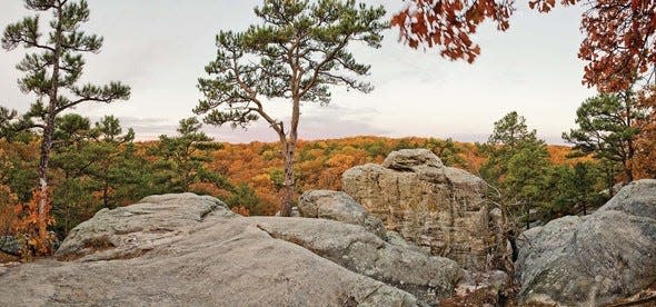
Where: Pickle Springs Natural Area near Farmington
Distance: About 2 miles
Difficulty: Moderate, according to an AllTrails rating
Hike time: Just under an hour, per AllTrails
Features: The trail "guides the visitor through 500 million-year-old geologic wonders carved in sandstone," according to Ste. Genevieve's tourism department.
West Ridge Trail
Where: Weston Bend State Park, Platte County
Distance: 1.25 miles
Difficulty: Rugged
Hike time: About an hour, 15 minutes
Features: You can see all the way to Kansas from this trail, Missouri State Parks notes, and encounter a variety of feathered friends.
Whispering Pines Trail
Where: Hawn State Park, Ste. Genevieve County
Distance: 9.5 miles
Difficulty: Rugged
Hike time: About 9 1/2 hours
Features: Whispering Pines features a diversity of landscape — from forests to rock formations — and wildlife and runs past Pickle Creek.
White Bison Loop
Where: Lone Elk Park, St. Louis County
Distance: About 3 miles, per AllTrails
Difficulty: Moderate to difficult, according to a St. Louis Post-Dispatch report.
Hike time: About an hour, 15 minutes, according to AllTrails
Features: Lone Elk Park is considered a wildlife management area, and its website notes the presence of bison, turkey, elk, deer and more.
Aarik Danielsen is the features and culture editor for the Tribune. Contact him at adanielsen@columbiatribune.com or by calling 573-815-1731. He's on Twitter/X @aarikdanielsen.
This article originally appeared on Columbia Daily Tribune: 23 unique Missouri hikes to enjoy all year round

