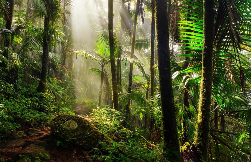
15 stunning landmarks that have been destroyed by extreme weather
Force of nature

Georg Ismar/DPA/PA Images
From flooding, forest fires and landslides, to hurricanes, dangerous waves and global warming, the weather has ruined some beautiful places in the world. Here are some parts of our planet that have fallen victim to severe weather.
Chacaltaya Glacier, Bolivia
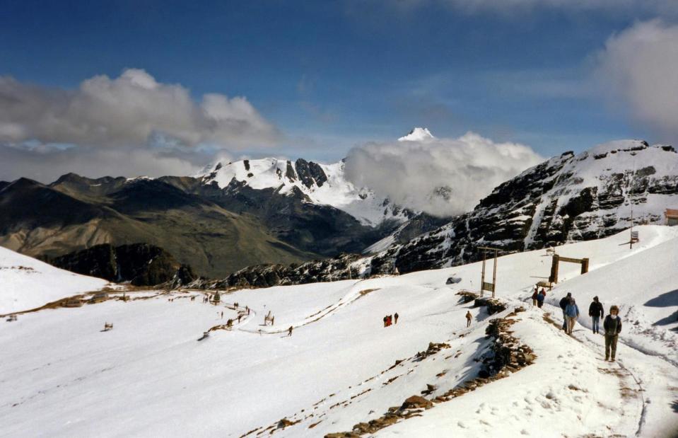
Bernard Gagnon/Wikimedia/CC BY-SA 3.0
Once the highest ski resort in the world, the notoriously tough Chacaltaya mountain lured daring skiers to take on its snowy slopes. The ancient glacier, which sits within it, spanned 0.085 square miles (0.22sq km) back in 1940 but rapidly decreased in size over the years until 2009, when it completely melted away.
Chacaltaya Glacier, Bolivia
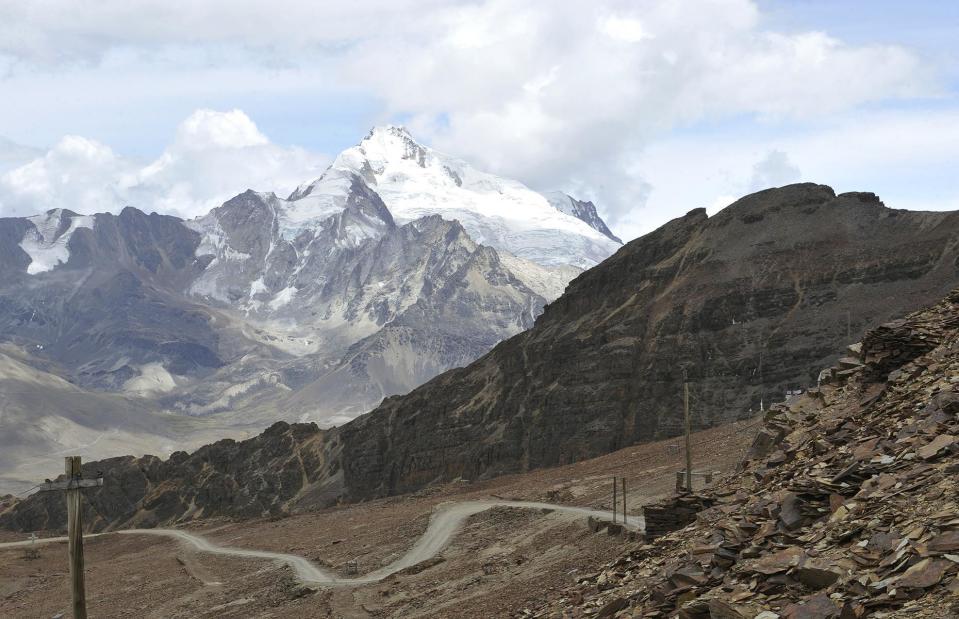
Aizar Raldes/AFP/Getty Images
In 1998, experts predicted the glacier would survive until 2015 but due to climate change, it melted six years earlier than estimated. This entire area was once covered in snow but now there are just a few patches of ice near its summit. The loss of the glacier has been a blow to the tourist industry in Chacaltaya, as well as threatening the local freshwater supply and the future use of hydropower which provides much of Bolivia's electricity.
The Bahamas
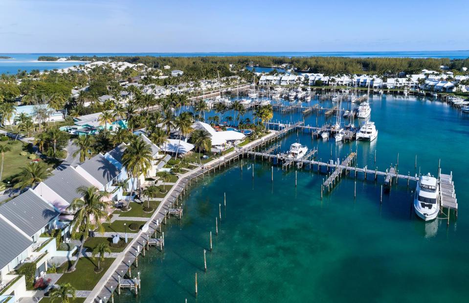
pics721/Shutterstock
Hurricane Dorian unleashed mass destruction across the Bahamas in September 2019 with current estimates placing the costs at billions of dollars. Entire neighborhoods were destroyed by the catastrophic rainfall, winds and storm surges that inundated the idyllic Caribbean archipelago. The Abaco Islands (including the resort Treasure Cay, pictured here before the storm) and Grand Bahama were hardest hit.
The Bahamas
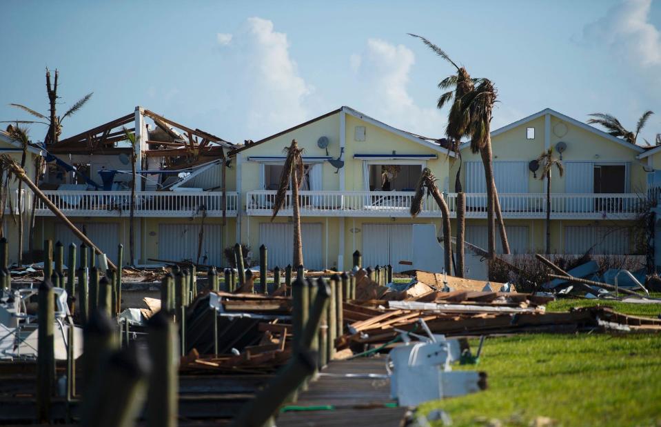
ANDREW CABALLERO-REYNOLDS/AFP/Getty Images
The death toll was at least 70 with many hundreds more people missing. The deadly 200-mile-per-hour winds and 24-foot (7.3m) storm surge severely damaged or destroyed around 45% of the homes on Grand Bahama and Abaco. Luxury resort Treasure Cay was completely devastated by the violent storm as winds ripped off roofs and tossed boats ashore. The UN estimates that 76,000 people were left homeless by the powerful Category 5 storm.
West Pier, Brighton, UK
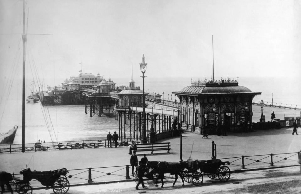
Francis Frith/Hulton Archive/Getty Images
Brighton’s West Pier opened to great fanfare in 1866 during the Victorian boom for beach vacations. An archetypal example of UK seaside architecture, the pier was added to over the years and at its prime featured a concert hall, funfair and tearoom. It was extremely popular in the late 19th and early 20th centuries and became a much-loved landmark on the Brighton seafront. The West Pier fell into financial decline in the 1960s, before closing in 1975 and falling into disrepair.
West Pier, Brighton, UK
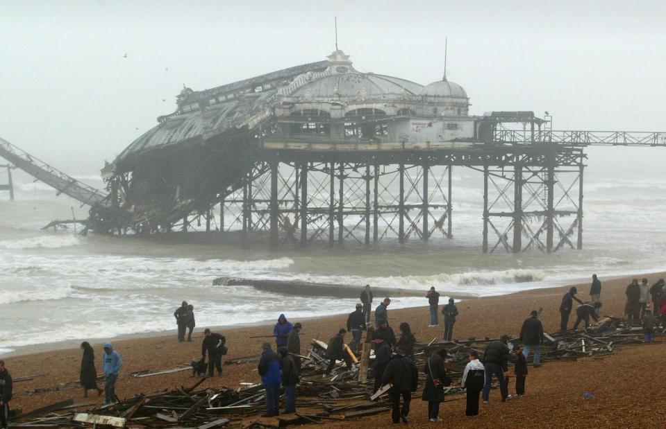
Mike Hewitt/Getty Images
After decades of being pounded by the waves, the crumbling structure succumbed to heavy seas and strong winds in 2002, which caused a walkway to collapse and felled part of the concert hall. The remains of the once iconic pier caught fire the following year, in a suspected act of arson. Part of the derelict Grade I-listed structure's eastern side crumbled into the sea in January 2013 following winter storms. However the evocative ruins remain a striking landmark on the seafront.
Old Man of the Mountain, New Hampshire, USA
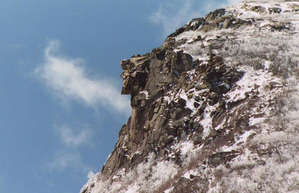
Ken Lund/Flickr/CC BY-SA 2.0
Seen from a distance, this piece of rock jutting out from Franconia Notch might not have looked like much. But when seen from the north, the rock once resembled the profile of an old man, with a clearly-defined forehead, nose, lips and chin. It became known as the Old Man of the Mountain, an iconic symbol in New Hampshire.
Old Man of the Mountain, New Hampshire, USA
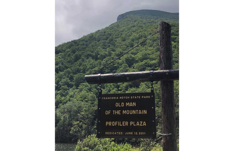
Dmoore5556/Wikimedia/CC BY-SA 4.0
After existing for an estimated 12,000 years, the poor Old Man fell off the mountain one fateful night in May 2003. Despite steps being taken to weatherproof the beloved rock formation since the 1920s (which was vulnerable due to freezing and thawing, opening fissures in the rock), the old man finally succumbed to natural causes. Local people mourned the loss of their mascot, creating a memorial in Profiler Plaza at the base of the mountain.
Otuquis National Park, Bolivia
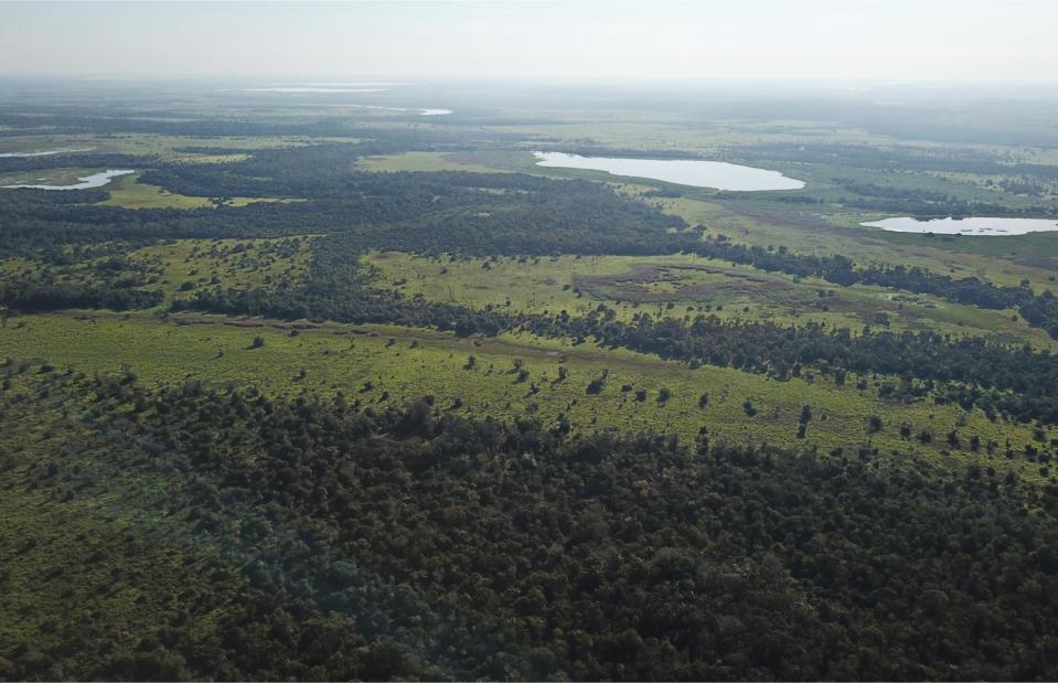
DEPLANQUE JOEL/Shutterstock
Remote and rich in wildlife, Bolivia’s little known Otuquis National Park is part of the Pantanal, the world’s largest wetland. Sat on the border with Paraguay, this incredible network of lagoons, wetlands and rivers is home to many rare species including ocelots, pumas, jaguars, caiman, anteaters, lizards and tapirs. Sadly, in 2019, dry weather and strong winds spread voracious wildfires and decimated great swathes of the precious nature preserve.
Otuquis National Park, Bolivia
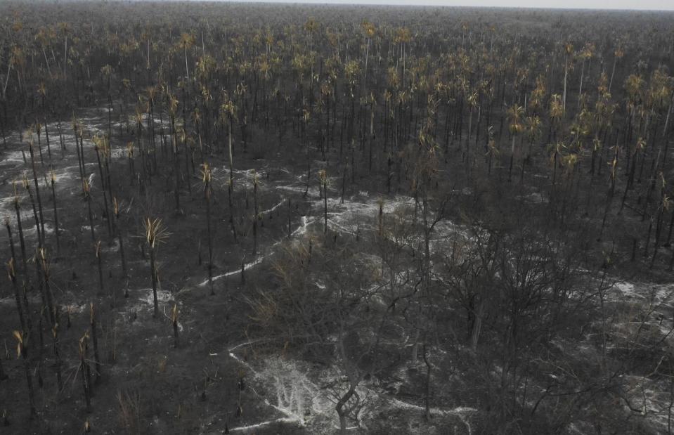
PABLO COZZAGLIO/AFP/Getty Images
The fires in Bolivia have devastated more than 1.7 million hectares (4.2 million acres) of land and killed scores of wildlife. While the government has attributed it to the hot, dry weather, environmentalists blame the government who enacted laws that encouraged the burning of forest and pasture land for agricultural production. It is one of a record number of fires that have consumed the Amazon region this year and devastated vast areas of the world’s largest tropical forest.
The Dolomites, Italy
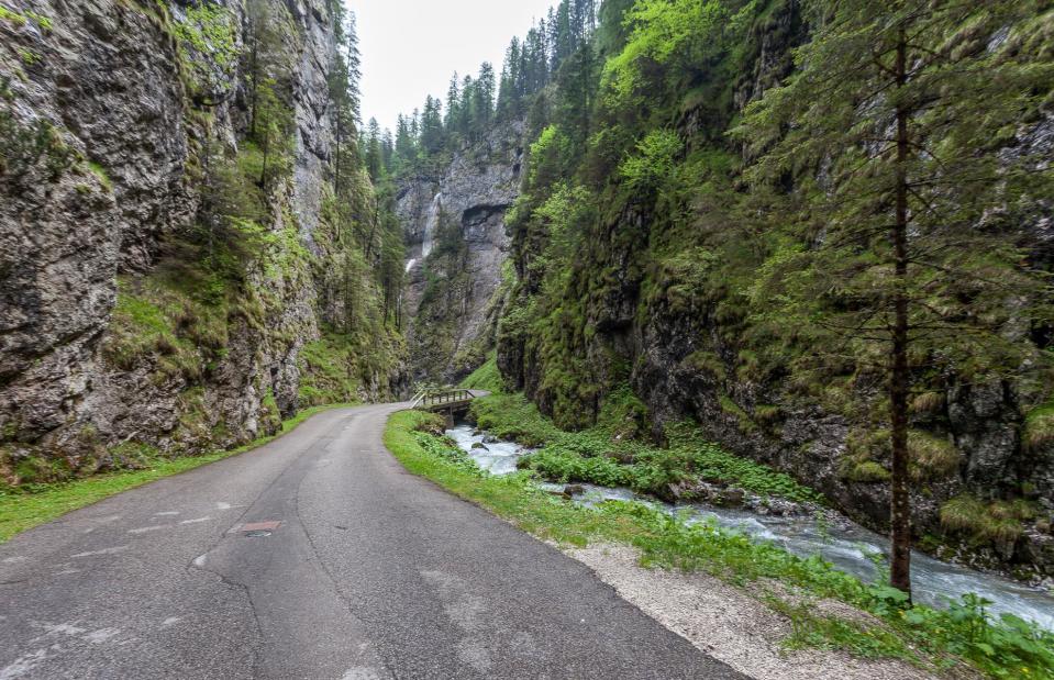
Gianluca Piccin/Shutterstock
Severe storms and winds up to 125mph ripped across parts of Italy's north and west in late 2018, killing at least 18 people, many by falling trees. The violent weather conditions caused catastrophic damage to ancient mountainside forests in the stunning Dolomites range, uprooting trees and snapping branches. The Serrai Di Sottoguda, one of the mountain range’s most scenic steep-sided canyons, was one place affected by the extreme weather.
The Dolomites, Italy
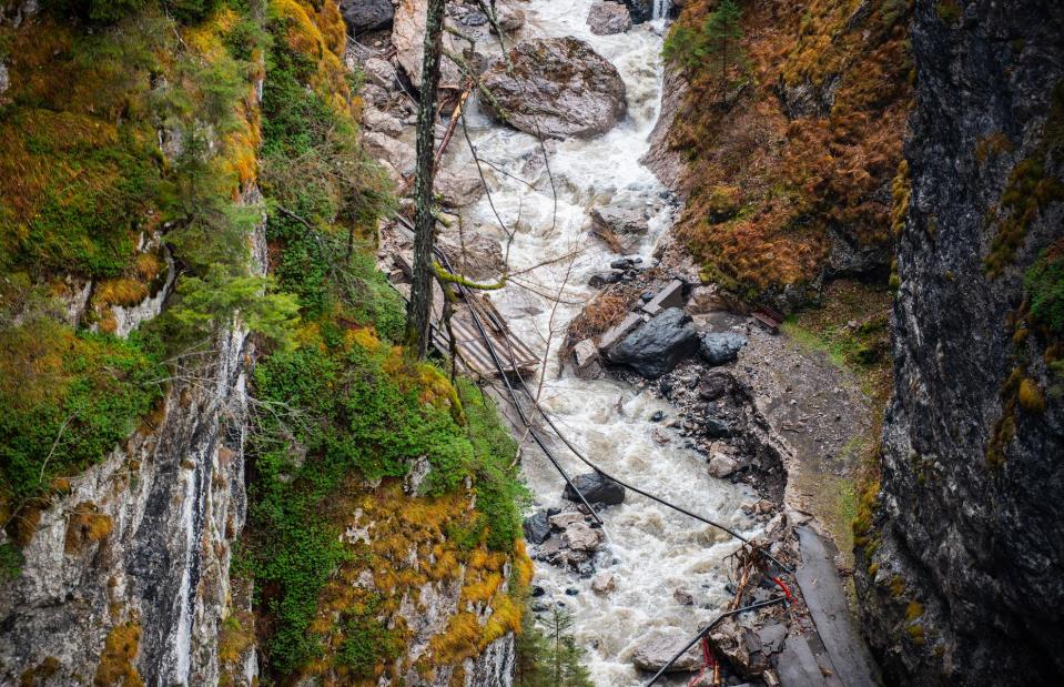
NurPhoto/NurPhoto/PA Images
The heavy rains and gales, which buffeted the Dolomites as well as other parts of Italy for five days, also caused mudslides and flooding. The narrow and winding road that follows the Pettorina river through the Sottoguda gorge, a popular tourist attraction, was totally demolished by the flooding (pictured). It is thought that around 14 million pine trees and red spruces were also razed by the storms.
Okjökull glacier, Iceland
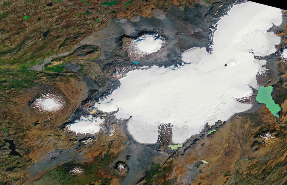
NASA
Renowned for its pristine and otherworldly icy landscapes, Iceland's topography is being dramatically affected by climate change. The Okjökull glacier (pictured by satellite here in 1986), on top of the Ok volcano in western Iceland, covered 6.2 square miles (16sq km) in 1890. By 2012, it measured just 0.2 square miles (0.7sq km), according to a report from the University of Iceland. The glacier was officially declared dead in 2014 – the first in the country to lose its status.
Okjökull glacier, Iceland
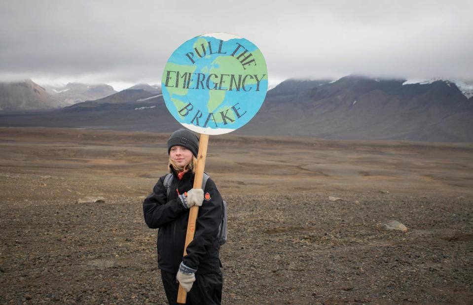
JEREMIE RICHARD/AFP/Getty Images
In 2019, the nation marked its loss with a ceremony to raise awareness about the effects of climate change. A bronze plaque was mounted on the now barren terrain titled “A letter to the future”. It reads: “In the next 200 years all our glaciers are expected to follow the same path. This monument is to acknowledge that we know what is happening and what needs to be done. Only you know if we did it.”
Porthcothan Bay, Cornwall, UK
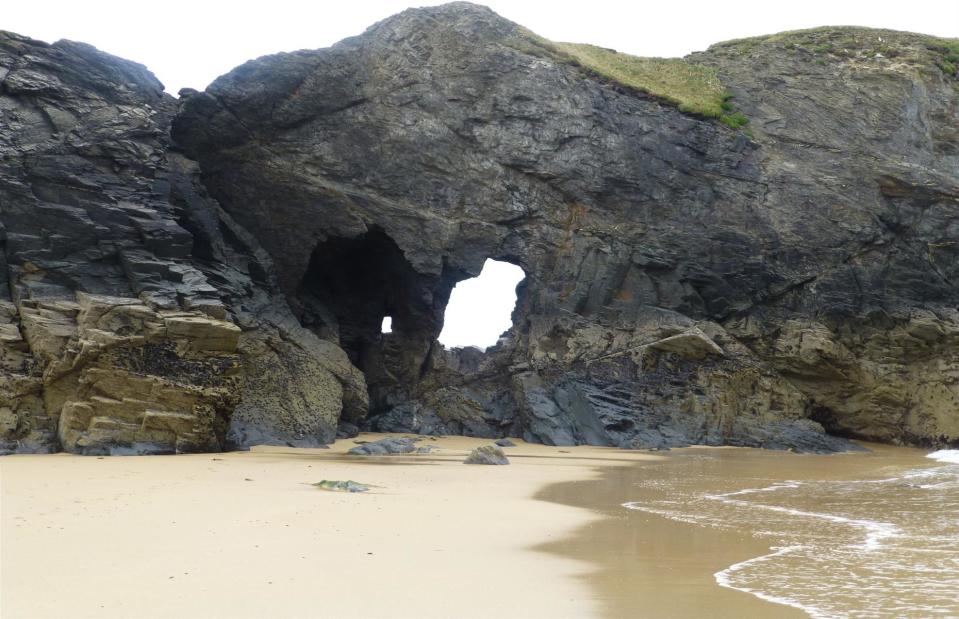
Andrew/Flickr/CC BY 2.0
This age-old rock arch in Porthcothan Bay, near Newquay in Cornwall, UK, was reduced to rubble after being battered by huge waves during a winter storm in January 2014. The surf beach’s famed stone archway, known locally as The Anchor or Jan Leverton's Rock, was a landmark on the Cornish coast but could not withstand the 30-foot (9m) waves and 70mph winds that battered it.
Porthcothan Bay, Cornwall, UK
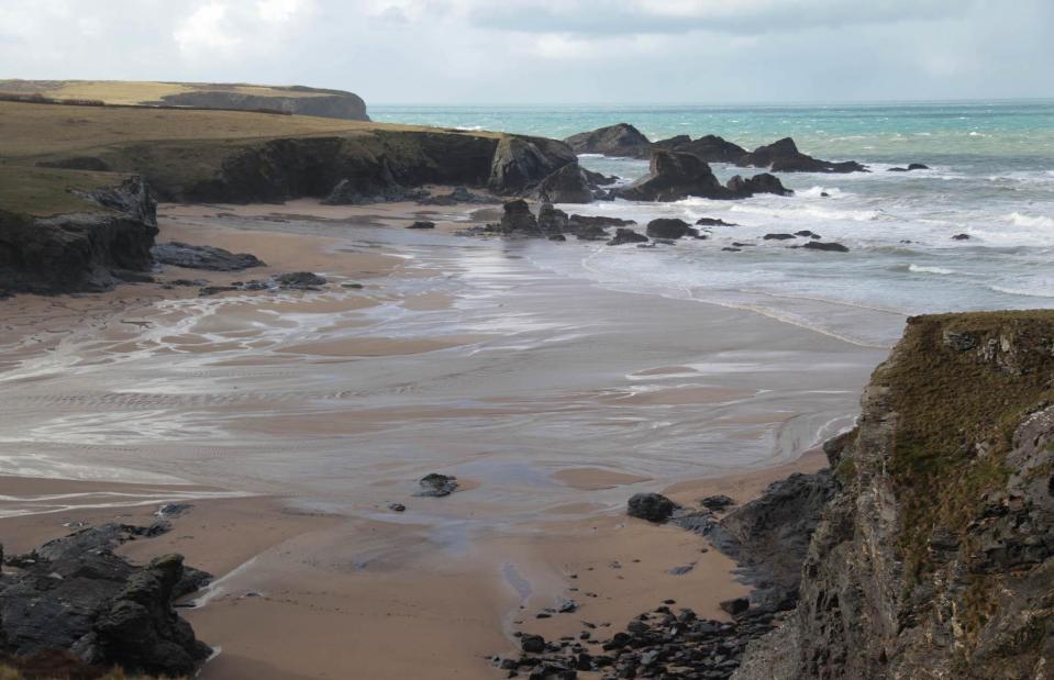
Keith Murray/Flickr/CC BY-NC-ND 2.0
The violent winter storms of 2014, some of the worst to hit Britain in decades, not only obliterated Porthcothan Bay’s natural arch but damaged other areas of the British coastline including parts of the UNESCO-listed Jurassic Coast in Dorset. Sections of Chesil Beach were lost and the 150-million-year-old Pom Pom Rock, a stack formation on the southern edge of Portland, also collapsed during the bad weather.
Glacier National Park, Montana, USA
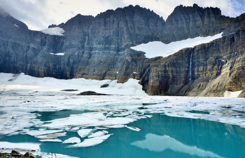
Alexey Kamenskiy/Shutterstock
Characterized by its towering granite peaks and glaciers, the landscape of Glacier National Park in northern Montana’s Rocky Mountains was shaped by glacial forces over millions of years. However, as temperatures continue to rise, its glaciers are dwindling. Of the 150 glaciers that existed in the park in the late 19th century, only 26 now remain.
Glacier National Park, Montana, USA
Jen-nifer/Shutterstock
The warmer winters are bringing more rain, rather than glacier-forming snow, to Montana and other parts of North America. In 2017, the US Geological Survey published an analysis of Montana's glaciers using aerial and satellite imagery stretching back to 1966. It revealed that all glaciers had reduced in area since 1966 with some glaciers having been reduced by as much as 85% by 2015. Scientists estimate that its glaciers will disappear entirely if current climate patterns persist.
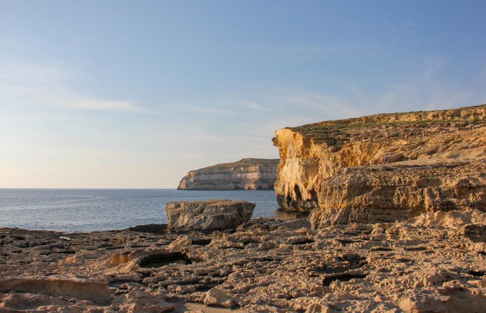
Azure window, Malta
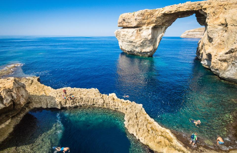
View Apart/Shutterstock
A limestone arch known as the Azure Window was one of Malta’s top tourist spots and featured in numerous films and TV series such as Game of Thrones. The spectacular sea arch, near Dwejra Bay on the gorgeous island of Gozo, was shaped by centuries of natural coastal erosion.
Azure window, Malta
Indegerd9/Shutterstock
Sadly in March 2017, heavy storms hit the Maltese archipelago and the striking rock formation, also known as known as Tieqa tad-Dwejra, collapsed dramatically into the rough seas. The rock still usually draws tourists who now come to scuba dive to see its submerged boulders beneath the waves.
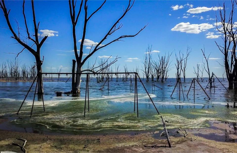
Lake Poopó, Bolivia
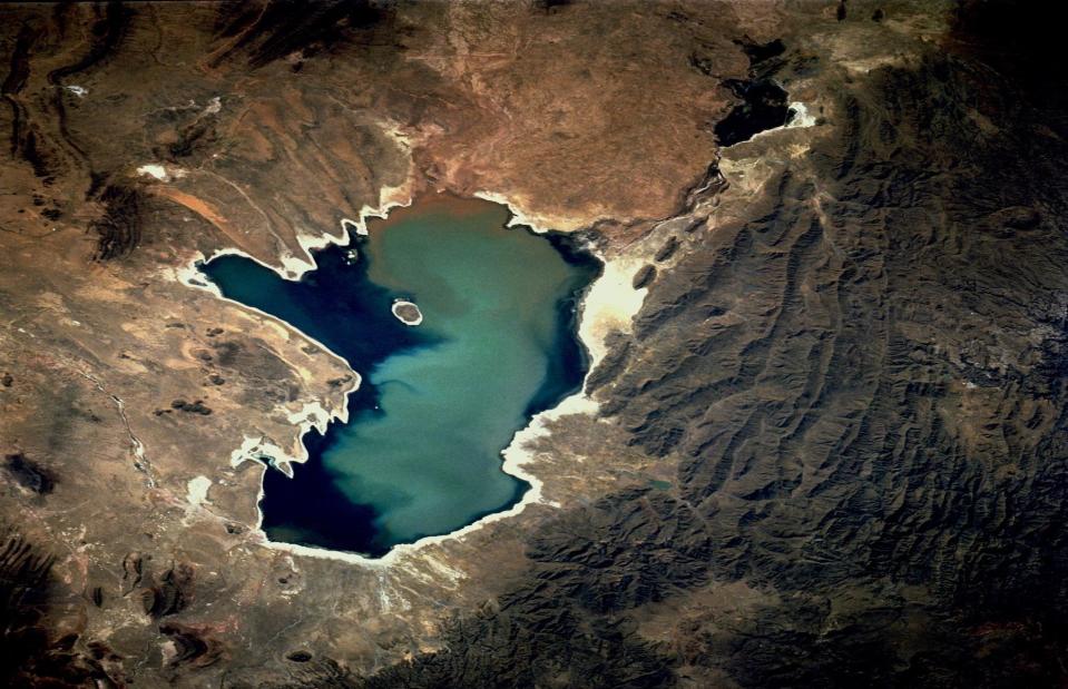
NASA Johnson/Flickr/CC BY-NC 2.0
Set high in the Altiplano Mountains in southwest Bolivia, Lake Poopó was once the country’s second largest lake. It sustained fishing communities and numerous species of birds, mammals and fish including three species of flamingos. However, due to a range of environmental factors, including increasingly dry weather and rising temperatures, the saline lake dried up in 2015 and is now a stark salt flat.
Lake Poopó, Bolivia
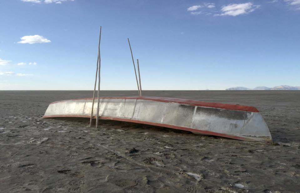
Georg Ismar/DPA/PA Images
In 2014 and 2015, the ever-shrinking lake’s temperature rose dramatically, causing a mass death of its fish. While climate change played a significant role in the high-altitude lake’s disappearance, its rapid and dramatic recession has also been widely attributed to misuse of the lake’s water supply. Upstream water diversions, including some from its prime source the Desaguadero River, for agriculture and mining are also why this once vast lake has transformed into a dry and barren place.
Stockton Beach, New South Wales, Australia
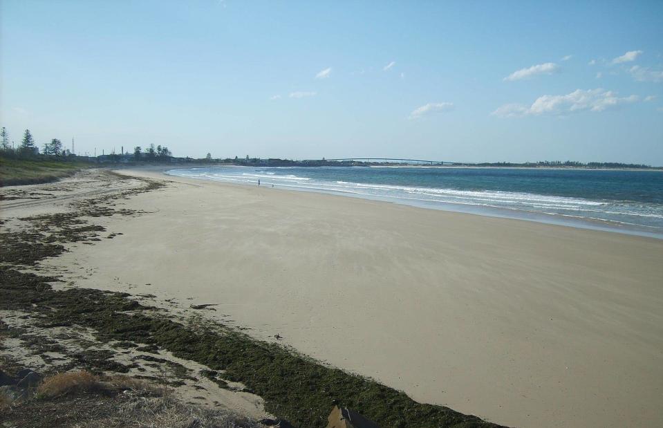
AussieLegend/Wikimedia/Public Domain
Community life centered around the lovely sandy beach of Stockton near Newcastle in New South Wales, Australia but intense coastal erosion and recent heavy seas have changed the face of the coastal town forever. Strong waves and big swells saw the beach’s sand completely swept away in September 2019, leaving just bare rocks.
Stockton Beach, New South Wales, Australia
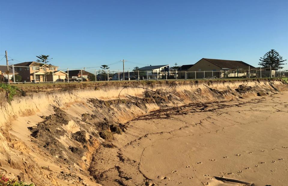
Save Stockton Beach/Facebook
The ruined beach has now been closed indefinitely after forceful weather battered the coast and left dangerous drops. The seabed at Stockton has apparently dropped more than 23 feet (7m) over the past century, causing significant damage to the area’s marine life habitat. A resident campaign group says the dramatic erosion has been escalated by the infrastructure at the Port of Newcastle which has affected wave patterns and stopped replacement sand from coming onto the beach.
Tropical forests of Puerto Rico
Dennis van de Water/Shutterstock
Puerto Rico is known for its beautiful beaches and lush forested hills. However, when Hurricane Maria barreled across the island in September 2017, it not only caused deaths and damage to infrastructure but it also transformed the natural landscape. With winds of up to 155 miles per hour and intense rain, Maria was the strongest storm to ever hit Puerto Rico. The stunning El Yunque National Forest (pictured) in the northeast, the USA’s only rainforest, took a big hit.
Tropical forests of Puerto Rico
Joe Raedle/Getty Images
Vast swathes of the forest were stripped of their leaves and uprooted. A NASA research team found that 40% to 60% of the tall trees that formed the canopy of the forests either lost large branches, were snapped in half or were uprooted. Doug Morton, an ecologist at NASA’s Goddard Space Flight Center, said: “The island lost so many large trees that forests were shortened by one-third. We basically saw 60 years’ worth of natural treefall disturbances happen in one day.”
London Bridge, Victoria, Australia
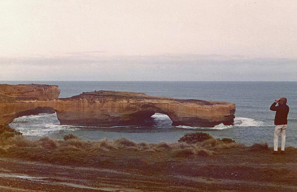
gjee/Shutterstock
The London Arch is one of many striking rock formations that can be seen along the sweep of Australia's magnificent Great Ocean Road. However, the much-photographed landmark used to be known as London Bridge until the rock connecting it to the mainland collapsed into the Southern Ocean in 1990. Two terrified tourists were left stranded on the remaining stack as the strong waves lashed below until they were rescued by helicopter hours later. It's now known as the London Arch.
London Bridge, Victoria, Australia
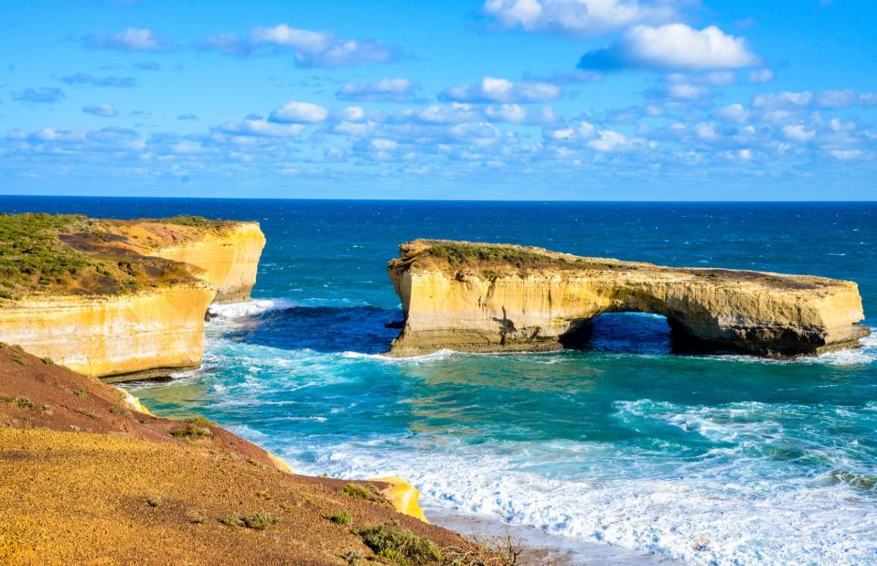
Philiphist/Wikimedia/CC BY 3.0
The natural arch in the Port Campbell National Park remains a popular tourist spot, although it's now appreciated from afar. The waves have carved out unique formations all along the limestone and sandstone coastline and continue to do so. It's something which onlookers were powerfully reminded of in 2005 when one of its most famous rock formations, the Twelve Apostles, succumbed to erosion. One of the nine giant limestone pillars collapsed into the sea as tourists looked on.
Villa Epecuén, Argentina

Wikimedia/Public Domain
Set on the banks of the Lake Epecuén, Villa Epecuén was a popular spa town in the Buenos Aires province, drawing tourists to soak in its mineral-rich waters. However, a sinister fate was to befall the lakeside resort in November 1985 after torrential downpours caused a major flood.
Villa Epecuén, Argentina
Anibal6226/Shutterstock
The heavy rainstorm came on the back of years of wet winters that caused the lake to overflow its banks and inundate the town. Incredibly no one died, but the entire community evacuated and Villa Epecuén vanished beneath the deluge for 25 years. The water began to recede in 2007 after a period of dry weather and now the eerie remains of Villa Epecuén are a tourist destination once again, albeit a more sinister one.
Now discover the world's landmarks under threat from climate change

