11 of the most forbidden places on Earth
No-go zones
Dmitry V. Petrenko/Shutterstock
It's thought the phrase 'no man's land' was coined in the 11th century in the UK and was originally used to describe unloved patches of land outside of city walls. More than 800 years on, the term is still relevant for no-go areas – sections of land where people dare not tread – still existing all over the world. Many are the result of conflict and political disputes but some are simply quirks of geography.
We take a look at taboo territories across the globe.
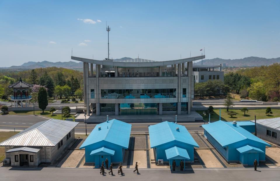
DMZ, North and South Korea
JNEZAM/Shutterstock
Dividing the Korean peninsula, the Korean Demilitarised Zone (DMZ) was established after the Korean War in 1953 to serve as a buffer between those loyal to the northern or southern leaderships. Stretching 160 miles (257km) and measuring on average 2.5 miles (4km) in width, the DMZ is one of the world's most heavily militarised borders. However, it isn't just a political barrier.
DMZ, North and South Korea
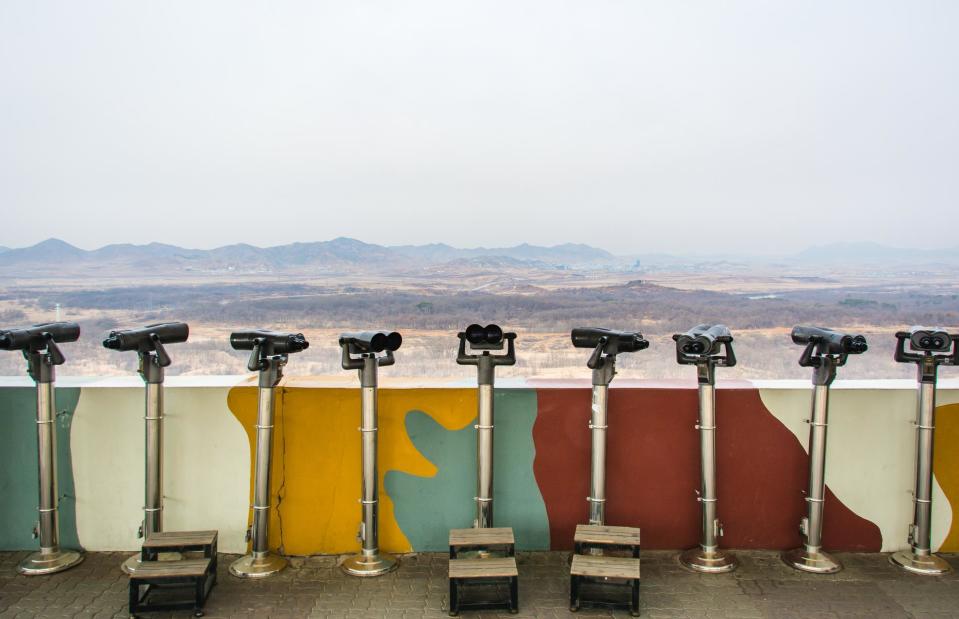
Panu Kosonen/Shutterstock
Albeit a no-go area, the DMZ is also a tourist magnet. More than 1.2 million visitors are usually welcomed every year (typically via Seoul) to see barbed wire fences, infiltration tunnels and catch a glimpse of Kim Jong-un's hermit kingdom in the north through binoculars.
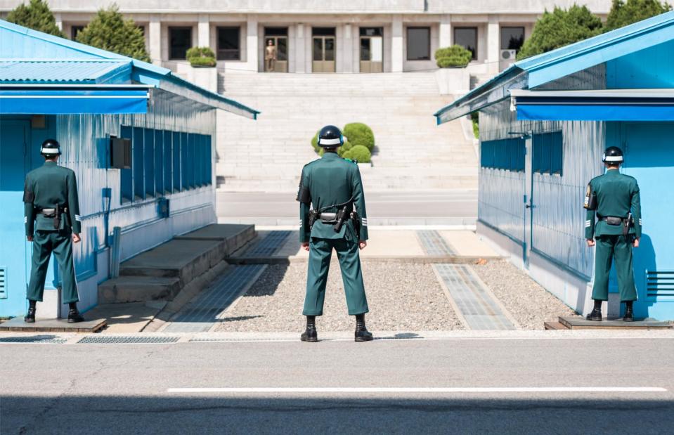
DMZ, North and South Korea
mbrand85/Shutterstock
The most well-known site of the DMZ and the closest point to North Korea, is the JSA (Joint Security Area, pictured). Here, soldiers from both countries face each other with only a few feet of gravel in between, always ready to act in case of an emergency. In the JSA, negotiations between North and South Korea are held, with no negotiator having to leave their country, because the border runs right through the center of the building and even the table the delegates sit around.
DMZ, North and South Korea
Courtney Kinger/Shutterstock
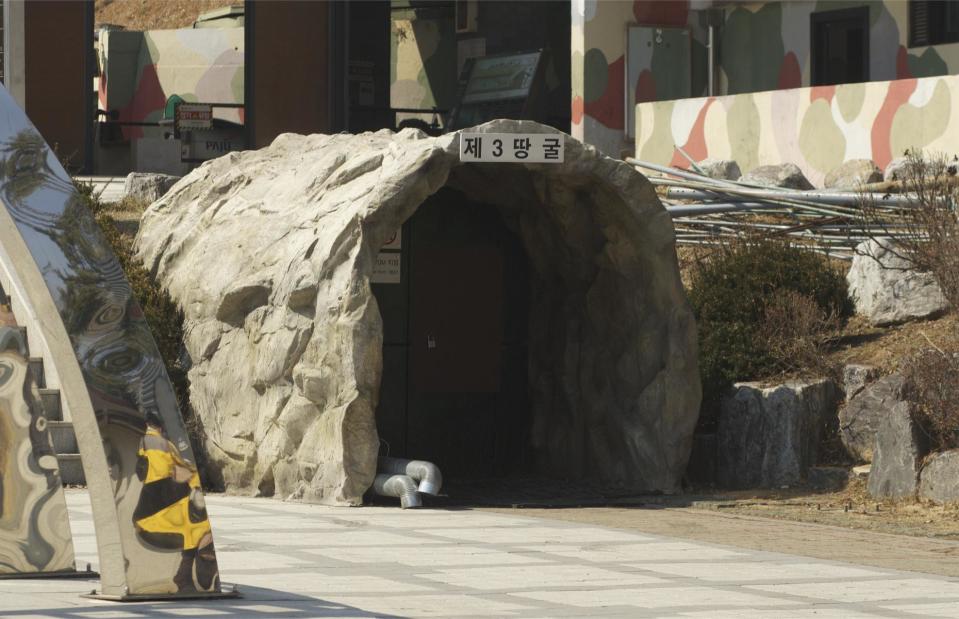
On guided tours, tourists are taken to the infiltration tunnels (pictured) that were dug through the ground to South Korean territory. Four passages have been discovered since the 1970s and when challenged, North Korean officials claimed they were for coal mining. They even painted the walls black in an effort to convince their South Korean counterparts coal was present.
DMZ, North and South Korea
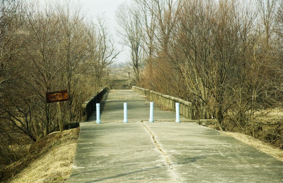
Amy Nichole Harris/Shutterstock
This bridge in the DMZ has been untouched for decades and was used for prisoner exchanges until 1968. Dubbed the 'Bridge of No Return', war prisoners were given an ultimatum to either remain in the country of captivity or cross the bridge to return to their homeland. Once across the bridge, however, there was no return allowed.
DMZ, North and South Korea
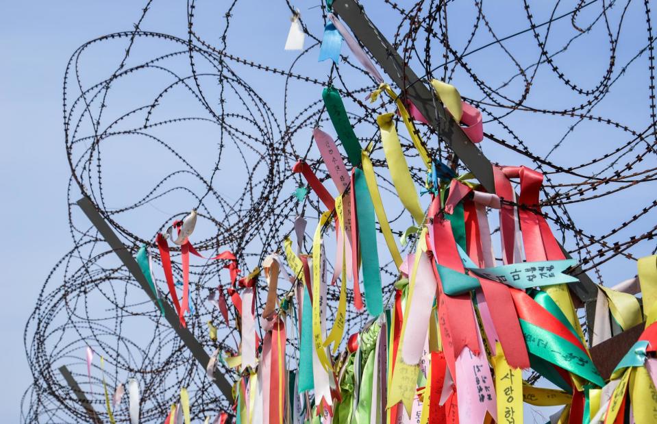
Jerker Larsson/Shutterstock
Civilians tie prayer ribbons to fences near the DMZ and hopes for peace and family reunifications on the Korean peninsula are persistent.
Area 51, Nevada, USA
CloudOnePhoto/Shutterstock
Situated in the middle of the Nevada desert, this US Air Force facility has long been kept a secret and there are many conspiracy theories and mysteries linked to it. Restricted Area 51 – also officially referred to as Groom Lake – is a military site used for flight testing.
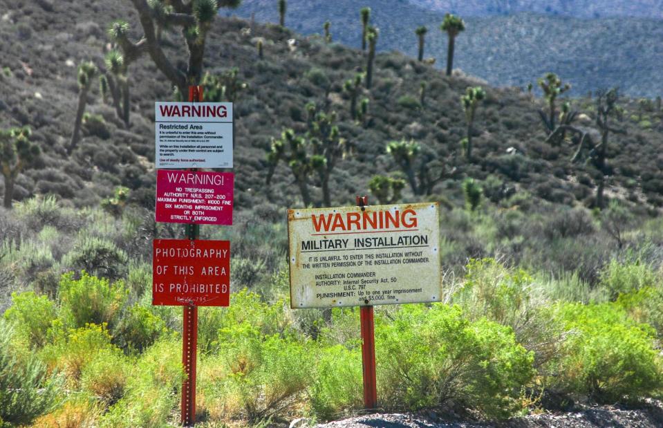
Area 51, Nevada, USA
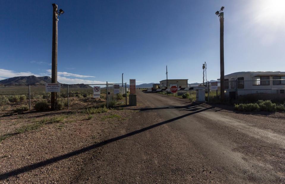
Ric LaFollette/Shutterstock
A dusty road leads to the front gate of the guarded military base. Conspiracy theorists believe that the remains of a crashed UFO are stored at Area 51 and alien technology is examined by government scientists. Others are even convinced that the Moon landing in 1969 was filmed here.
Area 51, Nevada, USA
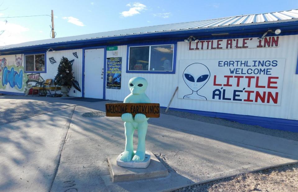
Jimmy Emerson/flickr/CC BY-NC-ND 2.0
The small nearby town of Rachel on the so-called 'Extraterrestrial Highway' is a key tourist attraction. A popular stopover among UFO hunters is the alien-themed restaurant Little A'Le'Inn (pictured).
Area 51, Nevada, USA
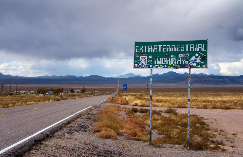
Nick Fox/Shutterstock
No wonder the state of Nevada officially named the State Route 375, the 'Extraterrestrial Highway' in 1996. Along the road, travelers have reported UFO sightings and alien activity, and for decades have met at a mailbox – 12 miles (19km) from Area 51 – to discuss them.
Area 51, Nevada, USA
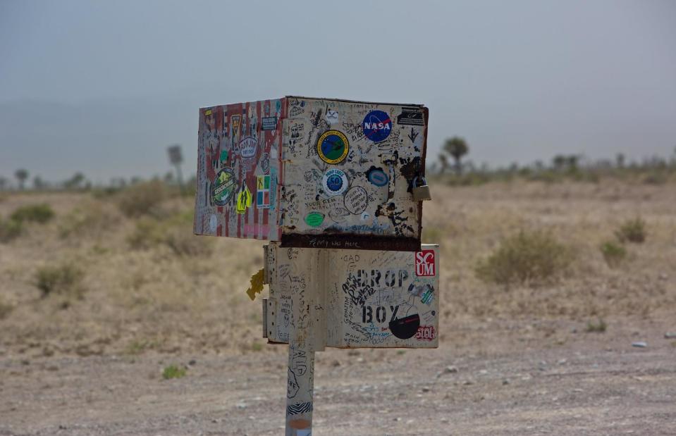
Craig Mirkin/flickr/CC BY-SA 2.0
Called the black mailbox (it was originally painted black), it belongs to Steve Medlin who lives on a nearby ranch. It is the only landmark for 40 miles (64km) on the highway and has become a handy meeting point for UFO seekers on dark nights, many of whom have filled the mailbox with letters to visitors from other worlds, much to the frustration of its owner. It was for that reason Medlin added the Alien mailbox beneath, so people would stop messing with his post.
Gruinard Island, Inner Hebrides, Scotland, UK
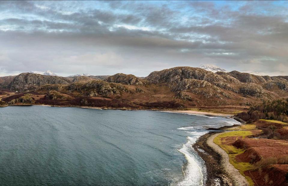
Robertsonpr/Shutterstock
This might look like a stunning spot but you probably wouldn't want to visit. Gruinard Island was used by the British armed forces to test anthrax as a potential weapon in the 1940s. While the island has since been decontaminated, for many years it was under government control. It was repurchased in the 1990s by the original owners, but currently isn't populated.
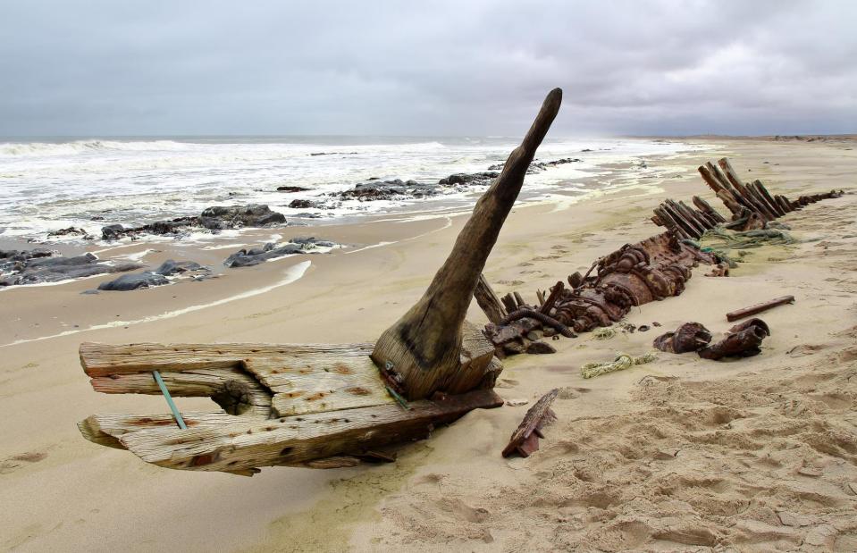
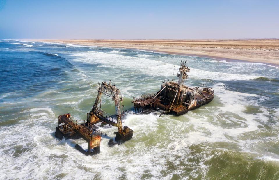
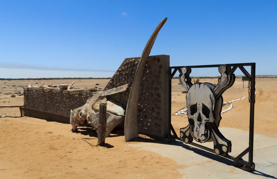
Skeleton Coast, Namibia
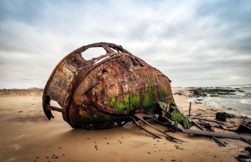
Lukas Bischoff Photograph/Shutterstock
This no man's land located along the Atlantic coast of Namibia has been given many names – all describing its inhospitable and deadly nature. While the native Namibians called it 'The Land God Made in Anger' and Portuguese sailors, 'The Gates of Hell', the extreme piece of land is now mostly referred to as the Skeleton Coast. Whale skeletons are scattered all over the area alongside numerous rusty shipwrecks.
Skeleton Coast, Namibia
giannimarchetti/Shutterstock
The old wrecks are reminders of how many shipwrecked sailors have lost their lives to the coast. Once stranded, the only way out was by walking hundreds of miles through a hot and arid desert – and it was impossible to survive.
Skeleton Coast, Namibia
Lukas Bischoff Photograph/Shutterstock
The unpredictable currents in the waters off Skeleton Coast, stormy winds and dense ocean fogs make this place impossible to inhabit. Oh, and did we mention the 11 types of shark circling the waters offshore?
Skeleton Coast, Namibia
elleon/Shutterstock
Brave tourists can usually visit the 6,200 square miles (16,000sqkm) of Skeleton Coast National Park and marvel at the shipwrecks and skeletons, as well as the dramatic sand dunes of the desert.
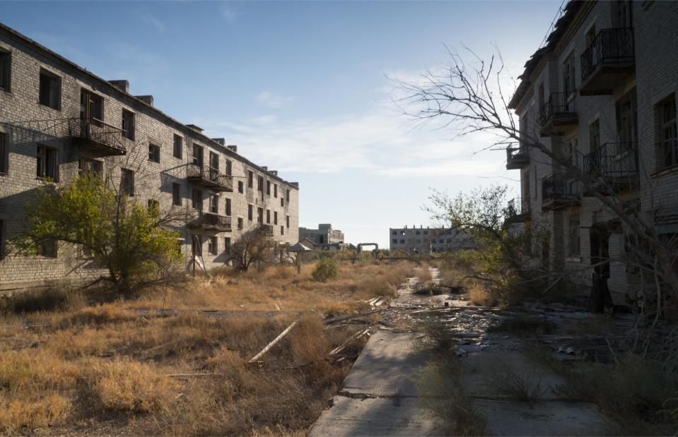
Kantubek, Vozrozhdeniya Island, Uzbekistan
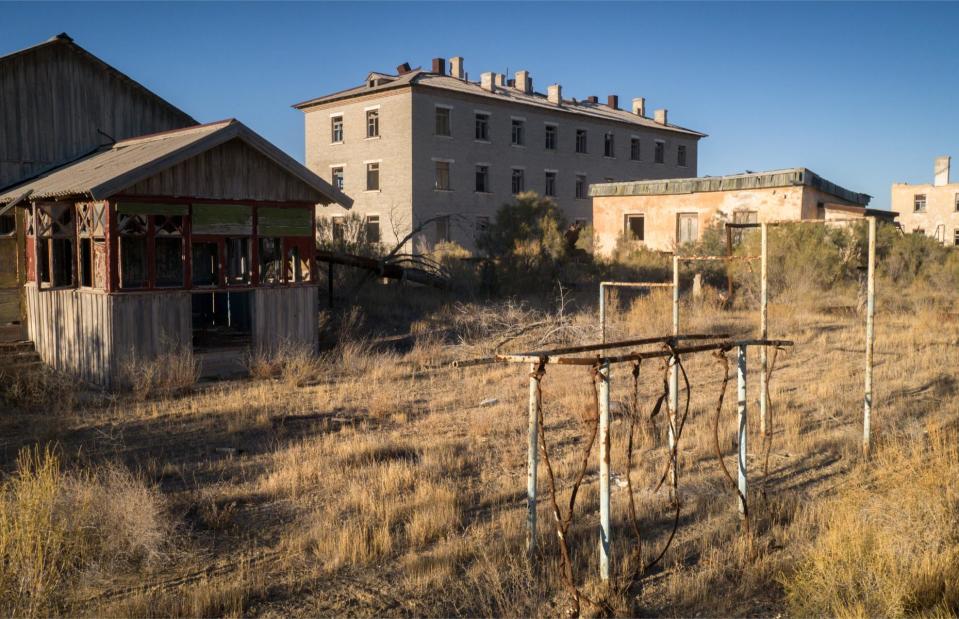
Constantine Vladimirovich/Shutterstock
Lying in ruins, the ghost town of Kantubek on Vozrozhdeniya Island in the Aral Sea once housed Soviet scientists for top-secret biological weapon research. Experiments were carried out for several decades until the collapse of the Soviet Union in 1991.
Kantubek, Vozrozhdeniya Island, Uzbekistan
Constantine Vladimirovich/Shutterstock
Explosions of shells with anthrax, plague and other biological agents took place in the southern part of Vozrozhdeniya. In 1971 an accidental release of smallpox from the island infected ten people, of whom three died. Tests have also caused widespread deaths of animals living in the Aral Sea.
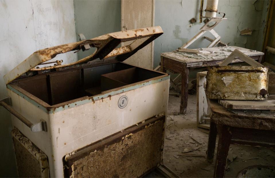
Kantubek, Vozrozhdeniya Island, Uzbekistan
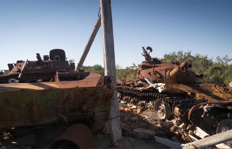
Constantine Vladimirovich/Shutterstock
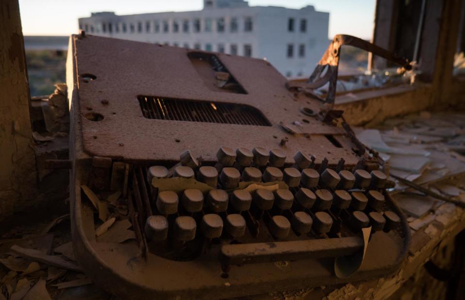
The civil and military infrastructure was abandoned after the evacuation of the island in 1991. However, many containers of the biological agents were left and have now developed leaks.
Kantubek, Vozrozhdeniya Island, Uzbekistan
Constantine Vladimirovich/Shutterstock
In 2002, an American biochemical expedition came to neutralise the dumping grounds on the island, which were believed to be the world's largest for anthrax. Within three months, 100 to 200 tonnes of the dangerous disease agent were decontaminated.
Kantubek, Vozrozhdeniya Island, Uzbekistan
Constantine Vladimirovich/Shutterstock
Despite the measures to disinfect the area, the burial grounds are still a dangerous place. Viruses could contaminate animals that could then spread the deadly diseases, making this one of the world's most untouched no-go areas.
Ilha da Queimada Grande, Brazil
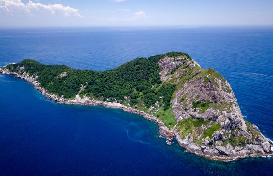
Leo Francini/Shutterstock
At first glance, this island off the coast of Brazil seems like the perfect escape with its crystal blue waters, lush vegetation and rocky expanse. However, there is a reason it's a no man's land...
Ilha da Queimada Grande, Brazil
Nayeryouakim/Wikimedia Commons/CC BY-SA 4.0
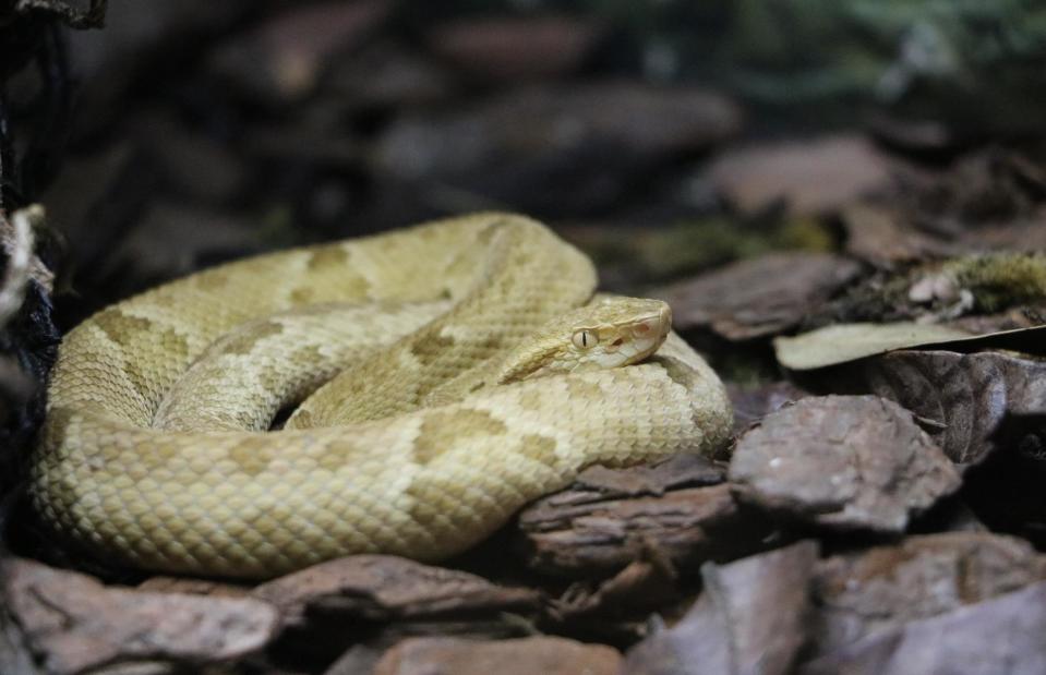
Aptly nicknamed 'Snake Island', the Ilha da Queimada Grande is home to around 4,000 venomous vipers – that amounts to approximately one snake per 10 square feet (1sqm). The bite of the golden lancehead (or Bothrops insularis), that can only be found here, is deadly. The Brazilian government has therefore banned visitors from the island. Only the navy is allowed to access it.
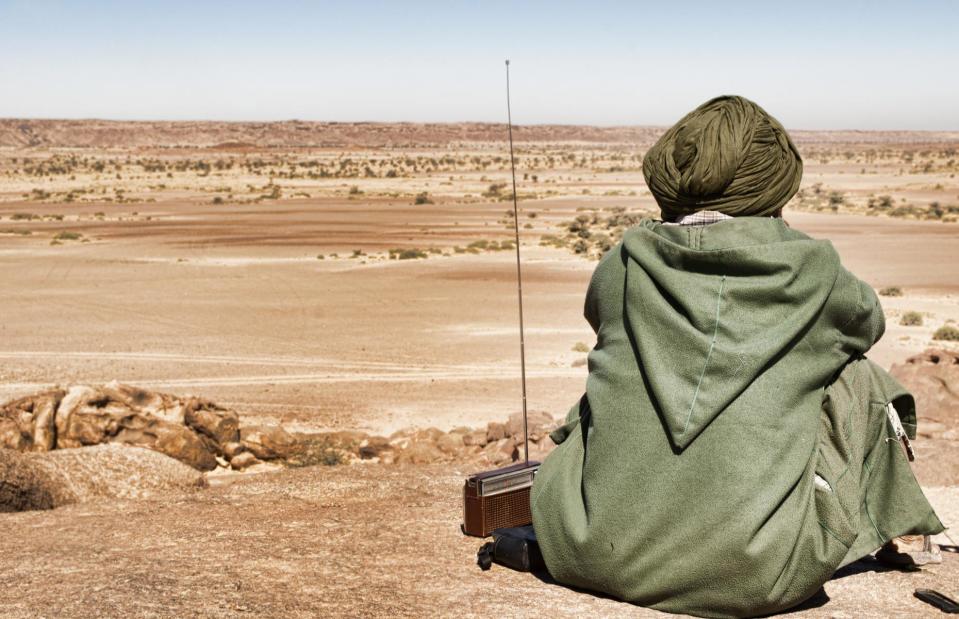
Western Sahara
SAHARALAND/Shutterstock
A no man's land of a different kind, Western Sahara is a disputed territory in northwest Africa. It is partially controlled by the nationalist movement Polisario Front, who fight for an independent state, the Sahrawi Arab Democratic Republic and partially occupied by Morocco. Its legal status remains unsolved and the UN requests that a referendum is held.
Western Sahara
UN Photo/Martine Perret/flickr/CC BY-NC-ND 2.0
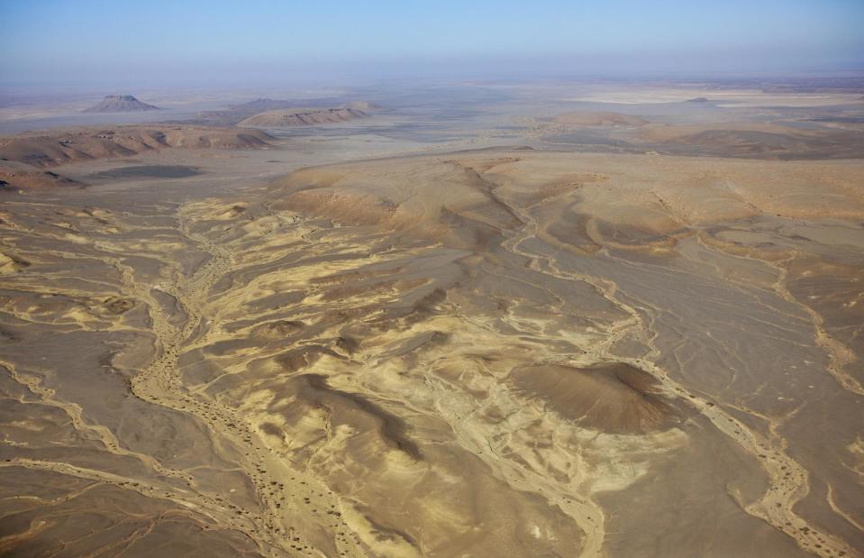
One of the most sparsely populated territories in the world, Western Sahara has just over 500,000 inhabitants and consists mainly of desert. Yet its land mass is larger than the UK.
Western Sahara
David Stanley/flickr/CC BY 2.0
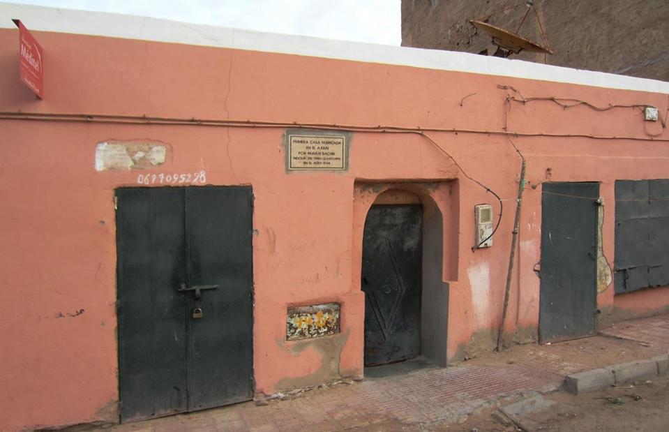
Almost half of that number live in its largest city Laayoune (about 200,000 inhabitants), which is administered by Morocco and is under the supervision of UN peacekeepers. This house is said to be the oldest, dating back to 1934.
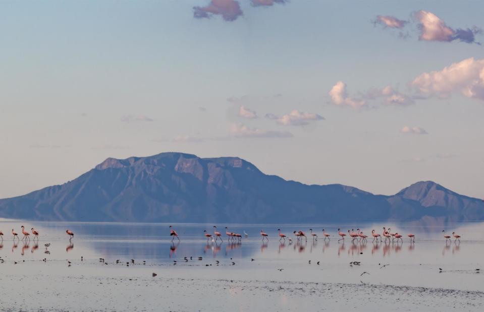
Lake Natron, Tanzania
mathiasmoeller/Shutterstock
Flamingos and the nearby Ol Doinyo Lengai mountain make this lake in Tanzania's Gregory Rift look like an idyllic spot. However, Lake Natron is a very dangerous place for a swim.
Lake Natron, Tanzania
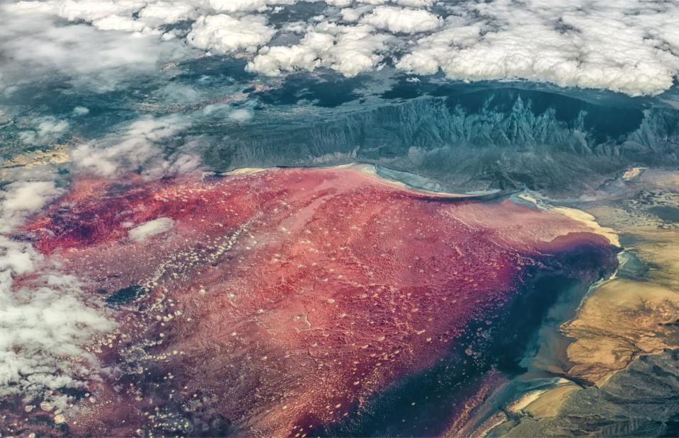
Bildagentur Zoonar GmbH/Shutterstock
With a pH of up to 12, the water of Lake Natron is so salty that it can calcify bodies, turning them into stone. It burns the skin and eyes of animals and humans that are not adapted to it. The alkalinity comes from the sodium carbonate and other minerals from the surrounding hills.
Lake Natron, Tanzania
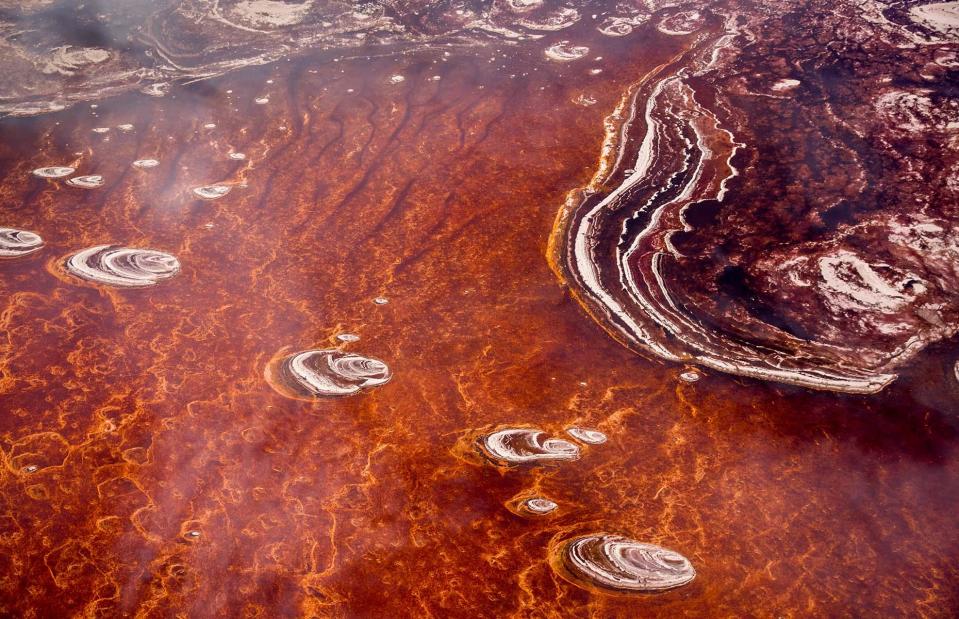
Danita Delimont/Shutterstock
The water temperature can reach up to 60°C (140°F), which in addition to the alkaline water, makes the lake inhospitable to many species. However, some flamingos, algae, and in the lake's less salty margins even some fish, have made the 405-square-mile (1,048sqkm) expanse of water their home.
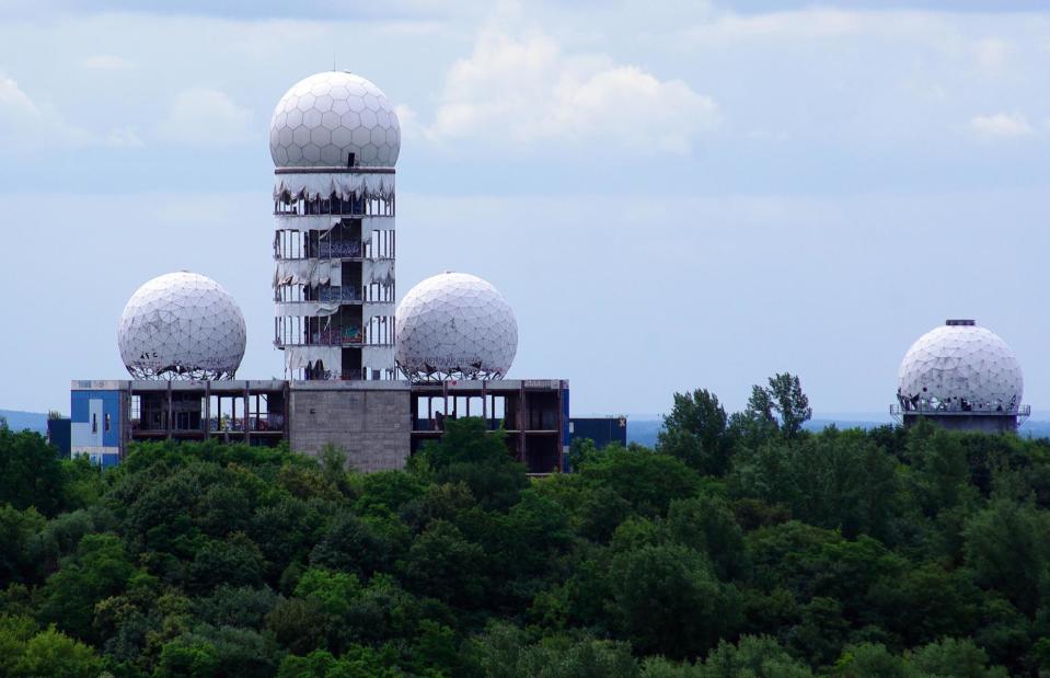
Teufelsberg, Berlin, Germany
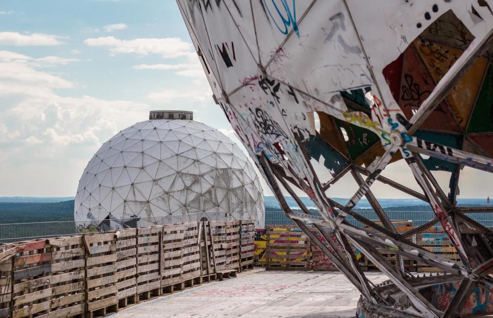
hanohiki/Shutterstock
These derelict domes once formed the antenna of a listening station run by the USA's National Security Agency (NSA), in Berlin. Hidden on an artificial hill called Teufelsberg in the forested Grunewald, American agents used the station to spy on the Soviets during the Cold War. Since the late 1990s, when the site was left to decay, time seems to have stood still.
Teufelsberg, Berlin, Germany
OlliFoolish/Shutterstock
The four mysterious radomes of Teufelsberg seem to be a bit out of place. Little is known about what exactly was listened to and what methods were used.
Teufelsberg, Berlin, Germany
hanohiki/Shutterstock
The abandoned buildings have become a popular canvas for street artists and many of the walls are covered with graffiti. Tourists can visit the now privately owned site and explore the towers and 'art gallery' of the former field station.
Teufelsberg, Berlin, Germany
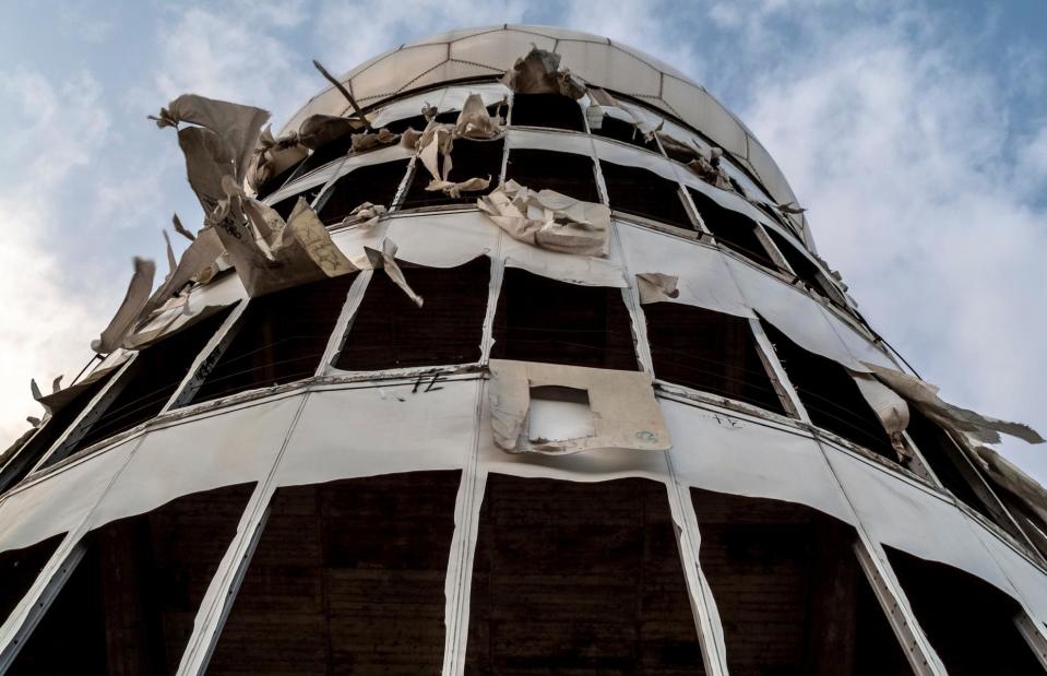
Jay-Dee/Shutterstock
The buildings now have uneven surfaces, broken glass and debris is scattered around. Climbing up inside the towers is only for the very brave as it involves ascending the stairs in total darkness.
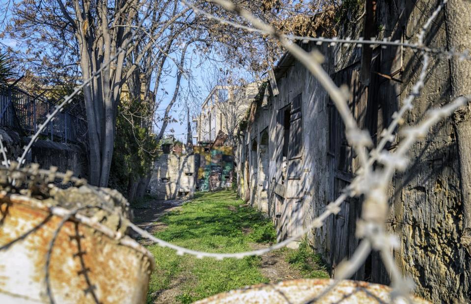
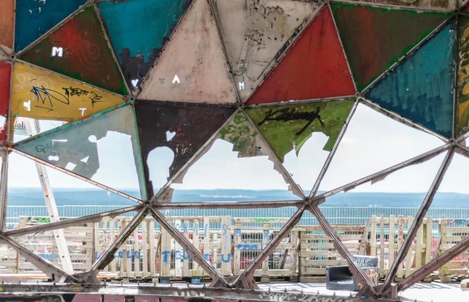
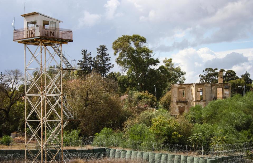
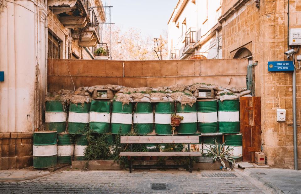
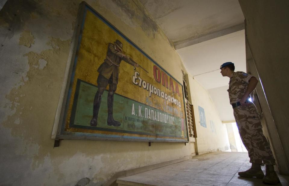
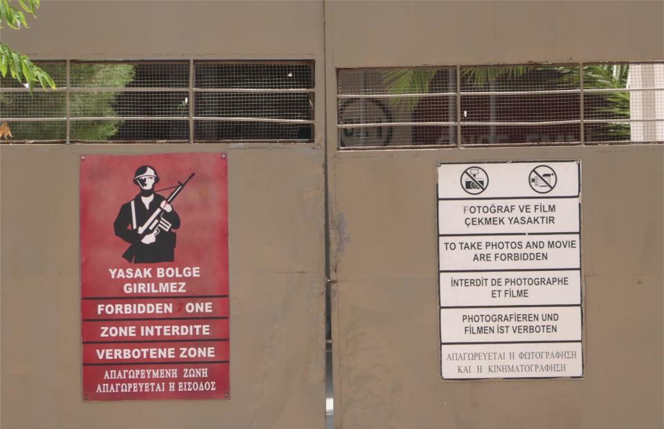
Cyprus Buffer Zone

Dmitry V. Petrenko/Shutterstock
For 45 years, time has stood still in the so-called 'Green Line' in Cyprus, a buffer zone introduced by the United Nations to keep the peace between the waring halves on the Mediterranean island. It was established following a civil war between the Turkish and the Greek communities on Cyprus, in 1974, and has largely been a no man's land ever since.
Cyprus Buffer Zone
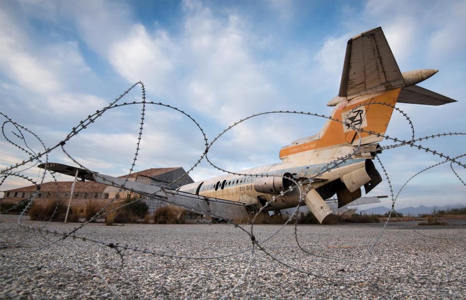
Michalakis Ppalis/Shutterstock
Abandoned houses, shops and even an airport remain untouched and crumbling reminders of a bygone era. At the derelict Nicosia International Airport, a destroyed Cyprus Airways jet still stands near the runway.
Cyprus Buffer Zone
Rutkowskii/Shutterstock
The demilitarised zone stretches 112 miles (180km) across the whole island. In many parts access is heavily restricted and civilians are not allowed to move freely within these areas, due to safety concerns over trip wires and mines.
Cyprus Buffer Zone
Ingus Kruklitis/Shutterstock
The buffer zone cuts right through the capital of Nicosia (Lefkosia). In some parts of the old town it is only several feet (a few metres) wide.
Cyprus Buffer Zone
UN Photo/Eskinder Debebe/Flickr/CC BY-NC-ND 2.0
UN peacekeepers are still present in the buffer zone and patrol within the area. In the case of an emergency, a mobile unit is always ready to respond. According to the UNFICYP (United Nations Peacekeeping Force in Cyprus), approximately one thousand incidents occur within the buffer zone each year.
Cyprus Buffer Zone
Friemann/Shutterstock
Pictured are warning signs marking the boundary of the UN. Since 2003, a number of crossing points have opened up that allow Cypriots and tourists to walk or drive between the north and south, allowing some freedom of movement.
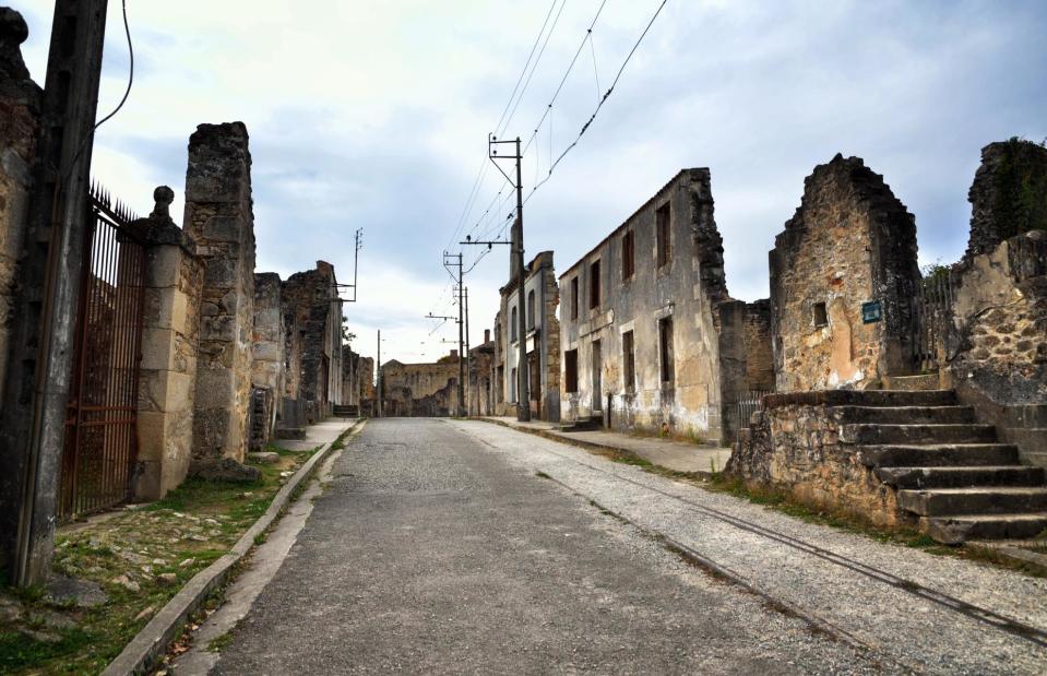
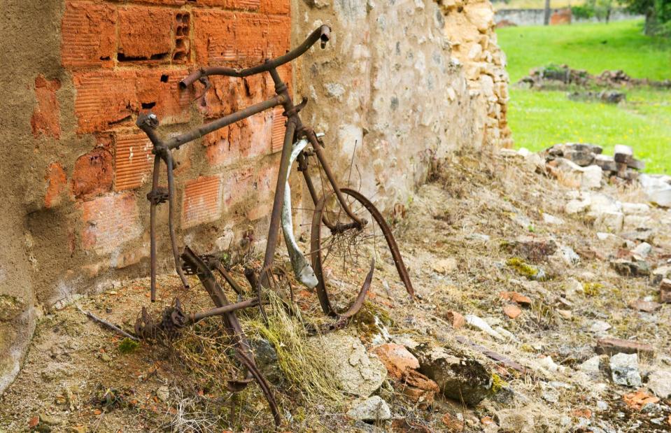
Oradour-sur-Glane, France
MilaCroft/Shutterstock
Since its destruction by the Nazis during the Second World War, this site in central France has been left untouched as a gut-wrenching reminder. On 10 June 1944, 642 inhabitants of the village Oradour-sur-Glane were shot or burned alive by the German forces.
Oradour-sur-Glane, France
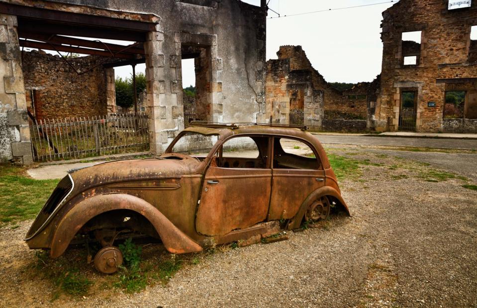
MilaCroft/Shutterstock
Three-quarters of a century later, the ghost town is a memorial to those who perished. Rusted cars, including the Peugeot 202 the mayor drove before his brutal death, still sit on the roads.
Oradour-sur-Glane, France
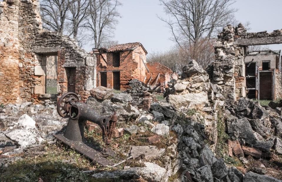
HUANG Zheng/Shutterstock
Sewing machines, pitchers and pans still lie scattered around, painting a picture of the fateful day the village was extinguished.
Oradour-sur-Glane, France
Ivonne Wierink/Shutterstock
The nearby museum is well worth a visit to give you an understanding of the history, then you can work your way through the town in respectful silence.
Now discover the eeriest abandoned attraction in every state

