11 Best Hikes in the San Francisco Bay Area
There's something for every type of hiker in the Bay Area.
Kevin Thrash / Getty Images
When you think of San Francisco, the iconic classics of the Golden Gate Bridge, Alcatraz, and Fisherman's Wharf might immediately come to mind. But there's far more to the Bay Area than just these sights, and if you're interested in exploring on foot, you'll actually find you're in a hiker's paradise. In and around San Francisco are hiking trails suitable for all skill levels and interests, from birders to history buffs to small children. Whether you're an experienced hiker in search of a challenge or simply in the mood for a sightseeing stroll, there are plenty of options within or just a short journey from the heart of the Bay Area.
Now, a little housekeeping: As with all outdoor excursions, be sure to be mindful of the rules and regulations within each park. Note that several trails on this list can get quite windy, especially the ones at higher elevations, so prepare for some gusts. Also, keep in mind that the busier trails tend to have packed parking lots on the weekends, so consider going earlier in the day or during the week, if possible.
Without further ado, here are our picks for the best trails in the San Francisco Bay Area.
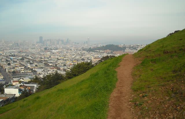
Batteries to Bluffs Trail
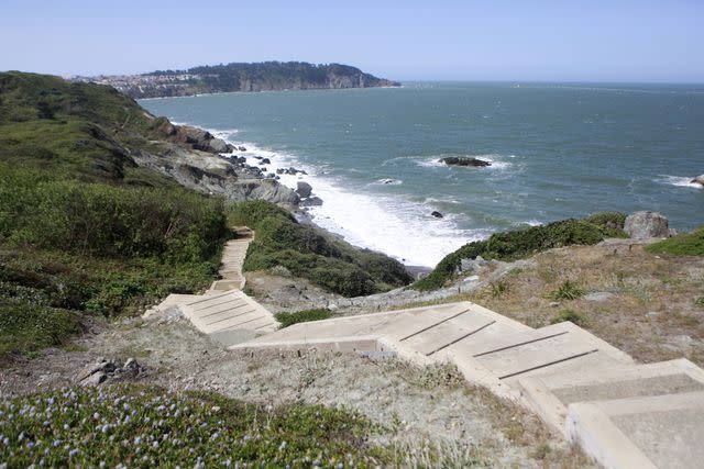
Jill Schneider / Getty Images
The Presidio, a nearly 1,000-acre park, offers unsurpassed, postcard-worthy views of the Golden Gate Bridge and is a must-see for both tourists and locals alike. The famous Batteries to Bluff Trail is short—just 0.7 miles long—but scenic, winding along the hilly coast with a breathtaking view of the bridge. Taking the extension down to Marshall Beach is worth the trip, as you can stroll across the sand with the water at your feet and the Golden Gate Bridge towering above you in the distance. If there's any one location that best represents the beauty of San Francisco, this might be it.
Lands End Trail
m-kojot / Getty Images
In the Sutro District of the Golden Gate National Recreation Area, you'll find the easy-to-moderate four-mile Lands End Trail. There are plenty of sights to keep you entertained, including the Sutro Baths, the USS San Francisco Memorial, the Eagle Point Overlook (with resplendent views of the Golden Gate Bridge), and Mile Rock Beach. If you want to extend your hike and hit two excellent trails in one go, you can combine Lands End with the Batteries to Bluffs Trail.
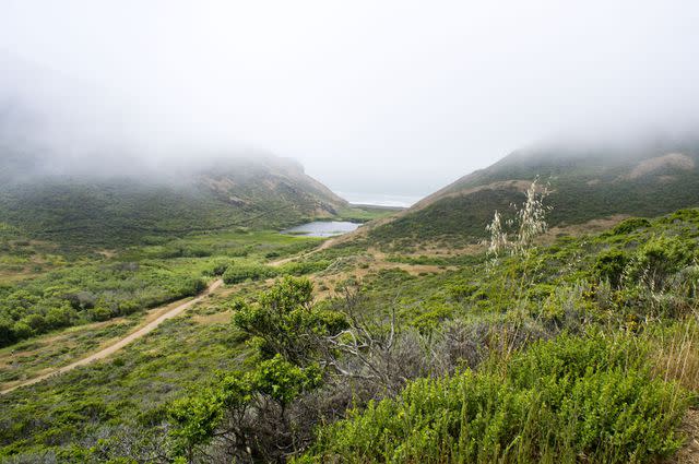
Tomales Point Trail
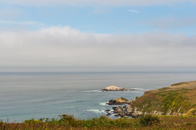
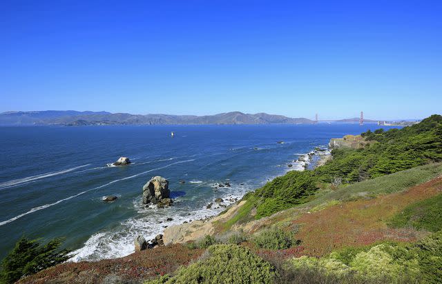
No list of California hiking trails would be complete without a trek with quintessential views of the Pacific Ocean from coastal bluffs. Tomales Point Trail is the one for San Francisco. You have a few different options in terms of distance: from the trailhead to Windy Gap is about two miles round-trip, but if you're willing to extend your journey, Pierce Point Ranch is about six miles round-trip. Pierce Point was once a dairy ranch in the late 1800s but is now used to house park employees. And if you want to go even farther, you can get all the way out to Tomales Point itself, which is a 9.5-mile round-trip journey. As with any trail along coastal bluffs, be sure to stay on the designated path, as the cliffs are notoriously unstable.
Juniper Trail
A simple but spectacular two-mile ascent to the 3,849-foot summit of Mount Diablo yields an epic view of mountains and valleys as far as the eye can see. This is a moderately difficult hike, thanks both to steepness and a gravel-packed trail that can get a tad slippery in some areas. Prepare for a windy atmosphere and, in the colder months, some snowfall. If you think the two-mile hike is a bit too short, you can start farther down the mountain to elongate the trek.
Bernal Heights Park Trail
Creative Commons
This hilltop park has multiple short trails (the longest is about a mile) that are perfectly suited for casual walkers or tourists in search of an Instagrammable, 360-degree view of the city. In the warmer months, the paths are lined with purple wildflowers. If you have a dog in tow, this is a great opportunity to get them out of your car and show them some sights.
French, Bridle, and Stream Trail Loop
Reinhardt Redwood Regional Park contains, as you might've guessed, plenty of towering redwoods, and it's mercifully free from the throngs of tourists you'll find at Muir Woods. (That said, you won't likely find complete solitude here, especially on weekends!) There are a few different trails at the park, but the most popular is actually a combination of three that forms one 7.3-mile loop of moderate difficulty.
Quicksilver History Loop
Nature itself is awe-inspiring, but we're also keen on hikes that can transport you back in time—in this case, to the 19th century, to be exact. On this eight-mile loop with picturesque mountain views, you'll journey to several long-abandoned mining sites, where you can wander through the ruins and learn about the quicksilver mining history from historical placards. Don't miss a stop at the Almaden Quicksilver Mining Museum for additional context, too.
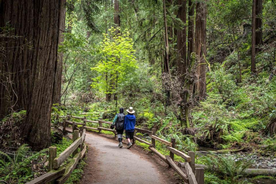
Muir Woods
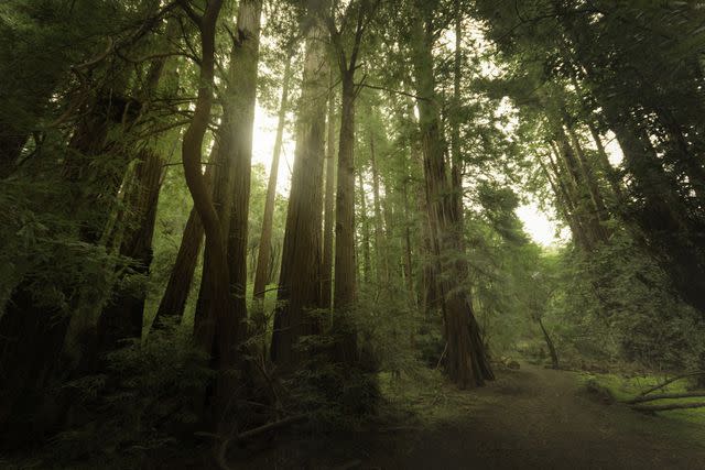
wayfarerlife photography / Getty Images
Muir Woods National Monument is a must-visit—which is why there are always so many people here. The site contains an abundance of trails, ranging from accessible walkways to more challenging switchbacks through the trees. Whatever route you take, there may be no better place on earth to feast your eyes on the magnificent redwood trees that have truly sprouted up everywhere. The easier trails are the most crowded ones, but if you're willing to walk a bit more, you can find some trails where you'll be able to enjoy the sounds of the forest.
Tennessee Valley Trail
luriete / Getty Images
Located in the Marin Headlands, this underrated, easy 3.6-mile out-and-back trail is lined with abundant wildflowers and rewards you with a beach view at the end of the journey. It's also a birder's paradise, with everything from songbirds to eagles spotted along the route. We recommend allowing for some extra time to explore the beach and observe the crabs. The earlier you get started with your hike the better, as the trail can get a tad busy in the afternoons.
Dipsea, Steep Ravine, and Matt Davis Trail Loop
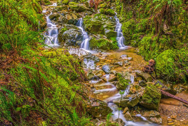
Ridge Walker / 500px / Getty Images
There are many trails in Mount Tamalpais State Park, but this moderately difficult 6.6-mile route combines three that hit most of the highlights. The journey begins at Stinson Beach and includes stints over rolling hills, through lush redwood forests, and past a couple of waterfalls. Along the way, you’re treated to views of Pt. Reyes and the Pacific Ocean.
Devil's Slide Trail
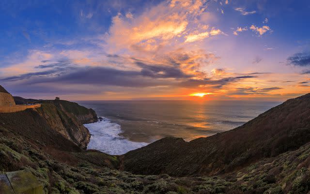
If you're in search of Pacific Ocean vistas accessed with minimal effort, Devil's Slide is the hike for you. Despite the sinister name, this is an easy 2.6-mile out-and-back paved trail with superb coastal views and plenty of convenient amenities, such as bathrooms, benches, and water fountains. This one is great for kids and dogs, as long as you keep them on a leash (the dogs, that is, but maybe the kids, too).
Read the original article on TripSavvy.

