Hidden Google Maps Features You Should Know About
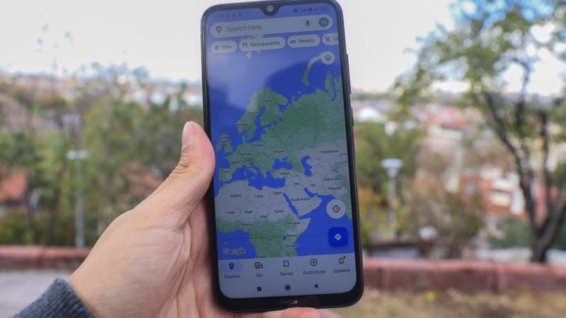
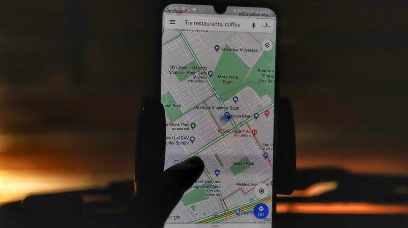
I have always used Google Maps but never cared enough to look beyond the basic features. It wasn’t until today that I made an effort to explore the app and ended up going down a rabbit hole of all the cool things it’s capable of. You might already know some of these, but you might have missed a handful of interesting hidden features.
Some of these are specific to car owners, some to folks who require accessible spaces, but most of the things on this list are features everyone could use to save time and energy.
Wheelchair-accessible transit routes
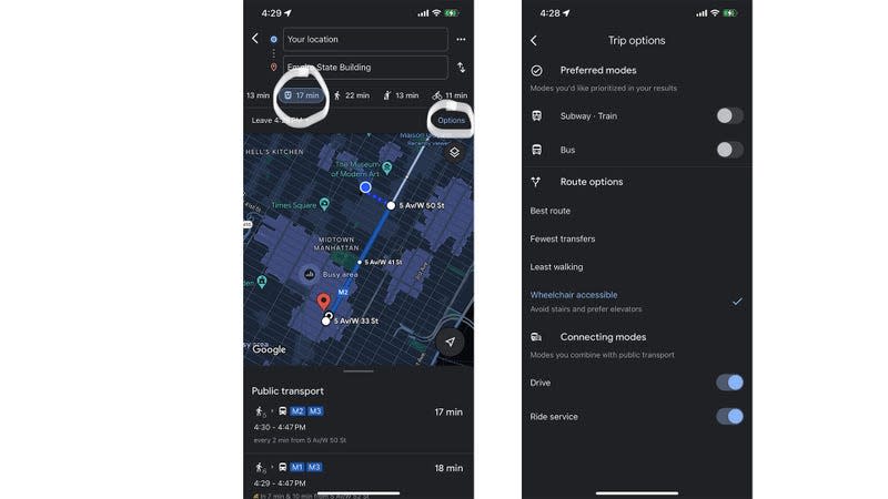
Google Maps has a dedicated feature that shows you transit routes that are accessible via wheelchair. All you have to do is put your destination on the app, tap Directions, click on the transit icon, and then tap Options on the top right corner of the map. Under Route options, click on Wheelchair accessible and go back to the map. You’ll now see different transit routes based on accessibility.
The Route options tab also offers other helpful stuff. You can choose from Best route, Fewest transfers, and Least walking based on your top priority.
Go back in time
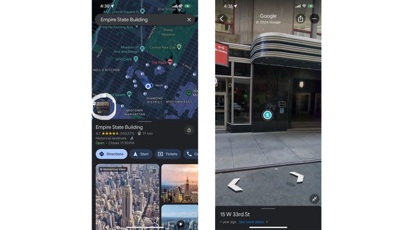
You can go back in time on Google Maps to see what a place, street, or area was like years ago.
Put the place you want to check out on the map and tap the Street View icon on the bottom-left of your screen. Once a street map of that place shows up, click anywhere on your screen and tap See more dates at the bottom. Pick any date and go as far back as you want. You can pan on your screen in any direction to take a good look at the area from every angle.
Parking scene
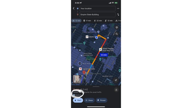
Google Maps will tell you what the parking scene is at the place you’re going to. Just put your destination on the map, click on the car icon, and you’ll see a P icon on the bar at the bottom. The icon will have either Limited, Medium, or Easy next to it. Easy or even Medium should be fine. But if it says Limited, you might want to plan in advance or pick another commute option.
Don’t forget where you parked
Have you ever forgotten where you’ve parked? It’s happened to the best of us. Google Maps gets it, and they specifically have a feature for that.
When you’ve parked, tap your blue location circle on the map, and click on Save parking. Your location will be saved to a Saved parking list. To retrieve it later, tap the Search field at the top and click on Saved parking.
See how busy it’s going to be when you leave
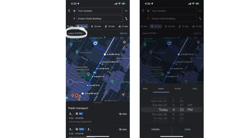
We often plan in advance by putting our destination on the map and seeing how long the commute is going to be. But it isn’t always possible to factor peak hours into consideration. I mean, I tell myself it’s going to be a lot busier at 6 PM, but I didn’t know there’s a fairly accurate tool for it.
Put your destination on the map, and tap Directions. Click on Leave now and pick a time you want. You can use either the Leave tool to see when you’re going to reach if you leave at a specific time or the Arrive tool to see what time you need to leave if you wish to arrive at a certain time.
Check what’s the latest you can leave
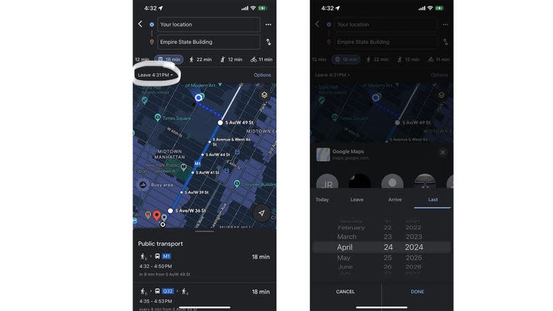
Having too much fun at a party but don’t want to miss the last train/bus back home either? This is the tool you’re going to use for that.
Google Maps lets you look at when the last ride back home is. Put your destination in the Search bar on the map, tap Directions, and click on the transit icon. Then go to Leave now, and click Last. Click on the date for that day, and tap Done. You’ll see the latest possible transit options for that day.
Fuel-efficient routes
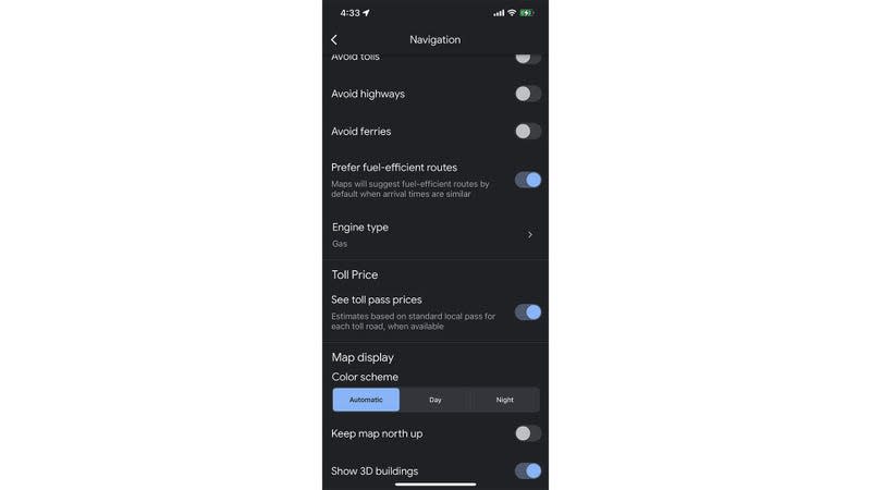
Just like wheelchair-accessible routes, Google Maps also shows you fuel-efficient routes. It’s a setting that you’d need to turn on just once, and all your future routes will have a fuel efficiency filter applied to them.
Head over to Settings on Google Maps, tap Navigation, and scroll down to Prefer fuel-efficient routes. Turn the toggle switch on. Then scroll down to Engine type and pick your engine out of Gas, Diesel, Electric, Hybrid. Google Maps will pick a fuel-efficient route for you based on your engine type.

