Google Maps now shows real-time public transport data in Australia's largest city

Anyone who catches public transport in Australia's largest city knows that delays and random missing buses are an inevitable part of commuting.
Google Maps is hoping to ease some of that pain by finally including real-time public transport data in Sydney, Australia starting from Thursday, the company announced in a blog post.
SEE ALSO: New York Times is using Google’s AI to expand online comments
It's the first city in Australia to have real-time public transport schedules added into Google Maps, following the lead of transit apps such as TripView, TripGo and Arrivo, which have had live data fed from the state's transport department since 2013.
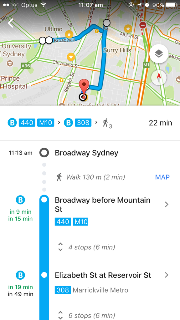
Image: mashable screenshot
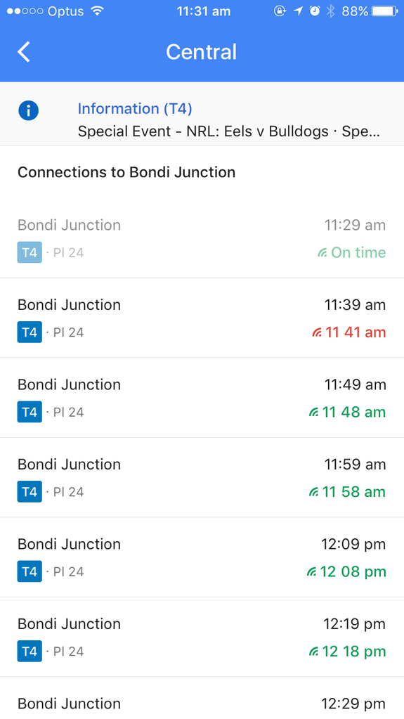
Image: mashable screenshot
Routes which have live data are on-time are marked in green — or red if they're delayed or early, and there's a signal-like icon marked next to the time so you know what's updated and what's not.
It's a pretty neat addition for those of us who already use Google Maps to get from one place to another, but might have had to rely on another transit app for live transport data.
The real-time feature is available on desktop and mobile (iOS and Android), so now you have less — or in some cases more — excuses to be late.
WATCH: IKEA's new adult coloring sheets are actually foolproof recipe posters for aspiring cooks