Why has it been so dry in South Florida? What to know as hurricane season ramps up
Aside from a few isolated downpours, the grounds of Palm Beach County have been significantly drier than normal this rainy season, but that's likely to change as peak hurricane season ramps up.
Since May 15, rainfall in Palm Beach County is nearly 4 inches lower than normal for this time of year, according to figures released by the National Oceanic and Atmospheric Administration's mid-rainy season update.
"It has been a lot drier than usual," said Sammy Hadi, a meteorologist with the National Hurricane Center. "And for Palm Beach County, that figure would be even lower had it not been for the system in early June."
More: More trees, not cooling centers, are South Florida's answer to increasingly hot summers
More: Who should I call for help in an emergency during a hurricane?
More: VIDEO: Are you ready for hurricane season? NHC's Ken Graham talks concerns
That system, which later became Tropical Storm Alex, originated near the Yucatan Peninsula and moved north through the Gulf of Mexico. It hit Florida's west coast between Cape Coral and Naples before moving across the state, ultimately dumping 4.52 inches of rain at Palm Beach International Airport on June 4.
Those 4.52 inches that day account for more than a third of the total rainfall the PBIA has received since May 15.
If you live on the east coast you may have felt it has been a little dry recently. It isn't your imagination, as the persistent easterly flow and occasional SAL intrusions have resulted in much of the east coast receiving noticeably below normal rainfall since early June!#Flwx pic.twitter.com/GOwhJkh4Ti
— NWS Miami (@NWSMiami) August 8, 2022
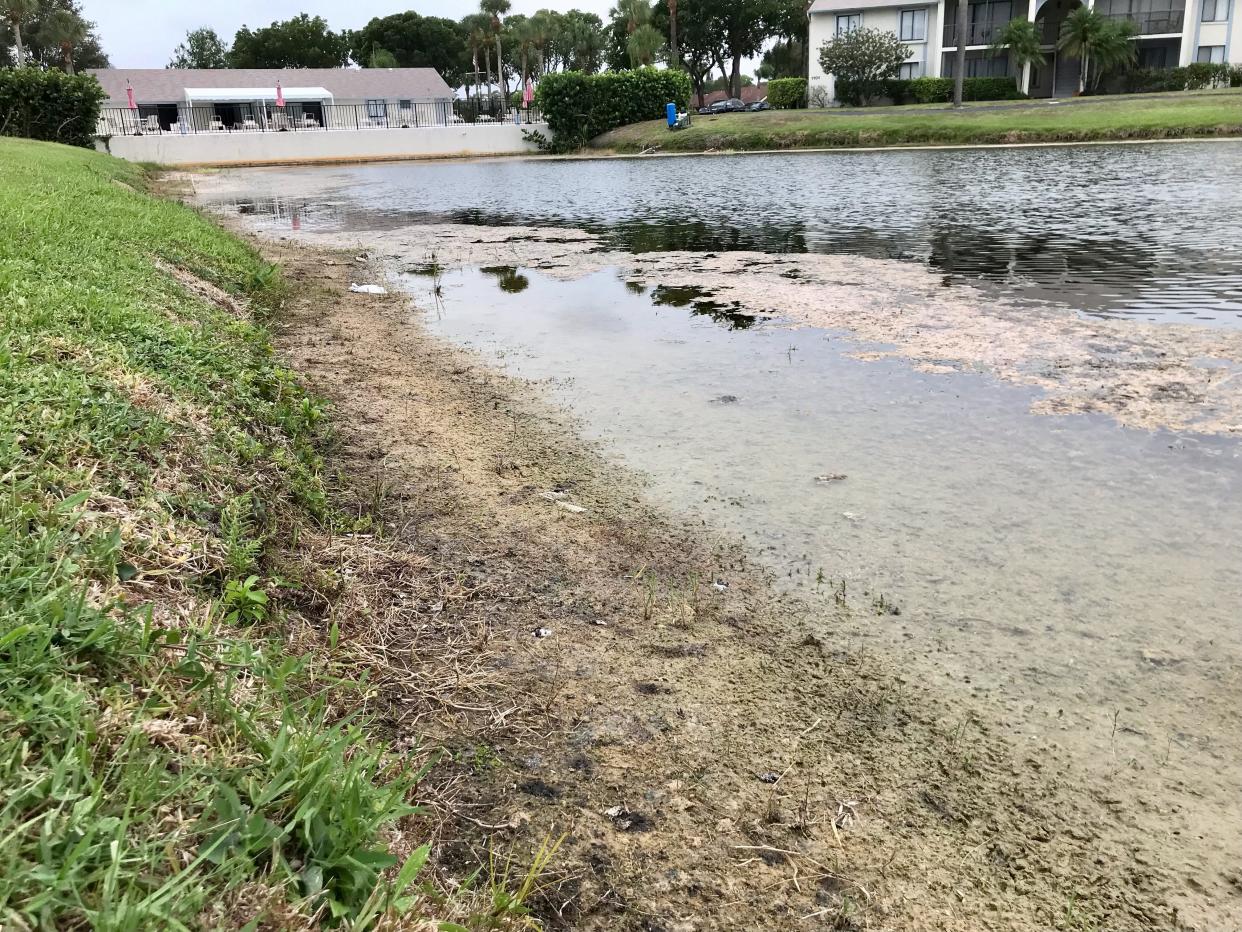
And while Palm Beach County isn't nearing any drought worries, some areas are noticeably drier and browner.
"We haven't had any substantial rain in about three weeks," said Andrew Schilf, an assistant golf shop manager at Atlantic National Golf Club west of Lake Worth Beach. "We're OK, but yes, some of the greens did yellow out a bit, and we've run the sprinklers pretty heavy in some spots."
Palm Beach County is the only area that is below average for rainfall in the southern portion of the state, and on the west coast, the numbers are higher than normal.
Marco Island (+8.68 inches) and Naples (+4.64) are among the spots that have been drenched the most this summer.
Why hasn't Palm Beach County received much rain lately?
Hadi points to three factors that has kept the rainfall totals low this summer in Palm Beach County – a dominant high-pressure system, wind shear and waves of Saharan dust.
"When you have a high-pressure system sitting there, it's just not the most conducive for severe weather," Hadi said.
The persistent high pressure on the eastern part of the state has shifted the winds to the east, and that's saturated Florida's west coast this summer.
Hadi explains that for Palm Beach County, the high-pressure system has created what is called "sinking air" that has prevented storms from developing.
"With low pressure, air rises, condenses into clouds and produces more showers and storms," he said. "With high pressure, air sinks and that really puts a stop to those storms firing up."
Wind shear has also been a big factor that has subdued any development of July and early August storms in the Atlantic. Wind shear is a large pocket of strong, high-level winds that will throw a wrench into any tropical storm formation.
This week, that zone stretched across much of the Caribbean and into the central Atlantic, and it could wipe out any chance of development of a tropical wave over the far eastern Atlantic Ocean that could become a tropical depression.
2pm EDT 9 Aug: Showers & thunderstorms remain disorganized associated with a tropical wave SW of the Cabo Verde islands. This system has a 30% chance 🟡 of tropical cyclone formation before conditions become less favorable this weekend.
Latest Outlook→https://t.co/m9946DGzPQ pic.twitter.com/1BOi77HNAU— National Hurricane Center (@NHC_Atlantic) August 9, 2022
As far as Saharan dust, it has been prevalent for a good chunk of the summer, and it has made temperatures feel higher than normal along with hazy sunshine and less cloud cover.
A plume of dust hit South Florida mid-week and will likely limit rain chances until Friday, when a weak front will dip south from the Midwest.
8/9, 1PM: Dry air and a layer of Saharan dust are gradually pushing in from the Atlantic Ocean, which should help bring dry conditions to South FL later this week. In the meantime, chances for rain remain in the forecast today, mainly over the interior and West Coast. #flwx pic.twitter.com/E5vmLsl7GO
— NWS Miami (@NWSMiami) August 9, 2022
"It's a weak front that really won't reach South Florida, but will bring an increase in thunderstorm chances for the weekend," Hadi said. "The sea breeze for a lot of coastal cities, though, will push the rain inland."
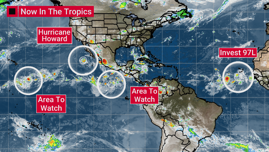
The tropics: What's on the horizon as hurricane season ramps up
The last named storm was more than a month ago when short-lived Tropical Storm Colin sputtered and dissipated off South Carolina's shore just before the Fourth of July weekend.
But the summer's quiet winds are by no means any indicator of what could be on the horizon in September and October.
NOAA's updated forecast released last week predicts 14 to 20 named storms and six to 10 hurricanes forming.
An average Atlantic season generally produces seven hurricanes and peaks in the first week of September. For Florida, Hadi said the majority of hurricanes and tropical storms that hit land come in October. For the past six years, there has been above-normal storm activity in the Atlantic.

“Although it has been a relatively slow start to hurricane season, with no major storms developing in the Atlantic, this is not unusual, and we therefore cannot afford to let our guard down,” said FEMA administrator Deanne Criswell, in a prepared statement. “This is especially important as we enter peak hurricane season – the next Ida or Sandy could still be lying in wait."
La Niña conditions, which are favored to remain in place for the rest of 2022, are also favorable for tropical systems, according to NOAA.
During a La Niña period, the sea surface temperature of the central Pacific Ocean along the equator is lower than normal. That moves warmer temperatures across the equatorial band of the Pacific and into the Atlantic basin, creating more favorable conditions for tropical development.
Aside from the current tropical wave in the Atlantic, forecasters don't see much development through Aug. 20, but don't get too comfortable – it's likely the big tropical waves moving westward from Africa are on the way.
James Coleman is a journalist at the Palm Beach Post, part of the USA TODAY Florida Network. You can reach him at jcoleman@pbpost.com. Help support our journalism. Subscribe today.
This article originally appeared on Palm Beach Post: South Florida weather: Why it's been so dry; what's brewing in tropics
