Parts of Triangle under severe thunderstorm watch. Here’s how long it will last.
The Triangle region is under a severe weather warning through at least 10 p.m., the National Weather Service reported Monday night.
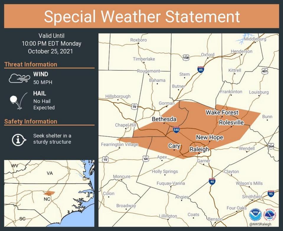
The weather service issued a “special weather statement” for Raleigh, Cary and Wake Forest until 10 p.m. The threat includes winds up to 50 mph, and people are advised to seek shelter in a sturdy structure, the weather service said. No hail is expected.
A thunderstorm warning is in effect for Durham, Chapel Hill and Carrboro until 9:15 p.m. and Henderson, Oxford and Creedmoor until 9:45 p.m. That means the potential for winds up to 60 mph with possible damage to trees and homes.
A severe thunderstorm watch is in effect until 1 a.m. for Alamance, Orange, Granville, Vance, Person, Durham and Warren counties.
Much of central North Carolina has been under risk level 2 of 5, meaning there’s a potential for scattered severe storms, forecasters said.
“A line of showers and thunderstorms are expected to move across the area (Monday) afternoon and evening,” the National Weather Service said. “A few storms may become severe, with a primary threat of damaging winds gusts.”
There could also be isolated tornadoes and heavy rain in some areas, according to ABC11, The News & Observer’s media partner.
In the Triangle, the biggest risk for severe weather lies from 6 to 10 p.m. Raleigh-Durham International Airport could see showers during the day and thunderstorms overnight, with up to a half inch of rain possible, forecasters said.
Skies are expected to clear by daytime Tuesday, when forecasters predict sunny conditions.

