Update: Light snow, low temps cause slick roads, traffic problems
Scroll to the bottom for the latest traffic updates.
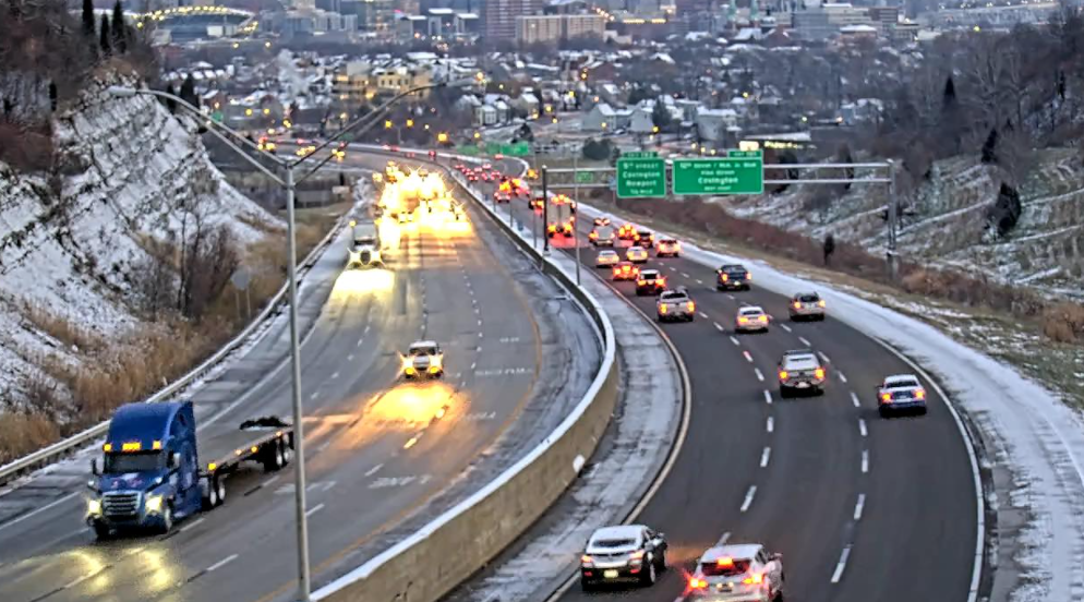
The snowfall that resulted in a light dusting in most areas may have ended but the slick conditions on roads remain.
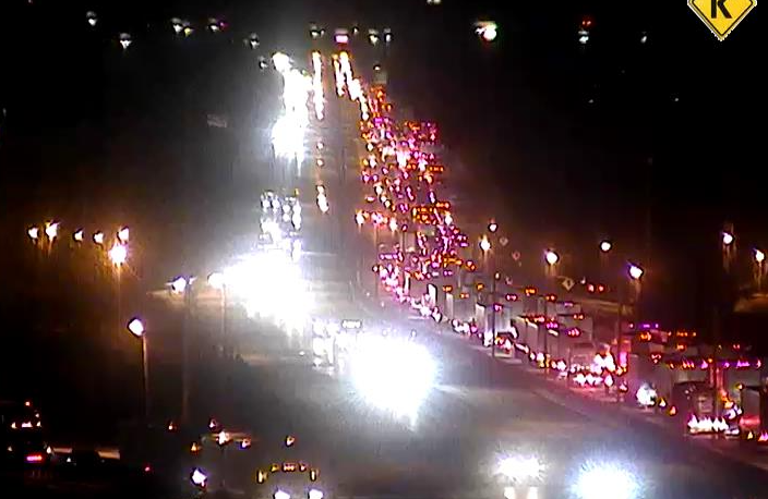
There have been reports of slippery conditions on major highways as well as local roads. Several schools have issued closing and delay notices.
The National Weather Service has issued advisories warning of slick spots on roads and transportation and local authorities are also urging caution.
Cincinnati police have put emergency accident reporting procedures in place until further notice. If you are in a minor fender bender and the vehicles are drivable, police are asking you to exchange information with the other driver and continue on. If needed, police reports can be made later.
By 8 a.m. Wednesday, total snowfall accumulations have reached between half an inch to 0.9 inches in Ohio and Kentucky around Greater Cincinnati.
[625 AM] Most areas in I-71 corridor have some residual slick spots, but esp so across northern KY south of Cincinnati (image) where roads are slippery in a little more widespread fashion. Several hours from warming yet, so cautious driving encouraged esp south of Cincinnati. pic.twitter.com/8bGkeAf17X
— NWS Wilmington OH (@NWSILN) December 8, 2021
Caution is needed, especially secondary and lesser traveled roads as well as ramps, bridges, and elevated road surfaces.
Major delays were reported on I-71/75 in Boone County between the Richwood exit and the I-71, I-75 split early in the morning.
According to the weather service, "It will still be several hours before daytime warming and perhaps some sunshine can substantially remove these slick areas, especially since temperatures this morning will be in the 20s, and not expected to get above freezing until mid-morning."
Drivers should slow down, maintain more distance between vehicles and be prepared for rapid changes in road conditions.
Rain is in the forecast Friday, and the NWS is warning of a risk for severe storms in the evening. The threat of damaging winds and localized flooding will affect areas in Northern Kentucky, Southeast Indiana and Southwest Ohio.
Although it is cold with a light snow observed overnight, the weather is going to change. A risk for severe storms exists for Friday night. Stay weather aware -- by keeping alert for the latest forecast as we get closer to Friday night. pic.twitter.com/pOO9rOuhQn
— NWS Wilmington OH (@NWSILN) December 8, 2021
Detailed Forecast
Today: Mostly cloudy, then gradually becoming sunny, with a high near 44. A low around 26.
Thursday: Partly sunny, with a high near 52. A chance of showers, mainly after 2 a.m. Increasing clouds, with a low around 46.
Friday: Showers likely, mainly after 4 p.m. Cloudy, with a high near 67. Showers likely, then showers and possibly a thunderstorm after 8 p.m. Low around 49.
Saturday: Showers, mainly before 8 a.m. High near 61. Chance of precipitation is 100%. A low around 29.
Sunday: Sunny, with a high near 48. A low around 31.
Monday: Sunny, with a high near 53, a low around 33.
Tuesday: Mostly sunny, with a high near 56.
A Twitter List by BriRiceWrites
Source: National Weather Service, Wilmington.
This article originally appeared on Cincinnati Enquirer: Update: Light snow, low temps cause slick roads, traffic problems

