Afternoon storms dump large hail on parts of Southwestern Indiana
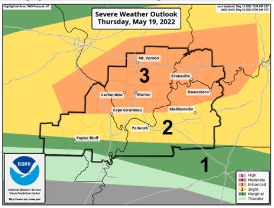
A tornado watch in effect for most of the Tri-State expired at 11 p.m. CST as a complex of potentially severe thunderstorms made its way through the region.
It was the second round of nasty weather in the area on Thursday.
More: Weather service: Damage from possible tornado reported in Mount Carmel, Illinois
A first wave exploded in Southwestern Indiana just after the lunch hour, producing large hail, damaging wind gusts and torrential rains as "supercell" thunderstorms pounded the area.
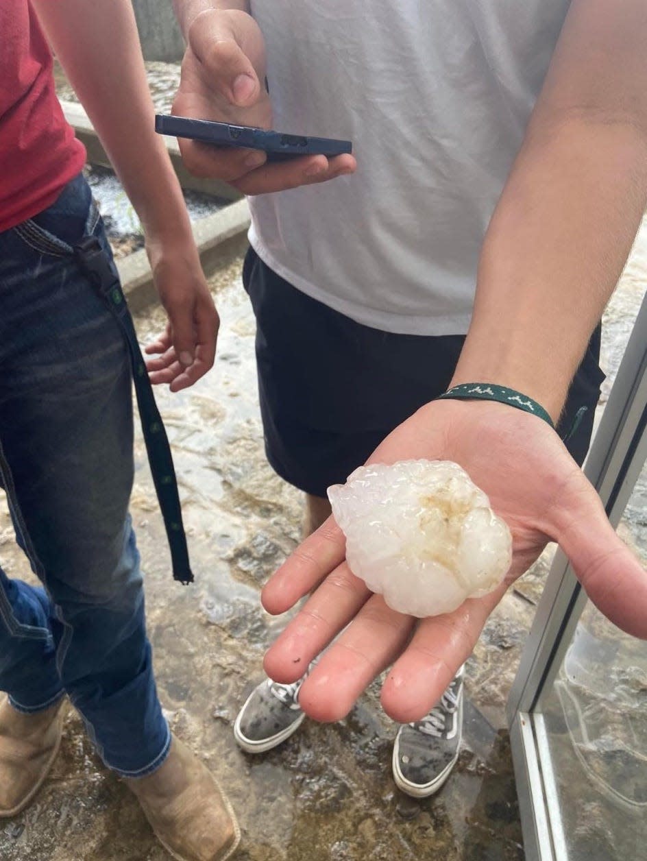
The most eye-popping event in the early round of storms was a period of 2.75-inch-diameter hail that damaged cars at North Posey High School and surrounding areas near Poseyville and Wadesville, Indiana.
National Weather Service Meteorologist Ryan Presley said hail with a diameter larger than 1.5 inches doesn't happen often in the Tri-State. He said the size of the hail is largely determined by how long a thunderstorm's updraft allows ice particles to stay suspended higher up in the atmosphere.
Presley said tornadoes and hail don't always go hand in hand. But, he said supercell thunderstorms, like the ones that rolled through the Tri-State Thursday, are conducive for both hail and tornadoes.
Thursday's storm had an "extreme" amount of instability caused by both warm temperatures and high humidity, Presley said, that allowed the hail to suspend up in the air long enough to grow to the sizes of plums or golf balls.
Contact Ray Couture at rcouture@courierpress.com or on Twitter @raybc94
This article originally appeared on Evansville Courier & Press: Evansville weather: Heavy rainfall, damaging winds possible tonight

