Scenic drive displays Little River Canyon's beauty
It was a beautiful, sunshiny, 65-degree morning when my eldest daughter called to say she was on the way to take me for a surprise ride. “Where,” I asked; “Wait and see,” she said with a laugh.
And off we went, first to Noccalula Falls, then following Tabor Road until it became Alabama Highway 176, and traveling northward to Dogtown.
An hour later, we were in the Little River Canyon National Preserve, created by an Act of Congress almost 30 years ago, located on top of Lookout Mountain (above Fort Payne) that takes in DeSoto State Park. The entire area covers 15,288 acres protecting the landscapes of what is said to be the nation’s longest mountaintop river.
I knew all this, and I knew the National Park Service managed the preserve with an agreement with Jacksonville State University as a “teaching tool” regarding the unusually diverse sets of plant and animal species — many considered to be endangered — found throughout the preserve.
What I had not known about was the 11-mile-long scenic drive we were about to undertake. Shortly after leaving the Dogtown intersection, continuing to follow Alabama Highway 176, we toured the rim of Little River Canyon, a drive that parallels anything Gatlinburg has to offer.
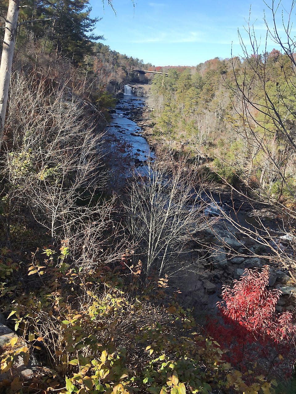
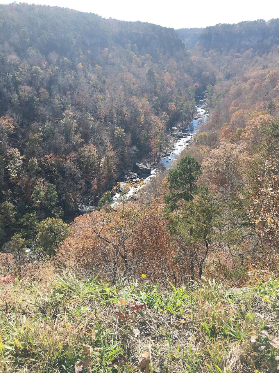
Even after recent rains washed many of the colors from the thousands of trees lining both sides of the roadway, the splendor of the 60-story deep, seemingly white-washed sandstone walls of the canyon, is (was) nothing sort of spectacular.
We rode the rim, looking downward to my right. A gorgeous view all the way!
There are nine overlooks along this “road of delight,” each with space to pull off the road to park and view the canyon from a great vantage place. It’s a perfect spot for making pictures and having a sandwich at one of the nearby concrete picnic tables. Now, let me describe them to you:
• 1: Eberhart Point was the overlook for our first stop; It was once known as Canyonland Park (late 1960s). It had a very popular chairlift that took you over the canyon.
• 2: Next came Grace's High Falls, a 133-foot seasonal waterfall that cascades off the cliffs.
• 3: Crow Point Overlook looks down the 600-foot cliffs to see where Bear Creek and Little River join together. The trail to this overlook has a curved semi-steep slope that’s about 100 yards long.
• 4: Wolf Creek Overlook was our next stop; my most favorite view of the trip came from here.
• 5: At this stopping place, you can get a fantastic view of the canyon and see the Wolf Creek Overlook. Little River is about 400 feet below the overlook.
• 6: Our next overlook to visit was at Hawks Glide for a great view of the fall colors. The foliage is very thick at this overlook and is a good place to watch kayakers when the water is high. Sometimes, you may be fortunate enough to witness the majestic flight of the soaring raptors from this spot.
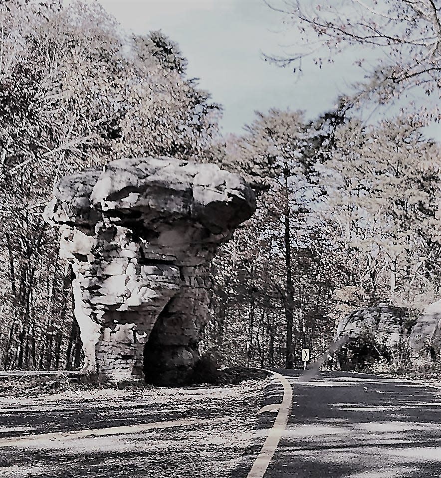
• 7: Next was not an overlook, but the most unusual rock formation I’ve ever seen: a Paul Bunyan-size rock in the middle of the road, shaped like a mushroom. It’s also been known as Needle Eye Rock because of the slot in its base.
• 8: Lynn Overlook, nearing the end of our scenic drive, has a long driveway through a sandstone rock glade. Beaver Pond Trail is located nearby; it’s an easy 1.24-mile loop trail is a favorite for bird watchers.
• 9: We came to the end of our journey when we reached Alabama Highway 35 at the Little River Falls Boardwalk, and an overlook that offered a view of the falls from afar. Here, you can see the river as it begins its journey down the canyon.
According to other park literature, there are several “must see” waterfalls throughout the entire preserve:
• DeSoto Falls, dropping 106 feet is one of Alabama’s tallest;
• Little River Falls, 45 feet deep, also marks the head of Little River Canyon which is 12 miles long and 600 feet deep;
• Martha’s Falls, just down the river from Little River Falls has a limestone base and is said to be a “good swimming hole;
• Azalea Cascade is a small cascade at the end of a short-wooded hike in DeSoto State Park;
• Laurel Falls is a 12-foot drop off of a moss-covered rock ledge in DeSoto State Park;
• Lost Falls is a small waterfall in DeSoto State Park;
• Indian Falls is a nice waterfall just down from the store at DeSoto State Park;
• Grace’s High Falls, at 133 feet high, is the tallest waterfall in the state (although seasonal).
I say again that the Little River Scenic Drive is one to take a second time. And a third. From whichever direction you begin, the scenery and the views are wonders to behold. Plus looking down into the 600-foot depths of the canyon can give you sense of what the Grand Canyon of the western United States is like.
Wow! What an adventure for this old man to see “Alabama’s Grand Canyon.” I’m ready to go again.
By the way touring the scenic drive and the overlooks is free of charge. Overlooks are open during daylight hours only. The road is narrow and has many curves and turns. Obey the speed limit and watch out for other vehicles, bicycle riders and wildlife in the road.
This article originally appeared on The Gadsden Times: Enjoying Alabama's 'Grand Canyon'

