Preferred route of Thomasville Multi-Use Path avoids park but safety concerns persist
Planning staff working on the route for a multiuse path on Thomasville Road have landed on it staying along the highway until it gets near the Market District south of Interstate 10 instead of cutting through a neighborhood park.
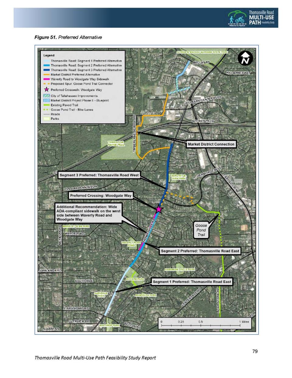
In a feasibility report released this week, the Capital Regional Transportation Planning Agency is suggesting sparing McCord Park, which was a possible part of the initial 12-foot wide pathway and a high point of contention, while also releasing an estimated cost for the pathway.
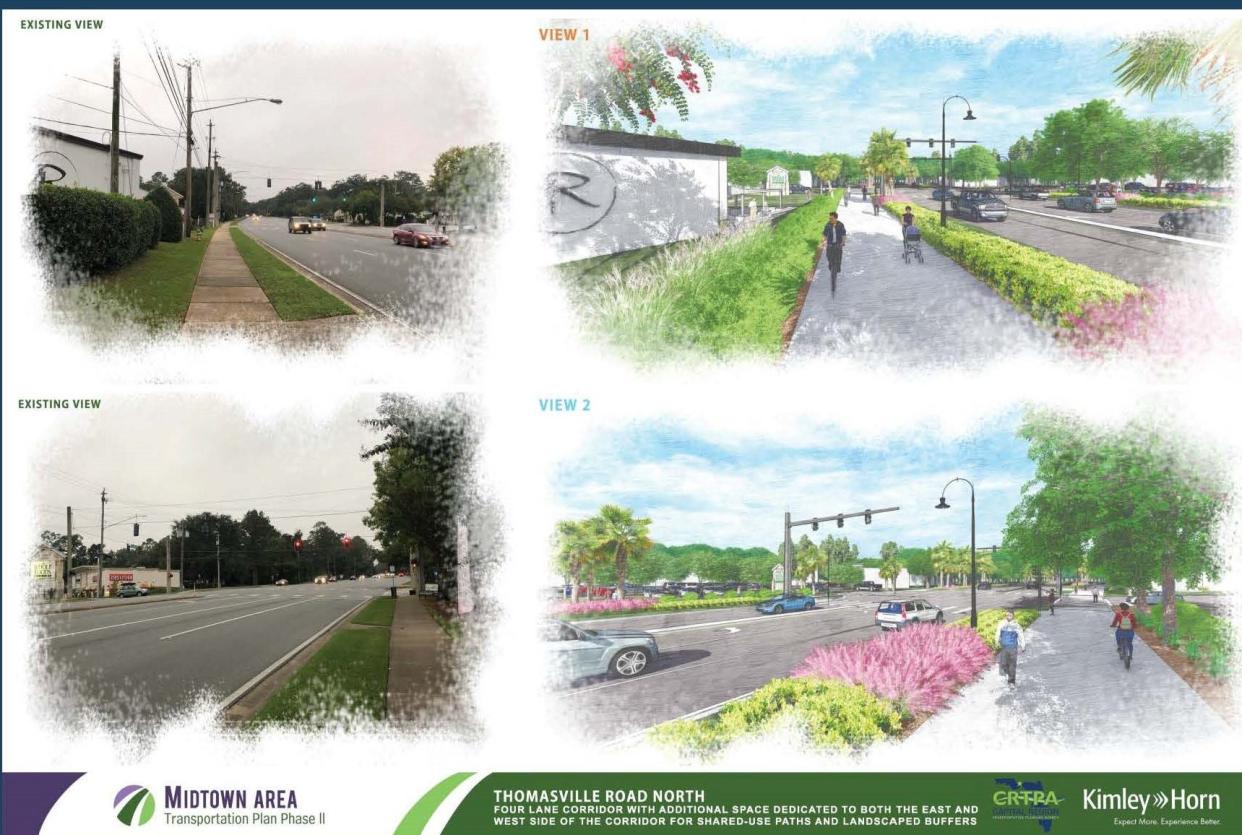
Intended to parallel Thomasville Road and run from Betton Road to the Market District, the 2.5-mile-long path is being imagined as a crucial piece of a commuter and recreational linkage through the city and beyond.
It’s drawn criticism for the way it rose to the top of the CRTPA’s projects list, amid safety and environmental concerns and whether there is a need in what is seen as an affluent part of Tallahassee.
A controversial connection?: Thomasville Road multi-use trail draws fire as planners gather input
One opinion: Let's talk about Tallahassee's Multi-Use Path over the din of traffic | Mark Hinson
CRTPA Director Greg Slay said the path is estimated to cost between $4.8 and $6.2 million for the entirety of the project. Slay said the study released this week is a snapshot of how the project may progress.
It’s not intended to be as detailed as some would like to show trees that may be impacted or how a road crossing may look.
“With the feasibility study, we’re looking at it at the 10,000-foot level to see if there’s sufficient right of way,” he said. “If we move forward into design, that’s when you go out and do actual survey work. That’s a level of detail we don’t get into in a feasibility study.”
Vote coming in January
The CRTPA board will vote on the proposal in January.
The 11-member board is made up of elected officials from Leon, Gadsden, Jefferson and Wakulla counties and the city of Tallahassee. It includes Leon County Commissioners Rick Minor, Kristin Dozier, and Nick Maddox and Tallahassee Commissioners Jeremy Matlow, Dianne Williams-Cox and Curtis Richardson.
The board has focused on developing the Thomasville Road path since about 2017 as part of the Greenway Master Plan and bike route system.
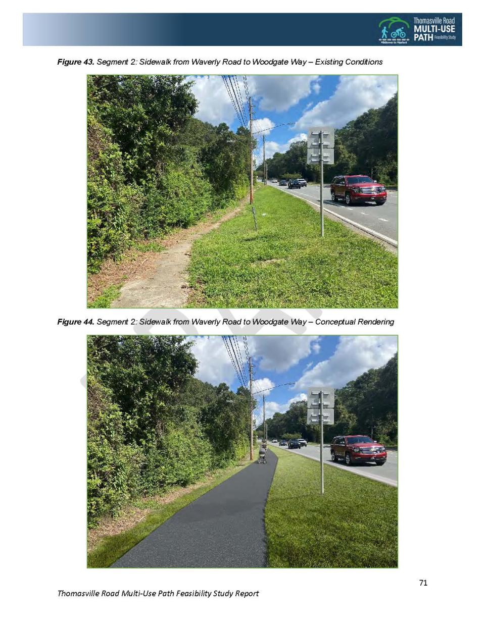
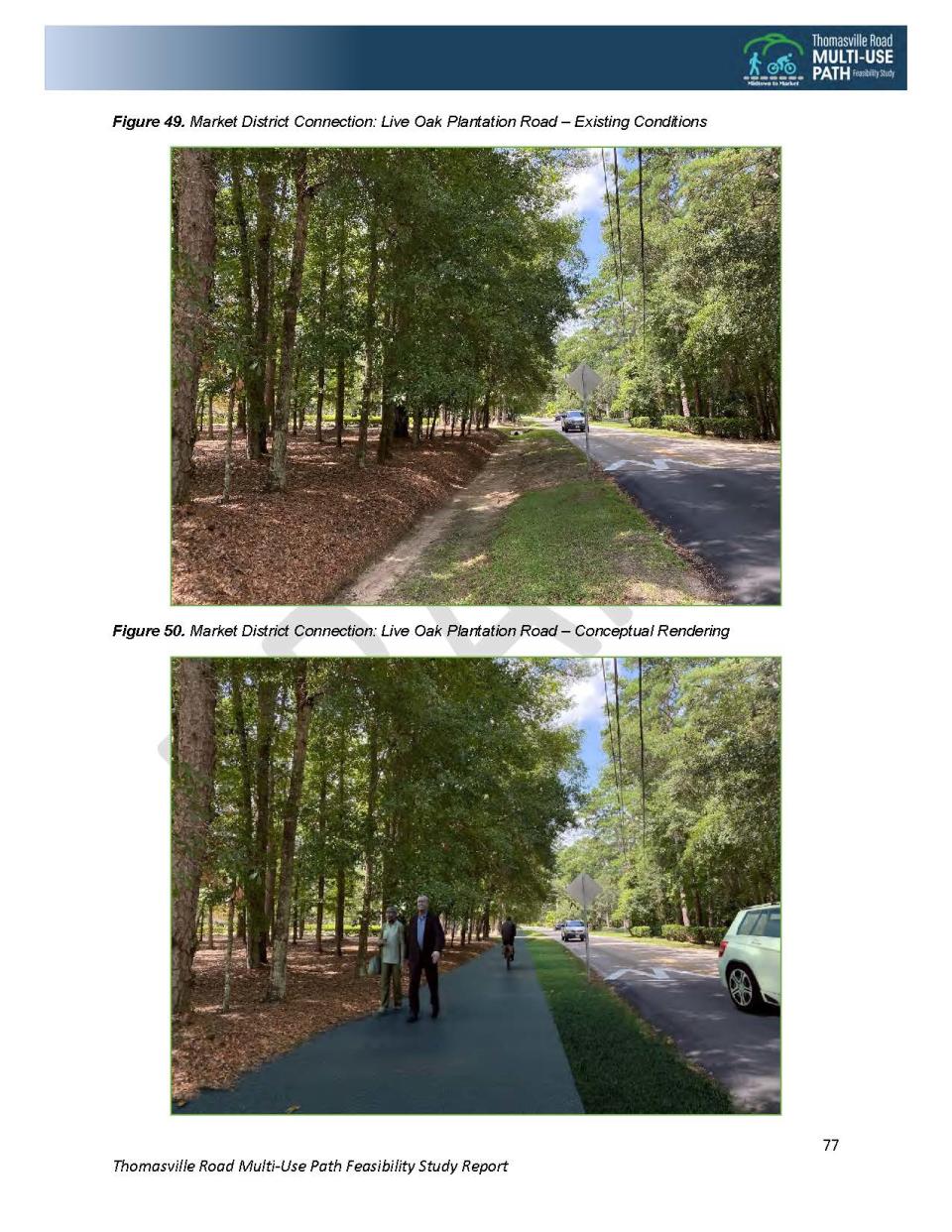
The feasibility study notes that the pathway would be the only north-south multi-use route through the city. It’s intended to hopscotch from the east to west side of Thomasville Road at Woodgate Way and link up to the Market District through the preferred alternative via Live Oak Plantation Road and Timberlane School Road.
Initially, an option was floated that would have taken the path through McCord Park. There were concerns from residents that it was a natural park and staff said the route along a connecting drainage ditch would have posed issues.
Between 2016 and 2020 there were five crashes along the path's route involving a vehicle and a bike or pedestrian, one of which resulted in a fatality. Seven major intersections along Thomasville were listed as the most concerning for potential users of the path. But in all, there are more than 40 places where it crosses a street.
One of those places is Peaceville Place, the dead-end street where Lori and Bob Guido have lived for the past 25 years.
The Guidos are cyclists, but they echo the concerns of many who live near Thomasville Road. The proposal to mingle bikes with pedestrians, other forms of transportation and cars traveling at least 45 mph make a recipe for disaster, they say.
“It has to do with safety,” said Bob Guido, who said he worked for years on various mult-iuse trails throughout the state, including the Miccosukee Greenway. “In my career, we would never work on a project like this because of safety issues because it just doesn’t fit.”
More: A safety blind spot: Proposed Thomasville Road path needs to be voted down | Opinion
Criticism continues from those along the path
Once the project surfaced more recently and the CRTPA was moving toward developing final routes, larger neighborhoods like Betton and Waverly Hills became more active in the planning process. What the Guidos found as they walked and talked to their neighbors was a number of people didn’t know about the project.
They say the scoring criteria that landed the Thomasville Road pathway at the top of the CRTPA’s list are flawed.
It was done so based on poverty levels, vehicle access and age from the census blocks surrounding the proposed pathway. But they say it also used a census block near the Governor’s Mansion that is not within the proposed project area that significantly shifts the number of residents who live below the poverty line and don’t live in a house with access to a vehicle.
The data was applied to five categories, safety, multimodal, equity, connectivity and health, and assigned scores which were used to rank projects.
“The thought is that these neighborhoods along Thomasville Road have poverty and households without vehicles,” said Lori Guido.
She said the funding and efforts should be used where there is a serious need for transportation infrastructure for walkers and cycllists in places with no or poor sidewalks.
Staff identified 42 trees that are within the right-of-way along the path that may be impacted if the project is approved and moves into the design phase.
The list comprises mostly live oak trees, including one with a 70-inch diameter trunk, and includes five trees in poor health and one that is dead.
Slay said there are creative ways to keep trees once the path is designed, such as a meandering style to avoid them, but at this phase it was unclear how many if any would have to be removed.
Bob Guido said, in addition to concerns about crashes involving motorists, cyclists or pedestrians, he was concerned about maintaining the character of Thomasville Road.
“It’s not safe, No.1,” he said. “No. 2, this is the gateway into Tallahassee from the north and we have some sort of canopy. If you go north, it’s starting to look like Orlando with all the trees cut down. That’s how this side is going to look if the multiuse path goes through.”
Contact Karl Etters at ketters@tallahassee.com or @KarlEtters on Twitter.
Never miss a story: Subscribe to the Tallahassee Democrat using the link at the top of the page.
This article originally appeared on Tallahassee Democrat: Thomasville Road path proposed to avoid park; safety worries remain

