Hurricane Ian forecast for Brevard: Up to 10 inches of rain, 60% chance of tropical-storm winds
- Oops!Something went wrong.Please try again later.
While Hurricane Ian's exact forecast track remains uncertain, National Weather Service meteorologists warn Space Coast residents to prepare for sustained tropical-storm-force winds to start striking as early as Tuesday night.
Jessie Smith, a meteorologist at the NWS Melbourne station, provided the latest localized Ian projections as of early Monday afternoon:
Brevard County can expect to receive anywhere from 5 to 10 inches of rain over the next several days
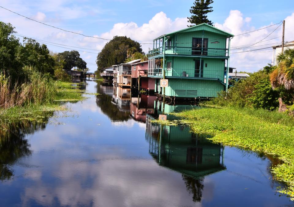
“We've had so much rainfall over the last week or so that our soils are very saturated. You can drive around anywhere, and you're going to see water. Ditches are pretty full. The retention ponds are really full," Smith said.
“So the flooding rainfall is going to be the primary concern here locally. If people live in low-lying areas or in flood zones, it's important to think about what your preparedness plan would include if you might need to leave your home," she said.
More: Hurricane Ian threatens waterlogged Space Coast with more flooding, forecasters warn
More: Hurricane threat from Ian prompts preparations for flooding, power outages in Brevard
There is a 60% chance that Cocoa Beach will receive sustained tropical-storm-force winds, along with a 6% chance of sustained hurricane-force winds
Tropical-storm-force winds range from 39 to 73 mph. Hurricane-force winds range from 74 mph upward.
“With any track shifts, especially one toward the east, those probabilities could increase," Smith said.
"Folks should definitely start planning on evacuating or have a plan in place," she said.
Odds of flash flooding in Brevard County have increased to 40%
“One of the big things that changed overnight is, we are in a moderate threat for excessive rainfall," Smith said.
“I think that's going to be our biggest message — just be prepared for the potential for flooding," she said.
Regarding Ian's approach, Smith warned that, “we have a lot of uncertainty in this forecast. But as we move forward in time, our confidence will increase."
Smith noted that the bulk of Brevard County remained within the eastern edges of Ian's forecast track cone, save the southeast corner.
She said low-lying neighborhoods near the St. Johns River west of Interstate 95 may particularly be at risk, as during Hurricane Irma in 2017.
DeSantis: 'This is a really, really big hurricane at this point'
During an 11 a.m. Monday briefing from the state Emergency Operations Center in Tallahassee, Gov. Ron DeSantis warned that Ian's weather impacts will extend beyond its forecast cone.
“This is a really, really big hurricane at this point. The width of it is about 500 miles wide," DeSantis said.
"So if you look at the cone, and if you look at where they have the landfall going — I think the landfall is still Levy County — the impacts are going to be much, much broader than that," he said.
"Of course, that track is still uncertain. It could absolutely wobble further into the peninsula — or even further away from the peninsula," he said.
During a noon press briefing in Miami, FEMA Administrator Deanne Criswell warned everybody along the edges of Ian’s path to expect power outages.
“So make sure that you’re charging all of your cell phones right now, and you’re making copies of important documents. You’re going to need those after the storm passes," Criswell said.
Monday, Brevard County officials put their Emergency Operations Center on "Level 2" activation in anticipation of the Space Coast feeling the impacts of Ian.

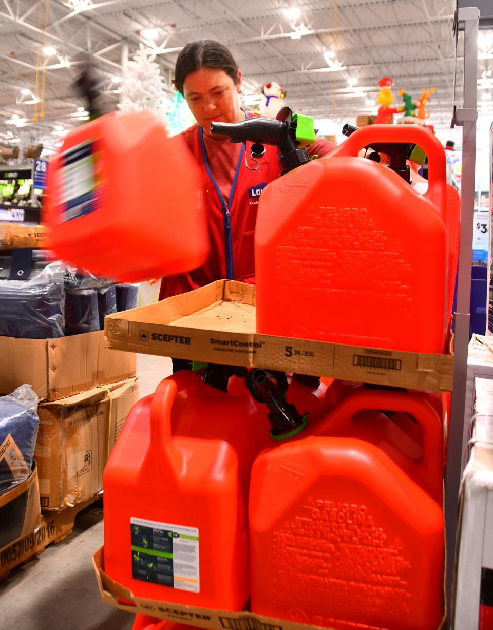
Free sandbags available at distribution sites
Brevard County Public Works and the Brevard County Sheriff's Office will continue teaming up to offer 10 free sandbags per vehicle from 8 a.m. to 6 p.m. Tuesday at four distribution sites:
Chain of Lakes, 2300 Truman Scarborough Way, Titusville.
Mitchell Ellington Park, 577 Hall Road, Merritt Island.
Wickham Park, 2500 Parkway Drive, Melbourne (use the park’s Parkway Drive entrance).
Eastern Florida State College Palm Bay campus, 250 Community College Parkway SE.
Brevard County officials are expected to decide Tuesday whether to open storm shelters, Communications Director Don Walker said. The Emergency Coordinators Group will meet during the afternoon.
In Titusville, sandbags are available through 5 p.m. Monday at the city public works facility at 385 N. Singleton Ave., police officials announced via Facebook. Residents can receive 10 sandbags, and they will need to fill the bags themselves.
Cocoa Beach officials are offering up to 10 sandbags per vehicle for city residents at the Cocoa Beach Country Club, 5000 Tom Warriner Blvd., until 5 p.m. Monday and from 8 a.m. to 5 p.m. Tuesday (Wednesday hours to be determined).
Participants should bring their own bags, and they can also bring shovels to speed up the process, per a post on the Cocoa Beach City Hall Facebook page.
The Cocoa Beach City Commission is expected to approve a Hurricane Ian state of emergency proclamation during a special meeting at 9 a.m. Tuesday at the country club.
The cities of Satellite Beach and Indian Harbour Beach have opened a sandbag distribution site at the Satellite Beach Sports Park, 750 Jamaica Blvd., through 8 p.m. Monday. The site will reopen at 8 a.m. Tuesday.
"While it is still too early to determine the exact impacts on our beachside communities, we are expecting heavy rainfall and flooding situations, especially since we are expecting at least 1-2 inches of more rain PRIOR to the Storm," said a Monday post on the Satellite Beach City Hall Facebook page.
Melbourne officials will offer up to 10 filled sandbags per vehicle to motorists who provide proof that they reside within city limits from 9 a.m. to 4 p.m. Tuesday at Club 52/Greyhound Park, 1100 N. Wickham Road. Participants should use the Sarno Road entrance.
Causeway closures are a common misperception
Walker said Brevard’s causeways do not close during hurricanes. Rather, Florida Department of Transportation officials will close causeways after the storms have passed to conduct safety inspections.
However, once wind speeds exceed 40 mph, Walker said the causeways become unsafe for high-profile vehicles — including fire trucks and ambulances. So beachside residents should bear that in mind when deciding whether to evacuate, he said.
Meals on Wheels and Seniors at Lunch officials expect to continue conducting business as usual as of Monday morning. To reach Aging Matters in Brevard, which coordinates those services, call 321-639-8770 or visit agingmattersbrevard.org.
Elsewhere on the transportation front as Ian approaches, the Federal Emergency Management Agency has activated a medical transport support contract for 52 ambulances and 100 paratransit seats that will stage at the Orange County Convention Center in Orlando.
Community Issues Columnist Britt Kennerly and Business Editor Dave Berman contributed to this report. Rick Neale is the South Brevard Watchdog Reporter at FLORIDA TODAY (for more of his stories, click here.) Contact Neale at 321-242-3638 or rneale@floridatoday.com. Twitter: @RickNeale1
Support local journalism. Subscribe today.
This article originally appeared on Florida Today: Hurricane Ian forecast to dump up to 10 inches of rain on Brevard County

