First tropical disturbance of hurricane season will dump rain on MS Coast. See forecast.
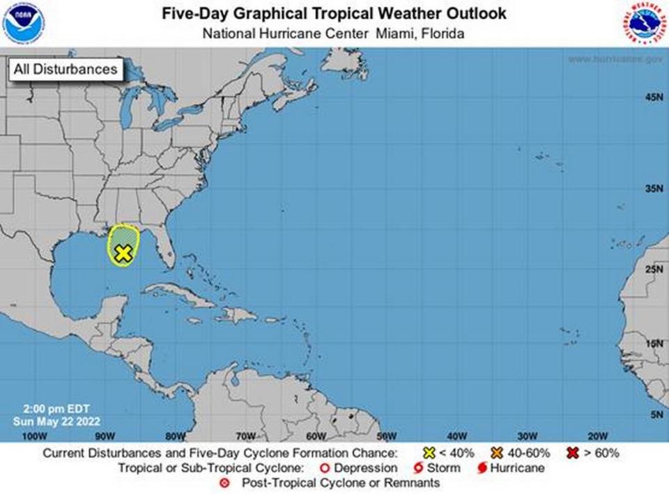
The Atlantic hurricane season kicks off June 1, but the National Hurricane Center on Sunday issued its first tropical weather outlook for a disturbance in the Gulf of Mexico.
The system has a very low chance of strengthening into a named tropical storm or hurricane before it moves over land, the NHC said in its 1 p.m. forecast.
“Surface pressures remain high, and environmental conditions do not appear favorable for significant development before this system moves inland over the central Gulf Coast in a day or so,” the update says.
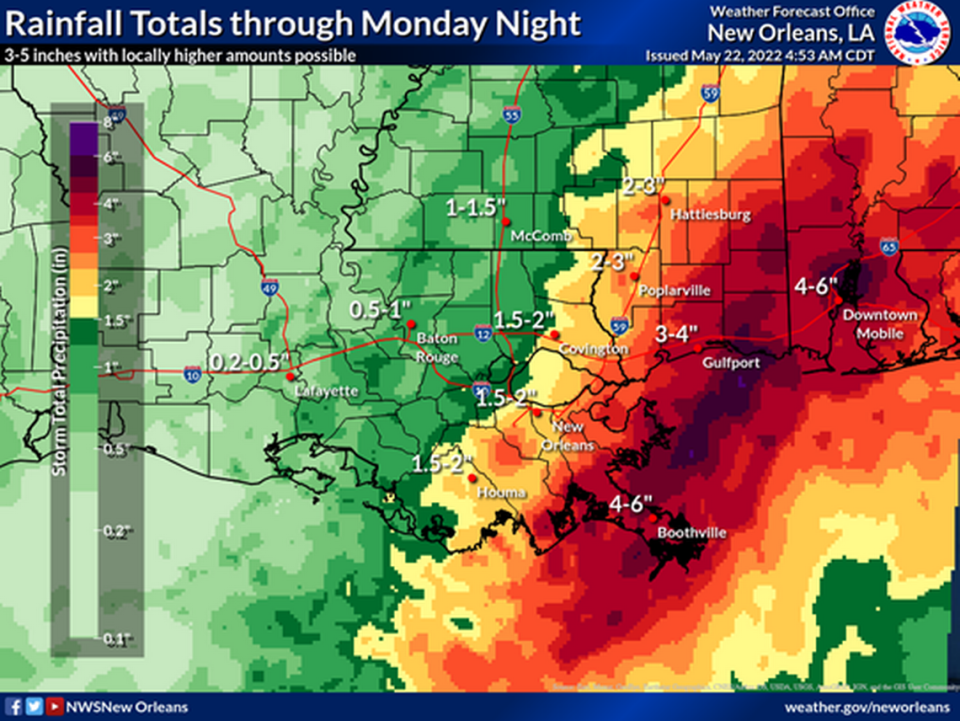
The system is expected to dump heavy rain and gusty winds from southeastern Louisiana to the western Florida Panhandle over the next 24-36 hours.
Three to four inches of rain is expected across the Coast through Monday night, said Matt Stratton, director of emergency management for Harrison County.
“Showers and thunderstorms are beginning to fire this afternoon across the region,” the National Weather Service New Orleans said in a Facebook post. “Expect heavy downpours with the stronger activity.”
Weather officials predict an active hurricane season this year.