Cumberland County may experience snow, black ice, flash flooding throughout week
Updated 8:30 p.m.
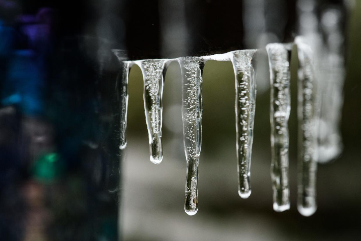
Although Cumberland County is no longer experiencing below-freezing weather, there is concern for black ice and flash floods throughout the Piedmont region, according to the National Weather Service.
Warning Coordination Meteorologist Nick Petro with the National Weather Service in Raleigh provided the last update for the winter storm on Facebook on Sunday.
“We’ve got temperatures that are basically going to stay put where they’re at through the night,” he said. “Black ice concerns Monday night and Tuesday morning.”
Petro said the winter storm has caused power outages throughout the region, but hopefully the warming weather discontinues any future power outages.
As of 7:30 p.m. there are no power outages in Fayetteville, according to PWC’s electric outage map.
“With temperatures…above freezing across the southern Piemonte (and) Sandhills’ region and precipitation ending, that’ll give this region an opportunity to really melt some of that ice,” Petro said.
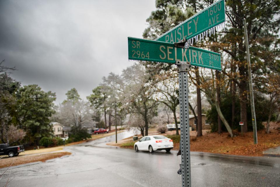
Cumberland County residents are still being advised not to travel if possible.
“There is an opportunity for isolated flash flooding and I don’t think we are out of those woods just yet, so watch out in those heavy downpour areas,” Petro said.
For up-to-date weather updates, visit the National Weather Service online.
Health and education writer Ariana-Jasmine Castrellon can be reached at acastrellon@gannett.com or 910-486-3561.
Support local journalism with a subscription to The Fayetteville Observer. Click the "subscribe" link at the top of this article.
-----------------------------------------------
Original story:
No additional ice is expected in the Fayetteville area, according to Nick Petro, a meteorologist with the Raleigh office of the National Weather Service. But snow is in the forecast once more for the area later this week.
Petro said for the Spring Lake area, residents should wait about one-to-three hours before moving around outside to ensure the risk of more ice is over.
"It looks like east of I-95, it's pretty much over," Petro said on Sunday. "At this point, folks still need to take it easy for about another hour or two or three, because that's what it's going to take to melt whatever ice occurred."
As of Sunday afternoon, temperatures rose in Fayetteville to 33 degrees from 30, and in Spring Lake to 32 degrees from 30. The highest temperature predicted for Sunday in Fayetteville is in the mid-40s, according to the National Weather Service.
"There's probably still some bridges and overpasses that are slick, and sidewalks," Petro said on Sunday. "It's just best for people to stay home if they can and only go out if they have to. Things will be improving quickly this evening."
Power outage map: See outages in Cumberland County and North Carolina area
New rain amounts for the Fayetteville area are between three quarters and one inch.
On Sunday afternoon, freezing rain was predicted for the area with wind chill of 22 degrees and wind speed northeast of 15-20 mph with gusts up to 40 mph, according to the National Weather Service.
The Fayetteville area saw freezing rain and some ice on Sunday morning. The National Weather Service predicted wind chill values could be as low as 19, with northeast wind 15 to 17 mph, with gusts as high as 34 mph.
The hazardous winter weather advisory remains in effect for cities in Cumberland, Johnston, Hoke and Harnett counties until 1 p.m.
In total, daytime ice accumulation is predicted to be less than 0.1 of an inch in the Fayetteville area, according to the National Weather Service.
On Sunday night, rain is expected before 2 a.m. with a low around 34 degrees. Wind gusts are predicted as high as 32 mph with southwest wind 10-17 mph. The National Weather Service said new precipitation amounts of less than a tenth of an inch are possible for the Fayetteville area.
Older reports: Fayetteville winter weather: Wind predictions increased, early-morning travel discouraged
Travel is still discouraged. More weather predictions can be found on the National Weather Service's website.
Late Sunday morning, the National Weather Service reported ice accumulations were beginning to increase across the sandhills. The highest ice totals were 0.18 of an inch in Raeford, about 35 minutes from Fayetteville.
Wind gusts could reach as high as 40 mph through the western Piedmont Sunday afternoon, according to the National Weather Service.
Some power outages were expected mainly west of U.S. 1 for Sunday throughout the night. Travel will also still be dangerous through Monday morning.
River flooding was also not ruled out as an effect of the storm, according to the National Weather Service. If rivers in the central areas do flood, the service predicted them to do so late Sunday through early next week.
There have been no new updates about closures in Fayetteville or Cumberland County for Sunday or the rest of the week.
For Martin Luther King Jr. Day, the Fayetteville area will be mostly sunny with a high of around 45 degrees, according to the National Weather Service. Wind gusts will be 15-to--20 mph with some gusts up to 35 mph.
Temperatures may drop as low as 26 on Monday night, but the Fayetteville area will be mostly clear with wind at 7-to-13 mph, with gusts as high as 24 mph.
The highest temperature for the week in Fayetteville is predicted for Wednesday, with a high of 58 degrees and mostly sunny. A chance of rain is predicted for that night after 2 a.m. with a low around 40 degrees
Tuesday is also expected to be sunny with a high around 49 degrees and a calm wind moving northwest around 6 mph in the morning. Temperatures will drop to around 28 that night.
Rain is again in the forecast Thursday between 8 a.m. and 2 p.m.
The area will get another chance of snow: Snow is forecast for Friday with temperatures from 35 degrees to a low of 22 degrees that night. Snow is also predicted for Saturday with mostly sunny skies during the day and a high of 36 degrees.
Additional details of what to expect from the storm can be found on the National Weather Service's website.
Investigative Reporter Kristen Johnson can be reached at kjohnson1@gannett.com.
Support local journalism with a subscription to The Fayetteville Observer. Click the "subscribe'' link at the top of this article.
This article originally appeared on The Fayetteville Observer: Snow, black ice and snow possible in Cumberland County

