St. Johns River three feet below normal as residents fear worse is yet to come
Lake Poinsett is parched beyond what Doug Sphar ever recalls seeing or believing could happen in more than six decades living along the Cocoa lake.
"This is all the talk of the people out here," Sphar said. "The consensus is that none of us remembers it this low this time of the year."
The lake, a favorite local spot to launch airboats, is an outflow of the St. Johns River, one of the few surface water supplies of drinking water in Florida. The fact that it is so low is raising concerns that more trouble is coming.
Less volume and flow into the river that feeds half of Brevard's water supply increases the risk of toxic algae taking hold. The algae makes it hard to treat the water and can fuel fish kills. It's happened before. Sphar and his neighbors worry it can and will happen again.
The way-below-low water levels aren't just happening here. Water levels are plummeting throughout the West this summer, as La Niña and climate trends converge and take a toll. Western states have griped about it for decades.
EEL tax put on ballot: Brevard County Commission puts on ballot third-time tax for environmental lands
Lagoon "inflow" study: Florida Institute of Technology given $1 million from State lawmakers for Indian River Lagoon
Smelly stretches of sargassum: Stringy, smelly algae dominates coastline from Cocoa Beach to Sebastian and beyond
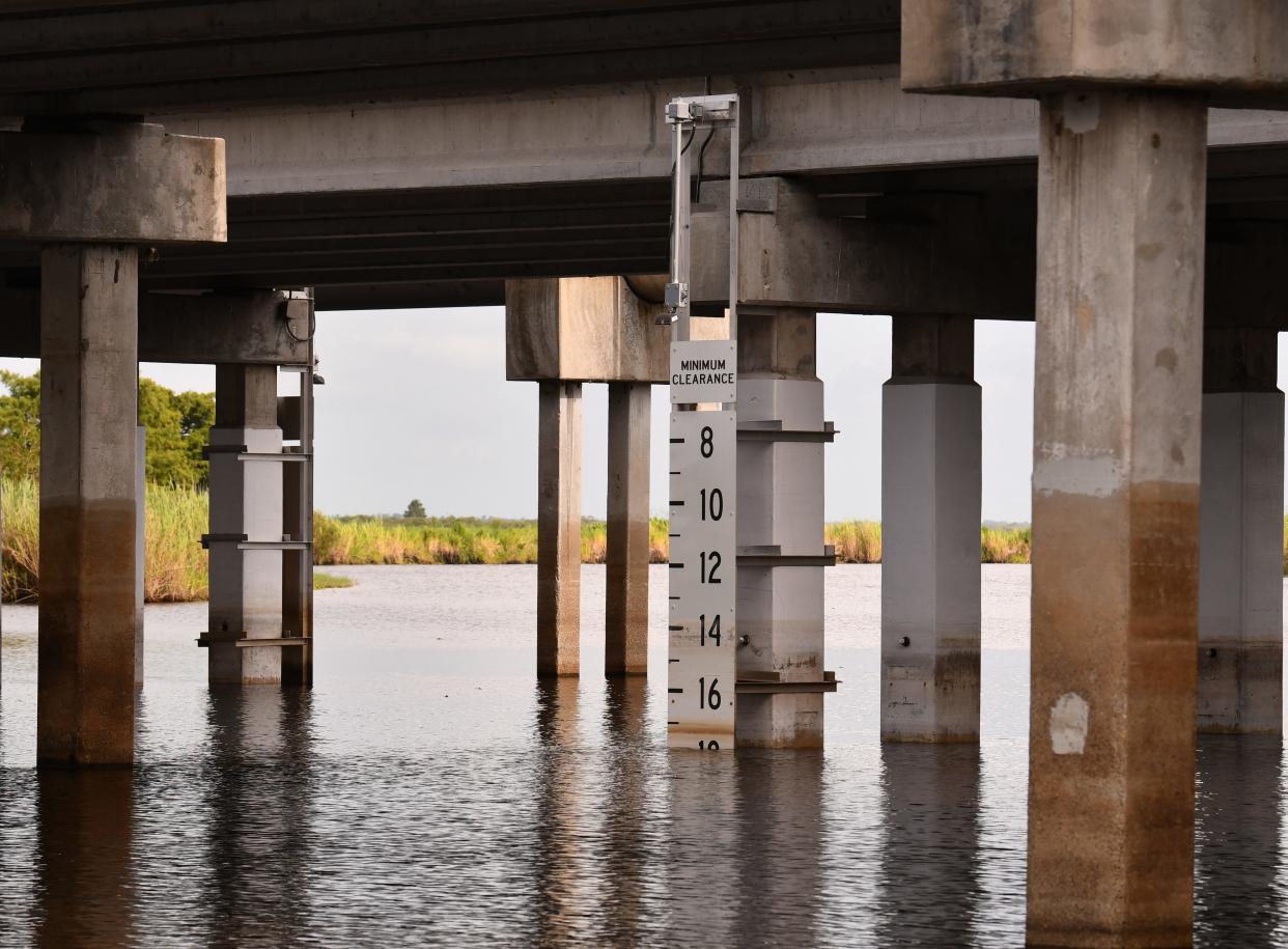
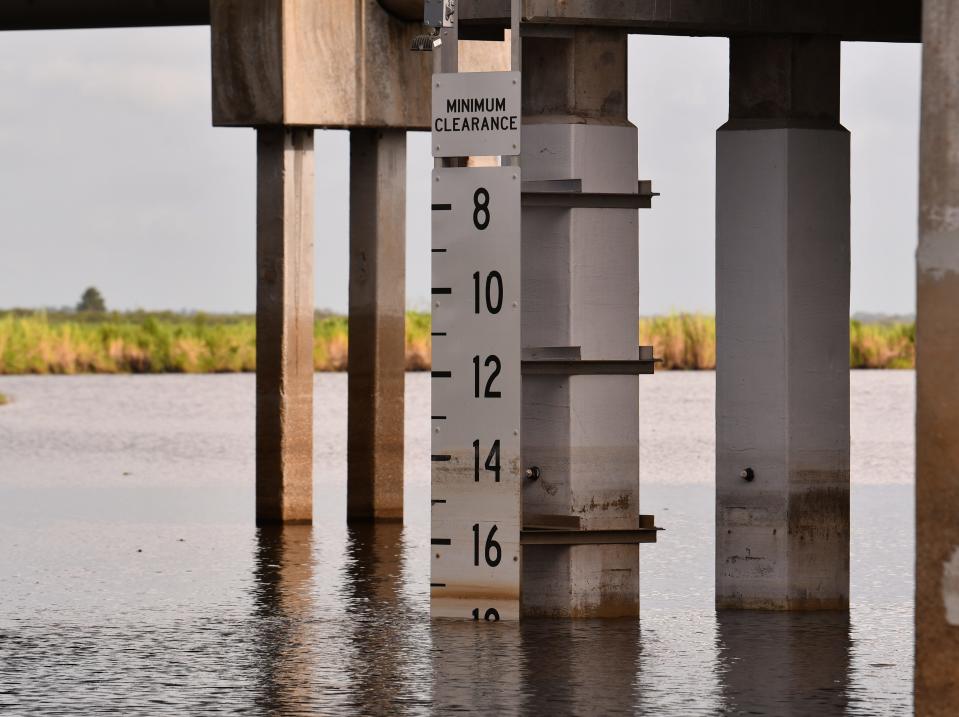
Indeed, the end of Tucker Lane where folks launch airboats looks like a moonscape. Airboat clearance at the State Road 520 bridge has seldom been better but the boat rides reveal an emaciated river stressed by drought.
And where Sphar once saw lake water lapping up against neighborhood seawalls, there is now a wide sandy beach between the waterlines and the homes where Sphar can now stand high and dry.
The water in the lake looks blacker and more stagnant than usual. That stagnation can spawn other troubles, especially for fish, farmers, airboat tours and potentially for water utilities.
"You'd think the conditions would be ripe for an algae bloom," Sphar said. "It's just a whole bunch of strangeness going on."
The localized drenching in the wee hours Saturday had yet to budge river levels much, according to USGS real-time gages. The downpour mostly hit the Cocoa Beach area.
Early morning showers brought Viera 4 to 5 inches, and one rain gauge in Cocoa Beach measured 7.31 inches, according to the National Weather Service in Melbourne.
More rain is expected through the weekend and the coming week, because of a frontal boundary stalling across the Southeast and very high atmospheric moisture, the National Weather Service in Melbourne's website said Saturday.
There’s always a significant lag time between heavy rains and the river levels. But it’s these downpours that could trigger algae blooms in the low waters as heavy runoff unleashes nutrients locked onto the land.
If algae blooms explode in Lake Washington or Taylor Creek — also outflows of the St. Johns River — that could complicate treatment of Melbourne and Cocoa's drinking water supplies. The low river levels in the St. Johns echo what's been going on throughout the southern United States this summer as short and long-term climate patterns converge to deny the nation rain and hint at more worrisome long-term trends that may one day render taps dry.
Should Brevard ban biosolids on lands near the St. Johns River?
The St. Johns River — which supplies about half of the drinking water in Brevard County — is almost three feet below its six-decade normal this summer in the Cocoa area, with similar dips throughout Brevard, according to real-time water gages operated by the U.S. Geological Survey.
The USGS gage height just north of Lake Poinsett — at the State Road 520 bridge in Cocoa — neared its record low of 9.1 feet this week, dipping to 9.6 feet, on Thursday. The median level over the past 66 years is 12.5 feet. The record maximum height was 15.5 feet in 2002.
The lower water levels this summer, climatologists say, are driven by an ongoing La Niña cycle and global warming. La Niña, a cooler-than-usual pulse of water near the equator in the Pacific Ocean, is the flip side of El Niño's warmer-than-usual water in the same region. Both patterns happen every several years, fueling global climate patterns.
La Niña tends to result in hotter, fierier summers that can favor more frequent and fierce hurricanes, but otherwise dry times for crops, forecasters warn. So far, the dryness has prevailed in east Central Florida. Melbourne has seen only 1.97 inches of rain in July, compared with the normal long-term average rainfall from the city of 6.5 inches of rain.
La Nina raises risk of drought, fire and hurricanes in Florida
On Aug. 8, the National Oceanic and Atmospheric Administration (NOAA) predicted La Niña would last through the end of the year. But odds of the pattern continuing decrease in the Northern Hemisphere in late summer (60% chance through September) before increasing in the fall and early winter (62-66% chance).
Droughts are not a given during La Niña, which spared Florida unusually dry weather the past two winters. But climatologists say droughts tend to happen seven or eight times out of every 10 La Niñas.
La Niña has fueled bad Florida fires in the past. In 2008, La Niña spelled catastrophic consequences in what came to be called the Mother's Day infernos, which destroyed 36 Palm Bay homes, damaged 250 others and scorched an estimated 13,500 acres in the city. Fires also burned several hundred acres in Cocoa.
This week, the Keetch-Byrum Drought Index – a key indicator of fire risk – put much of central Brevard County in the "red" danger zone for wildfires and showed the county among the driest in Florida.
While not too worried quite yet, the City of Melbourne and the St. Johns River Water Management District say they are monitoring the water levels and have plans in place to adapt if the summer gets drier.
City officials say they maximize groundwater use before drawing water from Lake Washington.
"We have an additional intake to draw water from the lake, if necessary," Cheryl Mall wrote in a email.
Melbourne's Joe Mullins Reverse Osmosis Water Treatment Plant, put into operation in 1995, has a five million gallon per day capacity and a four million gallon ground water storage tank. The reverse osmosis plant's raw water supply comes from four Floridan Aquifer wells 650 to 850 feet underground. Each yields 3.1 million gallons per day.
Water treated at the John A. Buckley Surface Water Treatment Plant is pumped from Lake Washington. The lake generally provides two-thirds of the water supply for the city's 59,000 connections, serving about 180,000 people. The rest comes from wells.
And when algae blooms happen on the lake, toxins from the algae are difficult to cleanse from the water. When toxic algae plagued the lake in the summer of 2019 and customers smelled weird odors from their taps, Rep. Randy Fine held a town hall on the matter.
Any algae toxins from Lake Washington are removed from the water before it reaches customers' taps, city officials assert. But the lake has been plagued by blue-green algae blooms for decades. Nitrogen and phosphorus from fertilizers, sewage sludge land application, leaking sewage systems and other sources can fuel excess algae growth, biologists say, especially in warmer summer months.
If St. Johns River flows and levels get low enough, it's up to the St. Johns River Water Management District to open levees to replenish Lake Washington and other water supplies.
"If it was of serious concern, we would issue a water conservation request asking customers to refrain from things like washing cars, watering lawns, hosing decks," Mall wrote. "There are multiple variables involved we use to determine this, such as the amount of rain and amount of upflow stream."
The water management district has been monitoring the water level in Lake Washington to ensure it does not get low enough to cause concern for the utility, Ashley Evitt, spokeswoman for the district, wrote in an email. "If the water level drops, the district is able to open S-257 (levee), which will route water from Three Forks Marsh Conservation Area to Lake Washington. Work is currently underway to construct a permanent fix and should be completed within the next two weeks."
"While current conditions, including decreased water levels and increased water temperatures, would be conducive to algal blooms, it is not a guarantee," Evitt added. "The high color of the river water does help provide some resistance to bloom formation."
That's because the dark tea-like color of tannins and humic acids from rotting bits of plants in the river reduce available light in the water to support photosynthesis algae needs to grow.
Florida wildfires: fire and smoke map
Sphar sees a deeper undercurrent to the wildly fluctuating water level in Lake Poinsett – global warming. In April and May there was very anomalous high water immediately followed by the recent lows. "Seems to be part of all this crazy weather that is afflicting the country this year," he wrote in an email. "Seems to get more unstable every year as part of the climate change."
This weekend's rains may bring some relief but for now Sphar is trying to focus on a potential upside: The lower lake levels expose the mud flats and the tiny organisms, making for easy pecking for famished fowl.
"It's a boon for the wading birds," he said.
Jim Waymer is an environment reporter at FLORIDA TODAY. Contact Waymer at 321-261-5903 or jwaymer@floridatoday.com. Or find him on Twitter: @JWayEnviro or on Facebook: www.facebook.com/jim.waymer
Support local journalism and local journalists like me. Visit floridatoday.com/subscribe
This article originally appeared on Florida Today: St. John's river level drop causes concern about algae blooms, drinking water

