Potential record lows for overnight; Showers expected toward end of week
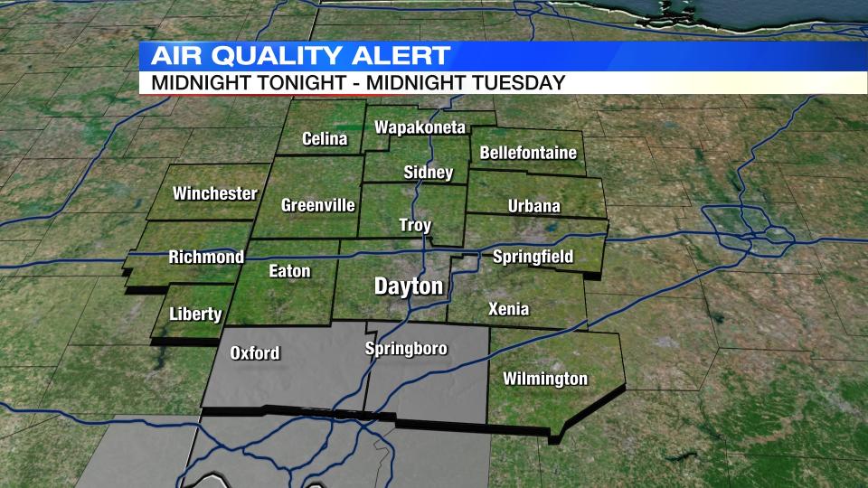
Air Quality Alert issued for Butler and Warren Counties for all day Tuesday.
QUICK-LOOK FORECAST:
Dry and sunny much of this week
Get hotter mid to late week
Few storms at times this weekend
>>TRACK THE LATEST CONDITIONS: Live Doppler 7 Radar
DETAILED FORECAST:
TONIGHT: Low temperatures fall to the lower 50s and potentially upper 40s for some with clear skies and dry conditions. The record low temperature for tomorrow morning is 52 degrees. Storm Center 7 Chief Meteorologist McCall Vrydaghs is forecasting 51 in Dayton which would be a new record low.
An Air Quality Alert has been issued for Butler and Warren Counties starting at midnight.

TUESDAY: Another warm and sunny day with highs around 80 degrees with low humidity. Temperatures will be in the low 50s Tuesday night.


WEDNESDAY: Partly cloudy skies for Wednesday and warmer. Highs in the mid 80s.
THURSDAY: Temperatures return to the lower 90s for Thursday as it will be feel like the upper 90s with the humidity.
FRIDAY: Partly sunny with a storm possible late in the day. High temperatures in the low 90s but heat indices will be in the mid to upper 90s with the humidity.
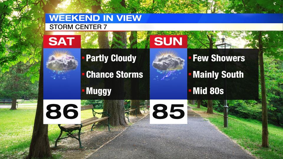
SATURDAY: Partly to mostly cloudy with scattered showers and thunderstorms. Warm and muggy with highs in the mid 80s.
SUNDAY: Partly sunny with a storm possible. The best rain chances will be south of I-70. Highs in the middle 80s.
MONDAY: Partly cloudy and warm for the 4th of July with highs in the upper 80s, a passing shower or storm is possible.

