Hurricane Ian Wednesday updates: Flash flood warnings issued for Sarasota, Manatee, Charlotte
8:11 p.m. | Flash flood warning for more parts of Sarasota, Charlotte
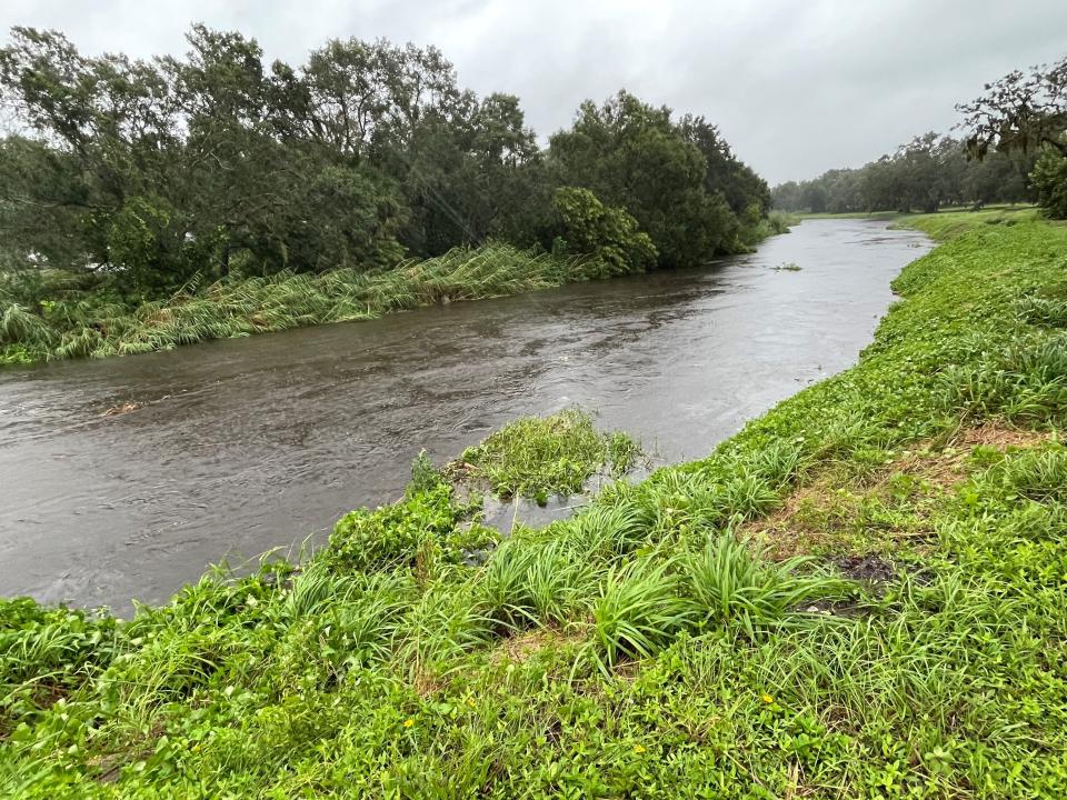
The National Weather Service has issued a flash flood emergency for Sarasota, Manatee, Hardee, western DeSoto, northwestern Highlands and southwestern Charlotte counties until 10:45 p.m. At around 7:47 p.m., The Doppler radar indicated that there was between 12 and 19 inches of rainfall, with an additional 3 to 8 inches possible in the area.
7:53 p.m. | Flash flood warning for North Port, Venice and Englewood
The National Weather Service has issued a flash flood warning for North Port, Venice and Englewood until 10:45 p.m.
7:40 p.m. | Pool damage in Venice
we lost our entire pool cage. It smashed my house and it’s in the front yard. Then my office started flooding. We have the lake in back that feeds off the gulf and Currie creek which is concerning me know. The winds are blistering. since filming this video, the street in front of my house has expanded. The water is halfway up my front yard. I guess I won’t be campaigning for a little bit, a lot of work here.
Posted by Frankie "The Scoop Guy" Abbruzzino For Mayor - Venice on Wednesday, September 28, 2022
7:31 p.m. | Much of Sarasota County without power
Much of Sarasota County is without power as Hurricane Ian hits Southwest Florida, the county’s director of communications said in a Wednesday evening press briefing. As of 7:14 p.m., 246,920 customers – or about 86% – in Sarasota County were without power, according to FPL's power tracker.
The county’s 12 evacuation centers – which are housing about 4,600 people – have lost power, but the two medically dependent shelters are being powered by generators, according to Jamie Carson, the director of communications.
Personnel at the county’s Emergency Operations Center are communicating with those shelters through radios.
Carson said Sarasota County schools will be closed through Friday.
The county’s Public Safety Communications Center, which answers 911 calls, is experiencing a “very high call volume,” she said.
“The Sarasota County Sheriff’s Office would just like to remind everyone to please try to be patient, stay in the queue,” Carson said. “They’ll get to you as fast as they can.”
The city of North Port’s call center and phone lines are down, so Carson asked North Port residents to call Sarasota County’s call center at 311.
The county’s Tactical First-In Teams are ready to start clearing major roadways once wind speeds go below 35 miles per hour for a sustained period of time.
Carson also said that National Guard soldiers are poised to help with the storm response once roadways are clear.
7:21 p.m. | Photos of Hurricane Ian in Sarasota, Manatee
7:09 p.m.| Stormy scene outside Bradenton City Hall
Bradenton City Hall at approximately 6:30pm. 🌀 #HurricaneIan pic.twitter.com/lf6keanYUH
— Bradenton Police (@BradentonPD) September 28, 2022
6:30 p.m. | NWS issues flash flood warning
The National Weather Service in Ruskin has issued a flash flood warning for Sarasota County, eastern Manatee County, northern Lee County, Charlotte County, DeSoto County, Hardee County and southwestern Highlands County until 9 p.m. Wednesday.
Doppler radar indicated that between 5 to 16 inches of rain has fallen so far and an additional 3 to 6 inches is possible for the areas indicated previously.
6:14 p.m. | Damage in Venice
5:35 p.m. | FPL official: Restoring power may take hours, days, maybe even longer than a week
A top Florida Power & Light official said customers who lose power from Hurricane Ian may face hours, days — maybe even longer than a week — to get it restored.
As of 5 p.m., about 75% - 214,560 - of FPL customers in Sarasota were without power. Another 67,720 – 34% of customers – in Manatee were without power.
Dave Reuter, FPL’s chief communications officer, told CNN on Wednesday that the biggest challenge facing FPL in the next 24-48 hours is dealing with storm surge and flooding, and seeing where its crews can work safely. FPL is the state's largest utility with nearly 6 million customers.
“We're going to use all of the tools that we have at our disposal, our drone technology, the diagnostic systems that we have to figure out where the power is out and what we may be able to do to get it back on safely and as quickly as possible,” he said.
But he tempered expectations because Ian’s magnitude could require FPL to do a “complete rebuild of the system in certain parts of the West Coast.”
“What we're seeing already just from some of the early visuals, we expect that there are going to be parts of our system on the West Coast, which will need to be rebuilt and that is going to take longer — could be number of days, could be a matter of weeks, depending on the nature of the damages.”
He said about 1 million customers have lost power, but that 350,000 customers have gotten their power restored within the past day.
“We have been restoring power to customers for the last 24 hours as [the storm’s] outer bands started to come through our services area,” he said.”
More customers, he said, will be losing power as the path of the storm meanders across central Florida and through FPL’s coverage area.
“The reality with a storm like this is, of course, you expect power to be out as a category 4 storm on the coastline, but as it goes through the state, there will also be additional outages due to tornadoes, flooding and the high winds that will accompany the storm all the way across the peninsula,” he said.
5:27 p.m. | Sarasota schools closed until further notice
All traditional public schools are closed until further notice. Stay safe!! https://t.co/J6pv4UkFZY pic.twitter.com/PQIg2l2qlK
— Sarasota Schools (@sarasotaschools) September 27, 2022
5:23 p.m.| Bradenton PD warning on downed trees
We're finding trees - and power lines - down. Winds are whipping. Please remain inside, do not drive through water, and never approach a downed power line. @BradentonGov #HurricaneIan pic.twitter.com/50o5ecT7J4
— Bradenton Police (@BradentonPD) September 28, 2022
5:12 p.m. | Manatee schools closed for remainder of week
Due to conditions resulting from Hurricane Ian and the fact that 17 of our schools have served as community shelters, all School District of Manatee County schools will remain closed for the remainder of this week - through Friday, September 30th. pic.twitter.com/Tadx8D03XU
— Manatee Schools (@Manateeschools) September 28, 2022
5 p.m. Extreme wind warning for Manatee, Sarasota counties
The National Weather Service in Ruskin issued an extreme wind warning for five counties, including Southeastern Manatee County and Sarasota County, which will last until 6 p.m. today. Charlotte, Lee and western DeSoto counties are also under the advisory. The Doppler radar indicated that just after 3 p.m., extreme winds were moving onshore near North Port.
As of 5 p.m., more than 182,000 customers were without power in Sarasota County and more than 42,000 in Manatee, according to FPL's power tracker page.
3:10 p.m. Hurricane Ian makes landfall
Hurricane Ian made landfall at 3:05 p.m. as a powerful Category 4 storm, with sustained winds of 150 mph.
Ian came ashore near Cayo Costa. an island off the coast of Fort Myers, according to the National Hurricane Center.
Stay up to the minute: Sign up to a special texting group for updates on Hurricane Ian and its aftermath
There she goes. A small tree is uprooted just outside a classroom at the storm shelter at Brookside Middle School. Wind gusts in Sarasota at 3 pm are reported to be near 60 mph. #HurricanIan #sarasota #stormshelter #treesdown pic.twitter.com/nnhfA3fFMJ
— Samantha Gholar (@SamanthaGholar) September 28, 2022
The hurricane is moving north-northeast at 9 miles per hour.
Hurricane Ian is poised to bring hurricane-force winds to Florida's East Coast as it moves across the state.
Sign up for the latest updates on Hurricane Ian and the storm's aftermath. We are a team of journalists from local newsrooms around Florida and we will be sending you the latest updates as we have them and answering your questions as possible.
Sign up to special texting group for updates on Hurricane Ian
Sign up here for the latest updates on Hurricane Ian and the storm's aftermath. We are a team of journalists from local newsrooms around Florida and we will be sending you the latest updates as we have them and answering your questions as possible.
Here's what's included:
Privacy. We'll never share your number with anyone. You'll only receive texts from us.
Insights. Updates and information on Hurricane Ian before anyone else gets it.
Answers. Got a compelling question about the hurricane? We'll try to answer it directly.
Frequency. This will vary depending on the progress of the storm and the aftermath.
Hurricane Ian nears landfall at 155 mph, one of the strongest U.S. storms
The National Hurricane Center said Hurricane Ian was nearing landfall with maximum sustained winds of 155 mph, just short of category 5 status. That would make it one of a handful of the strongest hurricanes to hit the continental United States.
The center said it was bringing "Catastrophic storm surge, winds and flooding in the Florida peninsula."
Location: About 50 miles SSW of Punta Gorda and about 25 miles WNW of Fort Myers
Maximum sustained winds: 155
Present movement: NNE at 9 mph
Central Pressure: 937 MB
2:45 p.m. | Manatee County residents urged to delay driving when storm passes
Manatee County Administrator Scott Hopes reports more than 5,120 evacuees are in county shelters. He said 15% of the lift stations, which lift and move solid waste, don’t have power and residents are asked to limit toilet flushing.
Residents are reminded not to drive through standing water unless you’re certain of the depth or that a large sinkhole wasn’t created underneath. Multiple traffic signals and power lines are down already, and that it will only get worse as flooding increases.
Residents also should only use generators outside the house where there is fresh air to prevent carbon monoxide poisoning.
Public officials will let residents know when it’s safe to leave their homes or shelter. He said people driving around immediately after the storm will only get in the way of the more than 2,000 Manatee County workers trying to assess and recover damages.
“What will slow our efforts down is if everybody gets on the road and drives around to look for yourself about what damage has been done,” Hopes said. “That is a disaster tourist.”
Residents who stayed put report damage and surge
Yvette Gagier, a Holmes Beach resident in evacuation zone A, chose to stay home despite the storm. She said she lost power and water but has had no damage to her home yet.
“The gulf water is being pulled out, otherwise so far ok,” Gagnier wrote in a text.
She said she was feeling anxious about potential storm surge, but her neighbor offered to let them use their elevated house in case of flooding.
On the Bayfront, Don Bruns chose to stay put in his sixth-floor condo at Le Chateau on John Ringling Causeway. He said the storm is the worst he’s seen in the ten years he’s lived here, but he feels safe.
Because he’s on the sixth floor with hurricane windows and shutters, he said he felt comfortable riding the storm out so close to the water.
Bruns said he also noticed the water from the bay being pulled out from the hurricane.
2:30 p.m. | Manatee and Sarasota counties urge residents to limit toilet flushing
Three line breaks in the potable system have been reported in Manatee County. Two have been repaired, and the additional one will be repaired as soon as storm conditions improve.
About 15% of sewage lift stations are without power so customers are asked to limit flushing to avoid potential backups.
Sarasota County officials also asked residents in a tweet to limit water usage until after the storm passes to “lessen stress on the county’s water systems.”
Three line breaks in the potable system have been reported. Two have been repaired, and the additional one will be repaired as soon storm conditions improve. Also, approximately 15% of sewage lift stations are without power so customers are asked to limit flushing. pic.twitter.com/rvcFo3LMiP
— Manatee County Government (@ManateeGov) September 28, 2022
2:25 p.m.|Power outages increasing as winds grow stronger
Florida Power and Light reports that nearly 36,450 homes, or about 18 percent of customers, are without power in Manatee County and about 79,000 homes, or 28 percent of all customers in Sarasota County have lost power as Hurricane Ian’s winds grow stronger.
Turn off AC breakers if you lose power
If you lose power during Hurricane Ian, it’s a good idea to turn the breakers to your air conditioner off, to avoid possible damage as linemen work to restore service.
“For a typical house that has your air conditioner outside and an air handler inside there will be two breakers,” said Billy Swanson, owner of Tri-County Air Conditioning and Heating in Venice.
Turn both of those breakers off and wait until lights aren’t flickering and your power is fully restored.
“Then you can go turn your breakers on,” Swanson said.
In the past, that was a practice to avoid a blown compressor but with modern units it’s not just the compressor that can be damaged.
“With the new units it’s not necessarily the compressor,” Swanson said. “It’s a lot of the digital computer stuff.
“You may not have to replace the whole unit but you'll have to replace the little part that didn’t like the whole voltage fluctuation,” he added. “The newer units, they’re all getting more and more dependent on computer chips and circuit boards.
“You’re not only protecting the winding of the compressor but also protecting the high tech chips.”
1:45 p.m. | Sarasota County emergency has stopped responding to calls.
Emergency vehicles have stopped responding to calls in Sarasota County because it isn’t safe to be on the roads, according to a county tweet.
“Use this time to shelter in place,” Sarasota County tweeted.
When sheltering in place, people should stay in the centermost place in their home, said Sarasota County Director of Communications Jamie Carson.

“You want to put as many walls between you and the exterior of your home,” she said at a midday press conference.
Residents with questions about sheltering in place may call 311.
Please stay off the roads. We have debris down on 9th street, next to Motorworks Brewing Co. @BradentonGov pic.twitter.com/9Mtgc8ruNR
— Bradenton Police (@BradentonPD) September 28, 2022
Despite impacts from Ian, hurricane party rages on
Marty Goodrick said he was already drenched from doing some last-minute hurricane prep favors for friends and wanted to get some food Wednesday afternoon, before hunkering down to ride out Hurricane Ian at home – that’s what brought him to Salty Jim’s Island Bar & Grill at 3655 Webber Street.

“It was the only place open to pick up some food, and I wanted to get an order of buffalo wings,” Goodrick said. “I knew this place was open, so I stopped by and got some wings to bring home.”
Dennis and Gemma Huff, owners of Salty Jims, said that for them, it was the logical place to ride out the storm.
“This is like our hurricane shelter because we live in Zone A, down in Nokomis,” Dennis Huff said. “We’re going to be here anyway, might as well open the door.”

As many as two dozen people had been there at one time, to grab a bite to eat and a beer.
“We owned Hurricane Mike in Gulf Gate, that was our hurricane shelter too,” he added.
They rode out Hurricane Irma in 2017 at Hurricane Mike’s.
The Huffs plan to hunker down at Island Jim’s for the duration of Hurricane Ian.
“As long as people are here, we’ll be open,” Huff said
1:00 p.m. |Strong winds hit area
Some of the wind gusts reported by the National Weather Service over the last two hours:
Skyway Fishing Pier 70 mph 12:11 p.m.
Sarasota Bay Marker 17 72 mph 11:54 a.m.
Sarasota 52 mph 11:42 a.m.
Venice 63 mph 12:15 p.m.
Punta Gorda 79 mph 12:18 p.m.
Sarasota Bradenton International Airport 64 mph 12:17 p.m.
Grove City (Englewood area) 66 mph 12:11 p.m.

12:45 p.m. |Emergency responders no longer heading south
Sarasota County emergency vehicles are no longer responding to emergencies from Center Road south in Venice. Winds have reached 45 miles per hour, which is the point at which emergency personnel can no longer respond.
The number of people at Sarasota County’s shelters increased substantially Wednesday morning.
The county’s 12 shelters had a total of 2,600 people as of about 8:30 a.m. They now have more than 4,200 people, according to Sarasota County Director of Communications Jamie Carson.
I have flown storms for the last six years. This flight to Hurricane #Ian on Kermit (#NOAA42) was the worst I’ve ever been on. I’ve never seen so much lightning in an eye.
This was the eye. You can see the curvature. Understand this is at NIGHT. The light is from LIGHTNING. pic.twitter.com/cfZ9ls6YD3— Tropical Nick Underwood (@TheAstroNick) September 28, 2022
12:30 p.m. |Extreme wind warning issued by National Weather Service
The National Weather Service in Ruskin has issued an extreme wind warning for south central Sarasota County and southwestern Charlotte County until 2 p.m.
Just after noon, the Doppler radar indicated extreme winds were onshore about 20 miles southwest of Punta Gorda. The winds are associated with the eyewall of Hurricane Ian, according to the National Weather Service.
The Weather Service also has extended a flood warning for the Manatee River at Rye Bridge until further notice, with waters expected to crest just below the major flood stage. Moderate flooding is expected in the area, according to the forecast. Drivers are asked to turn around when they encounter flooded roads.
Current Weather Alerts
If you can't see any local weather warnings here, you'll need to open this story in a web browser.
11 a.m. update I Hurricane Ian’s eyewall is coming ashore
Hurricane Ian's eyewall was moving onshore with maximum sustained winds of 155 mph, according to the 11 a.m. advisory from the National Hurricane Center. It is among the strongest storms to hit the state of Florida.
“Extremely dangerous eyewall of Ian moving onshore. Ian will cause catastrophic storm surge, winds, and flooding in the Florida peninsula soon.”
The center also said the hurricane's forward speed nudged down to 9 mph. The slower the storm moves, the longer effects will stay in the Sarasota-Manatee area. The storm remains large and will have impacts across the peninsula.
“Weakening is expected after landfall, but Ian could be near hurricane strength when it moves over the Florida East Coast tomorrow, and when it approaches the northeastern Florida, Georgia and South Carolina coasts late Friday.”
Peak storm surge is still forecast to be 12 to 18 feet in Charlotte harbor.
Meanwhile, Sarasota County’s director of communications urged county residents in Levels A and B to evacuate during a midmorning press briefing.
“The window to evacuate and go to an evacuation center, that window is rapidly closing,” said Jamie Carson, the director of communications. “The weather is deteriorating. Leave now.”
As of around 10:20 a.m., the county’s 12 evacuation shelters were still open. Once the winds reach 45 miles per hour, Sarasota County will send an alert to county residents telling them that they must shelter in place.
“Seek an interior space away from windows,” she advised. “Make sure you have your radio and your provisions.”
When different areas of the county reach wind speeds of 45 miles per hour, emergency vehicles will stop going to those areas.
The city of North Port reported that those in the Woodland Estates or the North Port Estates areas, and anywhere along the Myakkahatchee Creek or south of U.S. 41, will be severely impacted by historic flooding.
12:10 p.m. | Bradenton residents asked to conserve water
City of Bradenton officials are asking residents to conserve water after they received word from their public works staff that the wastewater treatment plant is full and in danger of overflowing, according to a City of Bradenton tweet. Officials are asking residents to not do dishes or laundry at this time, limit showering and to only flush when it is necessary.
Damage reports from Sarasota County Sheriff's Office
Here’s a quick look at:
Stone Ridge Tr
Stickney Point Bridge
N Honore Avenue @ Travini Circle
Deputies are still responding to calls for service but this is not the time to be on the road. This is the time to hunker down & shelter in place. Sit tight, stay safe, stay informed. pic.twitter.com/quAFxNaJvO— SarasotaSheriff (@SarasotaSheriff) September 28, 2022
10:22 a.m. | Manatee County closing all shelters
Manatee County Administrator Scott Hopes said shelters will be closed effective immediately. People who are waiting in line will still get in, but after them, authorities will be locking them down.
Law enforcement will be on lockdown as well so there will be no EMS services. Hopes said the lockdown is for the safety of EMS and residents. There will be medical personnel available at shelters, though. They're hoping to open the lockdown late morning tomorrow, as they're expecting the worst of the storm to hit between 4 p.m. and midnight.
The county has seen a huge surge of people trying to get to the shelters within the last hour and a half, reaching 5,000 residents after reporting close to 3,000 earlier today. Officials are asking people again not to leave their homes until everything is in the clear. Since the eye of the storm is so huge, they're saying it may look like we're in the clear, when in reality it's not.
It’s quiet in downtown #Sarasota. We’re as prepared as we can be for #HurricaneIan. @SarasotaPD is on patrol w/limited service. Please stay in a safe location & follow directions from local officials. Monitor this channel and local news outlets for updates. pic.twitter.com/8NPO6Hv5LQ
— City of Sarasota (@CityofSarasota) September 28, 2022
Sarasota County waterfront restaurant owners wait out Hurricane Ian
After completing hurricane preparations earlier this week, local owners of waterfront restaurants, or restaurants near the water, waited Wednesday to see what the effects of Ian would be to their businesses.
Venice Pier Group president Justin Pachota's businesses are all waterfront restaurants: Sharky's on the Pier at the base of Venice Fishing Pier and upscale, adjacent sister establishment Fins at Sharky's are both on Brohard Beach. Old Florida barbecue spot Snook Haven is on Myakka River, and concessionaire Siesta Beach Eats is on world-famous Siesta Beach.
Sharky's, Fins at Sharky's, and Siesta Beach Eats have been closed since Monday, and Snook Haven even before that, Pachota said. Windows have been boarded up and outdoor furniture and other items brought inside, along with moving as much as possible from Siesta Beach Eats' lower Sand Pavilion to the second-story Sun Deck.
Once the storm passes, Pachota said he will assess the properties, then try to organize schedules and get employees in as soon as possible, but doesn’t picture being able to open any earlier than Friday evening. Until then, Pachota will wait out the storm in Venice, as he waits to see what the effects of Ian will be compared to previous hurricanes, including Irma in 2017.
“Irma was a little nerve-wracking, because we hadn't gone through one of those in a while," Pachota said. "So I think as far as preparation went, it was under a probably better mental state going into this one. But now that everything's done and I'm having an opportunity to watch more of the news, I would say the anxiety is probably a little bit higher than it was with Irma."
Siesta Key restaurants and bars, including one open since 1947, brace for impact
Chris Brown co-owns Above the Hospitality Group, which operates several restaurants and bars less than a mile from Siesta Beach in Siesta Key Village including The Cottage, Summer House Steak & Seafood, MVP – My Village Pub, The Hub Baja Grill, and Beach Club, which opened in 1947. Above the Bar also operates the bar Joe’s in downtown Sarasota and Mad Moe’s Pub & Grill in Osprey, where Brown will wait out the storm at home.
Above the Bar’s establishments have also been closed since Monday, as staff boarded up buildings and brought in outdoor picnic tables and other furniture. Brown said they also have a generator up and ready that is mobile, in the event that multiple restaurants lose power.
For now, Brown will have to wait and see if the businesses suffer minor debris or major damage from the hurricane, and if humanitarian priorities following the storm will overshadow reopening restaurants.
“I’ve been here for 30 years and we’ve had several close calls over the years; it looks like we’re finally due for one," Brown said. "Obviously, we’re very concerned. Buildings, businesses can be replaced, we can get those up and running at a certain point, but people’s well-being is obviously the most important thing at this time.”
Damage being reported
As the outer bands of the hurricane begin to batter Southwest Florida, the first signs of damage are being reported on social media.
Water starting to rise
As Ian approaches landfall between Venice and Fort Myers, the counterclockwise rotation of the winds has pushed water out along the shorelines of Sarasota, Bradenton and Tampa Bay outwards, according to photographs from the surrounding area.
This is the Manatee river in Ellenton. Here, there's usually 2-3 feet of water, but the water is being sucked out right now. #HurricanIan pic.twitter.com/2rFxPS0yJ1
— Bradenton Police (@BradentonPD) September 28, 2022
Photos tweeted by the Bradenton police show the Manatee river in Ellenton, which usually has about two to three feet of water, has receded.
Here's another look at the tree that came down earlier at 50th St W and Cortez Rd West. The tree was put on a trailer and we helped drag it out of the way. #HurricaneIan #Bradenton pic.twitter.com/WAZc0Vw66T
— Bradenton Police (@BradentonPD) September 28, 2022

9:30 a.m. | Manatee County closing roads as storm approaches
Manatee County is preparing to close some roads as Hurricane Ian moves closer. In a briefing Wednesday morning, County Administrator Scott Hopes said more than 100,000 people were evacuated in the last two days. As of the time of the briefing, about 80 FPL customers in the county had lost power, and Peace River had slightly more than 3,000 customers without power.
Hopes said public transit stopped at 8:30 a.m., and shelters closed to new arrivals due to safety concerns. He said the county expects major flooding up to 13 inches and asked that people not to return home until they have been given clearance.
“Just because the weather clears and the skies blue doesn’t mean it’s necessarily safe to go out and about,” Hopes said.
He said there are seven teams staffed with a fire truck, bulldozer, bus and EMS unit placed in strategic locations around the county to be activated once winds subside.
8:45 a.m. | Sarasota-Manatee shelters mostly empty
Officials in Sarasota and Manatee counties say that the shelters set up to house those who had to evacuate their homes from Hurricane Ian are only at a fraction of capacity
Sarasota County spokeswoman Brianne Grant said shelters can accommodate about 26,000 people, but as of about 8:30 a.m. Wednesday, there were only about 2,600 people in the county’s 12 shelters. In Manatee, there were about 2,500 people in 17 shelters as of Wednesday morning, and the county can handle about 27,000, a county official said.
Grant said those who can still make it safely to a shelter should go as soon as possible.
Sunshine Skyway bridged closed
With winds now ranging between 50 to 60 mph, the Florida Highway Patrol has closed the Sunshine Skyway bridge in both directions. The bridge will remain closed until the storm passes, officials said.
7:20 a.m. update I Ian gaining strength before landfall, near Category 5
The National Hurricane Center put out a special advisory at 7 a.m. to say that Hurricane Ian had strengthened to 155 mph maximum sustained winds, just 2 mph below Category 5 strength. The center said it could have that strength just before landfall at 2 p.m. Wednesday.
At a National Weather Service briefing at 7 a.m., Ian was 55 miles southwest of Sanibel Island and 120 miles south of Sarasota. It’s moving north by northeast at 10 miles per hour.
The eyewall is 53 miles across and the outer eyewall was only 20 miles offshore of Sanibel, which has received 3.57 inches of rain over the last 12 hours.
A maximum storm surge of 10 to 16 feet is possible from Englewood to Bonita Beach this afternoon and/or tonight and 7 to 10 feet from the middle of Longboat Key to Englewood. Up to 2 feet of rain is possible, which would lead to historic flooding, the weather service said.
6:35 a.m.: Hurricane Ian strengthens into strong Category 4 storm
The National Hurricane Center issued a special advisory saying Hurricane Ian has grown even stronger. Maximum sustained winds have hit 155 mph.
The hurricane is moving north-northeast at 10 mph and is located 65 miles west-southwest of Naples.
A Category 4 storm has winds of 130 to 156 mph. Ian is just short of the 157 mph threshold to become a Category 5 storm.
The Herald-Tribune has made this article free of charge for all readers in the interest of public safety. Consider supporting the Herald-Tribune with a digital subscription.
Quick Sarasota-Manatee Hurricane Ian links:
Storm Coverage: Find all of our latest coverage of Hurricane Ian
Shelters: Find your Sarasota and Manatee county evacuation zone and hurricane shelters here.
Closures & Cancelations: Sarasota-Bradenton closures and cancelations due to Hurricane Ian
'This one feels scary': Sarasota and Manatee residents brace for direct hit from Hurricane Ian
Where is Hurricane Ian right now? See NWS radar showing storm's movement near Sarasota, Florida
5:45 a.m. | Tornado watch issued for Sarasota and Manatee counties as Hurricane Ian impacts the area
The National Weather Service has issued a tornado watch for four counties, including Sarasota and Manatee. This watch is in effect until 5 p.m.
A tornado watch has been issued for parts of Florida until 5 PM EDT pic.twitter.com/fHVWgb0I2p
— NWS Tampa Bay (@NWSTampaBay) September 28, 2022

5 a.m. | A Category 4 Hurricane Ian arrives in Sarasota-Manatee
Hurricane Ian has strengthened overnight and is now a Category 4 storm, with sustained winds of 140 mph that extend up to 40 miles from the storm's center, according to the National Hurricane Center.
The storm is expected to bring life-threatening storm surge, catastrophic winds and flooding to Florida.
At 5 a.m., the center of Hurricane Ian was located 129 miles south of Sarasota.
Parts of Sarasota County are already feeling tropical-storm-force winds.
The track shifted further south overnight, resulting in a possible landfall of Hurricane Ian in south Sarasota County, or north Charlotte County.
The NHC continues to predict a storm surge of 8-12 feet and rainfall of 12-18 inches for Sarasota County and lower in Manatee County.
For a more detailed look at what to expect throughout the day, see below.
What to expect today in North Port as Hurricane Ian makes landfall
6 a.m.: 40 mph wind, .3 inches of rain per hour
8 a.m.: 35 mph wind, .2 inches of rain per hour
10 a.m.: 40 mph wind, 1.1 inches of rain per hour
Noon: 40 mph wind, .5 inches of rain per hour
2 p.m.: 50 mph wind, .3 inches of rain per hour
4 p.m.: 60 mph wind, .5 inches of rain per hour
6 p.m.: 70 mph wind, .4 inches of rain per hour
8 p.m.: 60 mph wind, .3 inches of rain per hour
10 p.m.: 45 mph wind, .2 inches of rain per hour
What to expect today in Venice as Hurricane Ian makes landfall
6 a.m.: 40 mph wind, .2 inches of rain per hour
8 a.m.: 40 mph wind, .6 inches of rain per hour
10 a.m.: 40 mph wind, 1.3 inches of rain per hour
Noon: 40 mph wind, .6 inches of rain per hour
2 p.m.: 45 mph wind, .8 inches of rain per hour
4 p.m.: 50 mph wind, .7 inches of rain per hour
6 p.m.: 50 mph wind, .7 inches of rain per hour
8 p.m.: 45 mph wind, .6 inches of rain per hour
10 p.m.: 40 mph wind, .3 inches of rain per hour
What to expect today in Sarasota as Hurricane Ian makes landfall
6 a.m.: 35 mph wind, .2 inches of rain per hour
8 a.m.: 35 mph wind, .2 inches of rain per hour
10 a.m.: 35 mph wind, 1.3 inches of rain per hour
Noon: 40 mph wind, 1.25 inch of rain per hour
2 p.m.: 40 mph wind, 1 inch of rain per hour
4 p.m.: 45 mph wind, 1.3 inches of rain per hour
6 p.m.: 45 mph wind, 1.3 inches of rain per hour
8 p.m.: 45 mph wind, 1 inch of rain per hour
10 p.m.: 40 mph wind, .6 inches of rain per hour
What to expect today in Bradenton as Hurricane Ian makes landfall
6 a.m.: 35 mph wind, .2 inches of rain per hour
8 a.m.: 35 mph wind, .3 inches of rain per hour
10 a.m.: 35 mph wind, .4 inches of rain per hour
Noon: 35 mph wind, .5 inches of rain per hour
2 p.m.: 40 mph wind, .7 inches of rain per hour
4 p.m.: 40 mph wind, 1.1 inches of rain per hour
6 p.m.: 40 mph wind, 1.4 inches of rain per hour
8 p.m.: 40 mph wind, 1.2 inches of rain per hour
10 p.m.: 40 mph wind, .7 inches of rain per hour
This article originally appeared on Sarasota Herald-Tribune: Sarasota-Manatee affected by Hurricane Ian's Wednesday arrival

