Winter weather warnings issued. How much snow can we expect to see around Erie County?
You might not be ready for winter just yet, but wintry weather appears to be ready for us.
National Weather Service offices around the region have issued winter weather advisories or watches in Erie, Crawford and Warren counties in Pennsylvania, Ashtabula County, Ohio, and Chautauqua County, New York. The alerts are in effect from Thursday evening into Friday. Snow forecasts differ by region but generally call for 3 inches to 5 inches of lake-effect snow.
More: As we wait for winter, Farmer's Almanac predictions differ on what Erie can expect
Here's a look at near-term forecasts from around the Erie area, as of 6 a.m. Thursday:
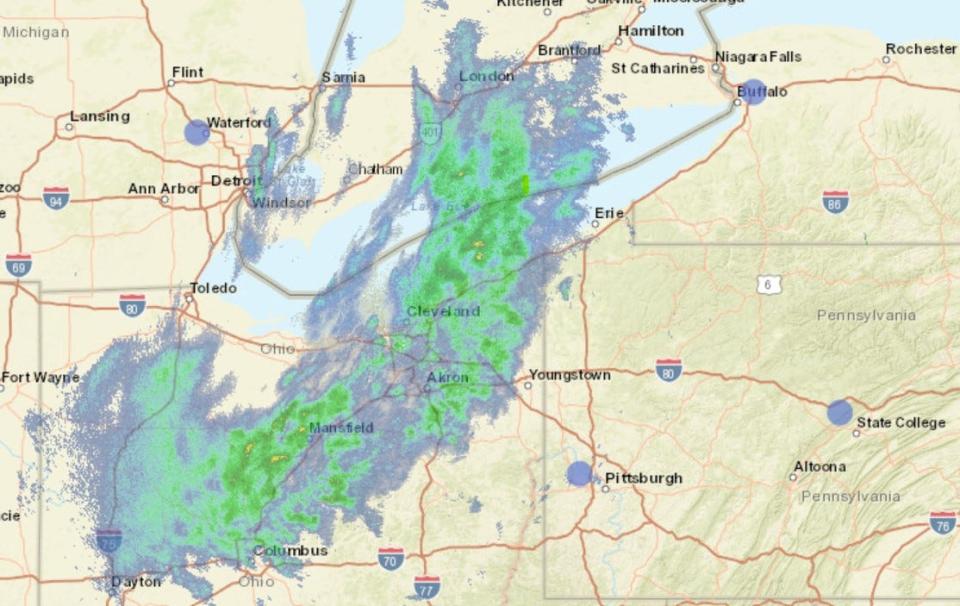
Erie, Crawford counties snow forecast
The National Weather Service office in Cleveland has issued a winter weather advisory for northern Erie County from 7 p.m. Thursday through noon Friday. Lake-effect snow is expected to accumulate 3 inches to 5 inches.
The weather service has issued a winter storm watch for southern Erie County, calling for 4 inches to 7 inches of snow.
More: October welcomed some unusually warm weather to the Erie region. Here's why
Chance of precipitation Thursday night and Friday is 80%, according to the weather service. Rain showers Thursday night are expected to turn to rain and snow. The low temperature will be near 34 degrees. Winds will be from the west at 20 to 22 mph.
Friday's high will be around 42. Snow is expected to end in the morning. Northwest winds will diminish to about 5 to 7 mph by Friday night, when there is a 30% chance of precipitation and a forecast low around 32.
More: From Turkey Trots to Christmas shows, here are holiday events not to miss in the Erie area
Warren County snow forecast
The weather service in State College has a winter weather advisory in effect from 9 p.m. Thursday through 1 p.m. Friday. Expect 2 inches to 3 inches of lake-effect snow, though some areas — especially the northwest corner of the county — could see 4 inches to 7 inches.
Chance of precipitation Thursday night is 90%, according to the forecast. The low will be around 29 with wind gusts from the west up to 21 mph. Friday's high will be near 38, with more gusty wind expected. The low will fall to around 25.
More: Remember, LIHEAP offers relief to households struggling to cover high heating bills
Chautauqua County, N.Y., snow forecast
The weather service in Buffalo has a winter weather advisory in place from 7 p.m. Thursday through 1 p.m. Friday. Snowfall of 4 inches 7 inches is expected in most areas, with greater amounts possible in some locales. Most snow will occur Thursday night across the Chautauqua Ridge and higher terrain into Cattaraugus County.
The low Thursday will dip to around 29, with winds from the west at 14 to 18 mph. Chance of precipitation is 90%, with accumulation of 3 inches to 7 inches of snow possible. An additional 1 inch to 2 inches is possible Friday, when the high will be near 35 and the low around 26. Winds on Friday will be steady at 17 to 20 mph and gusting to 31 mph.
► Get up-to-date forecasts for your ZIP code from AccuWeather
Ashtabula County, Ohio, snow forecast
The weather service in Cleveland's advisory for the northern part of the county calls for 3 inches to 5 inches of lake-effect snow between 7 p.m. Thursday and noon Friday.
Inland, a winter storm watch forecast generally calls for 4 inches to 7 inches, with more possible in some places and the heaviest snow falling between midnight and 7 a.m. Friday.
The forecast is rain turning to snow by around 11 p.m., with 4 inches to 8 inches possible in some locations. The low will be around 31.
Another 1 inch to 3 inches is possible Friday, depending on location. Chance of precipitation is 80%, with a high near 42.
Travel conditions
The weather service warns to expect slippery road conditions across the region, especially during the Friday morning commute. "Temperatures will drop into the lower 30s and will likely cause road surfaces, especially bridges and overpasses, to cool enough to allow snow to accumulate."
More: 'A huge mess': Big storm could disrupt Thanksgiving travel next week
Small craft advisory
A small craft advisory is in place until 7 p.m. Friday for the Lake Erie shoreline from Vermilion, Ohio, to Ripley, New York.
The weather service in Cleveland forecasts southwesterly winds tonight becoming westerly at 20 to 25 knots on Thursday. Waves will build to 3 feet to 6 feet Thursday and 5 feet to 8 feet Thursday night.
More: Lake Erie water levels dropped in August. What's the forecast for the months ahead?
► Sign up for GoErie.com news alerts to receive a weather forecast every day at 6:45 a.m.
This article originally appeared on Erie Times-News: Erie PA weather: How much snow can we expect to see in winter blast?

