Winter storm updates: Hazardous road conditions, wind chills and sleet in Wednesday's forecast
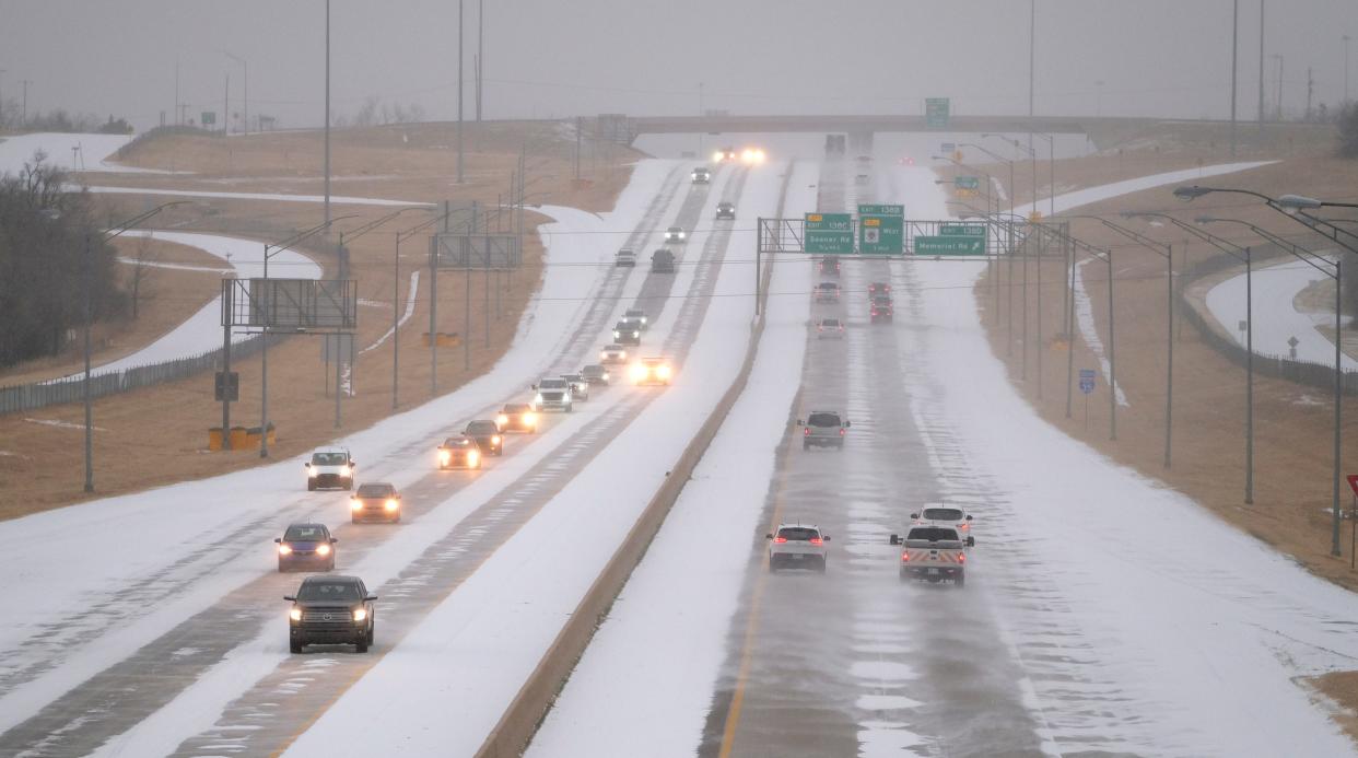
Widespread sleet and freezing rain blanketed much of central Oklahoma Wednesday morning. And meteorologists expect additional precipitation will hit the area overnight.
Sleet accumulation predictions varied across central Oklahoma, but some areas south and east of Oklahoma City could see up to 1 to 2 inches of sleet through late Wednesday.
Most counties in central and southeastern Oklahoma were in a winter storm warning early Wednesday.
Dangerous cold will also be a hazard Wednesday. The high temperature Wednesday was expected to be around 18 degrees with wind chills well below zero. Highs will not get above freezing until Friday.
We are monitoring the ongoing widespread sleet/freezing rain across OK and western north TX. This heavy freezing precipitation will continue this morning and exit this afternoon, with additional precipitation expected overnight tonight.
Stay safe out there!#okwx #texomawx pic.twitter.com/Sico7fOThR— NWS Norman (@NWSNorman) February 23, 2022
Prepare for the storm: What are Oklahoma City's snow routes?
The Oklahoman will provide updates as they happen here. Check back often for the latest developments.
EMSA responds to weather-related calls in Oklahoma City
As of 11 a.m. Wednesday, EMSA has responded in the Oklahoma City area to:
2 car accidents
1 cold exposure call
1 fall that led to cardiac arrest.
Sleet-covered surfaces can cause slips and falls, and EMSA officials recommend residents wear shoes with grip and traction while walking outdoors.
Other tips on staying warm during the winter storm include:
During cold wind chills, try to work in areas that can keep you sheltered from gusts of wind.
Dress appropriately in at least three layers of clothing: an outer layer like nylon to break the wind, a middle layer of wool or synthetic fabric to absorb sweat, and an inner layer of cotton weave to allow for ventilation. Layering can also help you adapt to weather changes more easily.
Keep an extra change of clean, dry clothes with you in case your work clothes get wet.
Make sure as much of your feet, hands, head and face are covered as possible. You can lose up to 40% of body heat if your head is exposed. Wear several layers of socks along with your boots or shoes to protect against dampness.
- Jessie C. Smith
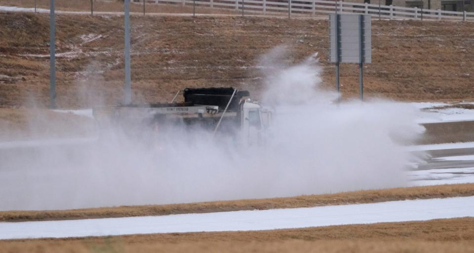
First wave of sleet will end late morning; more coming
The first wave of sleet and freezing rain will end in the Oklahoma City area around lunchtime.
A second wave — this one expected to be mainly freezing rain — will hit central Oklahoma later this evening.
- Ryan Sharp
A large area of mainly sleet will end from southwest to northeast late this morning into the early afternoon. Some very light precipitation may linger through the afternoon. #okwx #texomawx pic.twitter.com/LKztcDstz2
— NWS Norman (@NWSNorman) February 23, 2022
OG&E reporting power outages east of Oklahoma City
Nearly 2,000 OG&E customers north and east of Oklahoma City were without power Wednesday morning as a band of heavy sleet and freezing rain moved through central Oklahoma.
The line of outages stretched from Guthrie to near Lake Thunderbird east of Norman.
OG&E customers can keep track of outages using the company's System Watch.
- Ryan Sharp
Oklahoma City police not responding to non-injury crashes
With road conditions in and around Oklahoma City deteriorating quickly, the Oklahoma City Police Department said Wednesday morning it is no longer responding to non-injury accidents.
OKCPD urged motorists involved in non-injury crashes to exchange insurance information and take photos of any damage.
- Ryan Sharp
We are no longer responding to non-injury crashes.
Please exchange insurance information & take photos if you safely can for insurance purposes.
We’ll continue responding to injury crashes. Roads are getting slick, so please slow down if you’re out & about.#okwx pic.twitter.com/5pVJBTD2Q6— Oklahoma City Police (@OKCPD) February 23, 2022
Oklahoma House and Senate closed due to winter weather
The Oklahoma House of Representatives and the Senate announced early Wednesday they would be closed today.
- Ryan Sharp
ATTENTION: Oklahoma House of Representatives will close today due to inclement weather. pic.twitter.com/QUs2m28Gtm
— OKHouseNews (@OKHouseNews) February 23, 2022
This article originally appeared on Oklahoman: Winter storm live updates: OKC road conditions, snow routes, more

