Wildfire south of Banning grows to 34 acres, but stops spreading for now
A vegetation fire broke out on ranch lands south of Banning and had spread to 34 acres by mid-Saturday afternoon, according to Cal Fire. But it did not appear to be growing further.
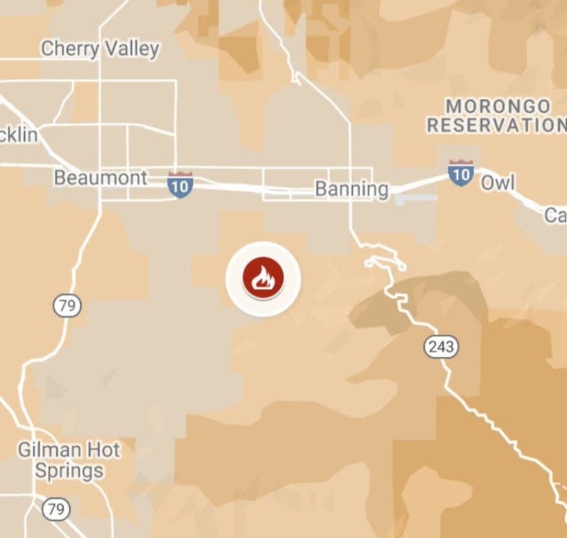
The agency said the fire began around noon on land near the intersection of Idyllwild Road and Shirleon Drive.
That intersection is located about a half-mile south of Banning city limits and two miles south of Interstate 10. It is dotted with ranch properties and isolated homes, but Cal Fire did not say whether any structures had sustained damage or were threatened.
Cal Fire said in a post on X that the fire was mapped at 34 acres at around 2 p.m. and considered to be spreading at a “moderate” rate. About an hour earlier, Cal Fire had estimated its size at 10 acres.
At 3:15 p.m., Cal Fire said the forward rate of spread had stopped.
Cal Fire has not identified how the fire started, nor said whether wind helped it spread. But it came amid windy and dry conditions in Banning and the surrounding San Gorgonio Pass. Wind speeds of 15 to 20 mph had been recorded throughout Saturday morning and afternoon, along with gusts of 25 to 30 mph at the nearby Cabazon weather station, the closest to Banning.
The National Weather Service is forecasting continued high winds and gusts through Monday, with winds starting to die down on Tuesday.
Paul Albani-Burgio covers growth, development and business in the Coachella Valley. Follow him on Twitter at @albaniburgiop and email him at paul.albani-burgio@desertsun.com.
This article originally appeared on Palm Springs Desert Sun: Wildfire near Banning spreads to 34 acres; Cal Fire says no new growth

