Why RiNo and LoDo aren’t listed in Denver’s neighborhoods

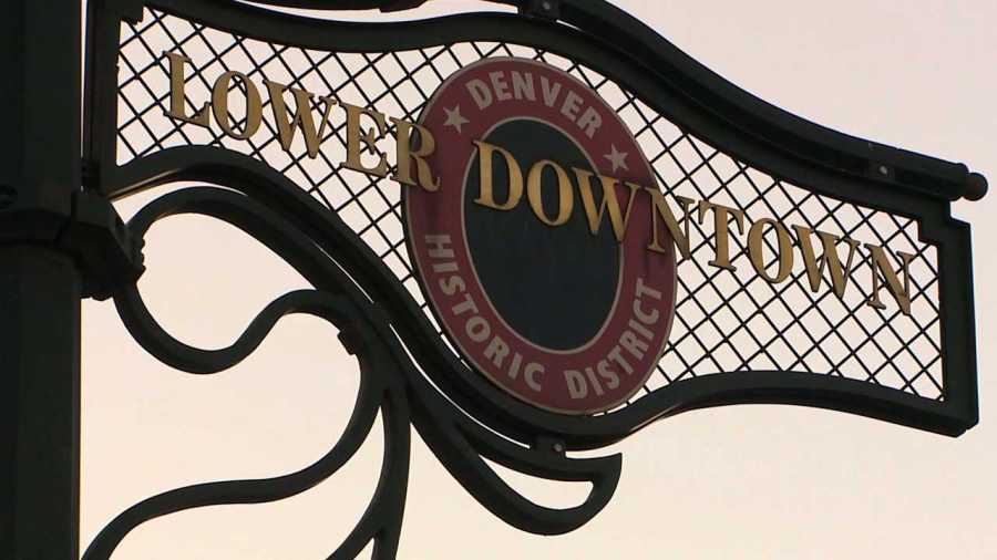
DENVER (KDVR) — In downtown Denver, you may notice signs reading “River North Art District” or “Lower Downtown Historic District.”
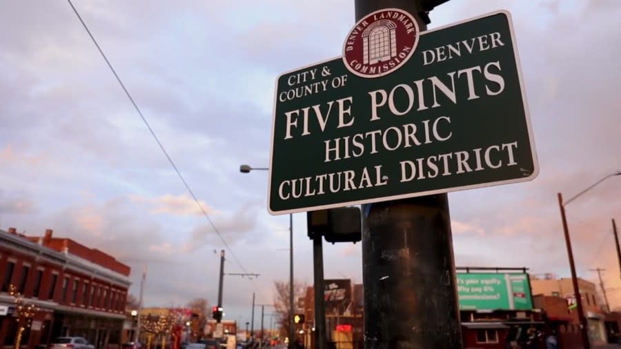
Those areas are commonly referred to by locals as RiNo and LoDo, but they are within the Five Points and Union Station neighborhoods of Denver.
Why are streets in downtown Denver crooked? History can explain
The city has a map showing the boundaries of Denver’s different neighborhoods. Have you ever wondered why areas such as RiNo and LoDo aren’t listed as neighborhoods?
FOX31 asked the Community Planning and Development Department why that is. Turns out, it’s not that they aren’t considered “official” neighborhoods, as Denver doesn’t have an official process for designating neighborhoods. It’s more that they are considered official districts, and they happen to be within those neighborhoods.
“There is no ‘right’ or ‘wrong’ as far as how people refer to the areas where they live, work or spend time in,” Alexandra Foster, a spokesperson for the department, told FOX31 in an email. “How a community identifies itself can and does evolve over time. Many of those names are not officially recognized and, therefore, aren’t officially changed.”
An example of this is how what the city calls North Capitol Hill is often referred to by residents as Uptown.
Five Points neighborhood (KDVR) Lower Downtown Denver sign
This is why Market Street turns into Walnut Street in downtown Denver
What is the point of the neighborhood boundaries?
Foster said the reason for the neighborhood designations has to do with data and record purposes. The neighborhood map shows what are called “statistical areas” or “statistical neighborhoods.”
“The map is a reference point. City agencies and their staff use it for data, research and records purposes,” Foster said.
For example, if an agency is doing work involving how the population has changed in an area, they can use the boundaries on the map to make sure they are comparing apples to apples.
When the Community Planning and Development presents rezoning to the City Council, Foster said officials always reference the statistical neighborhood where the rezoning will take place by using the names and boundaries on the map so there is no confusion.
What are the most expensive neighborhoods in Denver?
On the other hand, the reason for the official designation of cultural historical districts has to do with taxation purposes.
“Sometimes, the city designates a specific area to apply regulations or for taxation purposes, such as historic districts, art districts or business improvement districts. These have names, but those names don’t change the name of the statistical area,” Foster said.
Lower Downtown, for example, is a historic district, and even though it is commonly known as LoDo, the name of the statistical neighborhood it is in remains Union Station.
Why aren’t neighborhood names changed?
An area can be referred to by many names. Another example is the Hale statistical area, which is more commonly referred to as Mayfair. Foster said all of the areas date back to the 1970s and are based on census tracts, and the names don’t necessarily reflect a neighborhood’s current identity.
Another example of a neighborhood reference that didn’t exist decades ago is Ballpark. The name is now in common parlance because of the designation of the Ballpark Historic District. Foster explained that the emergence of these districts doesn’t affect the names or boundaries of the statistical neighborhoods they are in.
“The name of the statistical area on our map doesn’t have to reflect how a community refers to its neighborhood,” Foster said.
Mount Evans officially renamed Mount Blue Sky
There is a single exception, however. The name of the Central Park neighborhood was changed from Stapleton in 2020 after a push by members of the community.
“This name was changed on the city’s neighborhood map in 2020, in the wake of racial justice protests locally and around the country,” Foster said.
The Stapleton name refers to Benjamin F. Stapleton, who was once the mayor of Denver and was a member of the Ku Klux Klan. Neighborhood residents voted to change the name to Central Park, and the mayor and council person representing the neighborhood at the time agreed to have the city follow the community’s lead, so the name was changed on the map.
“That’s the only time that has happened in recent memory since, as I said, there is no formal process to name neighborhoods,” Foster said.
Black History Month: Denver firefighters recreate historic Five Points Fire Station No. 3
Similarly, although rare, district names can change following the same process as the initial district designation. This happened for the Five Points Historic Cultural District, which was originally named the Welton Street Historic Cultural District.
The name was changed through an official update to the designation by the Landmark Preservation Commission and City Council in response to the community calling for a name to better reflect the historic and cultural identity of the area.
For the latest news, weather, sports, and streaming video, head to FOX31 Denver.
