White gold to be found in Ontario on St. Patrick's Day amid cooldown
Despite what the calendar says, winter isn't going to leave quietly in southern Ontario this week.
A major pattern change that has begun to unfold this weekend across the country will continue to evolve into this week. For southern Ontario, that means cool air from the Arctic descending on the region, and bringing snow and gusty winds with it.
DON'T MISS: Canada's spring gets sidelined as winter fights back for start of the season
Any plans to go out on St. Patrick's Day may be spoiled or delayed by the snow and strong winds that are expected, depending on where you're heading, so plan ahead and brace for tricky driving at times, especially in the snowbelt regions.
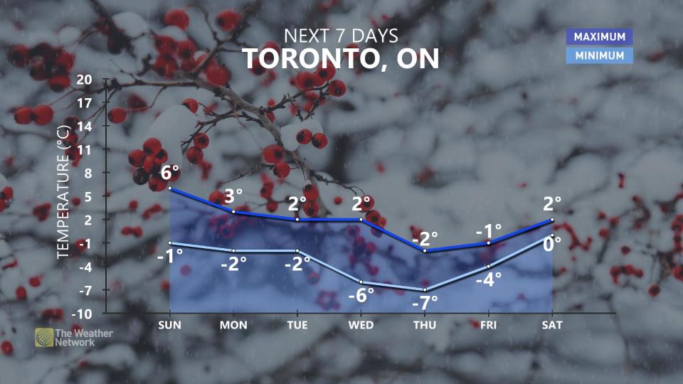
With the recent stretch of balmy weather, it shows you why March is such a transitional month as we get ready for the start of spring on Tuesday.
Sunday: Cool winds bring a risk for snow
A cold front diving into southern and eastern Ontario will shift our wind direction and bring a risk for rain and snow showers to parts of the region.
Westerly winds in the 30-60 km/h range will give rise to lake-effect flurries across central Ontario, as well as for the traditional snowbelt regions near Lake Huron and Georgian Bay.
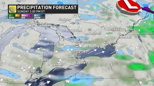
Some rain and mixed precipitation is likely for places along Lake Ontario and Lake Erie. A risk for more organized snowfall will exist across northeastern Ontario.
The breezy conditions, with winds gusting 30-60 km/h out of the west, may create localized blowing snow and reduced visibility.
RELATED: St. Patrick's Day green traditions linked to these weather patterns
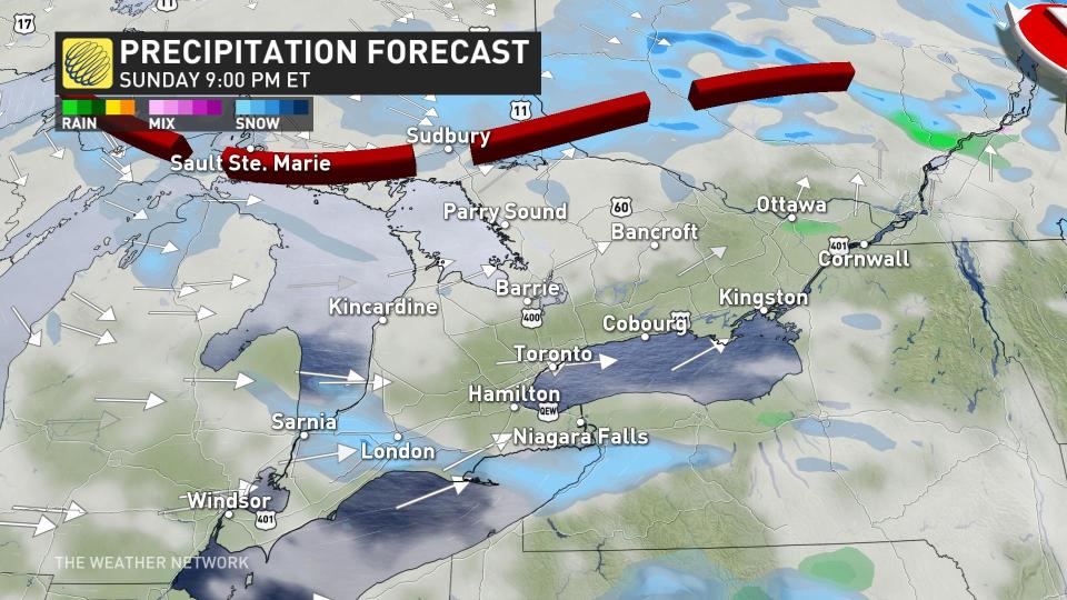
Monday: Burst of flurries moves through, colder weather hangs on
More widespread bursts of snow are expected by Monday as colder air settles into the region. Lake-effect bands are likely to develop southeast of Lake Huron and Georgian Bay. We’ll also see some snow in eastern Ontario.
There could be brief periods of reduced visibility through the early-morning hours, mainly in cottage country and nearby areas.
A trough sinking south will bring a burst of flurries to southern Ontario early Monday morning.
Northwesterly winds may gust 30-60 km/h, continuing the feed of chilly air from northern Ontario.
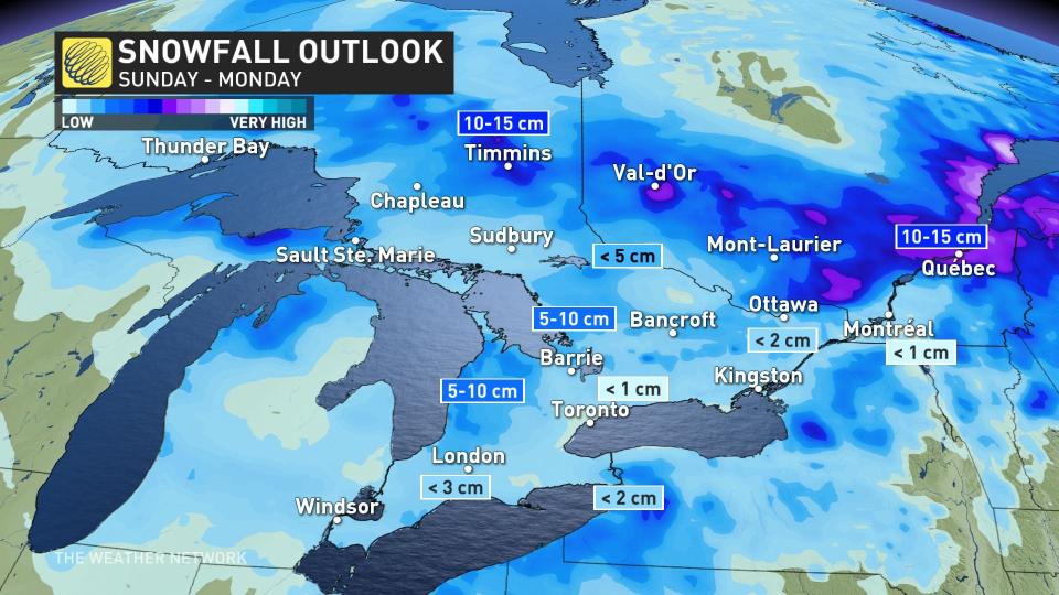
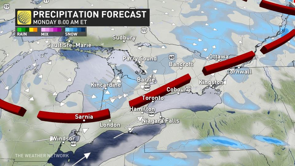
These lake-effect bands will continue into Tuesday and temperatures will fall a few degrees cooler than seasonal.
Forecasters see an unsettled week ahead as several disturbances look to track across the Great Lakes. While temperatures will remain around seasonal, that’s still cold enough to support the threat for wintry precipitation.
Check back over the next few days for the latest details on these systems.
Stay with The Weather Network for the latest on your forecast across Ontario.
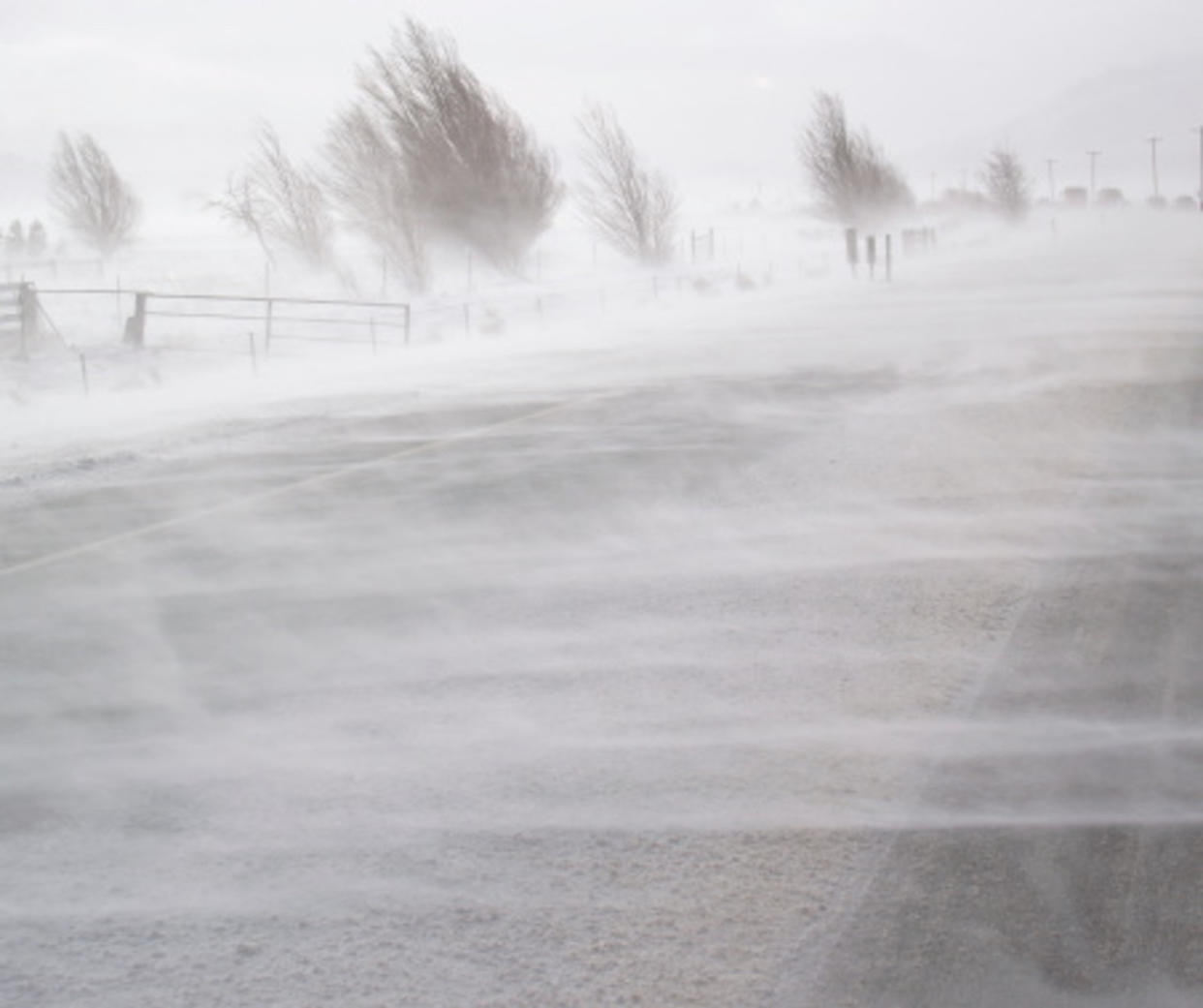
Thumbnail courtesy of Getty Images/Michelangeloboy/172849117-170667a.

